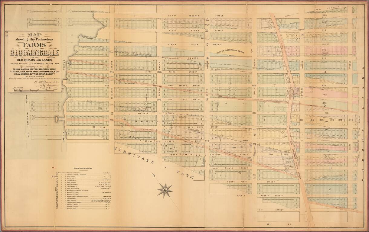
Rare Cadastral Map of Midtown West, Including Times Square and part of the Theater District. Antique, separately-issued John Bute Holmes hand-colored lithographed map, depicting the region from the Hudson River to Sixth Avenue and from 57th Street to...
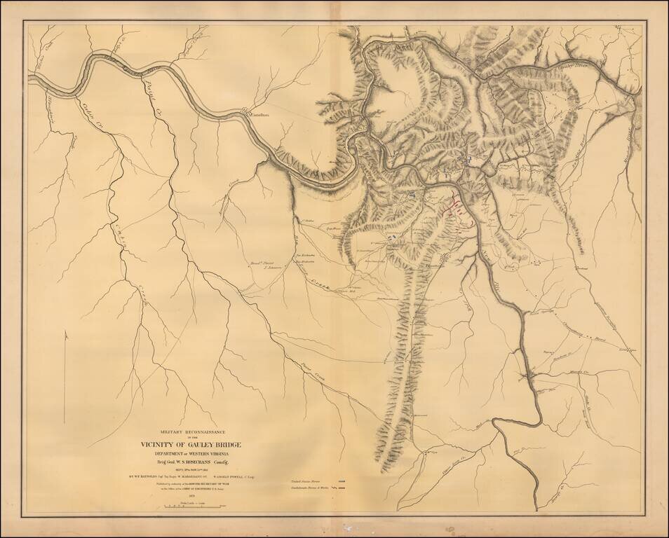
Color-lithographed map of the area near Gauley Bridge, (present-day) West Virginia. Gauley Bridge was the site of a minor battle during the Civil War, which resulted in a Union victory. "United States forces" are colored blue, and "Confederate forces...
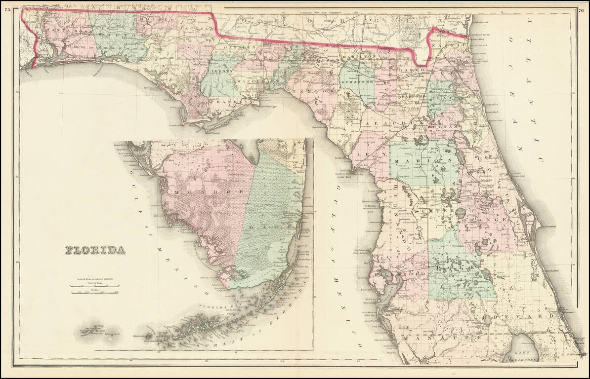
Detailed map of Florida, published by OW Gray & Sons. The map is colored by counties and shows towns, township surveys, forts, swamps, lakes, rivers, railroads, roads, post offices, stations, etc. Large inset of the Keys. One of the best...
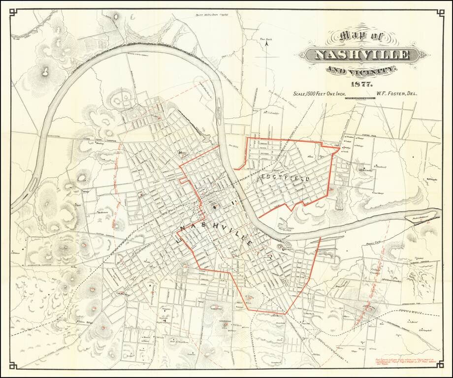
Showing Flooding Region of the Cumberland River Scarce early map of Nashville, with redlines illustrating the High Water Mark of the Cumberland River -- 57 feet above the low water mark. A highly detailed map of Nashville, showing streets, public...
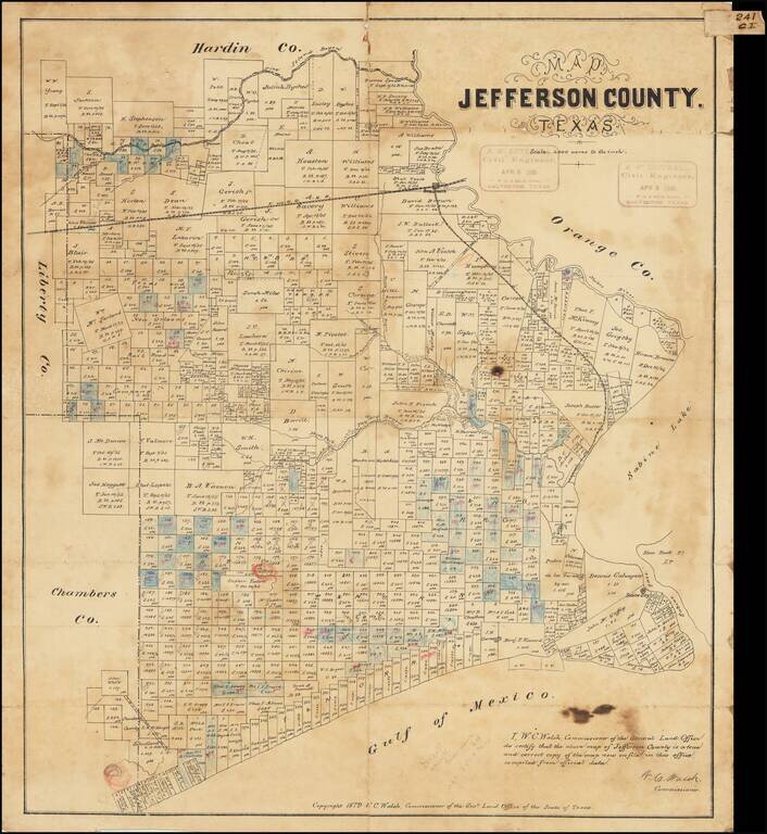
Antique Texas General Land Office map of Jefferson County, Texas. The map was prepared in 1879 by W.C. Walsh, Commissioner of the Genl. Land Office. This example of the map has manuscript annotations related to land sales and the oil industry. Three...
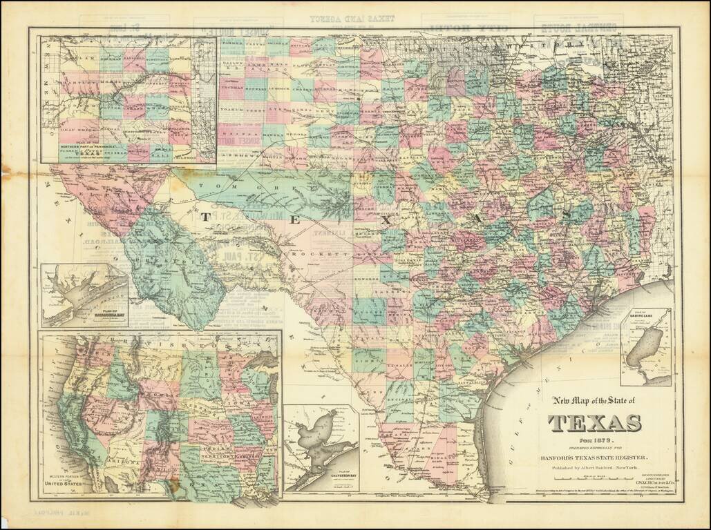
Scarce separately-issued version of Albert Hanford's map of Texas, originally published for his Texas State Register of 1879. The map was prepared by G.W. & C.B. Colton. The map includes a number of good insets: Plan of Sabine Lake; Plan of...
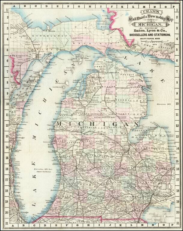
Cram's rare 1879 railroad map of Michigan, based on his first edition of 1875. Michigan prospered after the Civil War, with the lumber, dairy, and railroad industries taking off. This map reflects the booming economy, as the railroads stretched across...
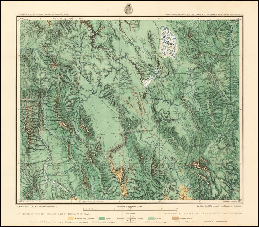
Fine regional map of Southeastern Idaho, based upon reconnaissance done in the Wheeler Survey Expedition of 1877, "Atlas sheet No. 32 (D) U.S. Geological surveys west of the 100th Meridian. Expedition of 1877 under command of 1st. Lieut. Geo. M....
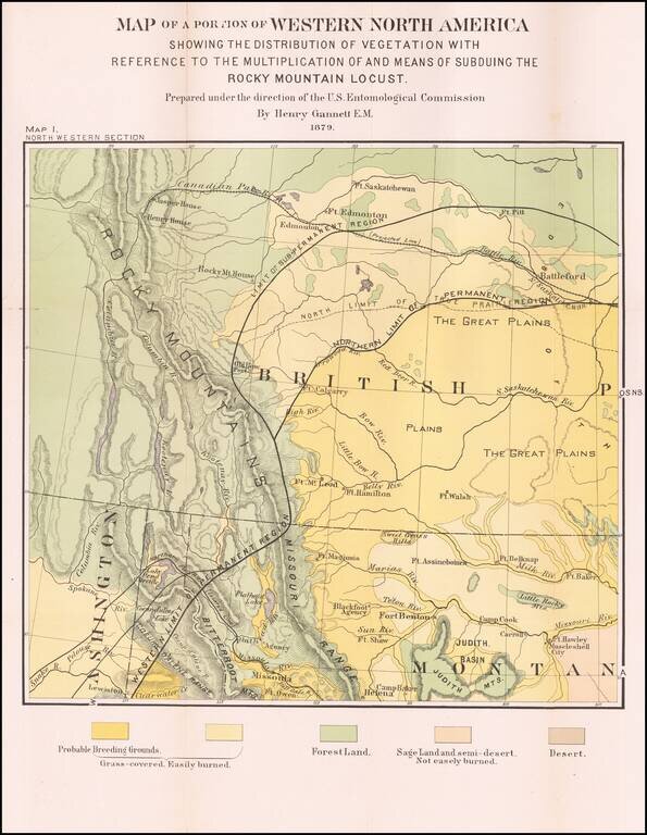
Detailed Vegetation Map of northern Montana, Idaho, Western Washington and contiguous parts of Alberta and British Columbia, from the Second Report of the United States Entomological Commission for the years 1878 and 1879. The map is relatedto the...
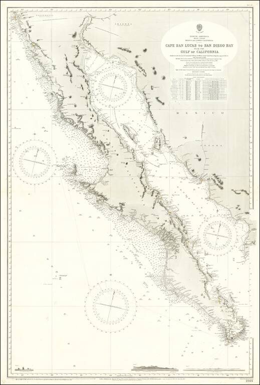
Large Sea Chart of Baja California and the Sea of Cortez / Gulf of California A fine example of the British Admiralty chart of Baja California and the Gulf of California, first engraved and published from London in 1879, and updated numerous times...
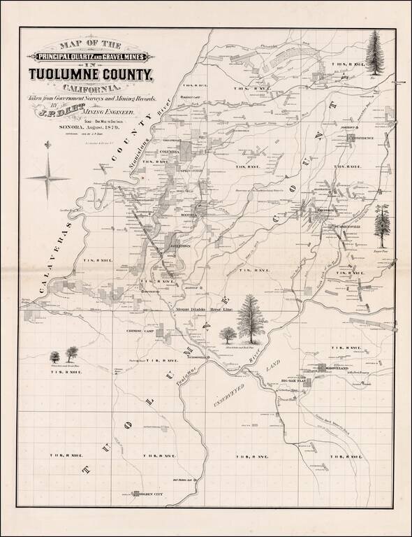
Scarce large format map of Tuolumne County. Includes extensive Mining and Government Survey Information and illustrations of the various types of Oak and Pine trees indigenous to the region. Shows towns, rivers, mining claims and other details. A...
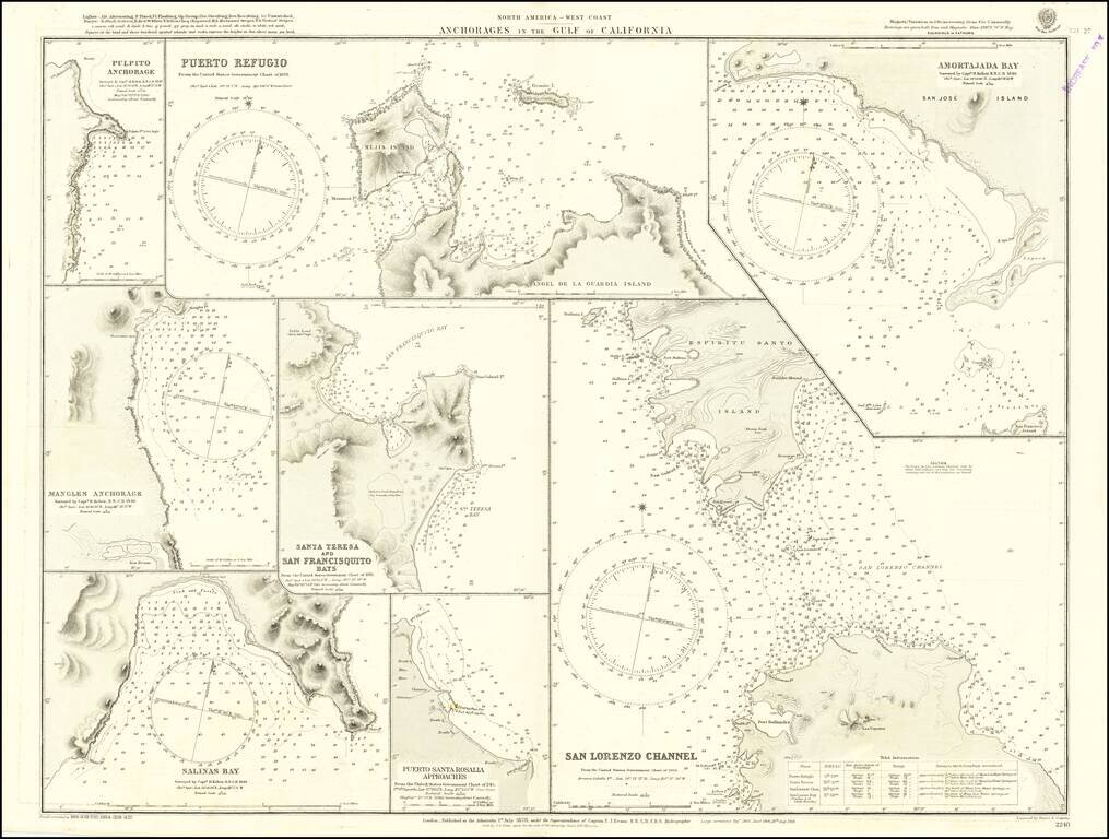
Detailed chart of the anchorages in the Gulf of California, including those on the eastern shores of Baja California. Much of the information comes from Henry Kellett's important 1845 hydrographical survey for the Royal Navy, undertaken on HMS Herald...
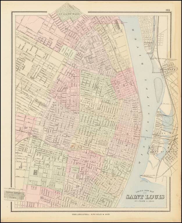
Detailed map of St. Louis, published by Gray. The map is colored by wards and showing streets, rail lines, parks, buildings, stations and a host of other details.
![Amerique du Nord [Manuscript Map with Decorative Hand Drawn Vignette]](/map/small/23250.jpg)
Decorative hand drawn map of North America, with a striking vignette of a two parrots. Includes excellent detail for a map of this type. The number of place names is quite extraordinary, with a number states, ciities and Indian Tribes noted.