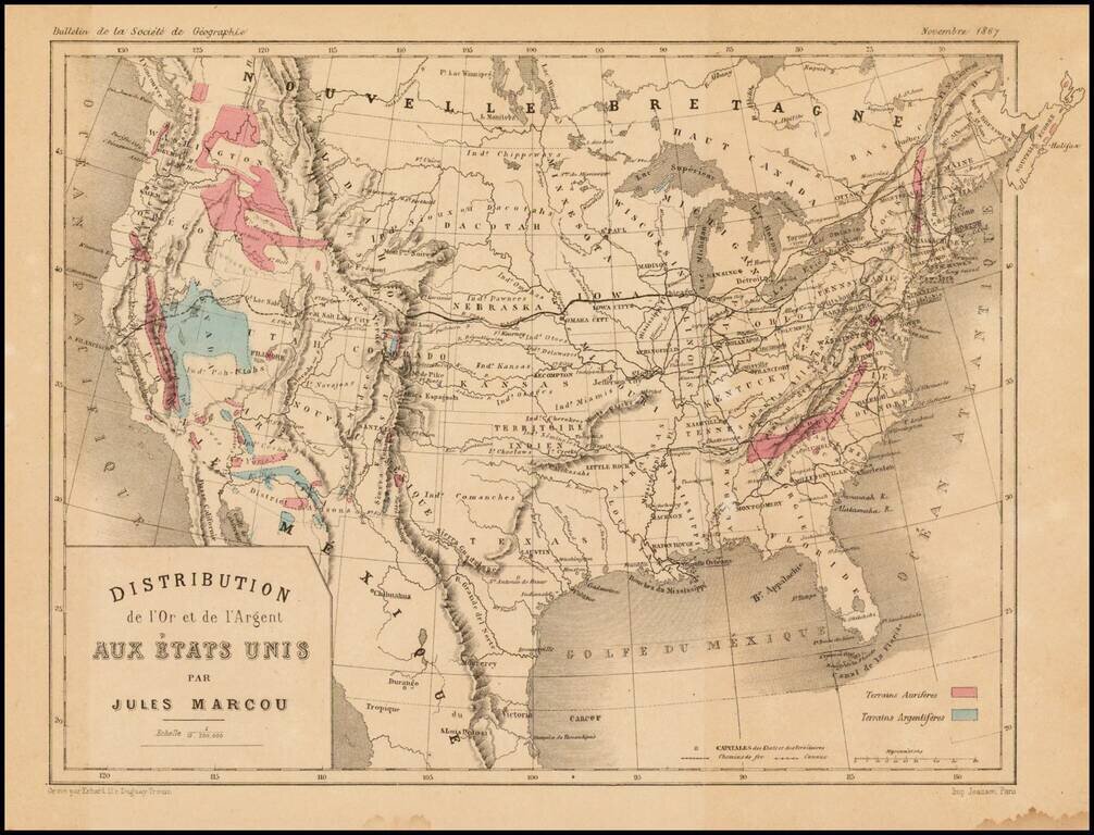
Scarce map of the United States, showing the distribution of Gold (red) and Silver (blue) in the United States. The map appeared in the November 1867 edition of the Bulletin de la Societe de Geographie, published in Paris. Jules Marcou was perhaps...
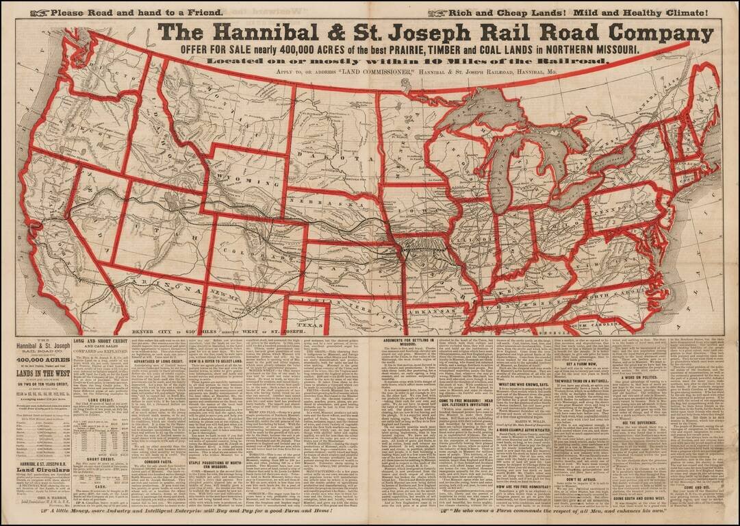
Advertising broadsheet map published by the Hannibal & St. Joseph Railroad, promoting land in Northern Missouri. The map notes the Railroad offering more than 400,000 acres of land for sale along the Hannibal & St. Joseph Railroad in...
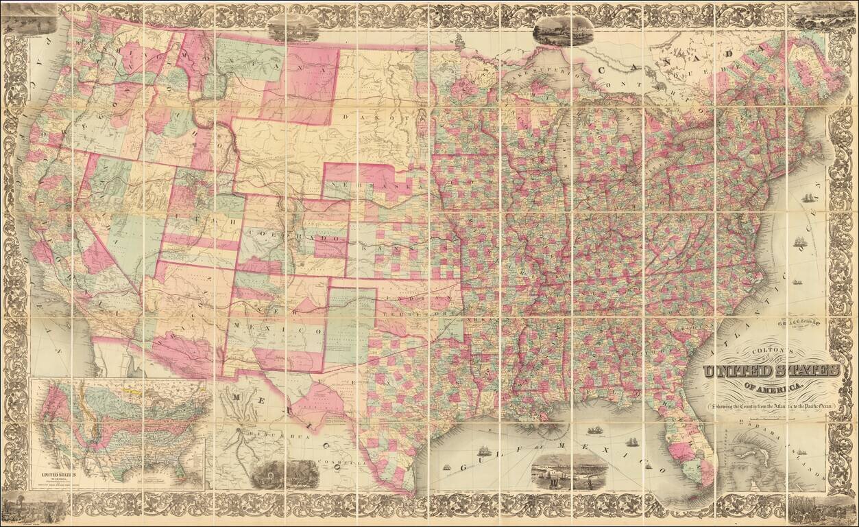
Scarce map of the whole United States following the Civil War, published by G.W. & C.B. Colton. The map includes eight vignette scenes around or within the decorative floral border, and a large inset map at lower left, "United States of America...
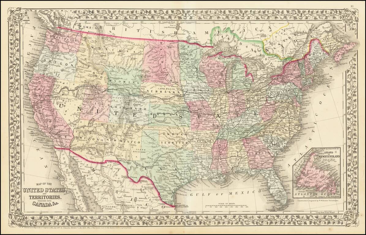
1867 edition of Mitchell's atlas map of the United States. The western Territories are now largely formed, with this being an early appearance of Wyoming Territory.
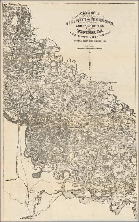
Rare map of the area between the Pamunkey and Ames Rivers, showing the Vicinity of Richmond, Virginia, as surveyed by Jeremy Francis Gilmer, surveyor for the Confederate States of America. The map bears some relationship to Albert H. Campbell's Map of...
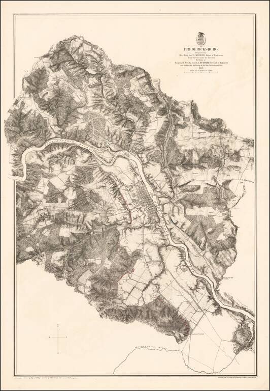
Highly detailed map of the area around Fredericksburg, Virginia, showing the theater of the Battle of Fredericksburg. The map is colored to show the troop positions of the respective armies, with red (Confederate) and blue (Union) positions shown on...
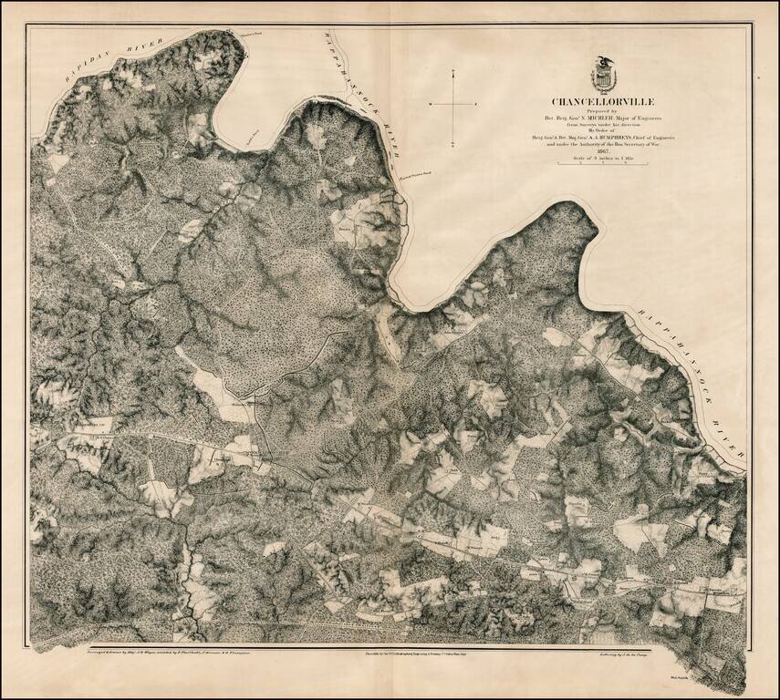
Scarce large format plan of the battle field and region around Chancellorville, showing the area south of the Rappahannock River. Shows fortifications. Highly detailed. What is most noteworthy about the map is the inclusion of dozens of land owners on...
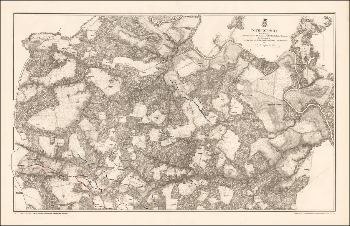
Highly detailed map of the area around Totopotomoy, Virginia, highlighting the battles fought in the area during the Civil War. The Battle of Totopotomoy Creek, also called the Battle of Bethesda Church, Crumps Creek, Shady Grove Road, and...
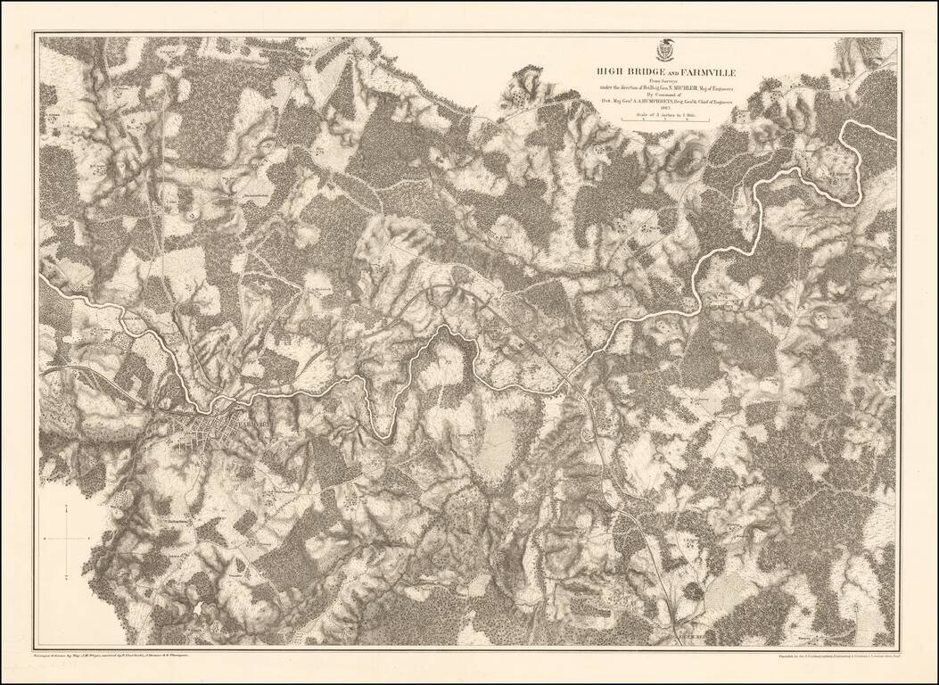
Highly detailed map of the area around Farmville, Virginia, depicting one of the final battle fields of the Civil War. Farmville Robert E. Lee retreated through Farmville as he escaped the Union Army in the Civil War. Farmville was the object of the...
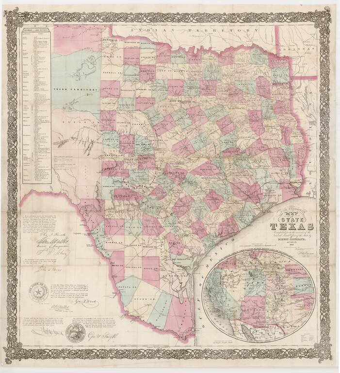
Rare late edition of Jacob De Cordova's important map of Texas and the first edition to be revised to identify the place of publication as Austin. The most obvious update is that the inset map has changed from a rectangle to an oval, still showing the...
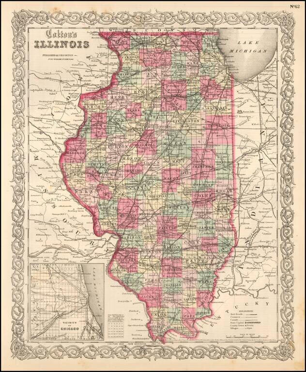
Detailed map of Illinois, colored by counties. The map shows roads, railroads, towns, villages, post offices, canals, rivers, lakes, stations and a host of other details. Inset of Chicago vicinity in lower left corner. Decorative border. A terrific...
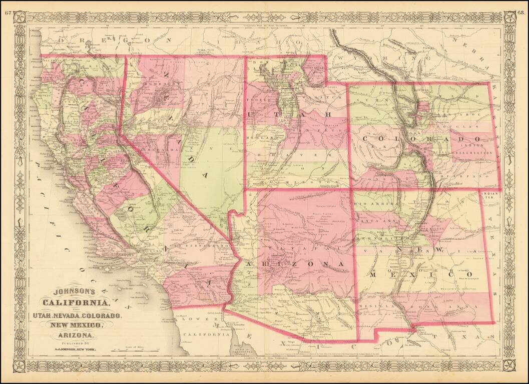
Interesting map of the southwest, hand colored by counties and showing a number of interesting territorial anomalies. Nevada has its lower corner truncated, leaving Las Vegas in Arizona. Nevada is truncated at the bottom. In each of the states and...
![Map showing the scene of General Hancock's operations in the Indian Country, the Forts, Military Stations, Pacific Railroads, etc. [Harper's Weekly. June 15,1867]](/map/small/70224.jpg)
Fine map of the Western United States, published in Harper's Weekly The map focuses on General Hancock's military operations against the Native Americans in Indian Territory. The map highlights the the forts, military stations, and railroads in the...
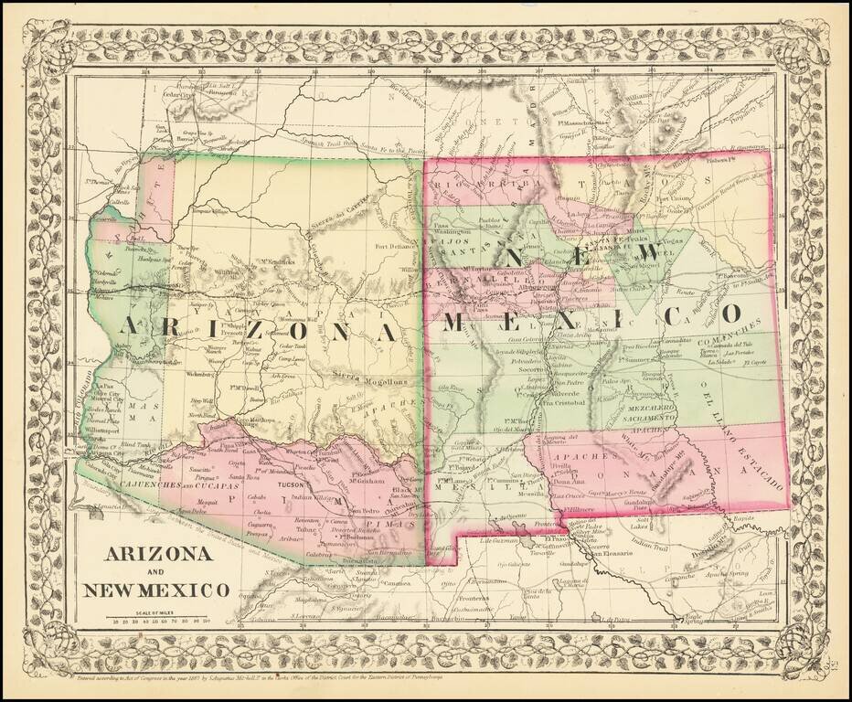
Attractive regional map of New Mexico and Arizona, colored by counties with beautiful decorative border. Shows towns, roads, railroads and rivers. This is a period when western county and state borders were rapidly evolving, such that each year holds...
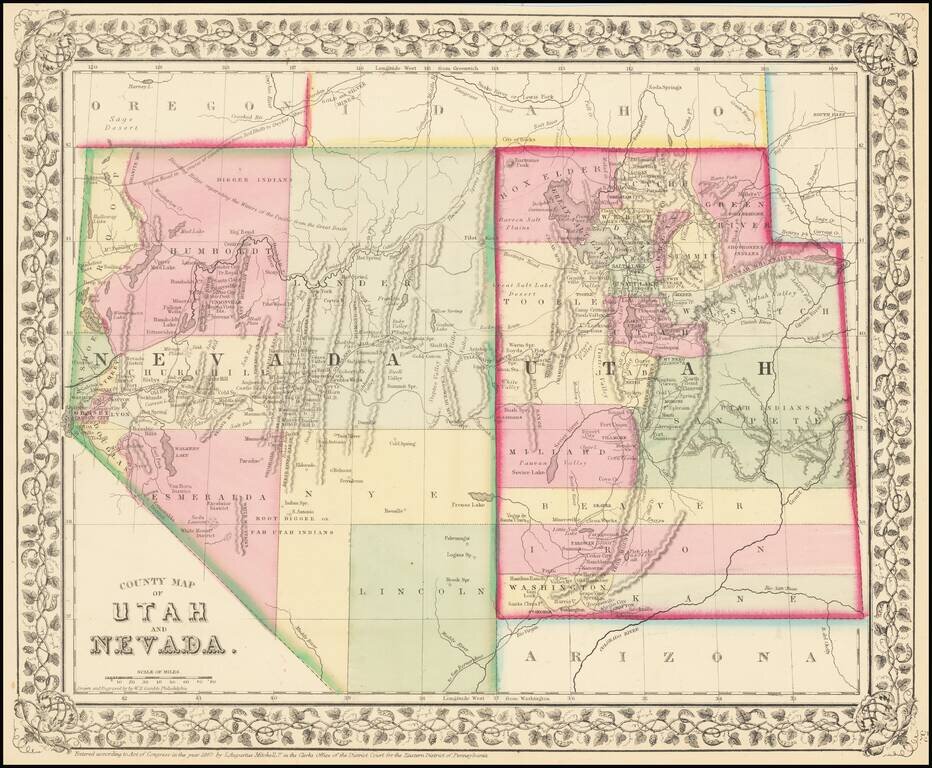
Detailed map of Nevada and Utah, colored by counties and showing towns, mountains, rivers, railroad lines, Indian Tribes, mining districts, etc. The first map of the region to appear in a commercial atlas. Decorative floral border.
![(Notherneastern Sheet) [Bancroft's Map of the Pacific States]](/map/small/54925.jpg)
Engraved Proof Sheet. "Bancroft's, in scope, was probably the most important map yet produced by a publisher of the Pacific coast." - Streeter (TMW 1061) Engraved proof of the 1867 edition of H.H. Bancroft's Map of the Pacific States. The detail in...