Map size in jpg-format: 2188810B
Click to open in high resolution (open in new tab).
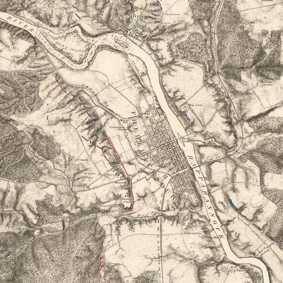
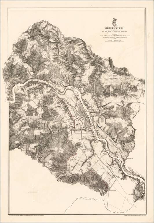
Highly detailed map of the area around Fredericksburg, Virginia, showing the theater of the Battle of Fredericksburg.
The map is colored to show the troop positions of the respective armies, with red (Confederate) and blue (Union) positions shown on both sides of the Rappahannock River.
The map identifies roads, railroads, rivers and the names of landowners, among other features.
Battle of Fredericksburg
The Battle of Fredericksburg was fought December 11-15, 1862, in and around Fredericksburg, Virginia, between General Robert E. Lee's Confederate Army of Northern Virginia and the Union Army of the Potomac, commanded by Major General Ambrose Burnside.
The Union Army attempted attacks on December 13 against entrenched Confederate defenders would prove to be one of the most disastrous battles of the war for the Union Army, with Union casualties more than three times as heavy as those suffered by the Confederates. A visitor to the battlefield described the battle to U.S. President Abraham Lincoln as a "butchery."
Burnside's plan was to cross the Rappahannock River at Fredericksburg in mid-November and race to the Confederate capital of Richmond before Lee's army could stop him. Bureaucratic delays prevented Burnside from receiving the necessary pontoon bridges in time and Lee moved his army to block the crossings. When the Union army was finally able to build its bridges and cross under fire, urban combat in the city resulted on December 11-12. Union troops prepared to assault Confederate defensive positions south of the city and on a strongly fortified ridge just west of the city known as Marye's Heights.
On December 13, the "grand division" of Major General William B. Franklin was able to pierce the first defensive line of Confederate Lieutenant General Stonewall Jackson to the south, but was finally repulsed. Burnside ordered the grand divisions of Major Generals Edwin V. Sumner and Joseph Hooker to make multiple frontal assaults against Lieutenant General James Longstreet's position on Marye's Heights, all of which were repulsed with heavy losses. On December 15, Burnside withdrew his army, ending another failed Union campaign in the Eastern Theater.
If you are a student, write to us in telegram: @antiquemaps and indicate what material you need and for what work you need a map in high detail. We are ready to provide material on special terms. For students only!