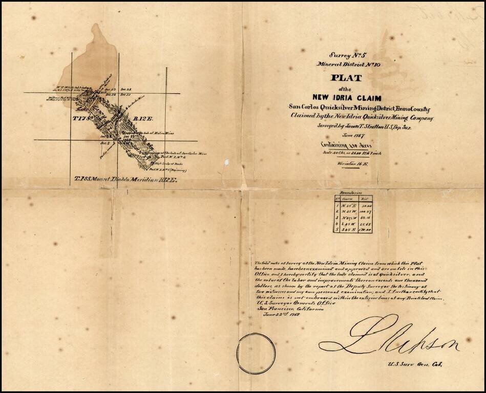
New Idria is an unincorporated town in San Benito County, California, which was named for a quicksilver (cinnabar) mine of the same name. The mine itself was named in honor of the world's second largest quicksilver mine in Idrija, Slovenia. The...
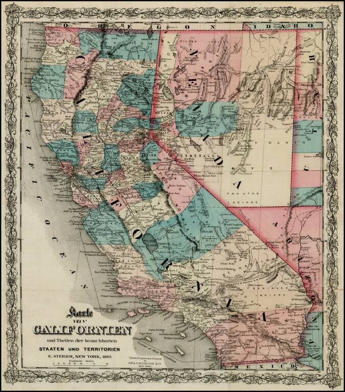
Rare separately issued map of California, published in New York City by Colton. Includes excellent detail throughout the map, including counties, roads, rivers, lakes, mountains, railroads, stations, gold mines, dry lakes, extinct volcano craters,...

Fine separately issued example of Adolph Lindenkohl's important early map of Alaska, the earliest printed map of lands recently acquired from Russia and the first appearance of the name Alaska on a printed map. Alaska was purchased from Russia for...
Detailed Coastal Chart of a section of British Columbia, published by the British Admiralty. The chart includes the southern part of Queen Charlotte Island in the west and extends from Bramham Island and Allison Harbor area in the south to the area...
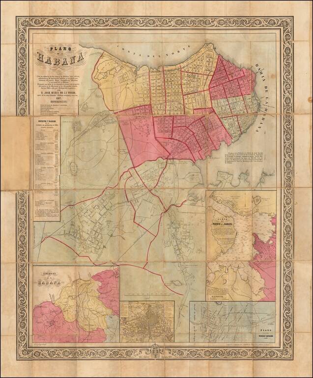
Rare, large-format, Havana-published lithographed folding map of Havana. The map was one of a number of beautiful maps of Cuban subjects made by de la Torre in the 1860s. Some of these maps were done in concert with the Colton firm. We have had...
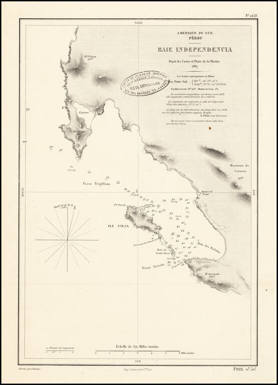
Scarce French sea chart of the area around the Peninsula de Paracas in Peru.
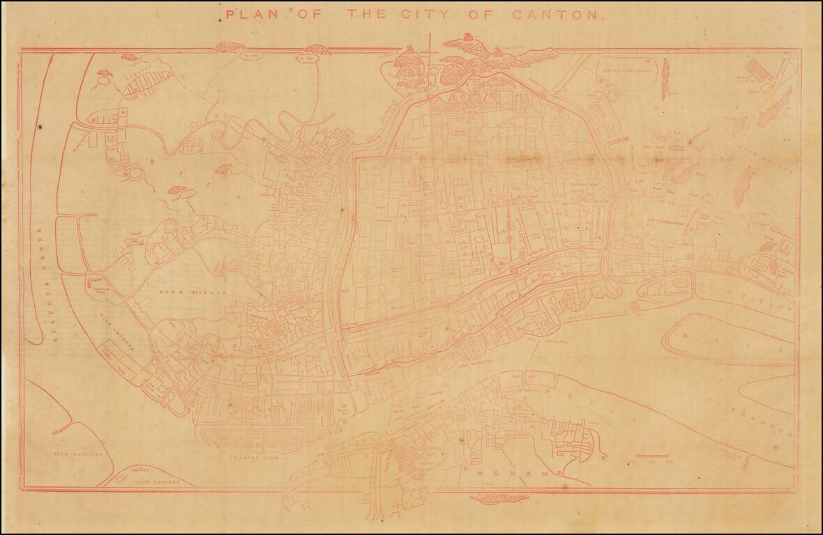
Rare Early Copy of Daniel Vrooman's Monumental Manuscript Map of Canton, China. Interesting early plan of Canton, based upon Daniel Vrooman's manuscript map of Canton. Vrooman's manuscript plan offered a little-seen view of Canton on the eve of the...
![[Vietnam & Cambodia] Carte Generale de la Basse Cochinchine et du Cambodge Levee en 1861-62-63-64 par M.M. L. Manen F. Vidalin, et G. Heraud, Sous-Ingenieurs hydrographes de la Marine. Publiee Par Ordre de L'Empereur . . . 1867](/map/small/58643.jpg)
The First Large Format Map of French Cochinchina Rare separately published map of the southern part of Vietnam and Cambodia, centered on the Mekong Delta and River. The map extends from the coast and the area around Ho Chi Minh City (Saigon) to the...