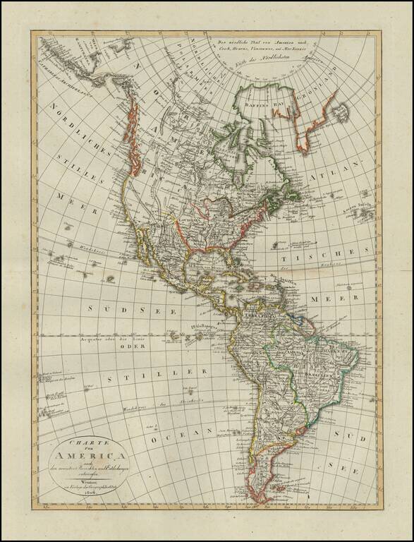
Scarce map of America, published in Weimar in 1806. The western part of North America is still relatively unknown, pre-dating the reports of Lewis & Clark and other western explorers. The map shows a very speculative Northwest Passage with a...
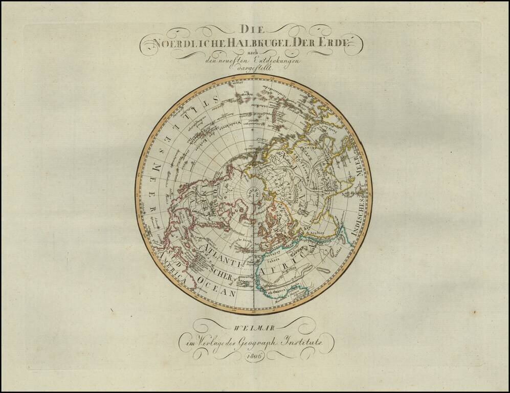
Rare map of the Northern Hemisphere, published in 1806. The map shows the incomplete understanding of the Northwest Passage, as well as still speculative details on the northwest coast of America and the interior parts of North America.
![The United States of America Confirmed By Treaty 1783 [shows Franklinia]](/map/small/70258.jpg)
Highly sought-after map of the United States, featuring the State of Franklin. Includes a massive Georgia, running to the Mississippi River, New Iberia, massive Western Territory and extensive notes along the Mississippi Valley. An important...
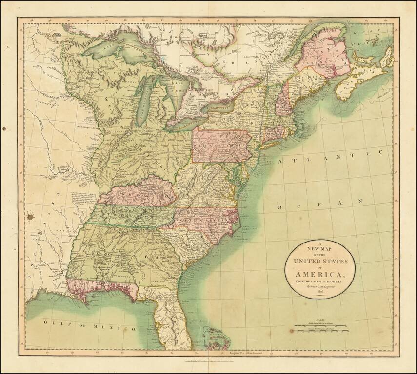
Beautiful Antique Map of the United States from 1806 Full original hand-color example of John Cary's map of the United States, published in London shortly before the War of 1812. Includes a massive Georgia, extending to the Mississippi River, East...
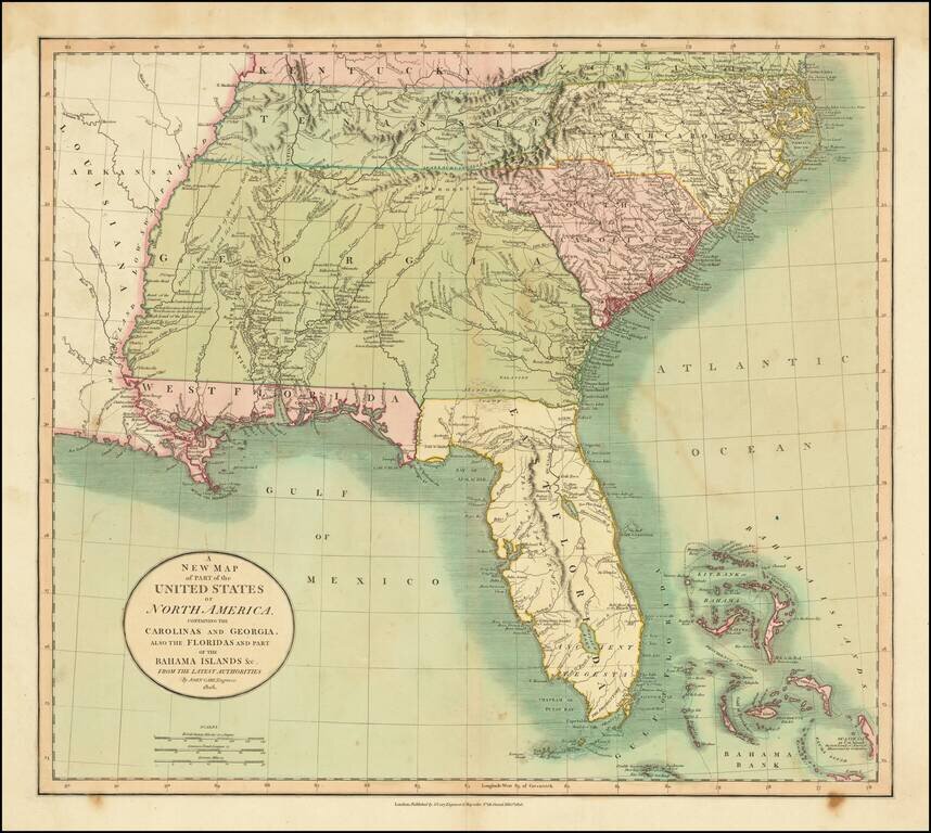
Fine example of the first edition of Cary's map of the Southern United States and Bahama Islands, extending the East Coast to the Mississippi River and from Tennessee and the Carolinas to Florida, the Bahamas and the Gulf Coast. A massive Georgia...
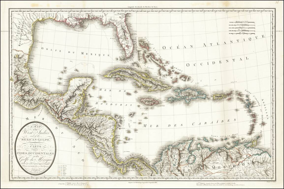
This is a rare separately issued map of the Gulf Coast and the Caribbean by Tardieu. The map was issued shortly after the Louisiana Purchase (1803) and the creation of the Mississippi Territory (1804). The map demonstrates the remarkably fine engraving...
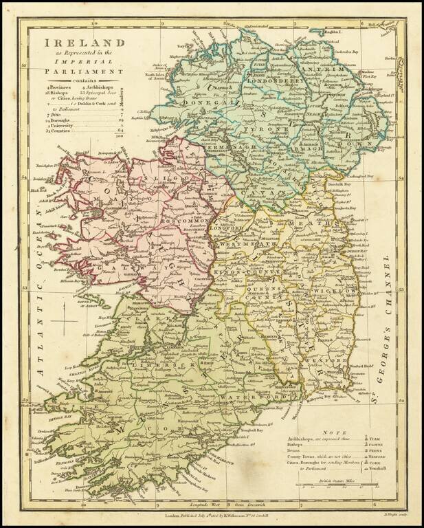
A fascinating map showing the electoral divisions of Ireland shortly after the island began sending MPs to Westminster. This map shows Ireland divided into its four provinces: Ulster, Leinster, Munster and Connaught and its 32 traditional counties. It...
![[Spandau] Spandow](/map/small/58956.jpg)
A Napoleonic Era French Map of Spandau Detailed manuscript map of the fortifications around Spandau and its Citadel, including French text, almost certainly indicating that it was prepared during the French occupation of the region, between 1806 and...
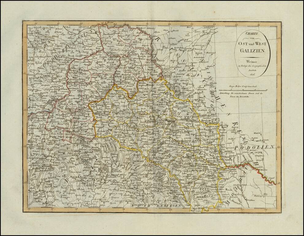
Scarce map of Eastern and Western Galizia in Poland, published in Weimar in 1806.
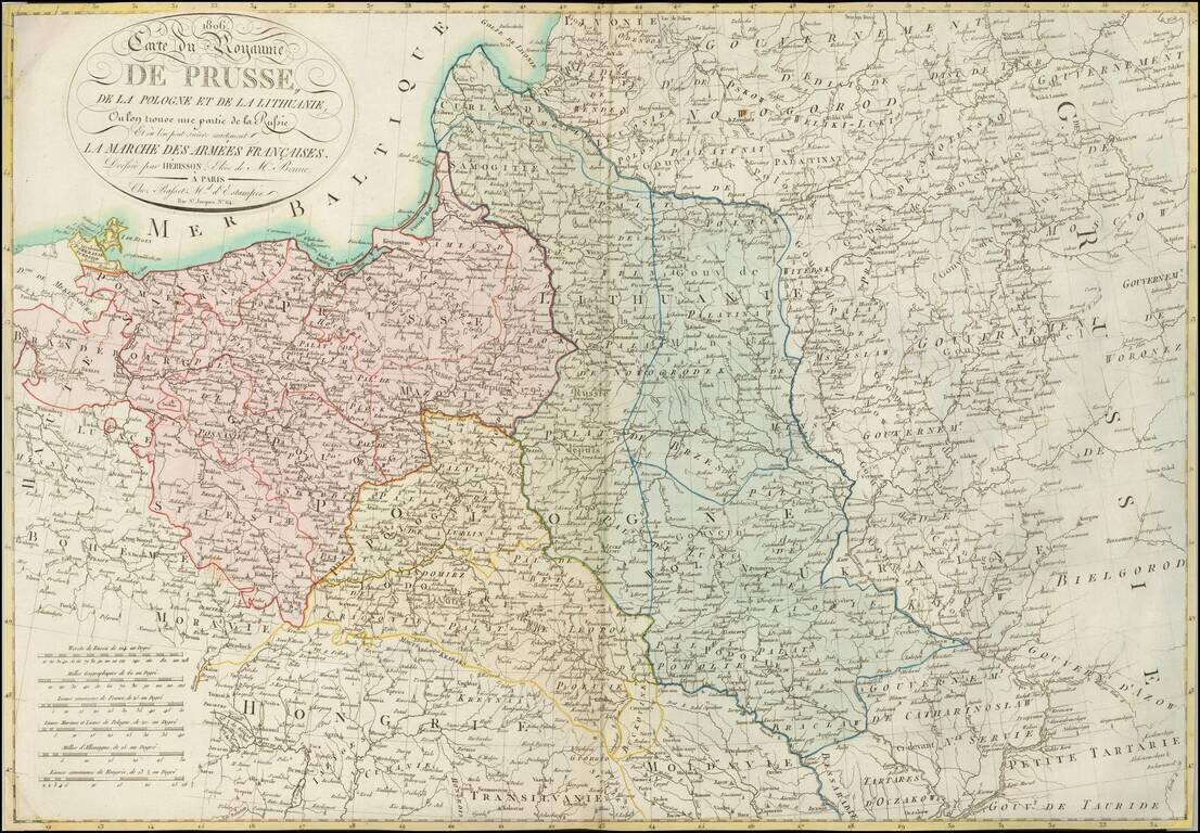
A Rare Map of Poland at the Time of the Creation of the Duchy of Warsaw. Detailed map of Poland and environs, showing the regions which were the subject of the marches of Napoleon's French Army and its allies, which resulted in the creation of the...
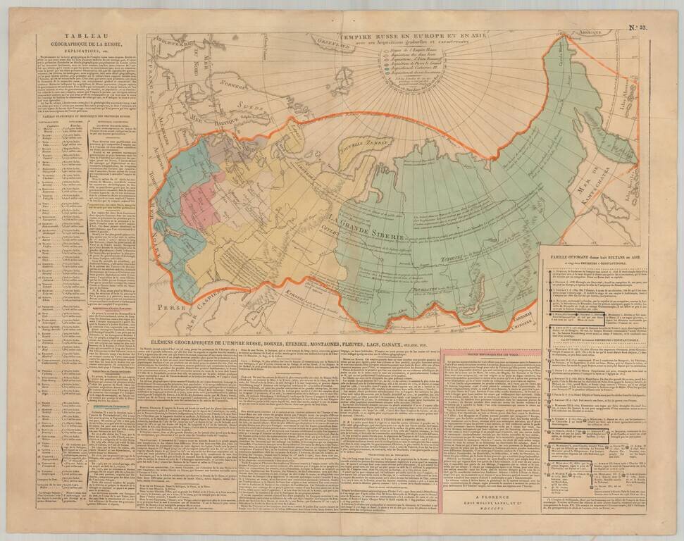
Rare Florentine map of Russia with original color showing the growth of the empire under the major rulers. Includes numerous notations and explanations. Panels of text describe the history and geography of the region. Side includes text panels. This...
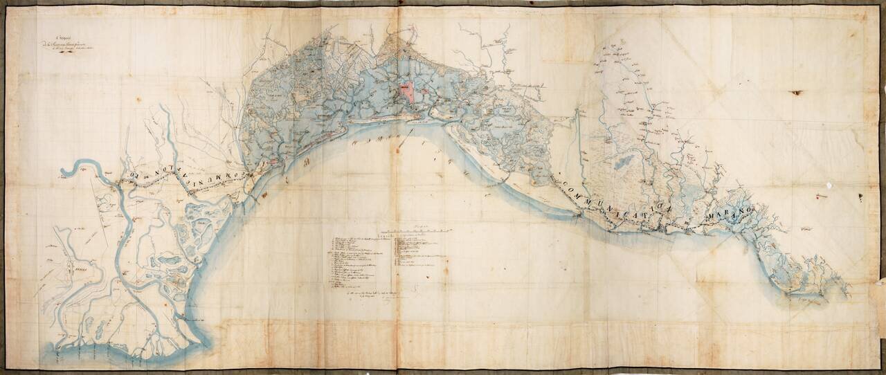
Napoleon's Survey of Venice After The Fall of the Venetian Republic Extraordinary manuscript reconnaissance map of the area around Venice, extending from San Canzian d'Isonzo and the mouth of the Isonzo River to Isola di Polensine and the mouth of the...
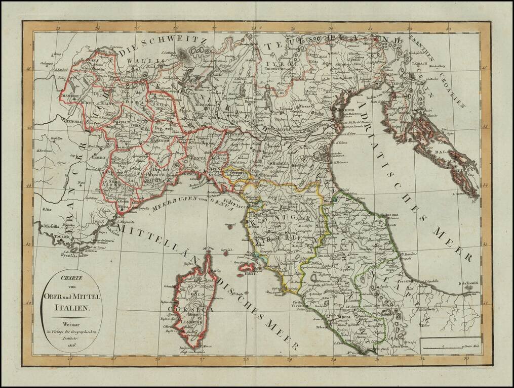
Scarce map of Northern Italy and Corsica, published in Weimar in 1806. A scarce map -- this is the first example we have seen.
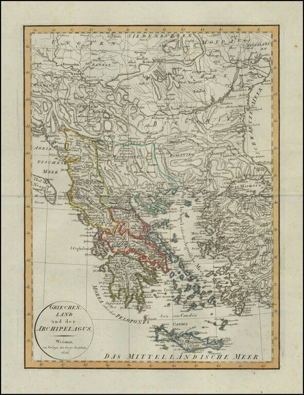
Scarce map of Greece, published in Weimar in 1806. A scarce map -- this is the first example we have seen.
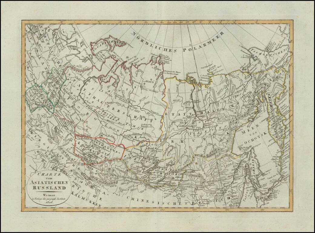
Scarce map of Russian Asia, published in Weimar in 1806.
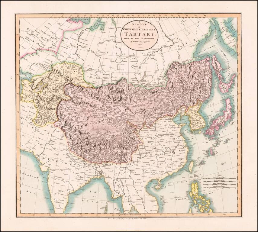
Antique Map of Central and Eastern Asia, from the Caspian Sea to China A marvelous map of Chinese Tartary, Corea and Japan. Includes nice detail and notes in the interior of Mongolia. Shows towns, rivers, mountains, lakes and other features.