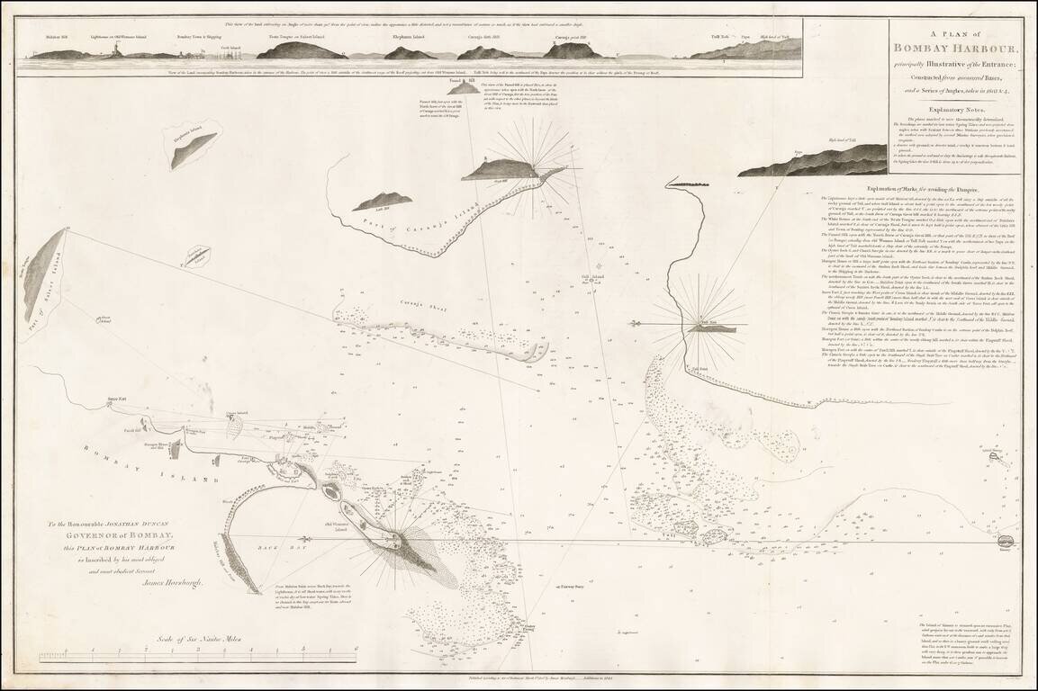
A fine early plan of Bombay (Mumbai) Harbor, first published from the survey work of James Horsburgh in 1806. The chart is the result of Horsburgh's survey work in Bombay in 1803 and 1804, with additions by an Admiralty assistant to 1844. It includes...
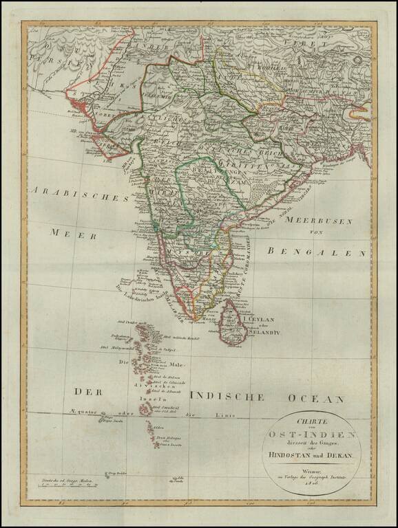
Detailed map of of India, from a scarce atlas published in Weimar. The map presents a fine depiction of the Maldives, along with political divisions in India. Some topographical information provided in Tibet and Nekpal (Nepal), including the location...
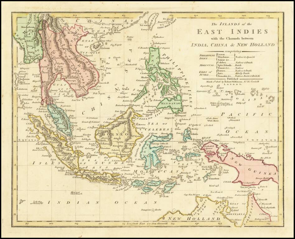
Highly detailed map of Southeast Asia, covering the region between Formosa and Hainan islands in the North and Australia in the South. Excellent detail in the Philippines, Indonesia and Southeast Asia. Johor is named, but not Singapore. Robert...
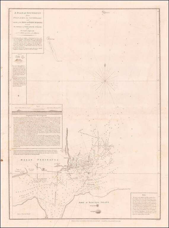
Horsburgh & Ross's Chart of Eastern Part of Singapore Strait Rare early sea chart of the Easternmost part of Singapore Strait, showing the area between Singapore, the southwestern tip of Malaysia, Bintan Island and Batam Island, published in...
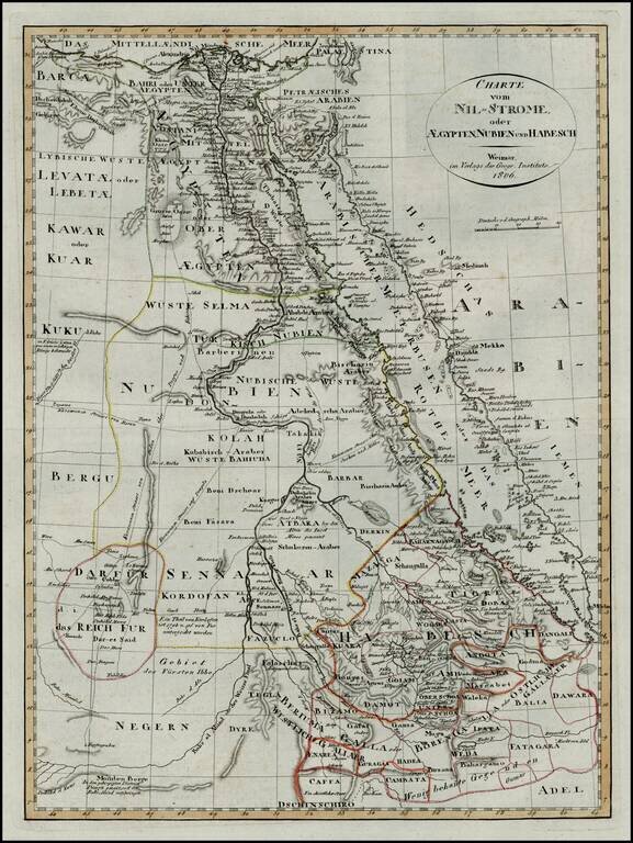
First edition of this scarce map of Egypt and Abyssinia, which was later copied in a pirated edition published in Prague.
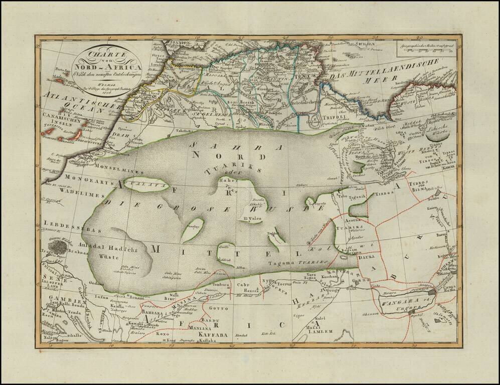
Scarce map of North Africa, published in Weimar in 1806. Incudes a fantastic depiction of the Sahara Desert. A scarce map -- this is the first example we have seen.
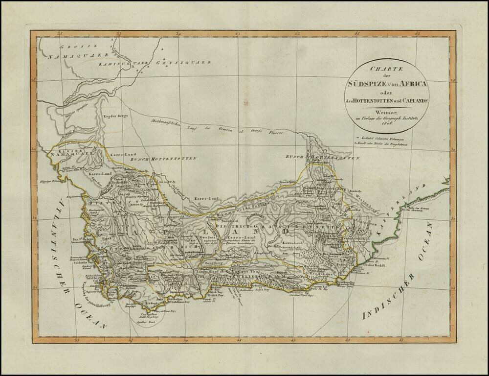
Scarce map of South Africa, published in Weimar in 1806. Includes details on Boer Villages and other colonist details in the region. A scarce map -- this is the first example we have seen.
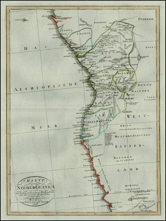
Rare early 19th Century map of the west coast of from Equatorial Guinea and Gabon to Namibia. The map is centered on Angola and the Congo.
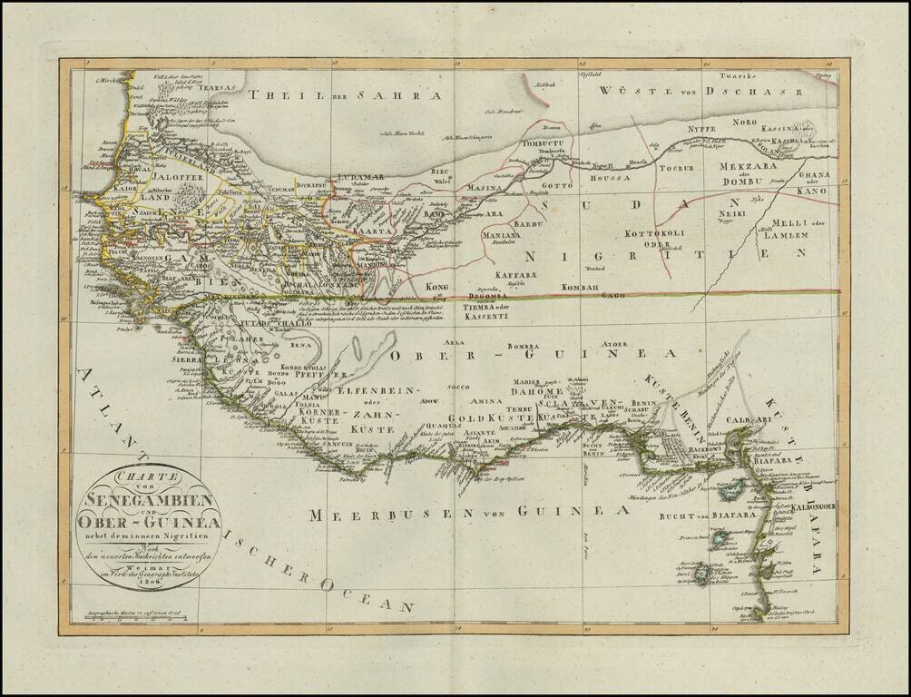
Scarce map of a portion of West Africa, published in Weimar in 1806. Incudes a fantastic depiction of the Sahara Desert in the north and the open unknown regions in the interior, with the extensive European Trading posts along the coastline. A scarce...