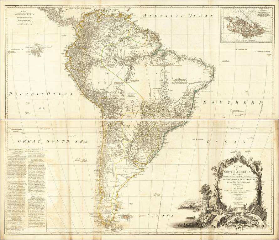
Detailed 4-sheet map of South America, based upon and earlier French map by D'Anville. Includes a large inset map of the Falklands. South America is shown during the Bourbon Englightenment period, when Spain was finally beginning to share more...
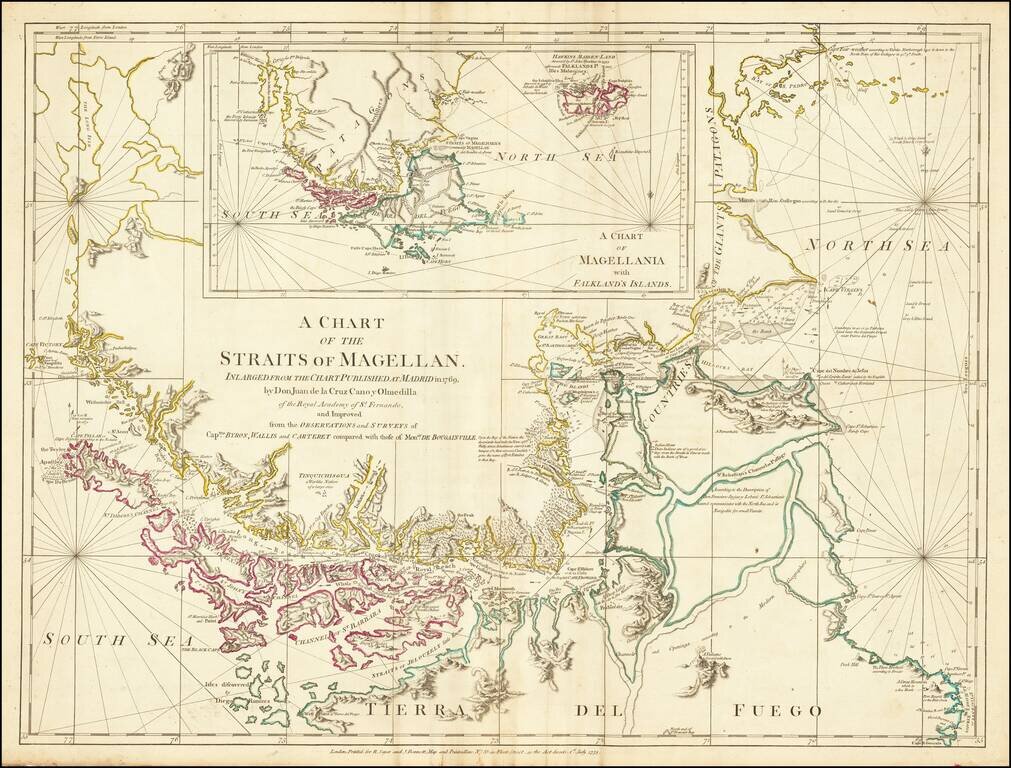
Nice example of this detailed map of the Straits of Magellan on continuous regions, prepared from the recently completed map of Juan de La Cruz Cano & Olmedilla and Hiolito Ricarte. Cruz Cano's eight-sheet map of South America, much like the...
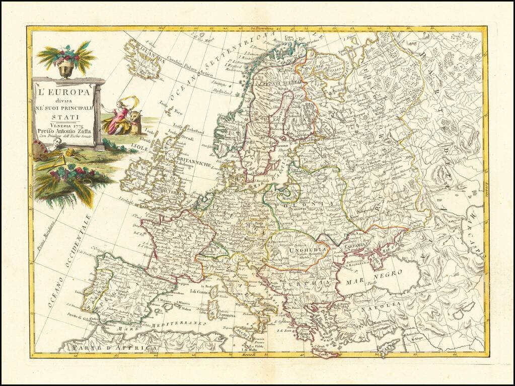
Decorative map of Europe, published in Venice in 1775. The present example is a rare early edition. Most examples are dated 1776 or later.
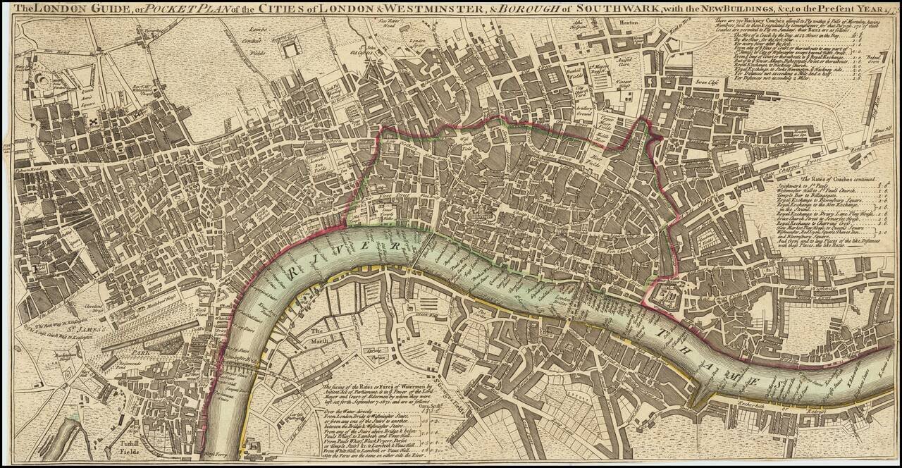
Unrecorded? 1775 Edition of This Map of London. Antique engraved map of in the late-18th century, published by Carrington Bowles in 1775. The map includes great detail of streets and built-up sections of the city; most streets and squares are named....
![Tabula Regni Borussiae Borussiam Orientalem exhibens MDCCLXXV [and] Borussiae Occidentalis Tabula . . . 1780](/map/small/58775.jpg)
Scarce map of Poland, Lithuania, Kalingrad, Pomerania, etc. The maps were created by Gussefeld, one of his earliest maps, and published by Homann Heirs.
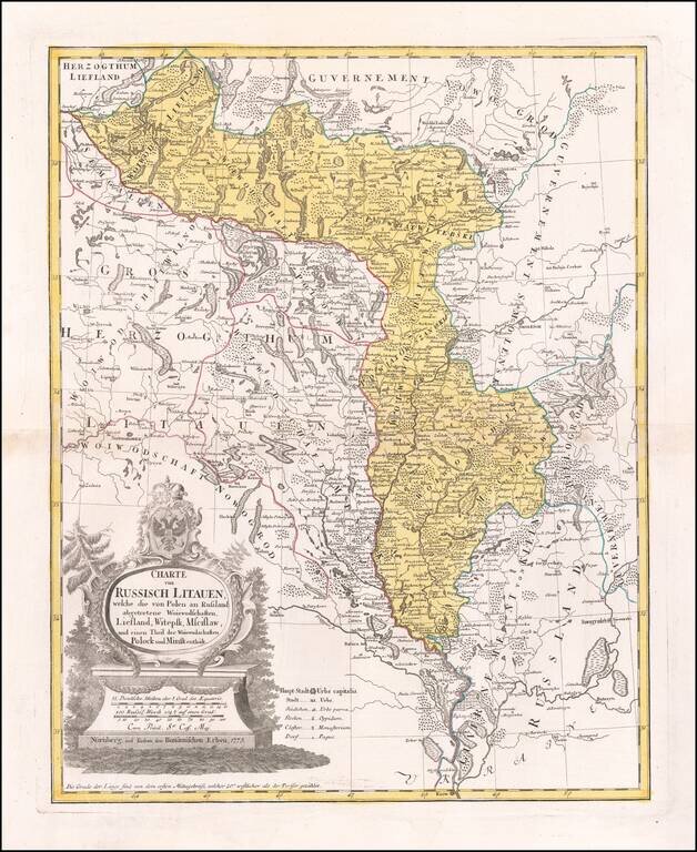
Antique Map of Russian Lithuania After The First Partition Interesting regional map of Russian Lithuania, showing remarkable detail along the upper Dniepr and Dwina River regions, from Liefland to Mscislaw and Woiwodschaft. This 1775 map depicts...
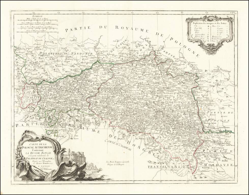
Fine and highly detailed map of Southern Poland and parts of Slovakia, Ukraine, Hungary, Romania and Moldova, which was then being called Austrian Poland and Red Russia. Santini gives credit to Homann Heirs in the cartouche.
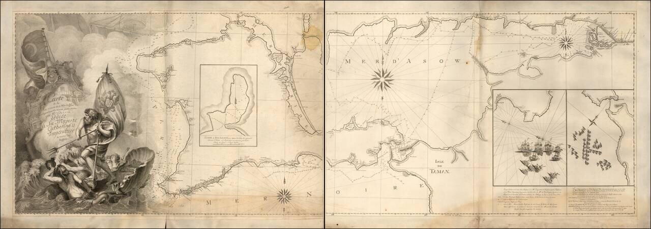
Imposing French Sea Chart of the Crimea Commemorating the Decisive Russian Victory over the Ottoman Empire. Two-sheet, separately issued engraved sea chart of Crimea, featuring insets of two naval battles during the Russo-Turkish War (1768-1774)....
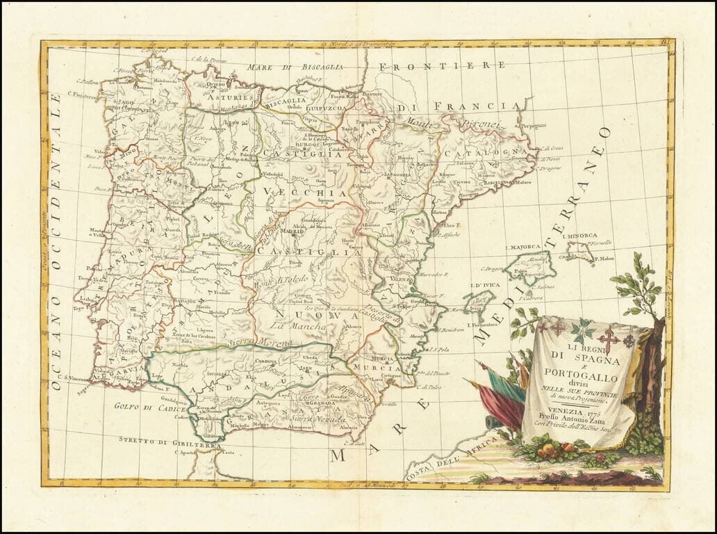
Detailed map of the Iberian Peninsula, published in Venice by Zatta. Very interesting early map, with nice detail. Decorative title cartouche. From Zatta's monumental Altante Novissimo, one of the last great decorative atlases of the 18th Century.
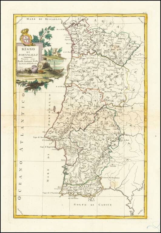
Detailed map of the Kingdom of Portugal, published in Venice. Includes a decorative title cartouche, with coat of arms. From Zatta's monumental Altante Novissimo, one of the last great decorative atlases of the 18th Century.
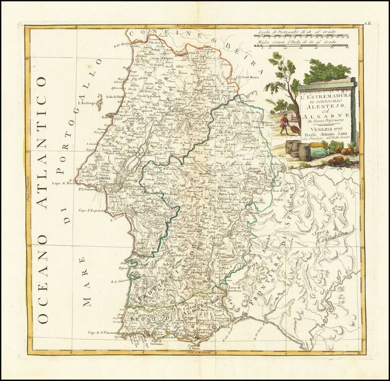
Detailed map of the Southern parts of the Kingdom of Portugal, published in Venice. Includes a decorative title cartouche, with coat of arms. From Zatta's monumental Altante Novissimo, one of the last great decorative atlases of the 18th Century.
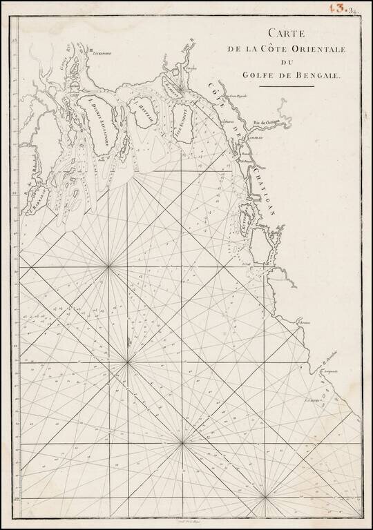
Detailed sea chart of the Bay of Bengal, engraved by De La Haye and published in the Neptune Orientale.
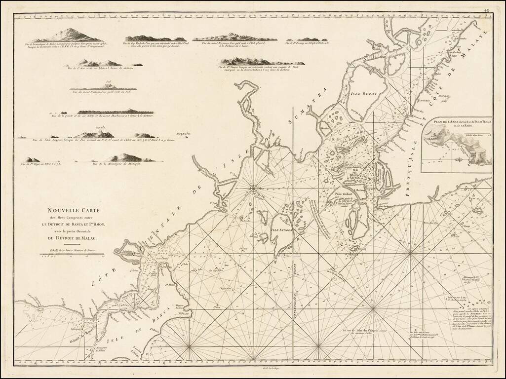
A rare sea chart, including a map of Singapore and the Straits of Malacca and Banca, which appeared only in the second and enlarged edition of Mannevillette's Le Neptune Oriental. Important early chart of the East Coast of Sumatra, the eastern portion...
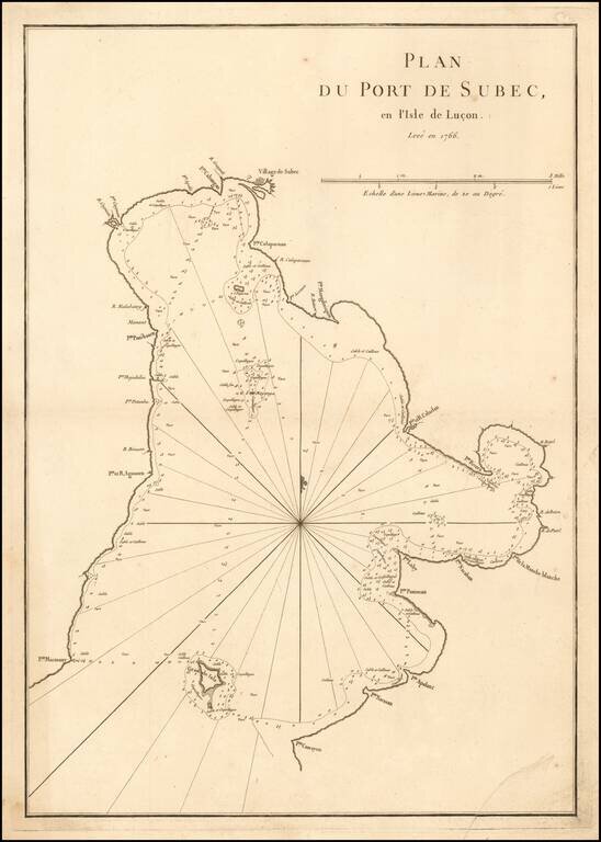
A rare sea chart of Subic Bay in the Philippines, which appeared in the second edition of Mannetvillette's Le Neptune Oriental, published in 1775. The chart is one of the earliest obtainable detail charts of Subic Bay. Subic Bay was discovered by the...
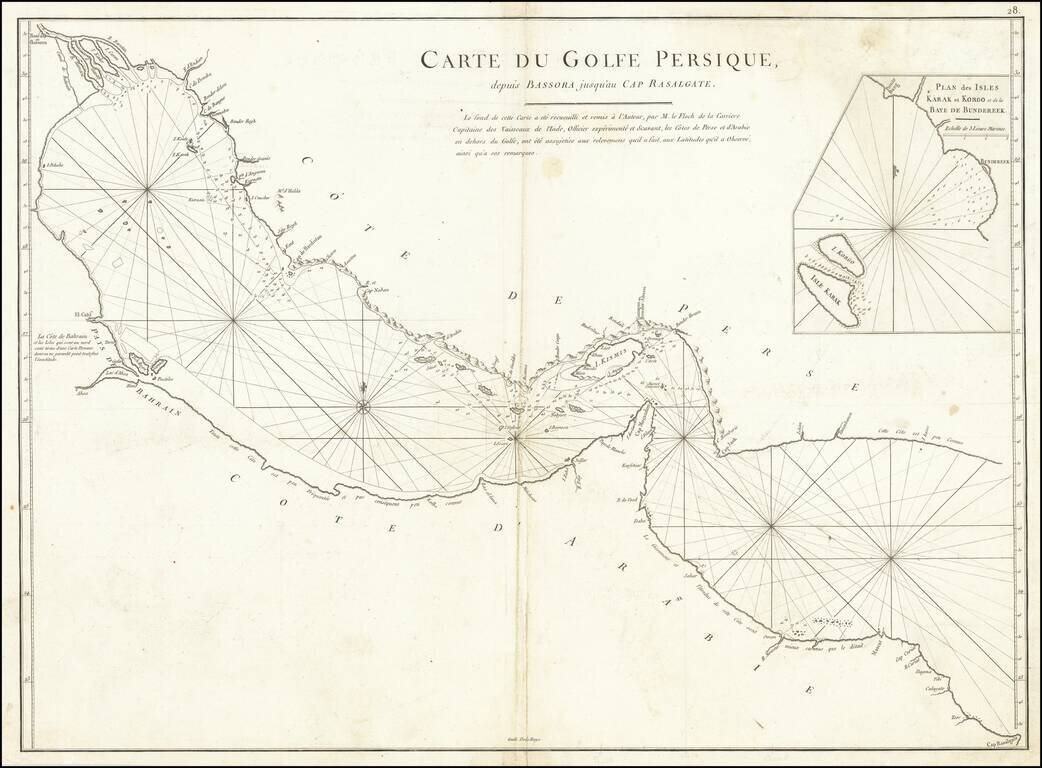
A rare antique map of the Persian Gulf and Gulf of Oman. Designed for navigational use by the French East India Company, this map is neatly designed and shows rhumb lines, bathymetric soundings, prevailing currents, and shoals. This chart is designed...
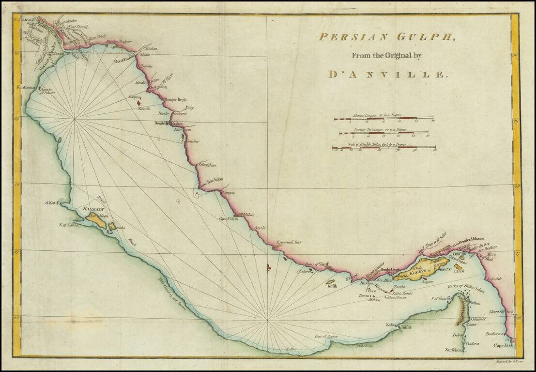
Scarce English Map of the Gulf Scarce coastal chart of the Gulf, from Basra to Cape Jask and Kursekian. The map shows several toponyms in the UAE, including Julfar, la Pagode blache, and Zaka. The map shows a lot of detail around Bahrain and Qatar,...