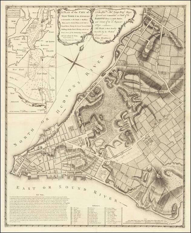
The First Large Scale Plan of New York City Fine example of John Montresor's map of lower Manhattan, the first large scale plan of New York City. Following the conclusion of the French & Indian War, the British introduced a number of measures in...

A nice example of the 1775 edition of Fry & Jefferson's map of Virginia and Maryland, widely regarded as the most important and influential 18th century map of Virginia and Maryland. Originally prepared by Joshua Fry of William & Mary and...
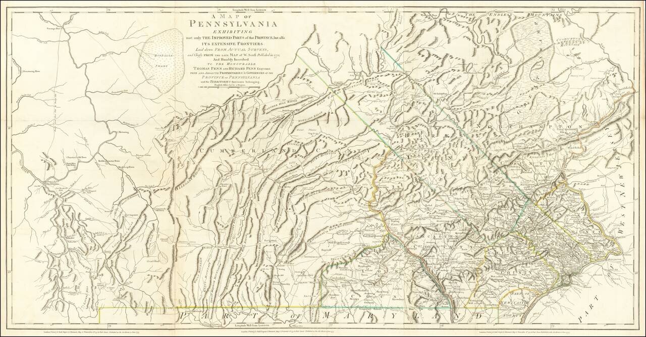
The Province of Pennsylvania on the Eve of the American Revolution Important Revolutionary War-era map of Pennsylvania, compiled by Sayer & Bennett, primarily from William Scull's landmark map. This large and impressive map of the colony of...
![The Coast of West Florida and Louisiana . . . [with] The Peninsula and Gulf of Florida or Channel of Bahama with the Bahama Islands . . .](/map/small/38977.jpg)
18th Century Florida & Gulf Coast Sea Chart Nice example of the Laurie & Whittle significantly revised and updated edition of Thomas Jefferys' 2-sheet map of Florida and the Gulf Coast, from Jeffreys' West India Atlas. This edition of the map...
![The Coast of West Florida and Louisiana . . . [with] The Peninsula and Gulf of Florida or Channel of Bahama with the Bahama Islands . . .](/map/small/66344.jpg)
Florida and the Gulf Coast at the outset of the American Revolution Nice example of this important early 2-sheet map of Florida and the Gulf Coast, from Jeffreys' West India Atlas. Jeffery's map is the earliest obtainable large format map to treat...
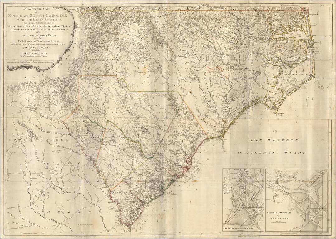
Second state of Henry Mouzon's landmark 4-sheet map of the Carolinas, the primary source for the geographical details of the Carolinas for the American, English and French armies during the American Revolution. Mouzon's map was unquestionably the most...
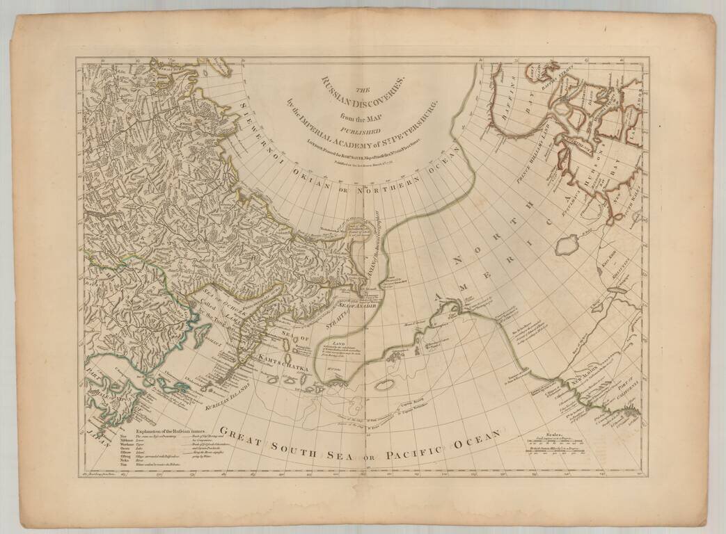
Fine English edition of Muller's map of the Northwest Coast of America and Northeast Coast of Asia, based upon reports from J.N. De L'Isle in St. Petersburg and others. Includes a massive conjectural land mass approximating the Alaskan Archipelago and...
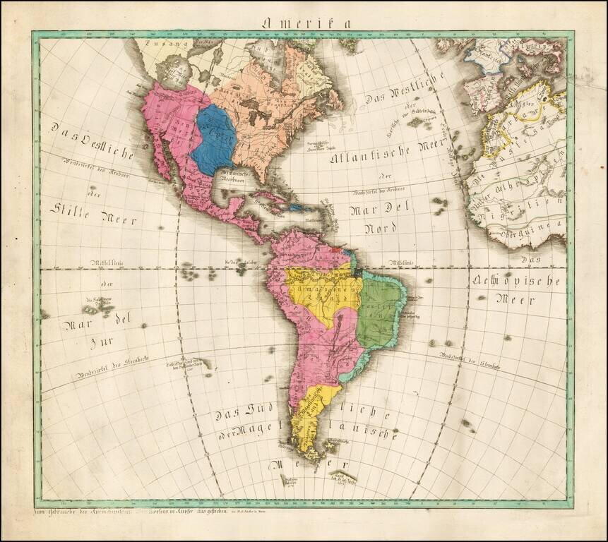
Extremely rare map of America, published in Mainz by W.C. Rucker. The map boldly shows the Bay of the West (Das West Meer oder West Bay). Louisiana is boldly depicted in blue, at a time when it was the only significant French territory the New...
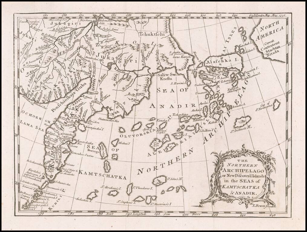
Rare early map depicting the Bering Strait and the newly discovered Aleutian Islands, shortly before the region was visited by Captain James Cook in 1778. In 1741, Vitus Bering, a Dane in the service of Russia, and Aleksei Chirikov, a Russian, sailed...
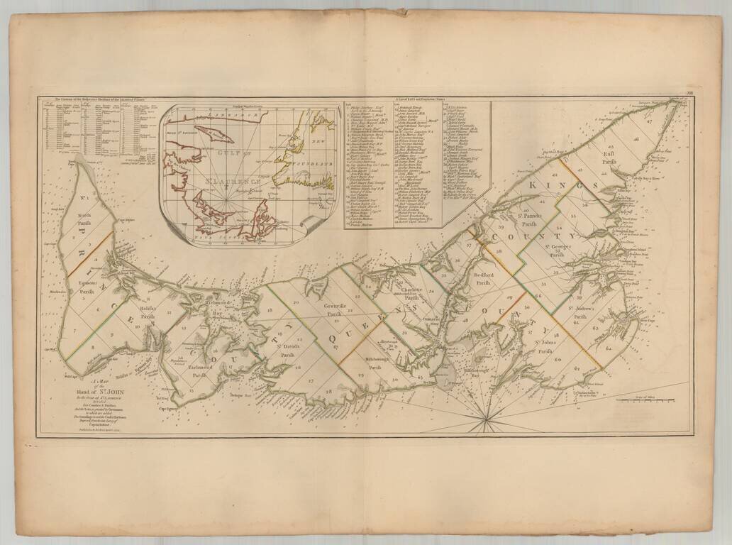
Important early map of St. Johns Island, published by Thomas Jefferys in the American Atlas. The map provides a finely detailed treatment of the island and environs, including a list of 67 lots and the proprietors of each lot, including Samuel Holland...
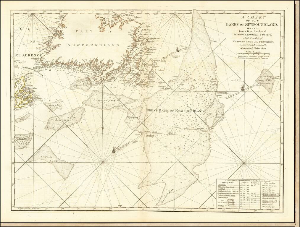
Detailed map of Newfoundland the Grand Banks, published in Jeffery's American Atlas. The map includes three ship illustrations representing the voyages of Chabert, Cook and Fleurieu, inset of astronomical observations on which the chart is based, as...
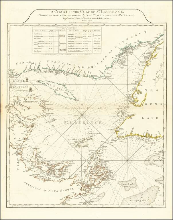
Fine example of Sayer and Bennett's chart of the Gulf of St. Laurence, based on the surveys by James Cook and Michael Lane. At the conclusion of the French and Indian War, the British needed accurate charts of the territories that had been awarded to...
![[Volcanos] The Bay of Honduras. By Thos. Jefferys Geographer to His Majesty](/map/small/70861.jpg)
With Volcanos in El Salvador and Guatemala shown Nice example of Thomas Jefferys chart of the coastline from Salamanca de Bacalar to Brewer's Lagoon and the Moskito Coast, centered on the Gulf of Honduras and the Rio Balize. Extends to the Port of...
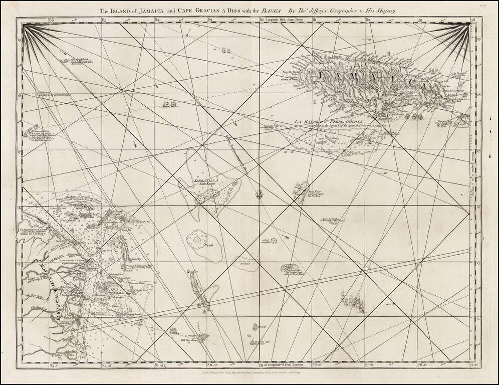
Detailed map of the Island of Jamaica and the Mosquito Coast, with the islands and shoals between, from Jefferys West India Atlas.
![[Cuba] [Plan of Lands at Bahia Honda]](/map/small/67161.jpg)
Intriguing Manuscript Map of Plantation Lands in Cuba Including Coffee Plantations Schematic manuscript sketch map of Bahía Honda, along the north coast of Cuba. The paleography indicates the map was made in the mid- to late-eighteenth century....
![Carte Reduite Des Iles Antilles . . . [and] Carte reduite des debouquements de St. Domingue . . . . 1775 [Includes Bahamas]](/map/small/58201.jpg)
A magnificent two-in-one map of the Lesser Antilles (from the eastern tip of Puerto Rico to St. Vincent and Barbados) and of the Turks and Caicos (including part of the Bahamas and the northern coast of Hispaniola). A later reissue and compilation of...