logo

1775. The London Guide or Packet Plan of the Cities of London & Westminster, & Borough of Southwark, with the New Buildings, & c. to the Present Year 1775.

  • The London Guide or Packet Plan of the Cities of London & Westminster, & Borough of Southwark, with the New Buildings, & c. to the Present Year 1775.

The London Guide or Packet Plan of the Cities of London & Westminster, & Borough of Southwark, with the New Buildings, & c. to the Present Year 1775. information:

Year of creation: 
Resolution size (pixels): 
 12386x6430 px
Disk Size: 
 29.6426MiB
Number of pages: 
 1
Place: 
 London
Author: 

Print information. Print size (Width x height in inches):
Printing at 72 dpi 
  172.03 х 89.31
Printing at 150 dpi 
 82.57 х 42.87
Printing at 300 dpi 
 41.29 х 21.43

An example of detailing the file of this map of in a printable high-resolution:

Click to open in high resolution (open in new tab).
Attention! this is just the central piece (central area 960x960 px) of the map file!
This is an example, so that you can see and study the level of detail of a given map. The entire Map will be fully available after payment!

The London Guide or Packet Plan of the Cities of London & Westminster, & Borough of Southwark, with the New Buildings, & c. to the Present Year 1775.

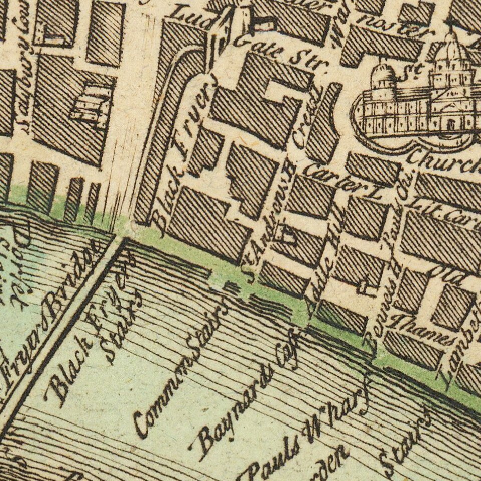
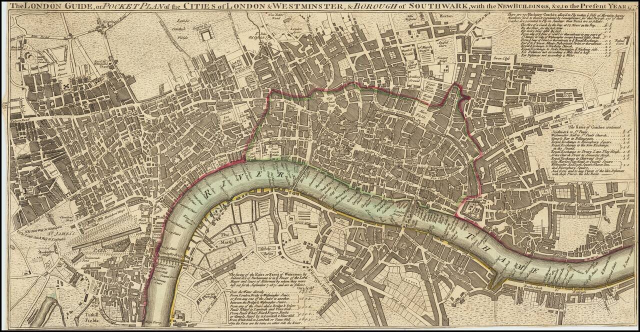
Unrecorded? 1775 Edition of This Map of London.

Antique engraved map of in the late-18th century, published by Carrington Bowles in 1775.

The map includes great detail of streets and built-up sections of the city; most streets and squares are named. The map shows London before its major expansions in the Georgian and Victorian Periods.

As the map was intended for visitors to London it includes notes on Hackney Coach rates ("There are 700 Hackney Coaches allow'd to Ply within ye Bills of Mortality, having Numbers fix'd to them & regulated by Commissioners for that Purpose, 170 of these Coaches are permitted to Ply on Sundays, their Rates are as follows."), and rates for crossing the Thames ("The fixing of the Rates or Fares of Waterman by Antient Act of Parliament, is in ye Power of the Lord Mayor and Court of Aldermen by whom they were last set forth September 7, 1671. and are as follows..."

Cf. Howgego 141,

Special conditions for students!

If you are a student, write to us in telegram: @antiquemaps and indicate what material you need and for what work you need a map in high detail. We are ready to provide material on special terms. For students only!

Item information:

Year of creation:
Size:
12386x6430 px
Disk:
29.6426MiB
Number of pages:
1
Place:
London
Author:
Carrington Bowles.
$14.99

Related item