
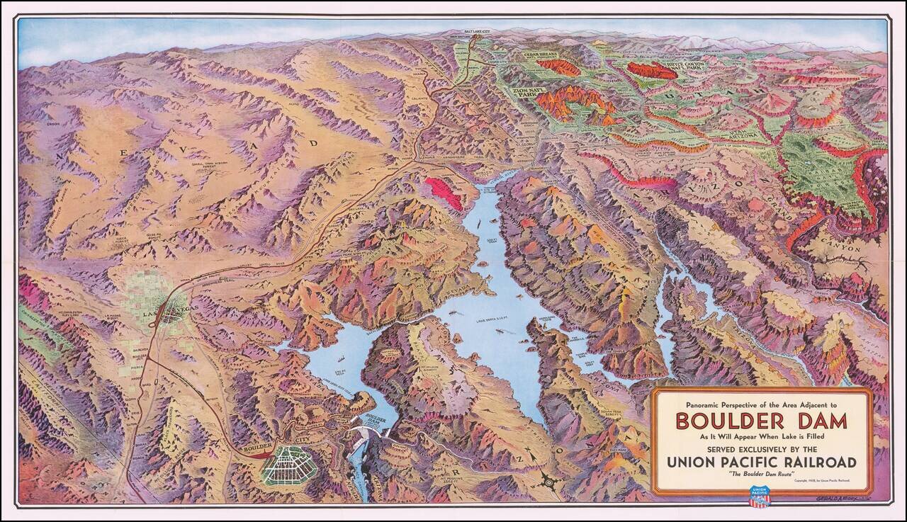
Boulder Dam & Environs Striking panoramic view of the Nevada, Utah, and Arizona desert, from Las Vegas to the Grand Canyon, published by the Union Pacific Railroad. The map extends east to the Union Pacific Grand Canyon Lodge on the north rim of...
![A Hysterical Map Of Lake Tahoe Wild and Woolly Nevada With Its Wide Open Places [With Original Envelope!]](/map/small/68358.jpg)
Hysterical Tahoe With Original Mailing Envelope! Fine example of this rare pictorial map of Lake Tahoe, "Drawn in Broken English by Jolly Lindgren." This comic pictorial map is full of puns and comic vignettes related to Lake Tahoe. The Legend...
![Las Vegas Fun Tour Map [on sheet with:] Las Vegas City Fun Map](/map/small/69008.jpg)
Rare vintage pictorial map of Las Vegas and the Las Vegas Region printed front-to-back on a 1947 promotional pamphlet for the city. The main map features the region around Las Vegas in George Ramsey's characteristic red, yellow, blue, and green color...
![[Nevada] Travel-Time in Nevada](/map/small/70216.jpg)
Explore the West with Scenic Guides Scarce folding map of Nevada, published to promote Weldon F. Heald's Scenic Guide to Nevada. The map was issued to promote Healds' travel book, highlighting natural points of interest and other details and...
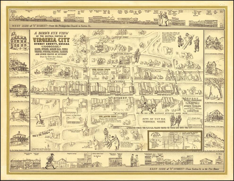
Finely executed pictorial map / birds eye view of Virginia City, drawn by Robert Lewis Richards and lithographed by the Silver State Press in Reno. The map is a fine combination of historical vignettes and meticulous recreation of Virginia City during...
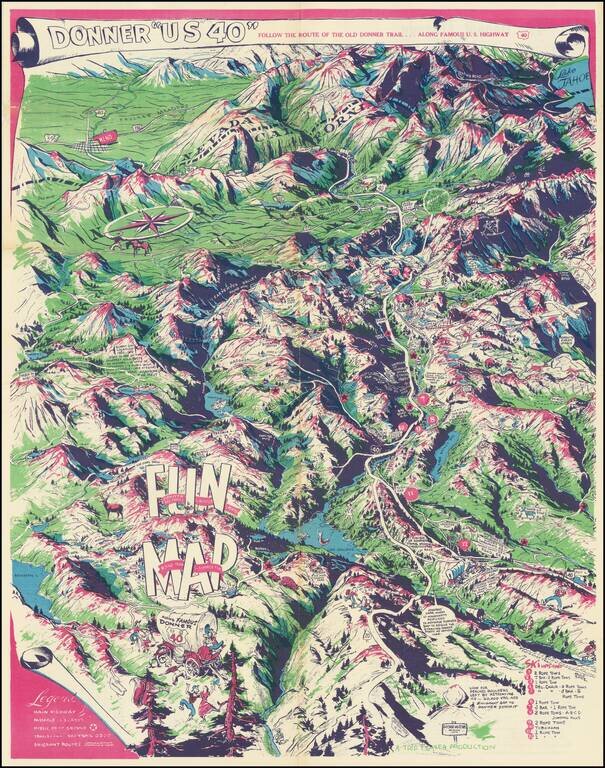
Humorous vintage pictorial map of U.S. Highway 40, the so-called Donner Trail Highway, through the Sierras near the California-Nevada border. The map is mostly focused on the Sierras west of the Nevada border, with Reno in the upper-left corner and...
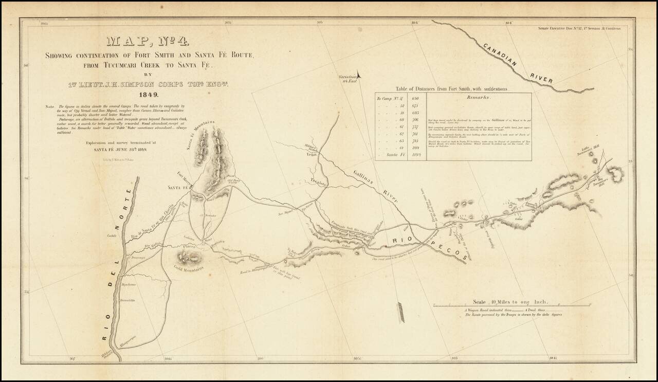
Detailed map of a portion of New Mexico Territory, showing the area east of the Rio Grande to the Canadian River. The map focuses on the roads and rivers in the region and the details surveyed by the exploration party led by James Simpson. Major...
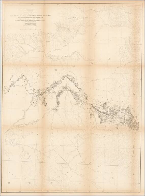
Detailed map extending from Bridger's Pass in the north to New Mexico, centered on the Sawatch and Wasatch Mountains. Shows proposed railroad line through Bridger Pass in Northeast Utah Territory, including parts of present day Colorado and Wyoming...
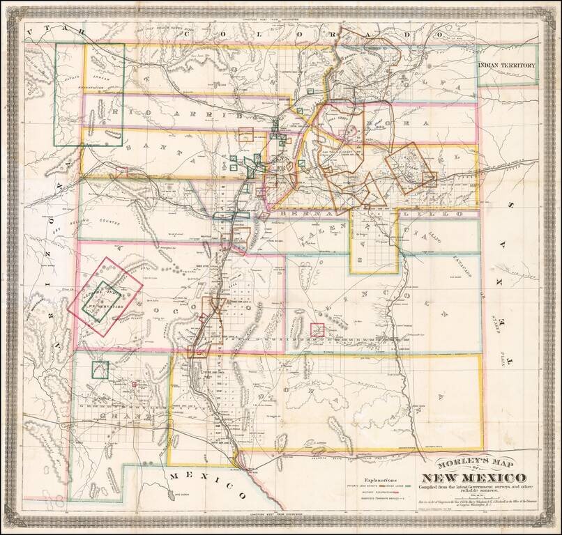
One of the Earliest Separately Published Maps of New Mexico Territory Detailed early map of New Mexico, prepared by the engineer and surveyor William Raymond Morley is generally acknowledged to be the first map to show only the territory of New...
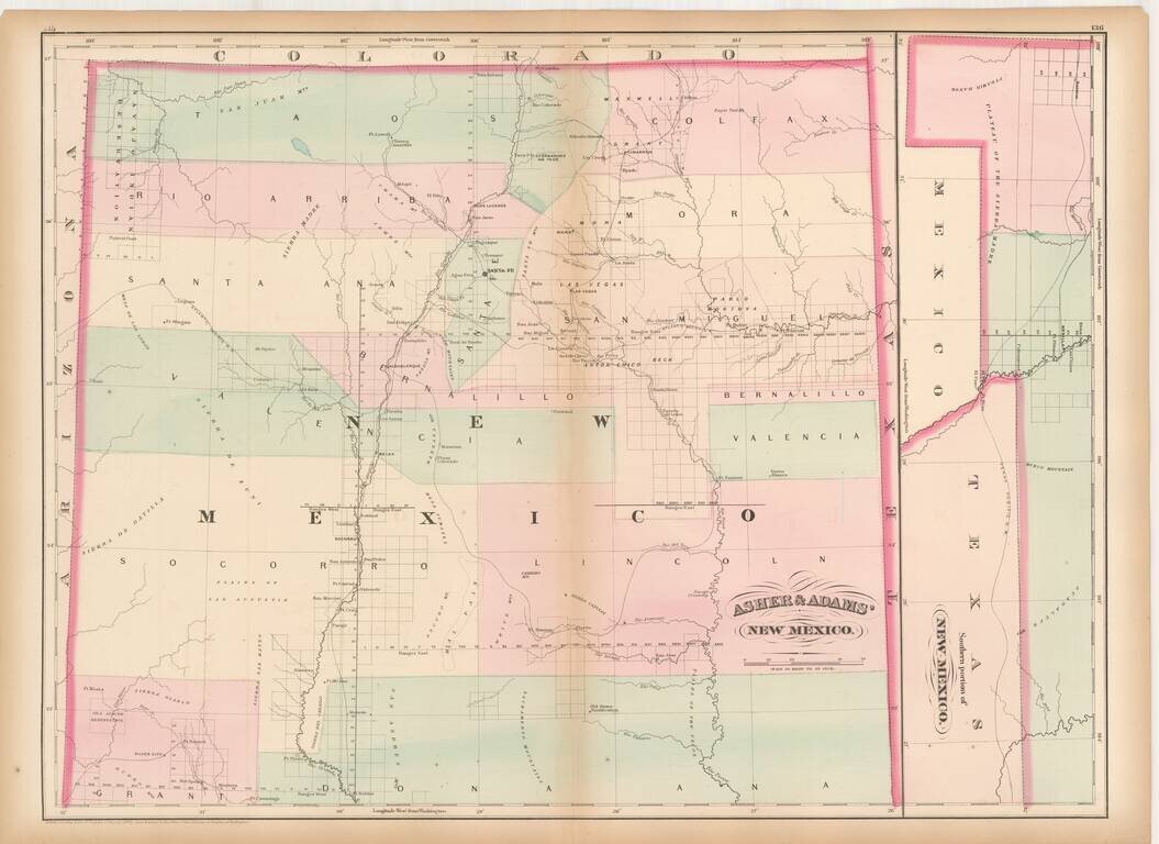
British Land Speculation in New Mexico? Rare early map of New Mexico Territory, lithographed in London by Whiteman, Hicks & Whiteman. New Mexico is colored showing early counties, with the earliest proposed railroads illustrated, including a line...
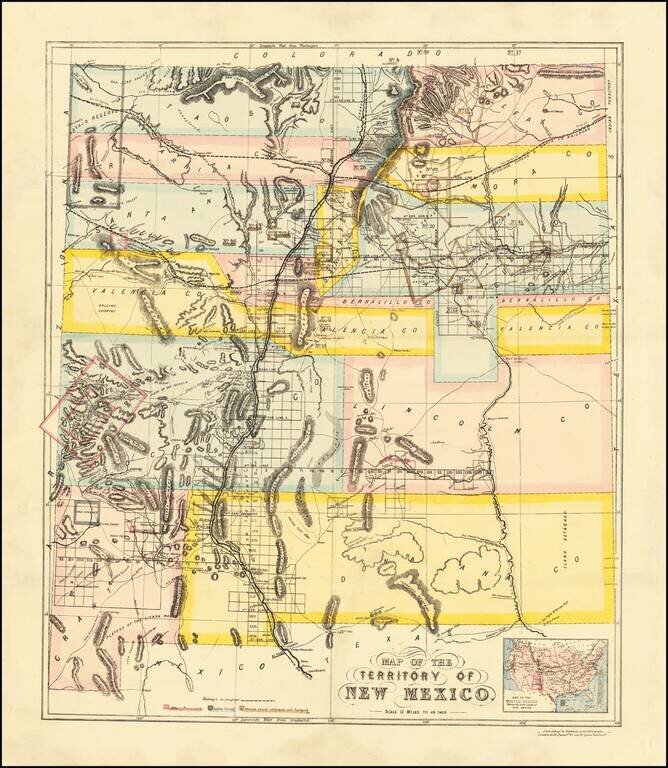
Remarkable large format railroad map of New Mexico Territory. The earliest separately issued map of New Mexico Territory in its modern configuration to appear in a commercial atlas . The map illustrates the early railroads, settlements, mining...
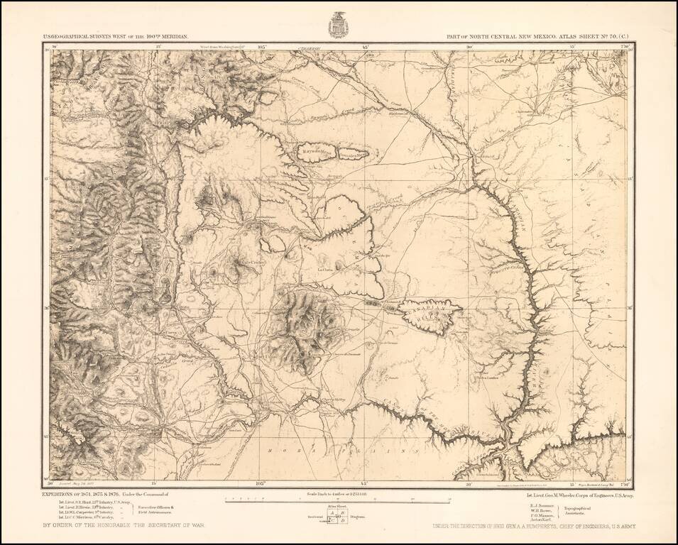
Detailed topographical map showing north central New Mexico, with the Taos Mountains at the upper left and Fort Union toward the center. Shows towns, roads, mountains, rivers, lakes, hydrographical details, etc. The map was generated during the...
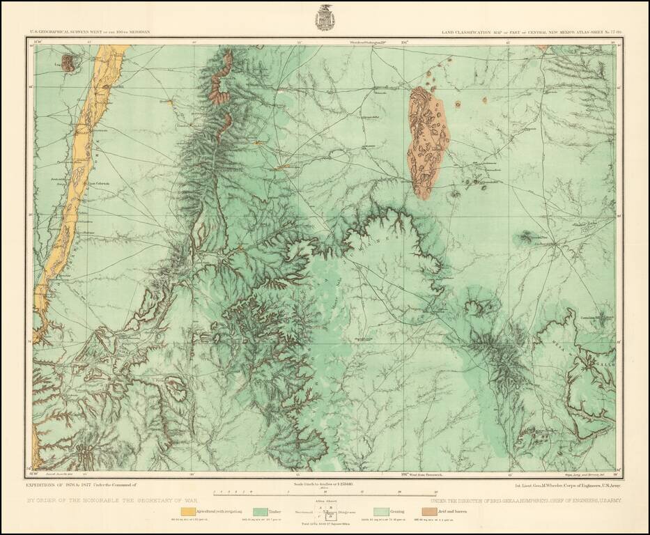
Detailed topographical map of central New Mexico, showing the area immediately southwest of Albuquerque. Shows towns, roads, mountains, rivers, lakes, hydrographical details, etc. The map was generated during the Wheeler Survey. The Wheeler Survey...
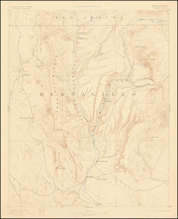
Detailed geological map of a large portion of Bernalillo County, published by the United States Geological Survey, originally surveyed in 1887-88. The map is centered on Jemes Peak and Jemes Creek. Covers the region north of Albuquerque and west of...
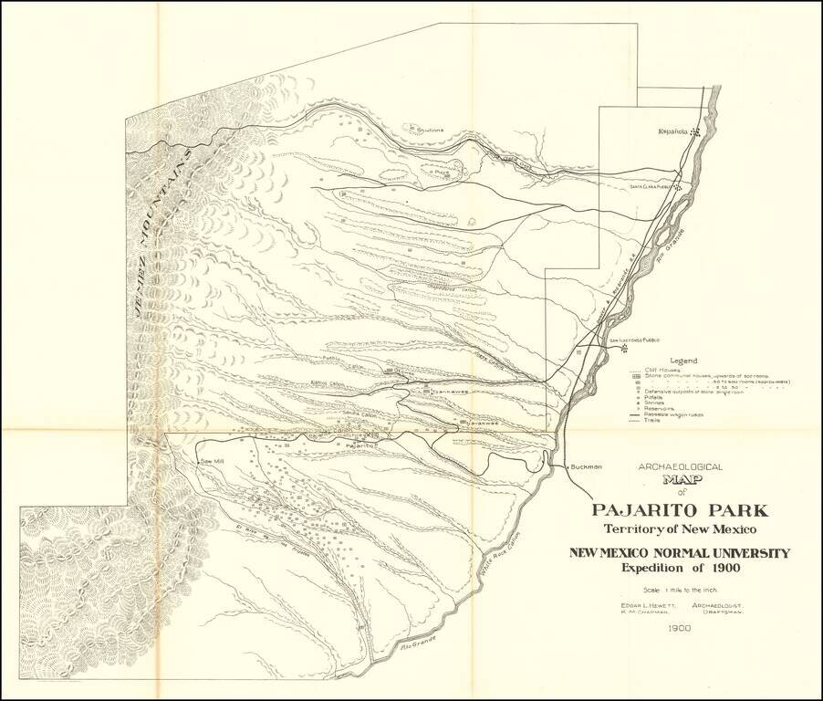
Highly detailed map of what is now Bandelier National Monument bounded on the northwest by the Jemez Mountains and on the east and south by the Rio Grande. On the northeast are Espanola and Santa Clara Pueblo. This map shows topography, names all the...
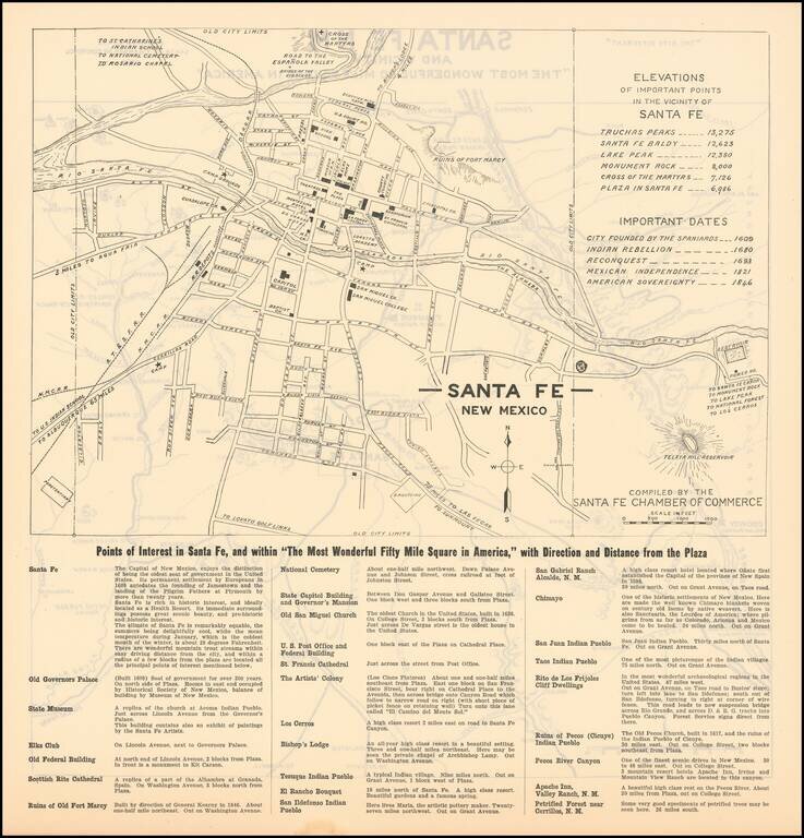
The Most Wonderful Fifty Mile Square in America Fine map of Santa Fe, during the earliest period of its artistic and preservationist history. Detailed map of the town of Santa Fe, New Mexico, with a regional map of the area around Santa Fe on the...