Map size in jpg-format: 18.7355MiB
Click to open in high resolution (open in new tab).
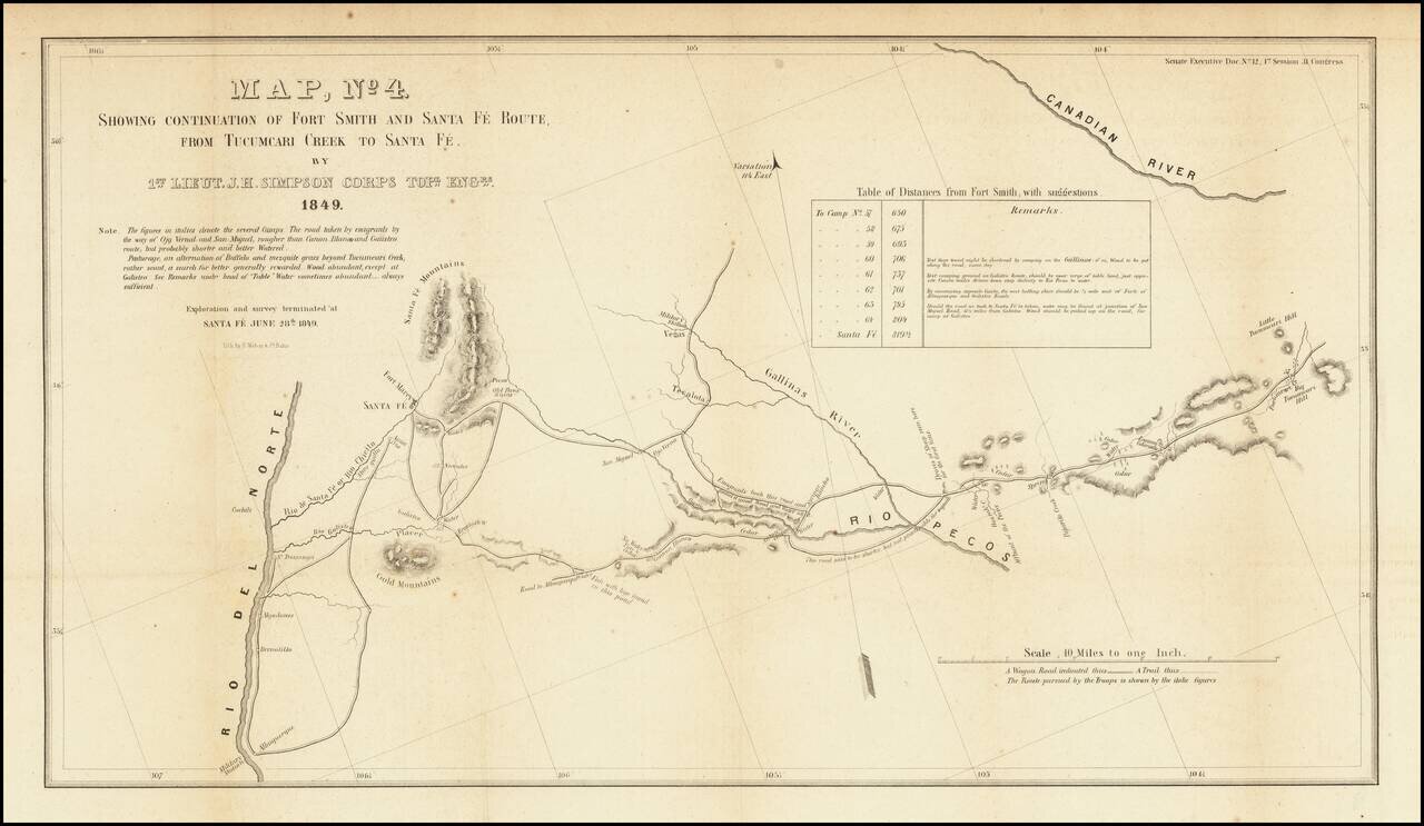
Detailed map of a portion of New Mexico Territory, showing the area east of the Rio Grande to the Canadian River.
The map focuses on the roads and rivers in the region and the details surveyed by the exploration party led by James Simpson. Major landmarks on the map include:
The map appeared in Report from the Secretary of War, Communicating... the Report and Map of the Route from Fort Smith, Arkansas, to Santa Fe, New Mexico, made by Lieutenant Simpson.
If you are a student, write to us in telegram: @antiquemaps and indicate what material you need and for what work you need a map in high detail. We are ready to provide material on special terms. For students only!
![Mexique par Th. Duvotenay…1843 [Republic of Texas]](/map/small/67925.jpg)
