Map size in jpg-format: 68.6688MiB
Click to open in high resolution (open in new tab).

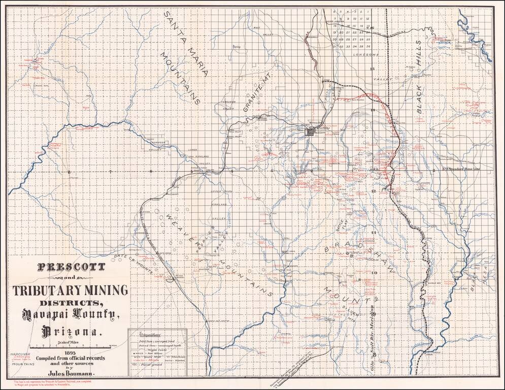
Scarce map of Yavapai County, showing the Prescott and Tributary Mining Districts, overprinted to show the lines of the Prescot & Eastern Railroad.
Detailed map locating hundreds of mines, ranches, school houses, towns, railroads, roads, and post offices. Includes Jerome, Prescott, and Congress.
Large script title, rivers and streams over-printed in blue.
Features a red overprinted line and note that "represents the Prescott & Eastern Railroad, now completed to Mayer, and proposed to be extended to Alexandria." The Prescott and Arizona Central R.R. line extending north from Prescott appears to be cancelled through red overprinting.
A very fine example of this map.
If you are a student, write to us in telegram: @antiquemaps and indicate what material you need and for what work you need a map in high detail. We are ready to provide material on special terms. For students only!

![Mexique par Th. Duvotenay…1843 [Republic of Texas]](/map/small/67925.jpg)
