
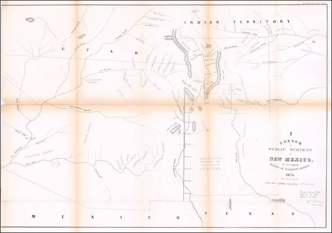
Interesting early map of New Mexico and Arizona, published by the General Land Office. The map extends from the confluence of the Colorado and Gila Rivers to Nicollet River in the northwest, the Rio Pecos in the southwest and Bent's Fort, the...
![Guide To the Blazed Trails of Montana and Wyoming . . . [Montana, Wyoming, NW Colorado, Eastern Idaho, Northern Utah, NE Nevada] Rand McNally Offical 1923 Auto Trails Map [Yellowstone National Park and Glacier National Park on verso]](/map/small/66099.jpg)
Early Automobile Road Map Detailed map of [Montana, Wyoming, NW Colorado, Eastern Idaho, Northern Utah, NE Nevada, published by the Automobile Club and prepared fkr Kilmer & Sons of Spokane, Washington, The map is scarce -- this is the first...
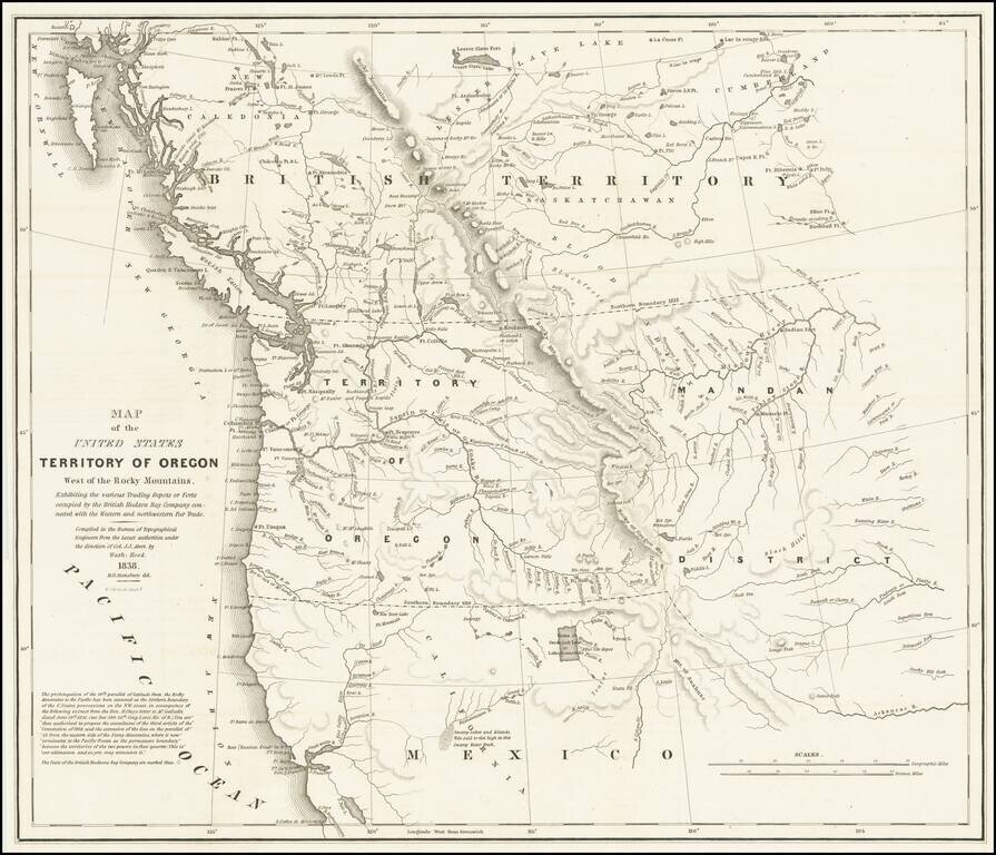
Important Map Showing Oregon Territory used during Congressional Debates about the Status of Oregon Country Hood's landmark map of the Oregon Country was integral to political debates about the area, its place in the growing United States, and its...
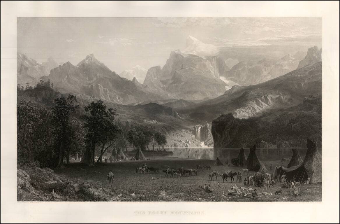
Magnificent view of Lander's Peak in Wyoming by Edward Bierstadt, the original of which now resides in the New York Metropolitan Museum of Art. As noted on the New York Metropolitan Museum on line exhibition: This painting is the major work that...
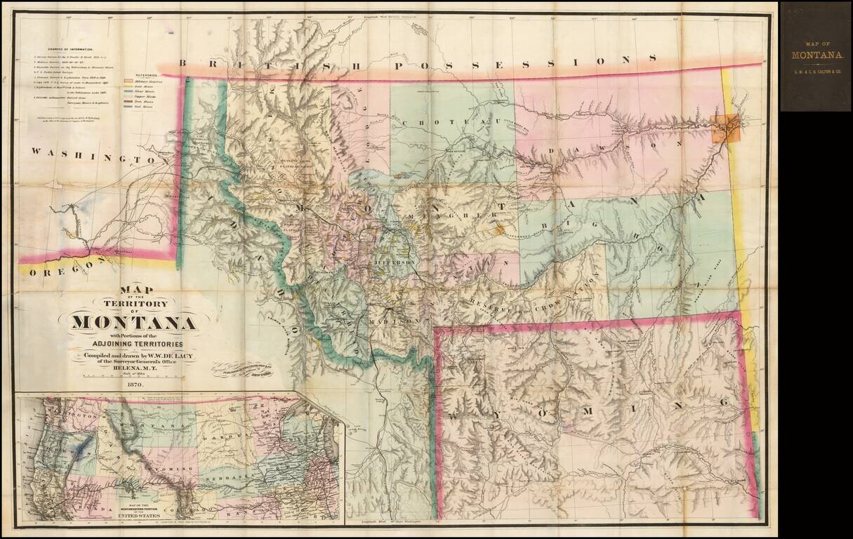
One of the great maps in the record of Western Cartography Nice example of the 1870 edition of the W.W. De Lacy map of Montana, referred to by Carl Wheat as "one of the great maps in the record of Western Cartography." The present example is the...
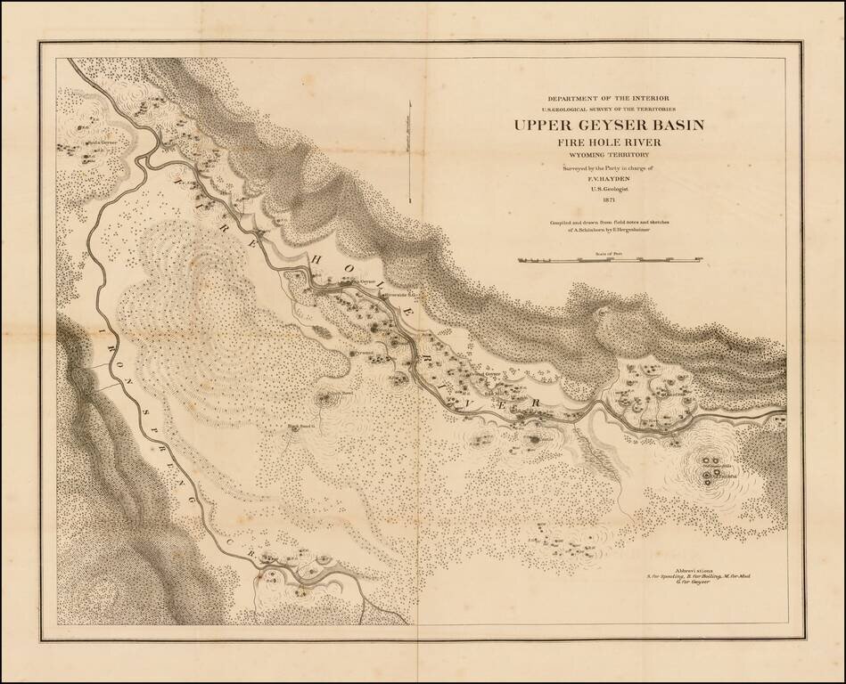
Scarce separately issued large format map of the Lower Geyer Basin in Yellowstone Park, compiled and drawn from field notes and sketches of A. Schonborn, by E. Hergeshiemer. The map is one of two maps of the Fire Hole River area published. This map...
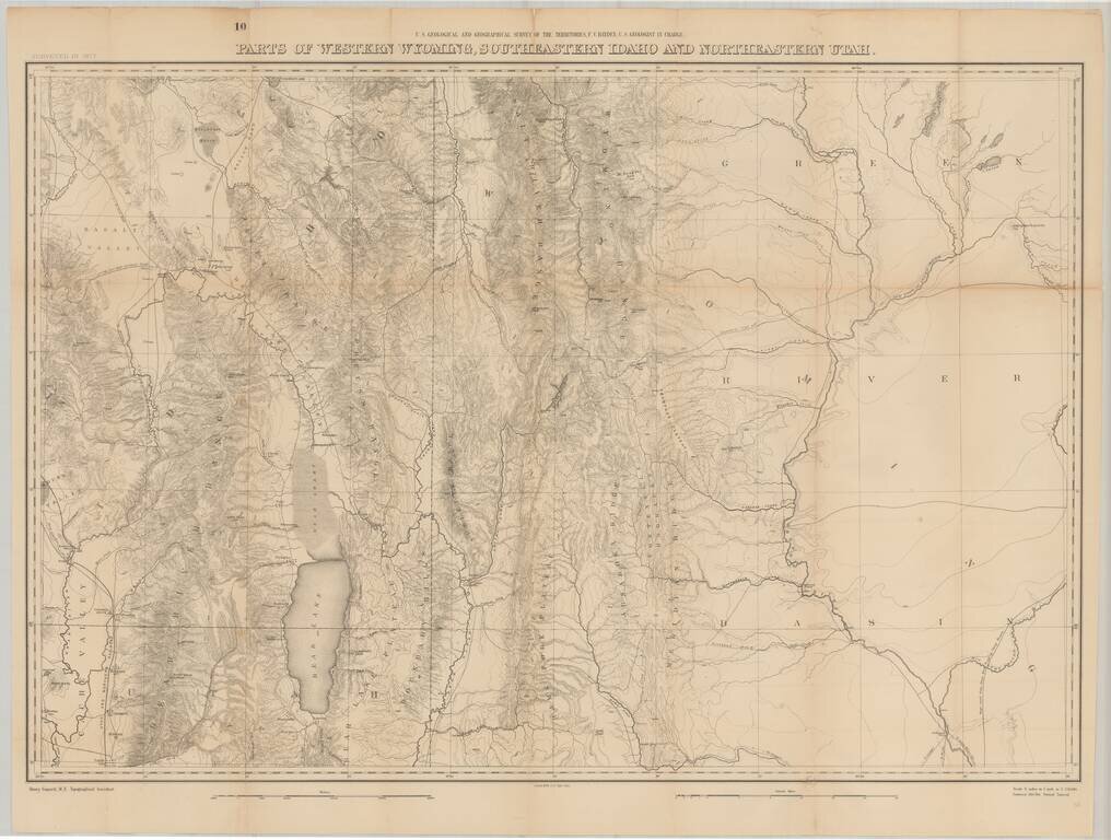
Fine large format map of the region just south of Yellowstone National Park, as surveyed in 1877 by the Hayden Survey. The map extends from Logan, Utah and the Black Foot Marsh (now Reservoir) in the West, to Fremont Lake Wyoming, and the confluence...

Excellent early map of Idaho, Montana and Wyoming Territories, published by SA Mitchell Jr. Includes early county configurations for each: Wyoming has only 7 counties; Montana has 11 counties; Idaho has 13 counties. The map shows Indian...
![[Yellowstone National Park]](/map/small/37103.jpg)
Highly detailed early map of Yellowstone National Park, which accompanied the Annual Report of the Superintendent of Yellowstone National Park for 1892. A note at the top of the map provides a key for identifying the roads which existed prior to 1891...
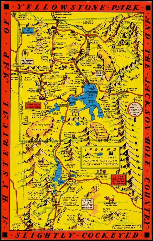
"Drawn in Broken English by Jolly Lindgren," this comic pictorial map is full of puns and comic vignettes related to Yellowstone and environs. The Lindgren brothers issued a number of other silly whimsical maps of national parks and other parts of the...
Scarce 1948 edition of the Jolly Lindgren map of Yellowstone, "Hatched & Scratched by Jolly Lindgren." This edition adds the table of miles at bottom left, among other changes, including the addition of Pilot Peak at the top right corner. This...
![(Northern Half) [Bancroft's Map of the Pacific States]](/map/small/54923.jpg)
Rare Early State with a Massive Idaho Territory Upper half of HH Bancroft's rare map of the Pacific States, first published in 1863. The map includes all of Oregon, Washington, Idaho, and most of Montana and Wyoming, with a large inset of Hawaii. The...
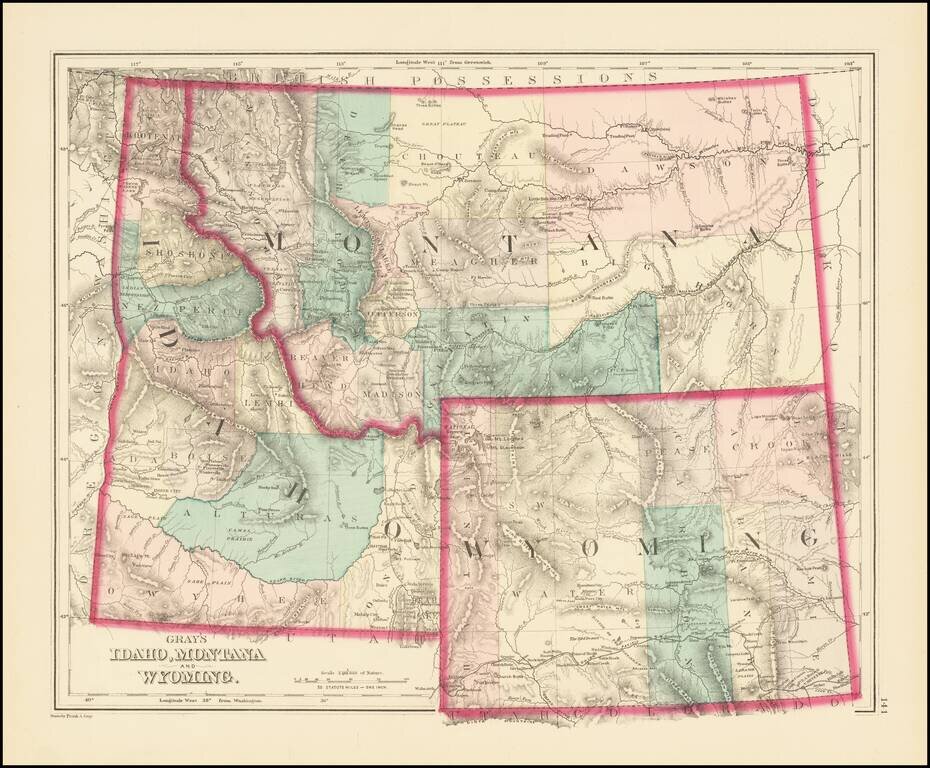
Excellent early map of Idaho Territory, Wyoming Territory and Montana Territory, published by OW Gray. Wyoming is shown with only 7 counties. Idaho has 10 counties and Montana has only 11. Yellowstone National Park is noted as a proposed national...
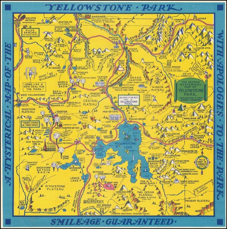
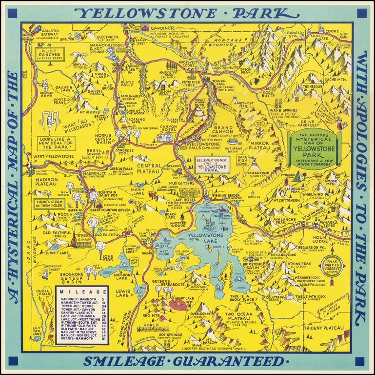
"Hatched & Scratched by Jolly Lindgren," this comic pictorial map is full of puns and comic vignettes related to Yellowstone and environs. The Lindgren Brothers issued a number of other silly whimsical maps of national parks and other parts of the...
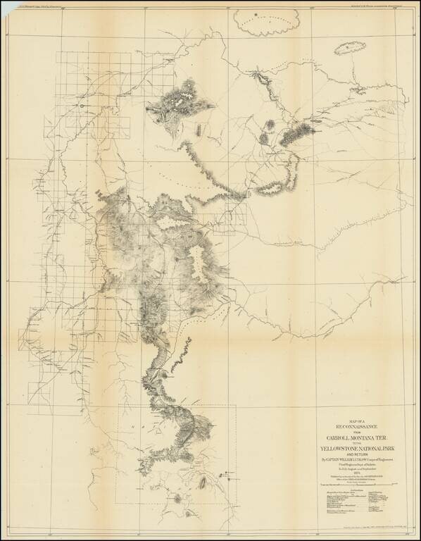
Captain William Ludlow's Expedition To Yellowstone From Montana in 1875 Important early exploration and survey of the route from Carroll, Montana to Yellowstone, undertaken by Captain William Ludlow in 1875. Carroll, Montana was described by Ludlow...
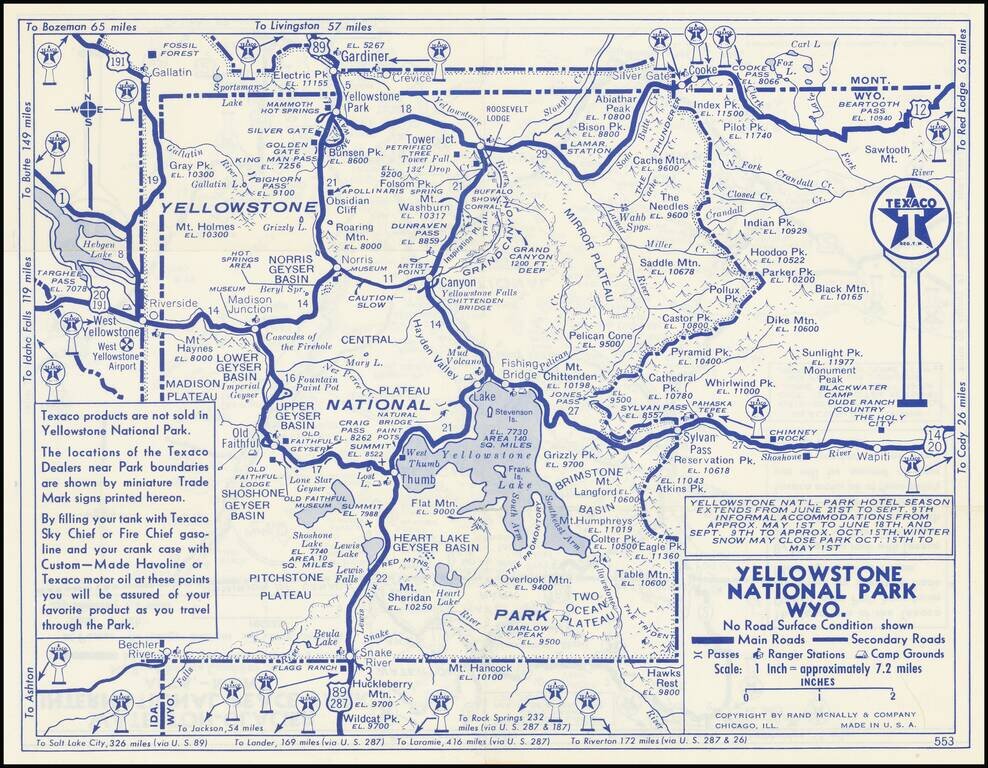
Detailed Texaco Road map covering Yellowstone National Park and Glacier National Park. This an early example of the major oil companies using auto touring in the National Parks as a medium for product promotin.