
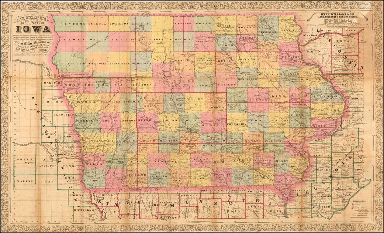
Nice example of the third edition of Henn, Williams & Co.'s large format map of Iowa. The map is hand colored by counties and shows township surveys, towns, railroasd,s roads, rivers, post offices and other details. The map has been entirely...
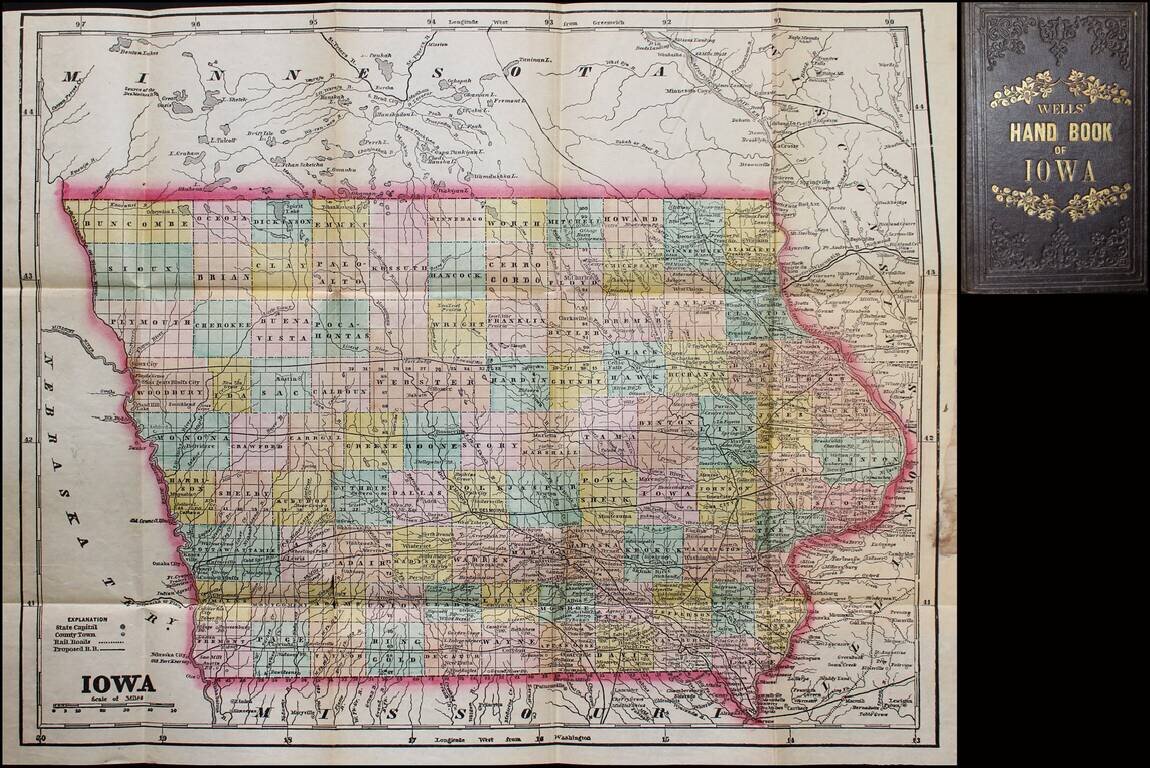
Scarce map and guide for Iowa, published by John G. Wells. Includes material on pre-emption of public lands, "Instructions to Settlers," mineral productions, "Various Avenues to Wealth" (including wool-growing and stock-raising), etc. The full title...
Scarce 1857 edition of this detailed map of Iowa. The map is hand colored by counties, showing railroads, stage lines, canals, roads, rivers, lakes, forts and other details.
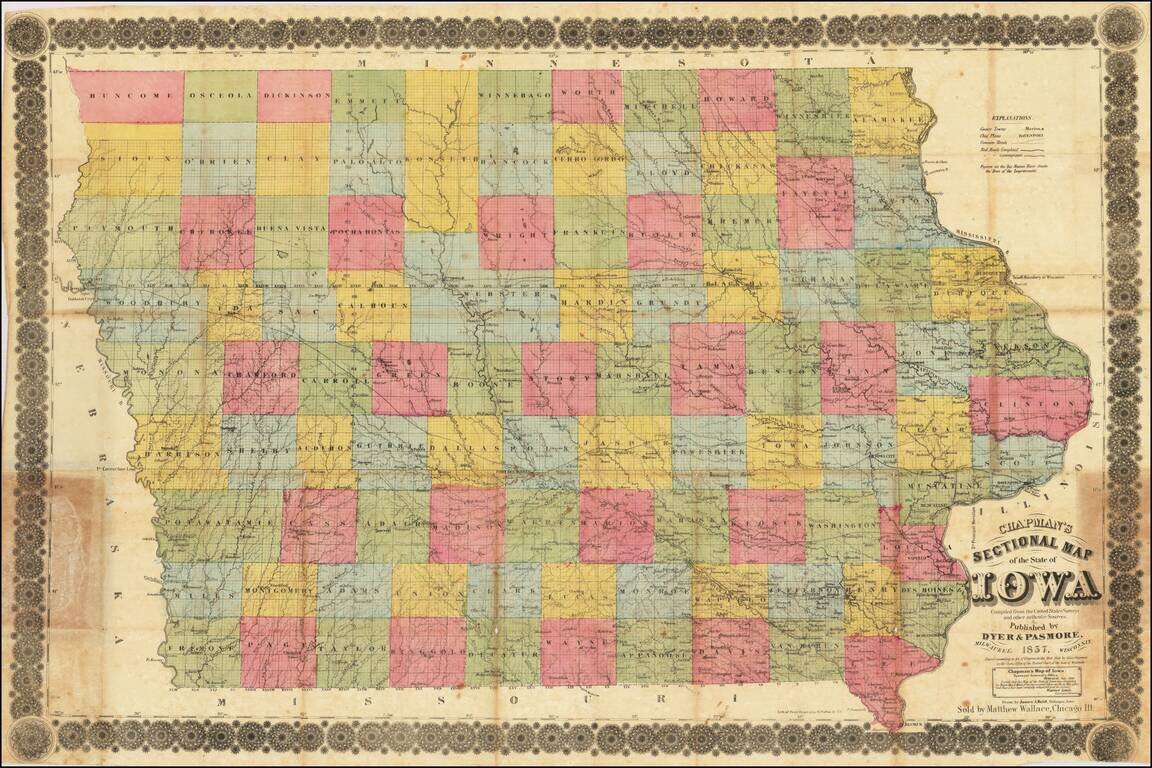
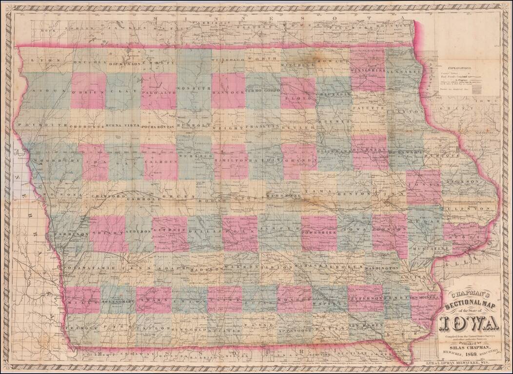
Iowa in 1857 Rare separately published antique map of Iowa, published in Milwaukee by Silas Chapman and drawn by James A. Reid of Dubuque. The map is colored by counties and shows township surveys, county towns, completed railroads, railroads in...
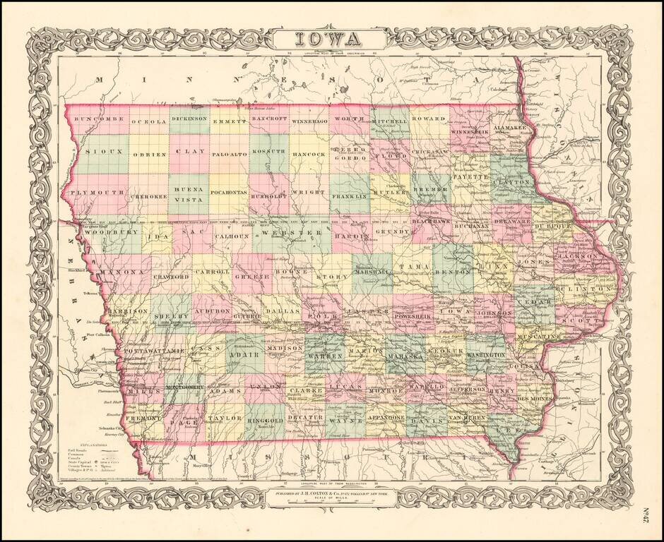
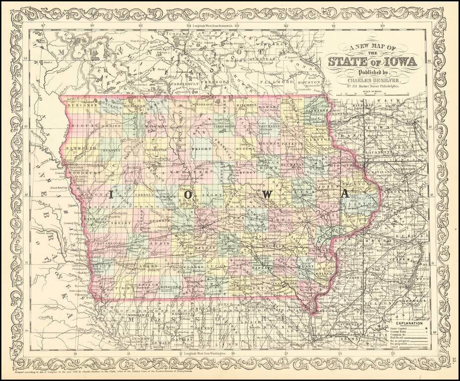
Attractive and detailed early map of Iowa with an ornate border. The map is hand colored by counties and shows cities, towns, railroads, rivers, and lakes. From an early edition of JH Colton's Atlas. Wide margins. JH Colton was one of the pre-eminent...
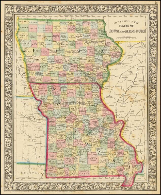
Attractive map of Iowa and Missouri, colored by counties. Shows towns, roads, railroads, rivers, etc.
Rare separately published antique map of Iowa, published in Milwaukee by Silas Chapman. The map is colored by counties and shows township surveys, county towns, completed railroads, railroads in progress and other details. Chapman began offering maps...
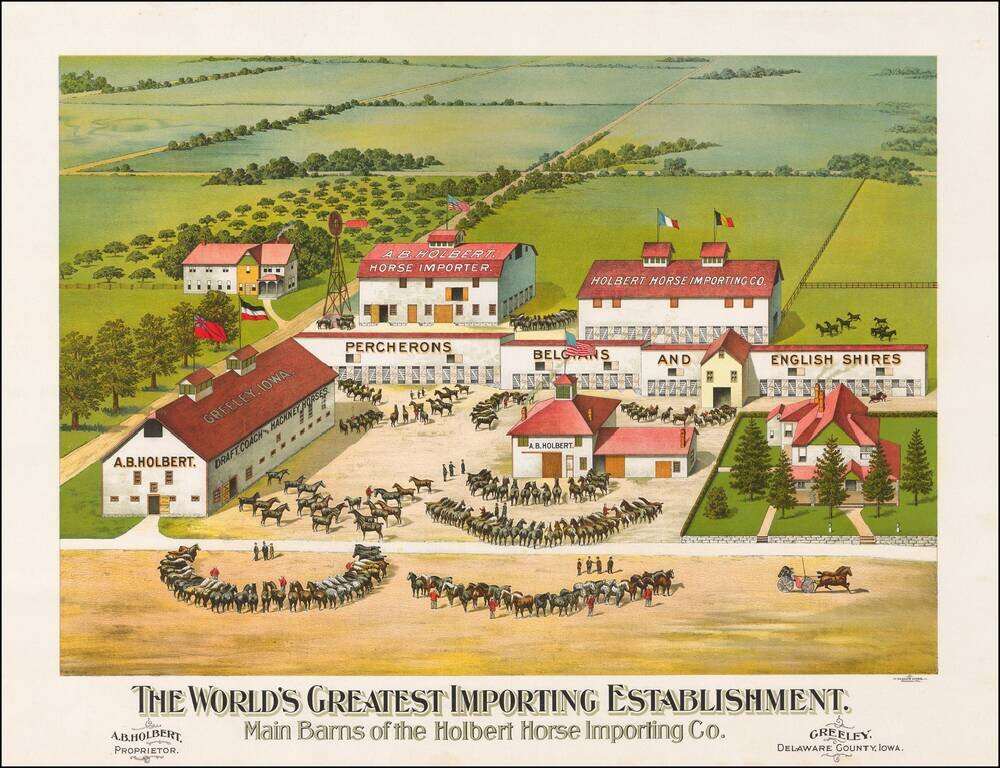
The most extensive importer, breeder and seller of registered horses in the United States Fine chromolithographic image of this outstanding horse farm in Greeley, Iowa. On the barns Holbert advertises that he carries the following breeds:...
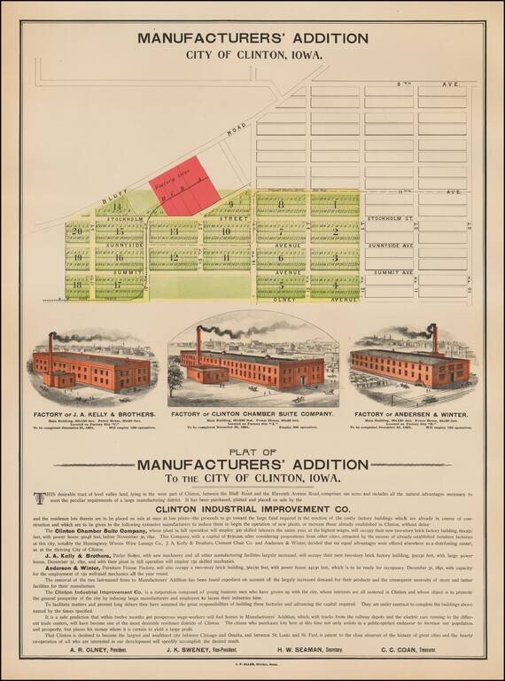
Rare illustrated promotional map broadside, promoting the Plat of Manufacturers' Addition To The City of Clinton, Iowa. In addition to the Plat of the Manufacturers Addition, the map illustrates 3 factories, each of which was scheduled for completion...
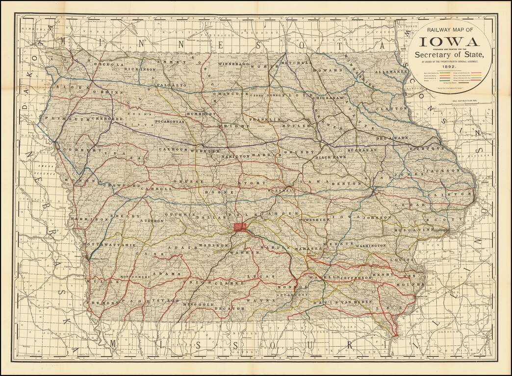
Finely detailed railroad map of Iowa, published for the Iowa State Legislature by Rand McNally & Co. The map illustrates 9 color coded railroads, including: Burlington, Cedar Rapids and Northern Central Iowa Railway Illinois Central RR...
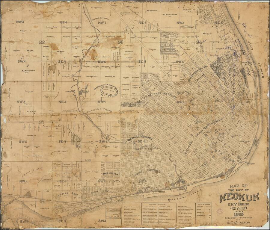
Finely executed cadastral map of Keokuk, published in 1895. The map provides an excellent overview of the city, which at the time had a population of about 14,000. The original townsite is shown, along with a number of later additions. The Keokuk...
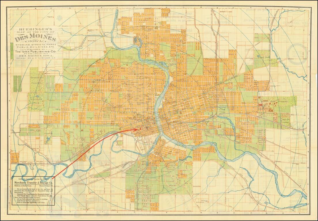
Fine large map of Des Moines, Iowa, published by Melchior Huebinger, Civil Engineer, of Des Moines Iowa and the Iowa Publishing Company. Published as a promotional map for the Merchant Transfer & Storage Company, the map elegantly differentiates...
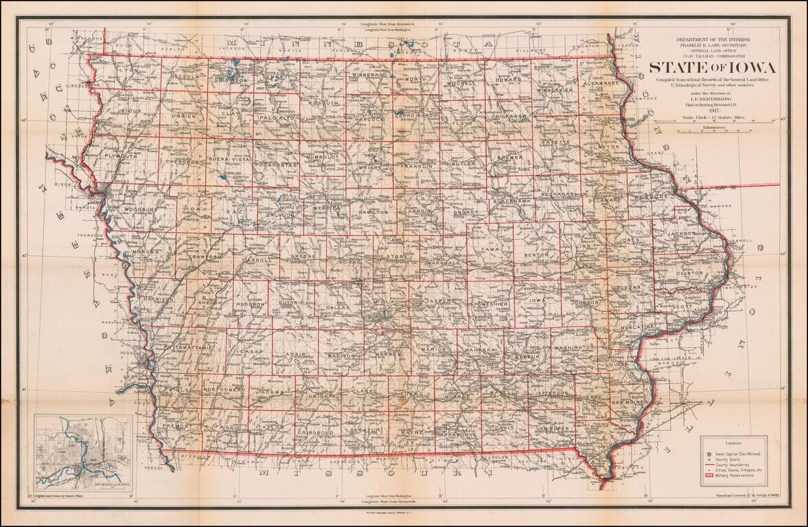
Highly detailed map of Iowa, published by the General Land Office. Shows county boundaries and railroad land-grant limits are shown in color. Also shows Private Claims, county names, public land surveys, towns, principal railroad stations, post...
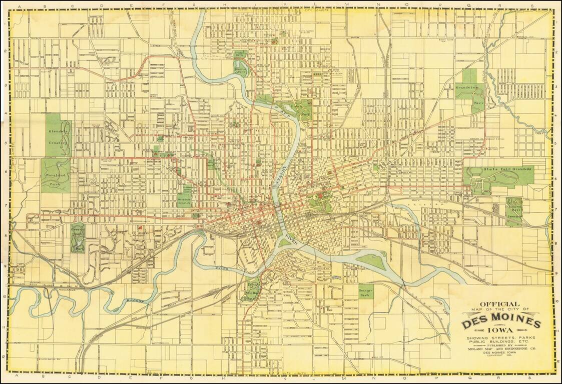
Des Moines City Beautiful Project Detailed map of Des Moines, Iowa, published in Des Moines in 1920. The map is filled with important local information, including early street car lines, parks, pubic buildings, etc. The map was issued following Des...
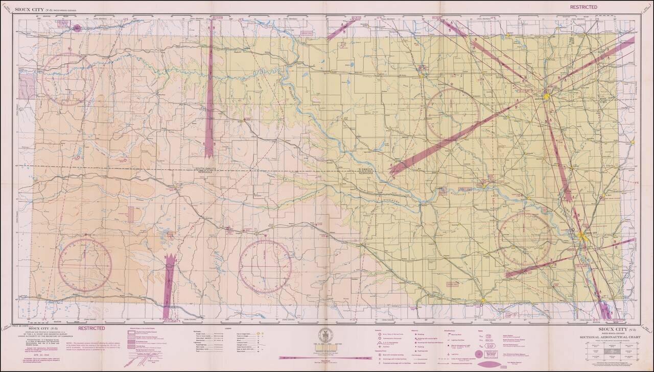
Restricted World War II Aviation Map Detailed aeronautical map of the Boise area. The chart is a font of information about civil and military aviation during WWII. It was intended for civil aviators flying by visual navigation and so includes data...