

Scarce working sea chart of the Strait of Juan de Fuca and contiguous regions, published by the British Admiralty. The map extends from Flores Island and Sydney Inlet in the northwest to Cape Flattery and New Dungeness in the south. with Victoria, and...
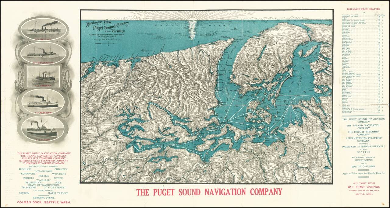
A Puget Sound Navigation Company Promotional View Detailed antique bird's eye view of Puget Sound, the Olympic Peninsula, the San Juan Islands, Vancouver Island, including the major cities of the region, such as Seattle, Tacoma, Vancouver, Olympia,...
![[Map of Clarke County Washington]](/map/small/58454.jpg)
You'll Prosper in Vancouver, Washington Early promotional map of Clarke County, promoting businesses in and around the Vancouver, Washington area. The map is ringed by illusrations of local businesses. On the verso, an illustrated guide shows the...
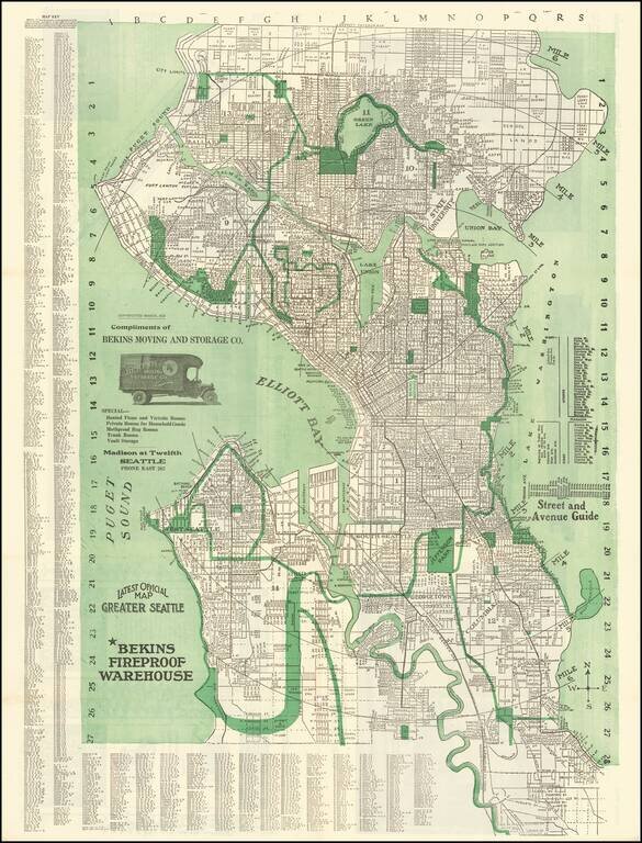
Fine early map of Seattle, originally copyrighted by Kroll in 1913. The map extends north to the City limits beyond Green Lake and east to Lake Washington, with 6 mile radius illustrated from the center point at the Bekins Warehouse. The map includes...
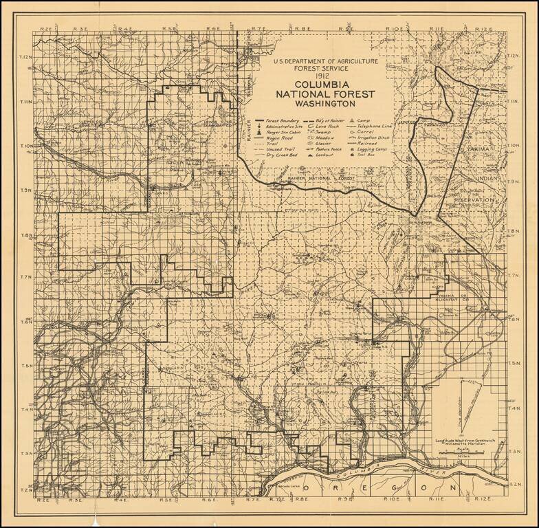
Rare US Forestry Service map of Columbia National Forest, published in 1913. The map provides excellent detail, including: Administrative Sites Ranger Station Cabins Lookout Camp sites Telephone Lines Wagon Roads, Trails, Unused Trails Dry...
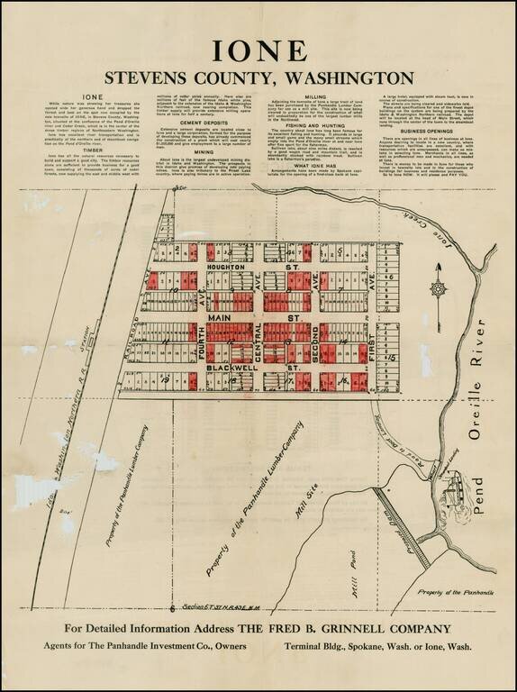
Detailed plan of Ione, Washington, promoting the town's natural resources, including Timber, Cement Deposits, Mining, Milling, Fishing & Hunting, etc. The map shows the steamboat landing, proposed dam, town plan and other details. The present map...

Detailed early map of Vancouver. Nice plan of the city including streets, major buildings, railroad lines, etc. Highway map of the state of Washington on the verso.
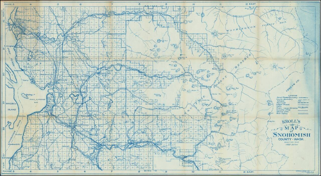
This is a vintage survey map of Snohomish county, stretching in scope from the shores of Puget Sound to the Cascades. Detail is extensive, with rivers, roads, railway lines, lakes, mountains, and more all demarcated. Towns in the region, still small,...
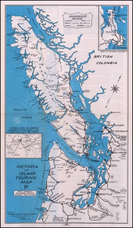
Rare promotional map, showing the roads and cruise ship lines in and around the Vancouver Island area. Promotional advertising on the verso.
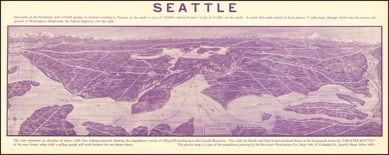
Promotional antique bird's eye view panorama for Seattle, "Metropolis of the Northwest. . . " An exceptional view, centered on Lake Washington, with Everett at the far left and Tacoma at the far right. The map shows the eastern shore of Bainbridge...
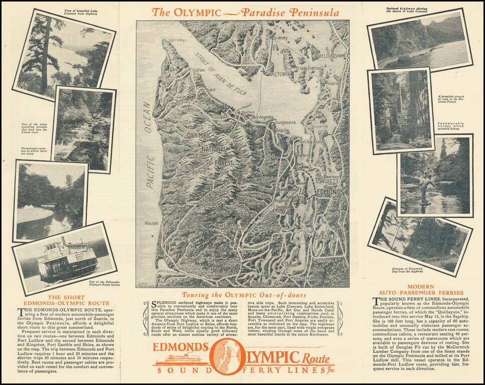
Promoting A Short Lived Puget Sound Ferry Line Interesting pictorial map and illustrated travel brochure, promoting the Edmonds Olympic Route - Sound Ferry Lines Inc. The main map image shows a monochromatic view of the Straits of Juan de Fuca and...
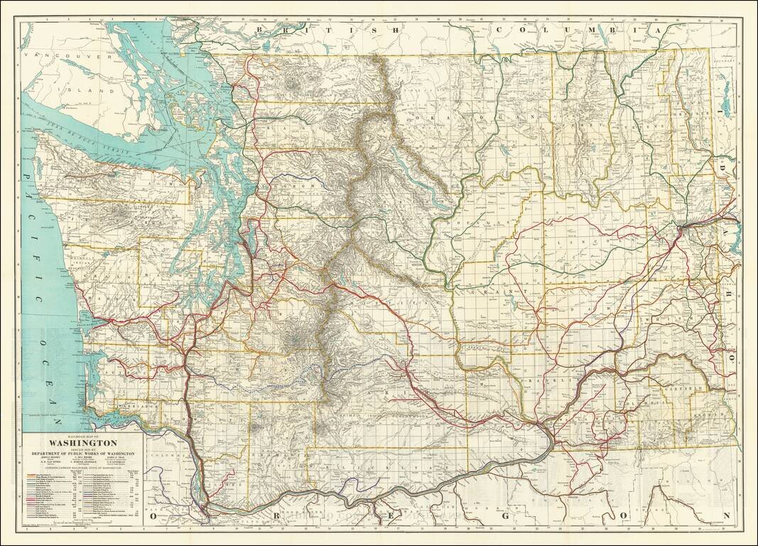
Highly detailed Railroad map of Washington, published by the Washington Department of Public Works First edition of this informative map delineating miles of steam and electric railroads in Washington State during the 1920s. The map shows 40 different...
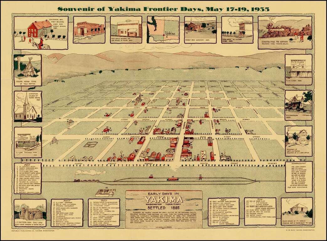
Scarce view of the town of Yakima, Washington, as it appeared in 1885. The view shows a plan of the City, naming streets and identifying 67 early structures. The map is surrounded by views of early buildings, including the Block House at Ft. Simcoe...
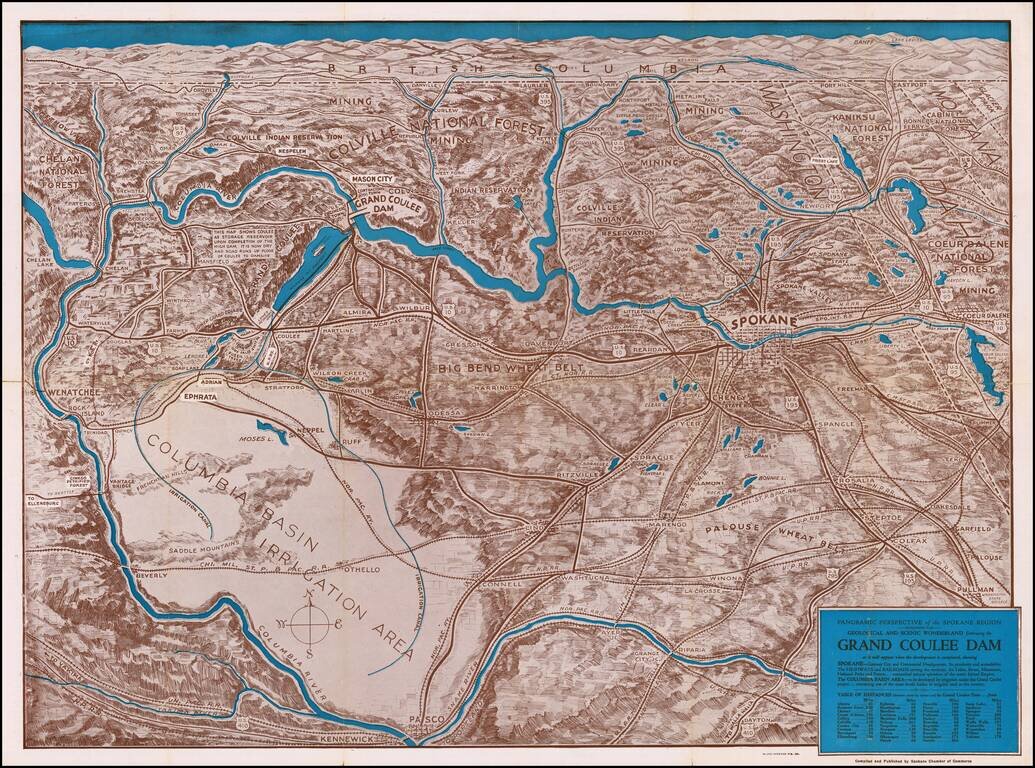
The Beginning of Construction at Coulee Dam Detailed birdseye view style map of the region bounded by Banff, Pullman Washington and the Pacific Ocean, centered on Lake Roosevelt and Grand Coulee Dam. The map is marvelous graphical depiction of the...
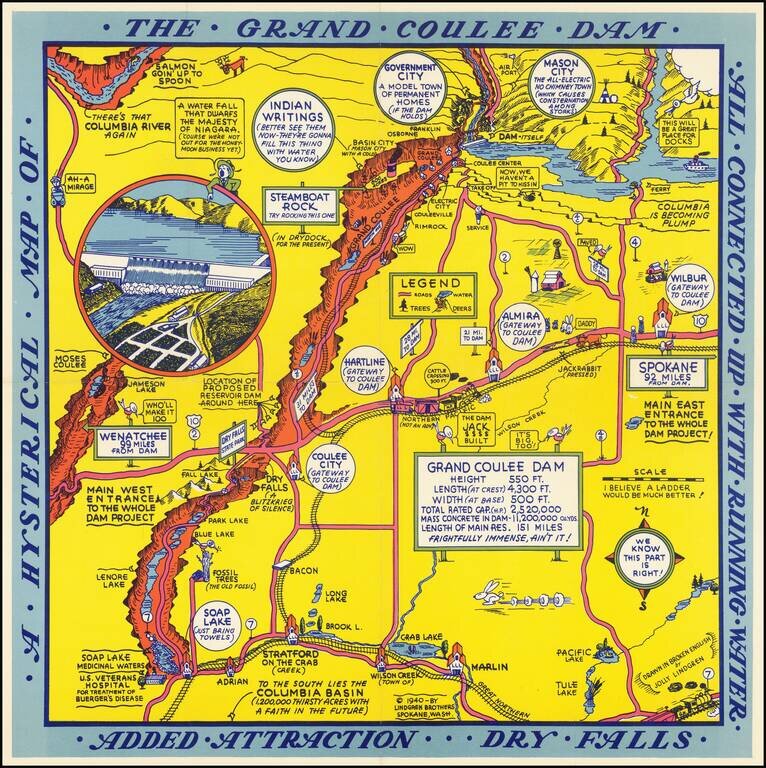
Second of two whimsical maps of Grand Coulee Dam, published by the Lindgren Brothers, "Drawn In Broken English by Jolly Lindgren," this comic pictorial map is full of puns and comic vignettes related to Grand Coulee Dam. The Lindgren Brothers issued a...
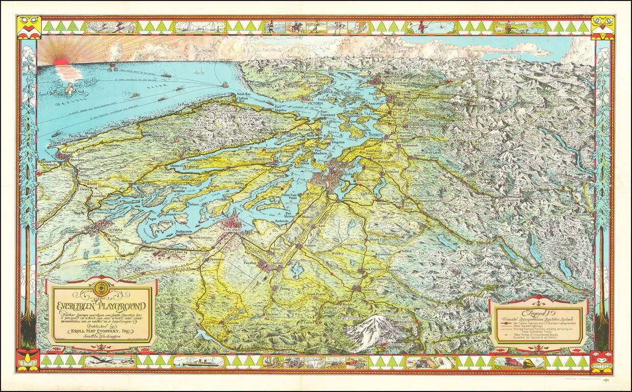
Fine large pictorial map of Puget Sound and the Northwestern Part of Washington State. The Evergreen Playground map was originally drawn during the Great Depression by Ed Poland, cartographer of many years at Kroll Map Company in Seattle, and changed...