
![(Notherneastern Sheet) [Bancroft's Map of the Pacific States]](/map/small/54925.jpg)
Engraved Proof Sheet. "Bancroft's, in scope, was probably the most important map yet produced by a publisher of the Pacific coast." - Streeter (TMW 1061) Engraved proof of the 1867 edition of H.H. Bancroft's Map of the Pacific States. The detail in...
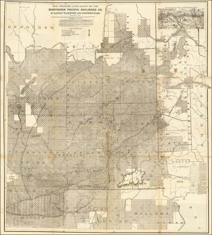
Rare large lithographed folding map showing land ownership opportunities in eastern Washington State and western Idaho, published to promote the lands owned and serviced by the Northern Pacific Railroad. The map is focused on the the growing...
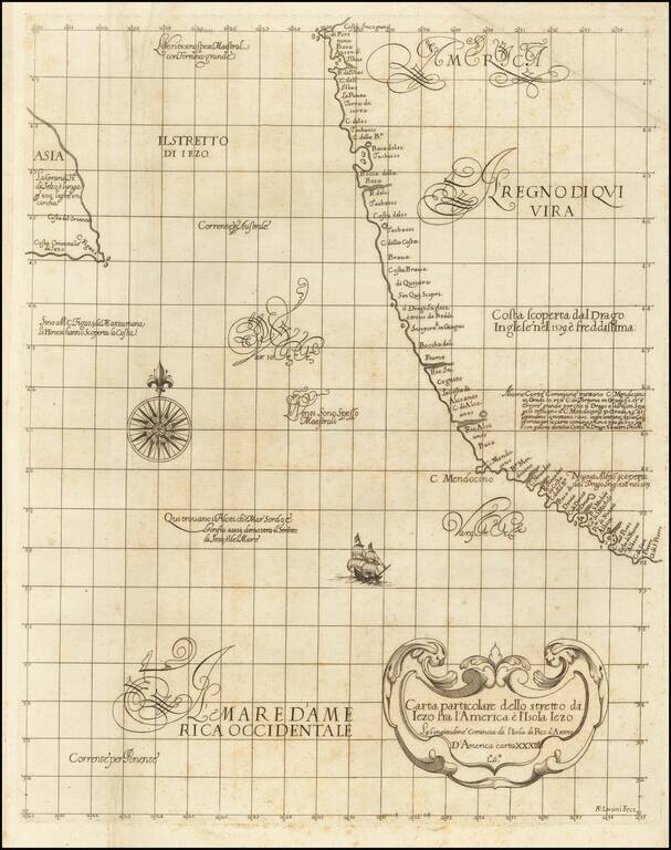
"The First Printed Sea Chart of the Northwest Coast of North America" (San Francisco to Vancouver Island) Rare early sea chart of the Pacific Northwest, from Sir Robert Dudley's Dell'Arcano del Mare. The chart shows all of the American Pacific coast...
![Wm. T. Coleman & Co.'s Map of the State of California [and] Wm. T Coleman& Co's. Skeleton Map of Columbia River Canneries, Showing Their Location.](/map/small/69974.jpg)
Exceptional Chromolithographic Promotional Maps Rare promotional maps of California the Columbia River Basin one verso, promoting the shipping business of pioneer California Businessman William Tell Coleman. The California map locates several...
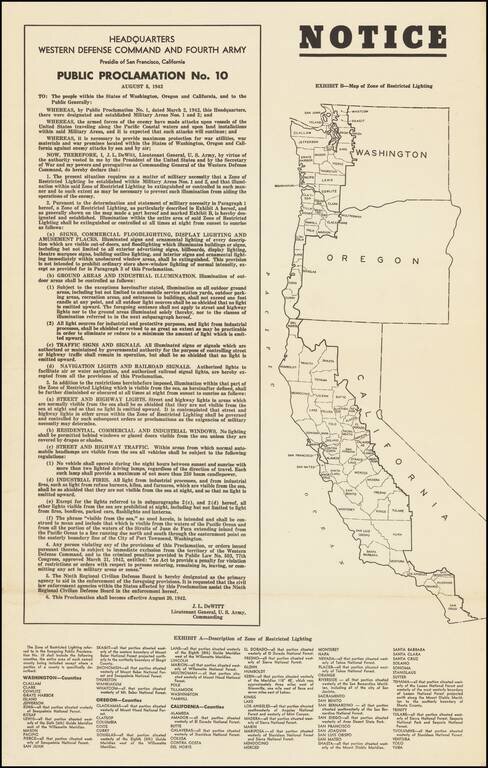
Lights Out Across the Pacific Coast. World War II broadside declaring the institution of Public Proclamation No. 10, which heavily controlled the use of artificial lighting on the West Coast, so as to inhibit nighttime attacks by Japanese warships and...
![[Pacific Northwest] Cape Mendocino to Vancouver Id. From Cape Flattery Southward, From The United States to 1886, with corrections and additions to 1920 . . .](/map/small/70829.jpg)
This is a detailed navigational chart showing the whole of the Pacific Northwest, stretching from northern California to southern British Columbia. Many minor coastal and riverine towns are labeled, including some that would become major cities, such...
Detailed map of Washington and Oregon, which appeared in a late edition of Mitchell's General Atlas, pubished by William Bradley. The map is colored by counties and showing towns, roads, railroads, rivers, lakes, and a host of other details. SA...
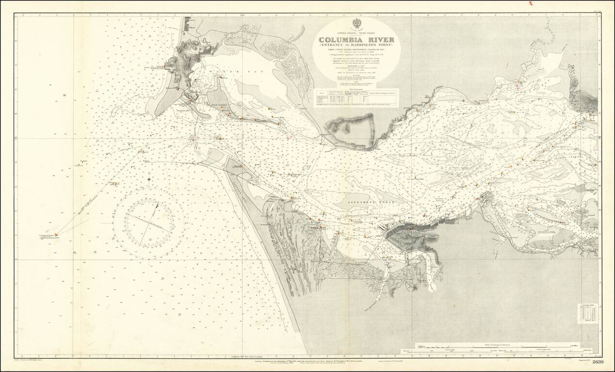
Extremely detailed chart of the mouth of the Columbia River, between the states of Oregon and Washington. The map covers the north and south shore of the Columbia as it exits into the Pacific Ocean. On the north shore, the towns of Ilwaco, Holman, and...
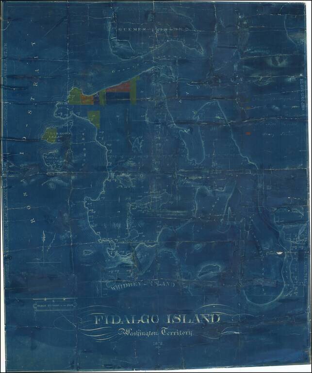
One of the Earliest Surviving Maps of Fidalgo Island Rare map of Fidalgo Island, named after the Spanish explorer and cartographer Salvador Fidalgo who explored the area in 1790. The map is color coded to show the lands owned by several different...
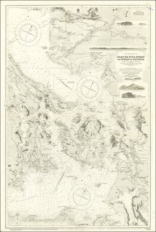
Excellent British Admiralty chart of the Strait of Juan de Fuca, focusing on the San Juan Islands, and also showing Victoria and Vancouver B.C. The chart was originally published in 1882 and was updated numerous times to 1924. Despite the fact that...
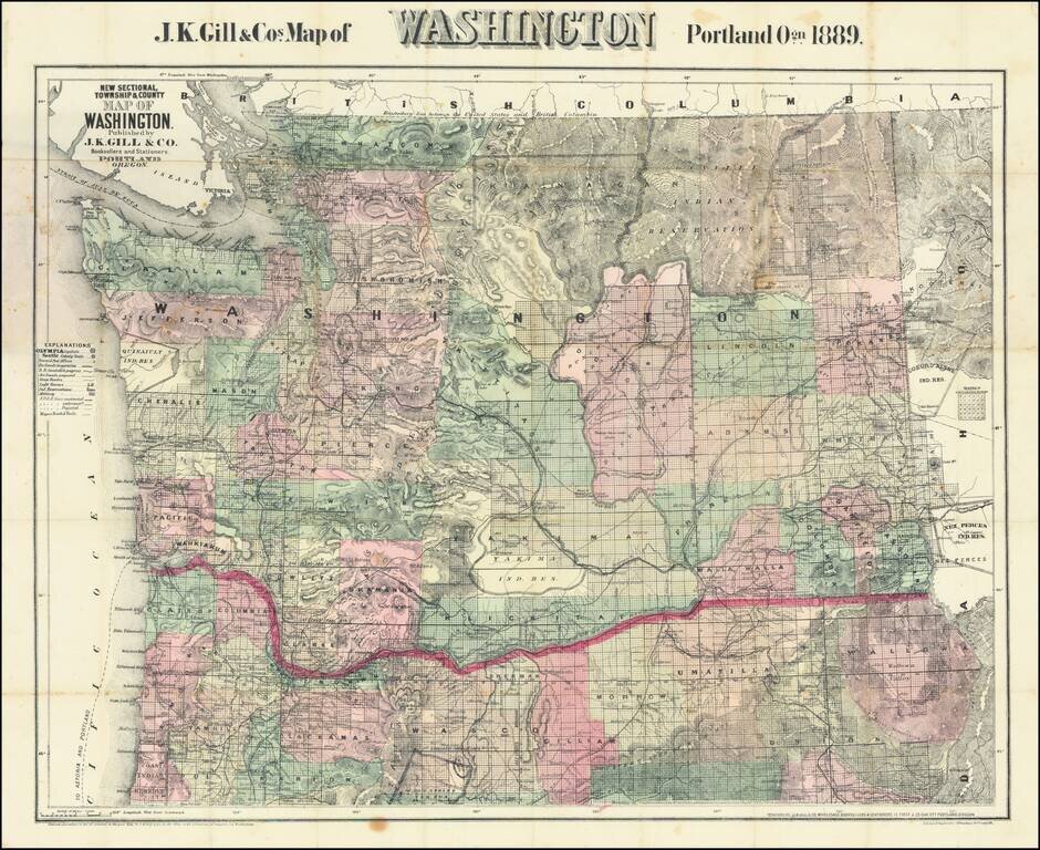
Large Separately published map of Washington. Scarce separately issued map of Washington by J.K. Gill, the leading local seller of books and stationery in Portland at the time. This would appear to be the third state of Gill's map, which was first...
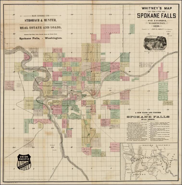
Early promotional map of the City of Spokane Falls (Spokane), Washington, which includes facts and figures encouraging early settlers, published at the beginning of Spokane's major boom period and at the time the Union Pacific Railroad was first...
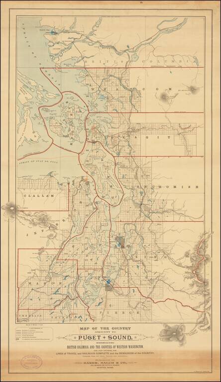
Rare separately published map of "the Puget Sound Country," published by Baker, Balch & Co. Civil, Mechanical and Electrical Engineers and lithographed by A. Zeese & Co. of Chicago. A remarkable advertising map issued to promote settlement,...
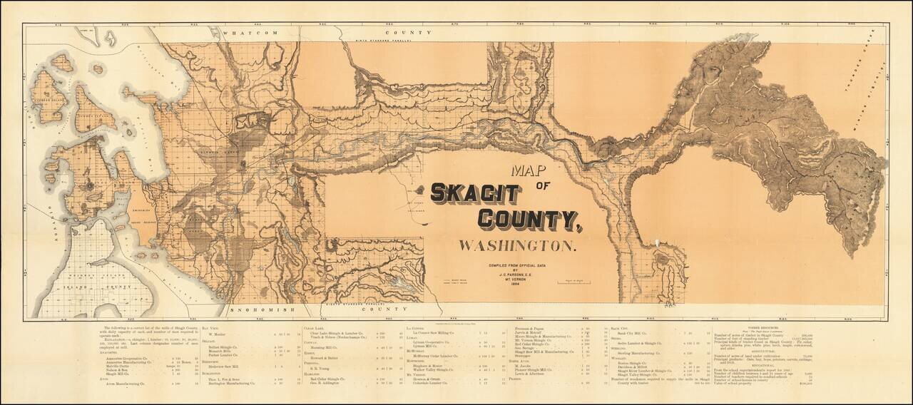
A highly detailed map of Skagit County, showing the county in great detail. The focal point of the map is the lumber industry within the county, with lumber and shingle mills noted in over twenty towns. The map identifies wagon roads, public roads,...
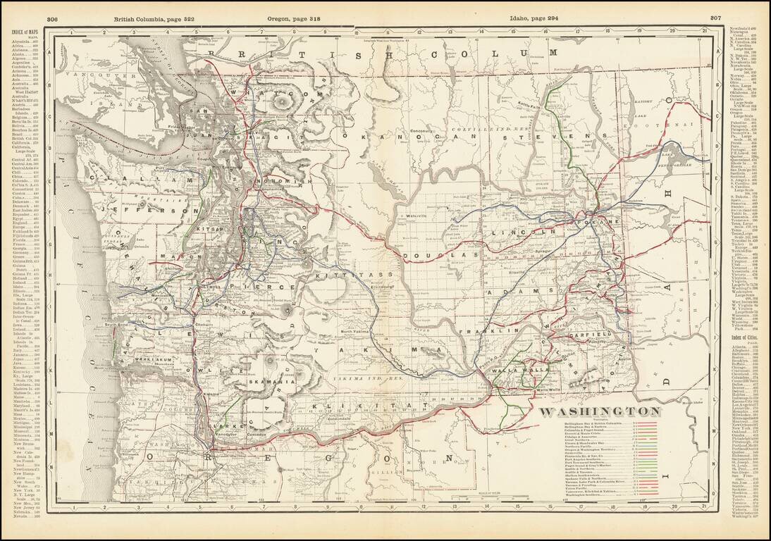
Detailed railroad map of Washington State, showing counties, railroad lines, towns, rivers, township surveys, lakes, mountains, creeks, waterfalls, and a host of other information. Includes a list of over 20 operating railroad lines in Washington...
![Western Part of Washington [with] Eastern Part of Washington](/map/small/69112.jpg)
Scarce two-sheet George Cram map of Washington State. The map, which appeared only in a few 1890s editions of the Cram railroad atlases, contains a wealth of information on late-19th century railroads in Washington. This is the first time we have had...