Map size in jpg-format: 202.61MiB
Click to open in high resolution (open in new tab).
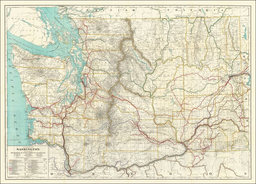
Highly detailed Railroad map of Washington, published by the Washington Department of Public Works
First edition of this informative map delineating miles of steam and electric railroads in Washington State during the 1920s. The map shows 40 different railroad lines operating within the state, including those projected and under construction, as well as logging roads, and index to counties, towns, and logging, coal, and iron companies on verso.
If you are a student, write to us in telegram: @antiquemaps and indicate what material you need and for what work you need a map in high detail. We are ready to provide material on special terms. For students only!
![[Map of the United States, illustrating the routes of the Candian Pacific Railway and the Seattle, Lake Shore and Eastern Railway]](/map/small/71080.jpg)

