logo

1913. Latest Official Map of Greater Seattle

  • Latest Official Map of Greater Seattle
  • Latest Official Map of Greater Seattle

Latest Official Map of Greater Seattle information:

Year of creation: 
Resolution size (pixels): 
 11517x15114 px
Disk Size: 
 61.2577MiB
Number of pages: 
 2
Place: 
 Seattle
Author: 

Print information. Print size (Width x height in inches):
Printing at 72 dpi 
  159.96 х 209.92
Printing at 150 dpi 
 76.78 х 100.76
Printing at 300 dpi 
 38.39 х 50.38

An example of detailing the file of this map of in a printable high-resolution:

Click to open in high resolution (open in new tab).
Attention! this is just the central piece (central area 960x960 px) of the map file!
This is an example, so that you can see and study the level of detail of a given map. The entire Map will be fully available after payment!

Latest Official Map of Greater Seattle

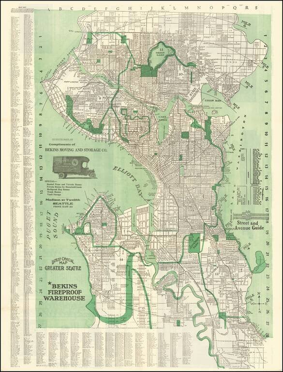
Fine early map of Seattle, originally copyrighted by Kroll in 1913.

The map extends north to the City limits beyond Green Lake and east to Lake Washington, with 6 mile radius illustrated from the center point at the Bekins Warehouse.

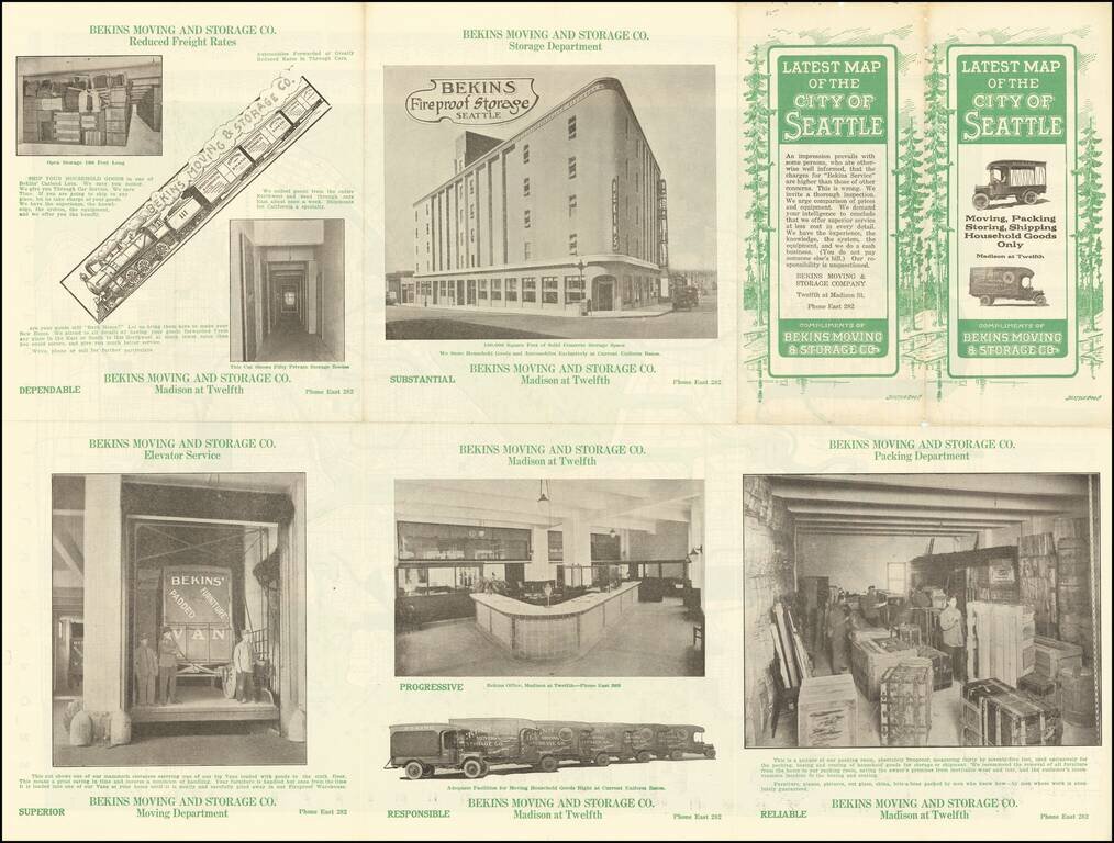
The map includes a vignette of an early Bekins moving van and photo illustrations on the verso, along with an extensive street index.


Special conditions for students!

If you are a student, write to us in telegram: @antiquemaps and indicate what material you need and for what work you need a map in high detail. We are ready to provide material on special terms. For students only!

Item information:

Year of creation:
Size:
11517x15114 px
Disk:
61.2577MiB
Number of pages:
2
Place:
Seattle
Author:
Kroll Map Company.
$14.99

Related item