
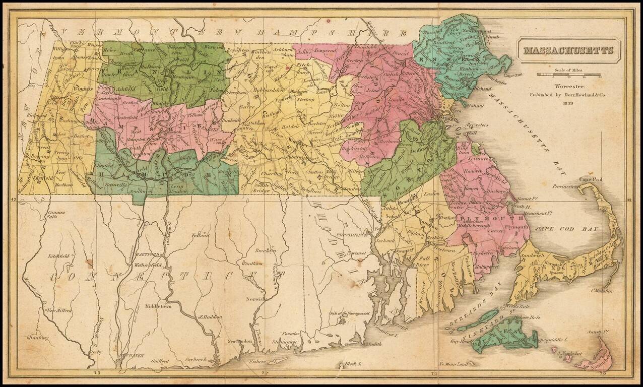
Rare map of Massachusetts, hand-colored by counties and showing towns, roads, railroads, townships, rivers, islands, and other details.
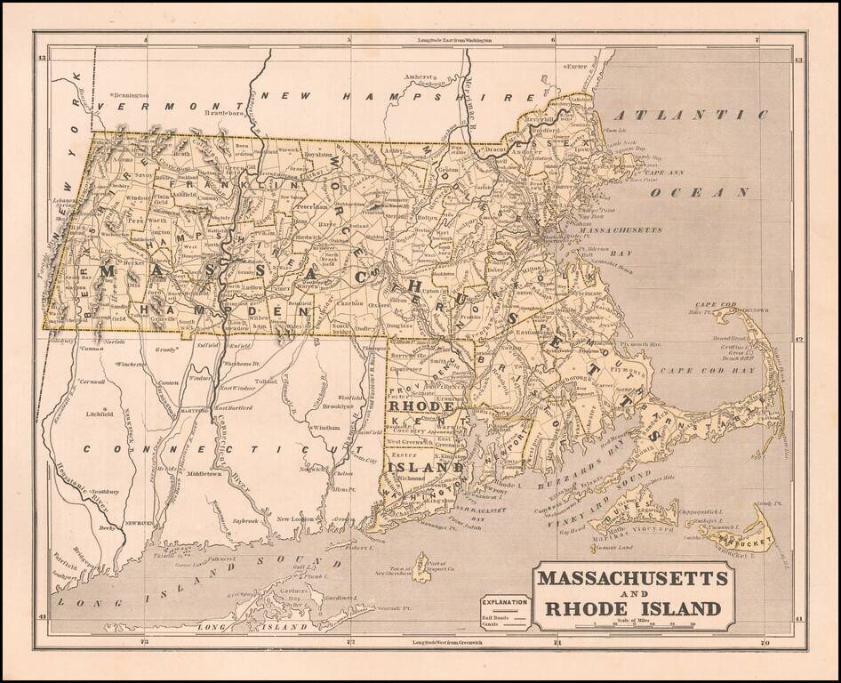
Marvelous and highly detailed map of Massachusetts and Rhode Island, from Morse's important Atlas of North America, the first cerographic atlas. Shows towns, roads, rivers, townships, etc. Morse & Breese's North American Atlas was a landmark in...
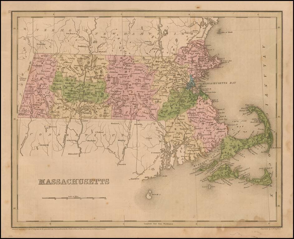
Interesting and detailed map of Massachusetts, from an early edition of Bradford's Comprehensive Atlas. The map is colored by counties and shows towns, rivers, lakes, bays, harbors, islands and other important places. Bradford's Comprehensive Atlas...
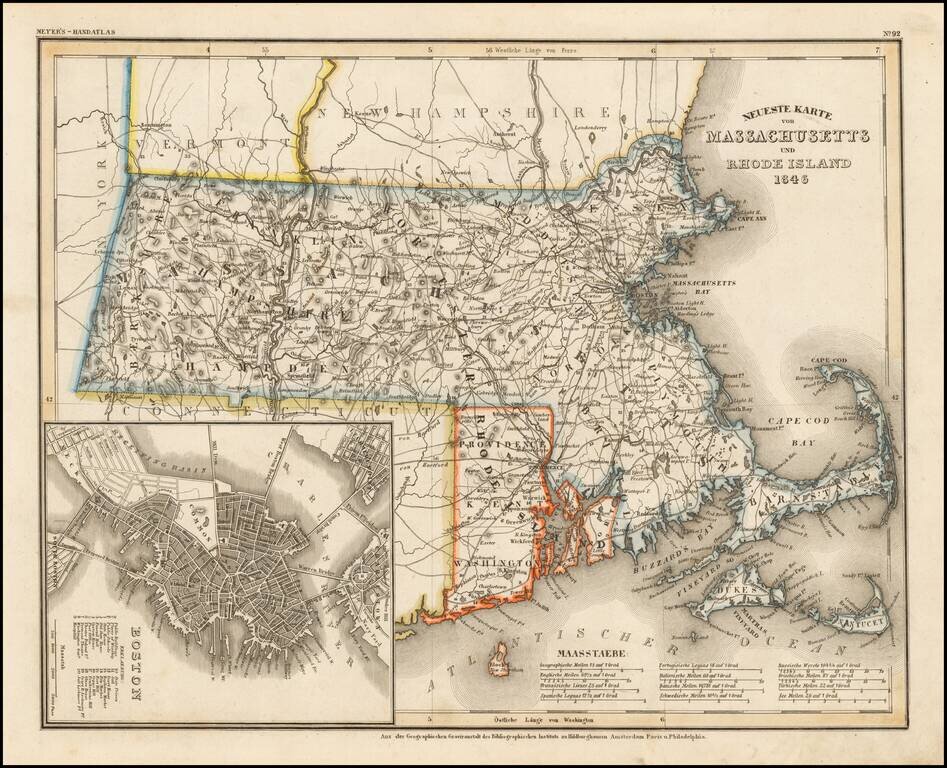
Scarce German map of Massachusetts & Rhode Island, etc. Elegantly engraved & detailed map of Massachusetts and Rhode Island, with a large inset plan of Boston, based upon Tanner's work in the early 1840's. Shows counties, towns, roads,...
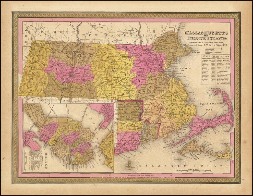
Detailed map of Massachusetts and Rhode Island from Mitchell's New Universal Atlas, showing railroads, townships, canals, etc. Hand colored by county. Statistical table shows population by county. Inset of Boston showing important buildings. An...
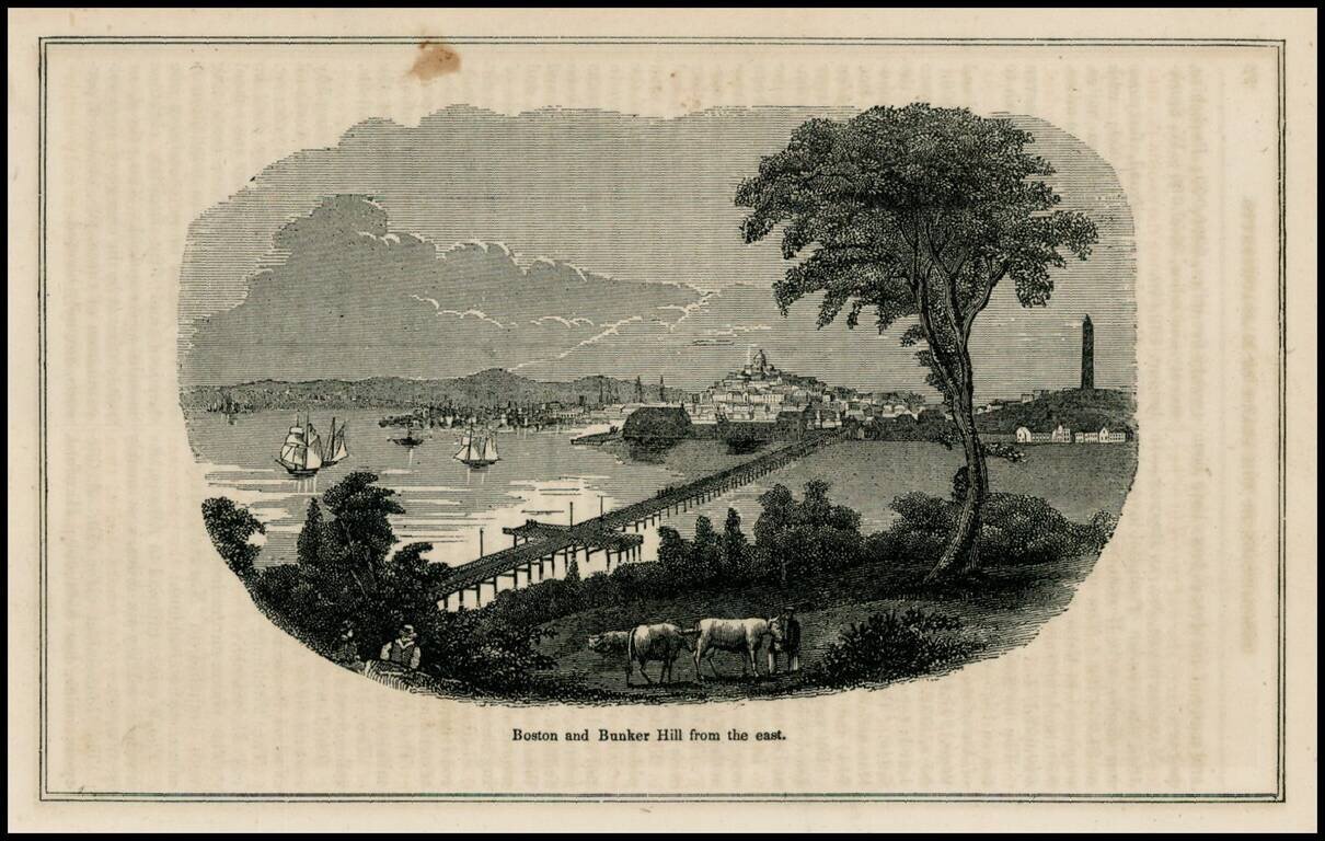
Woodcut view of Boston and Bunker Hill, from a mid 19th Century work.
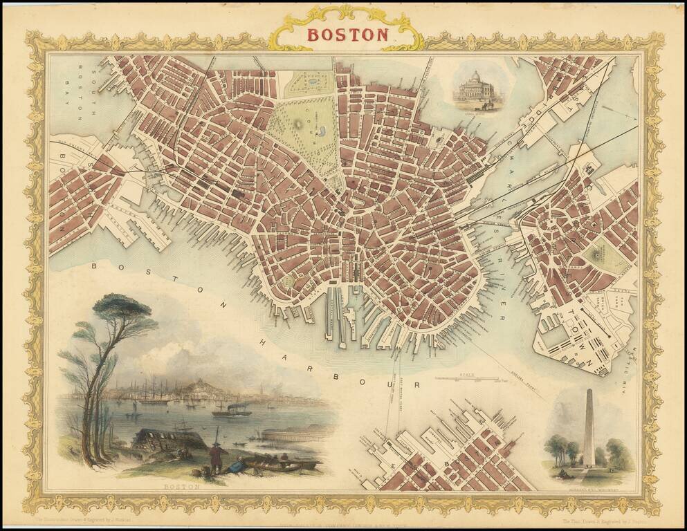
Striking full color example of Tallis's town plan of Boston, with a massive view and vignettes of Bunker Hill Monument and the State House. One of the most decorative and sought after town plans of the City to appear in an atlas in the mid-19th...
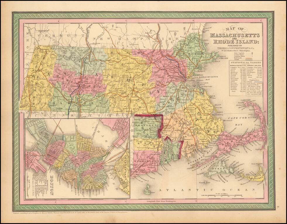
Striking map of Massachusetts and Rhode Island, hand colored by counties, from Thomas Cowperthwait & Co.'s New Universal Atlas. The map names towns, rivers, lakes, islands, etc. and shows roads with distances, railroads and other details. Large...
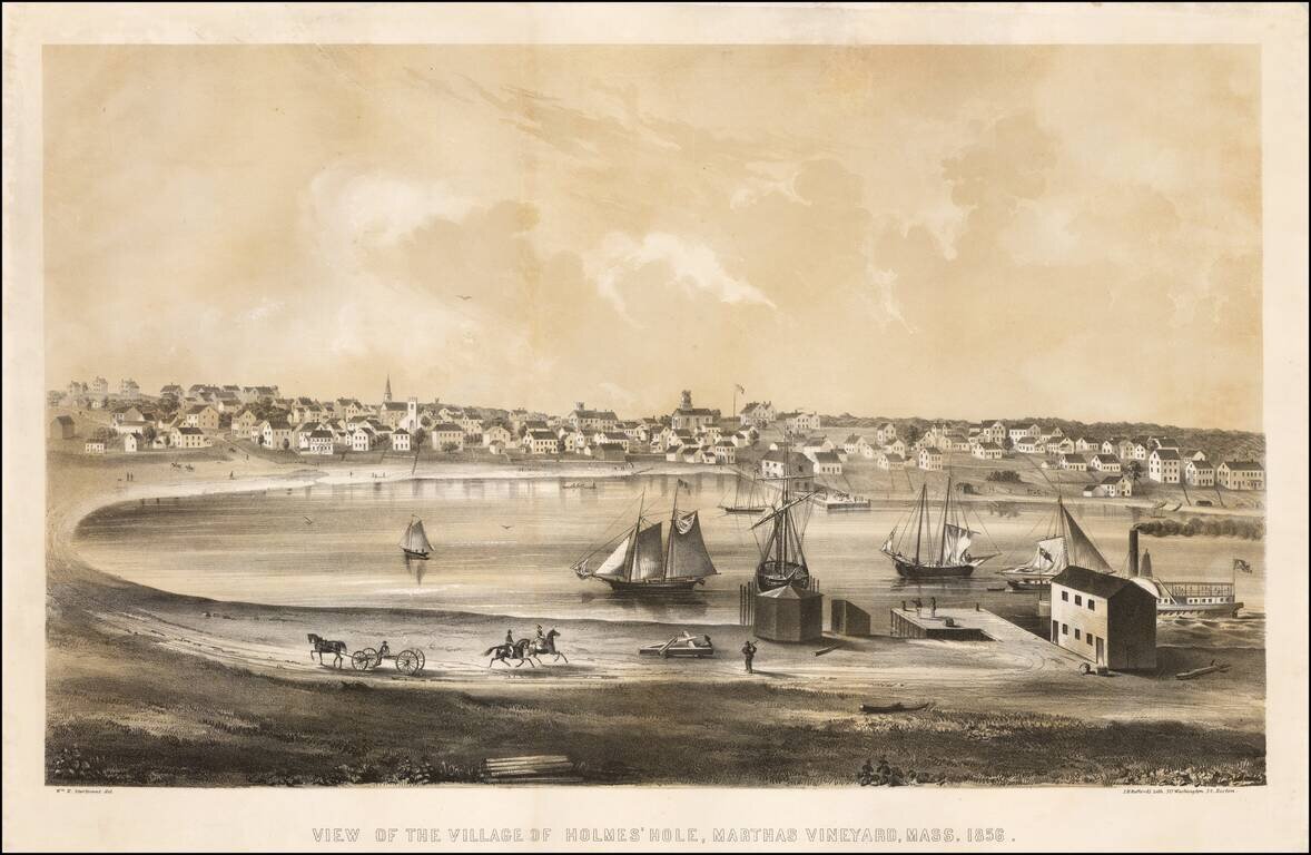
Fine early birdseye view of Vineyard Haven on Martha's Vineyard. Vineyard Haven, known until 1871 as Holmes' Hole, was a fishing and shipbuilding village, and a primary harbor for boats traveling the coast between New York and Boston. Bufford's view...
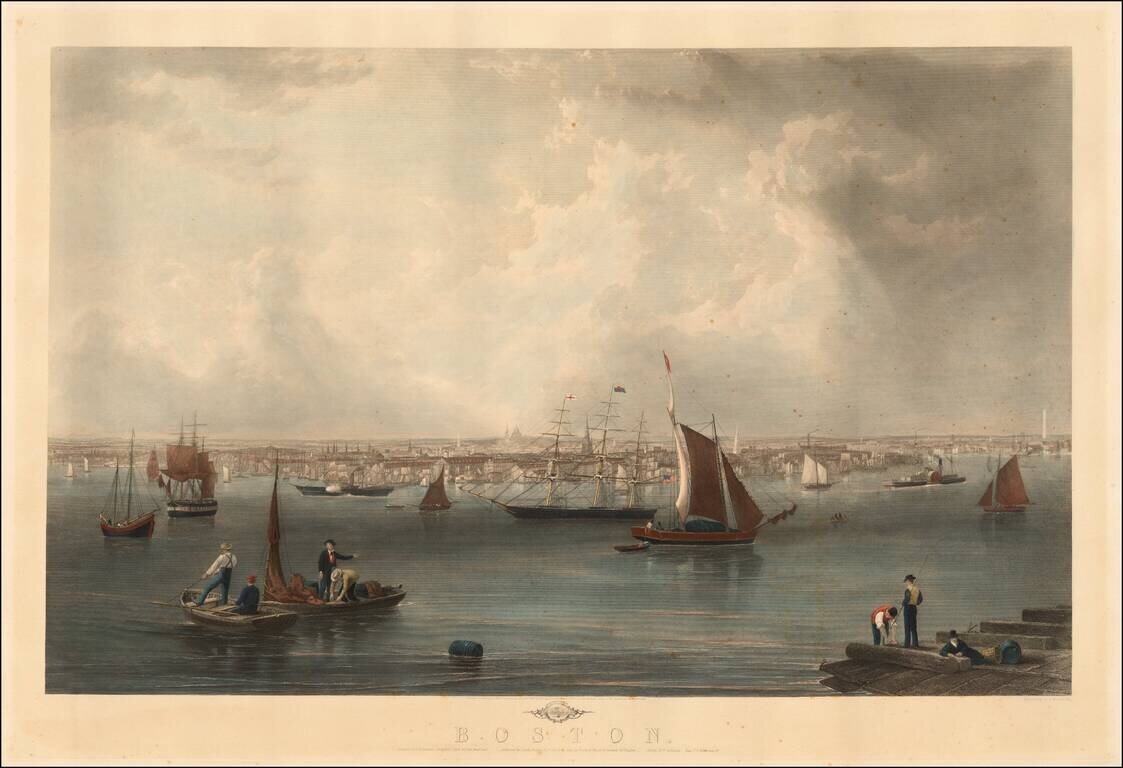
Fine view of Boston engraved by Charles Mottram, based upon a painting by John W. Hill. Originally published by Smith Brothers & Co. in 1857, the view is one of the finest 19th Century views of Boston and its harbor, with the statehouse dome...
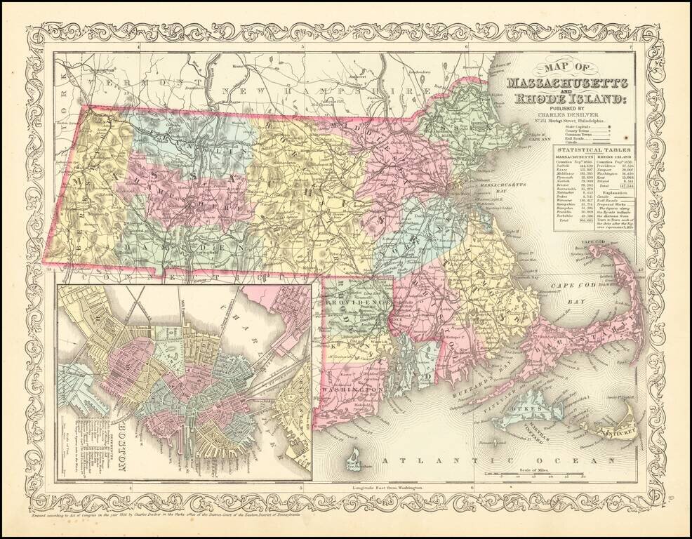
Striking map of Massachusetts and Rhode Island, hand colored by counties, from Charles Desilver's New Universal Atlas. The map names towns, rivers, lakes, islands, etc. and shows roads with distances, railroads and other details. Large inset of Boston.
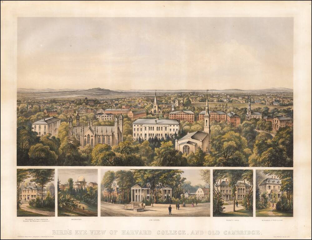
Finely colored early view of Harvard College, published in Boston in 1858. Includes a fine overview of Harvard, with 5 smaller views showing: Residence of Prof. Longfellow, formally Genl. Washington's Headquarters Observatory Law School Divinity...
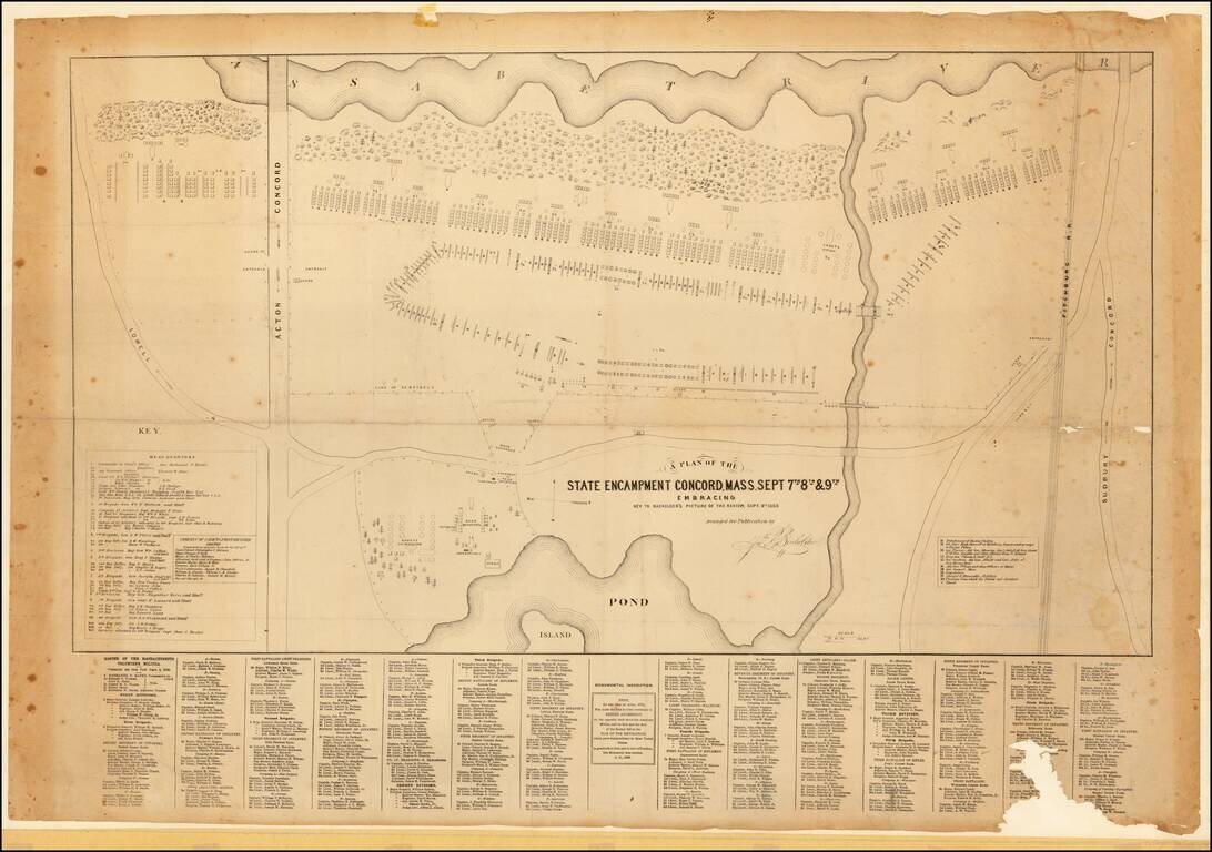
Scarce plan of the 1859 military procession of the Massachusetts Volunteers, published to accompany Bachelder's fine lithographed view of the same, titled: REVIEW OF THE MASS. VOLUNTEER MILITIA, at Concord, Sept. 9th, 1859. An inscription below the...
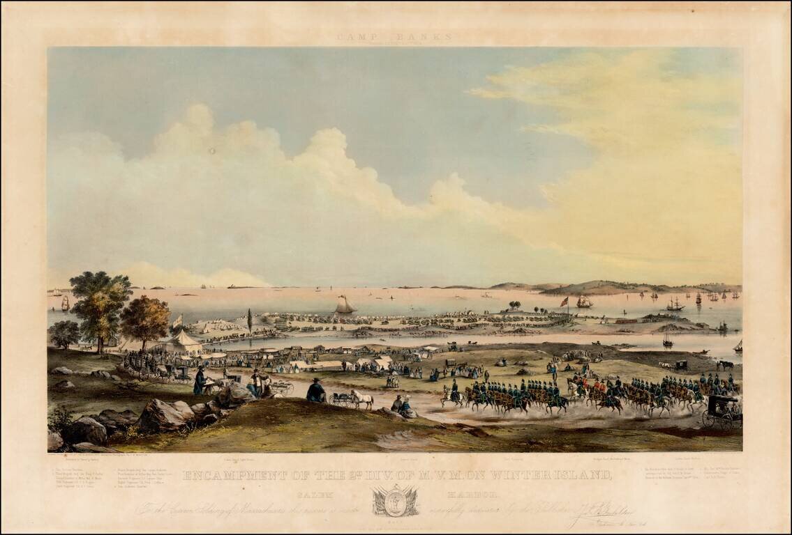
Large colored lithograph showing a Military encampment on island and shore with soldiers on horseback, troops parading, tents and carriages. Overlooking body of water with many ships. "Drawn from nature by JNO. B. Bachelder, assisted by photographs...
Fascinating large format map of part of downtown Boston, published for the Common Council. Detailed planning map showing part of downtown Boston, near the modern day Aquarium, Harbor Towers, Norman B. Leventhal Park, and Boston Harbor Sailing Club....
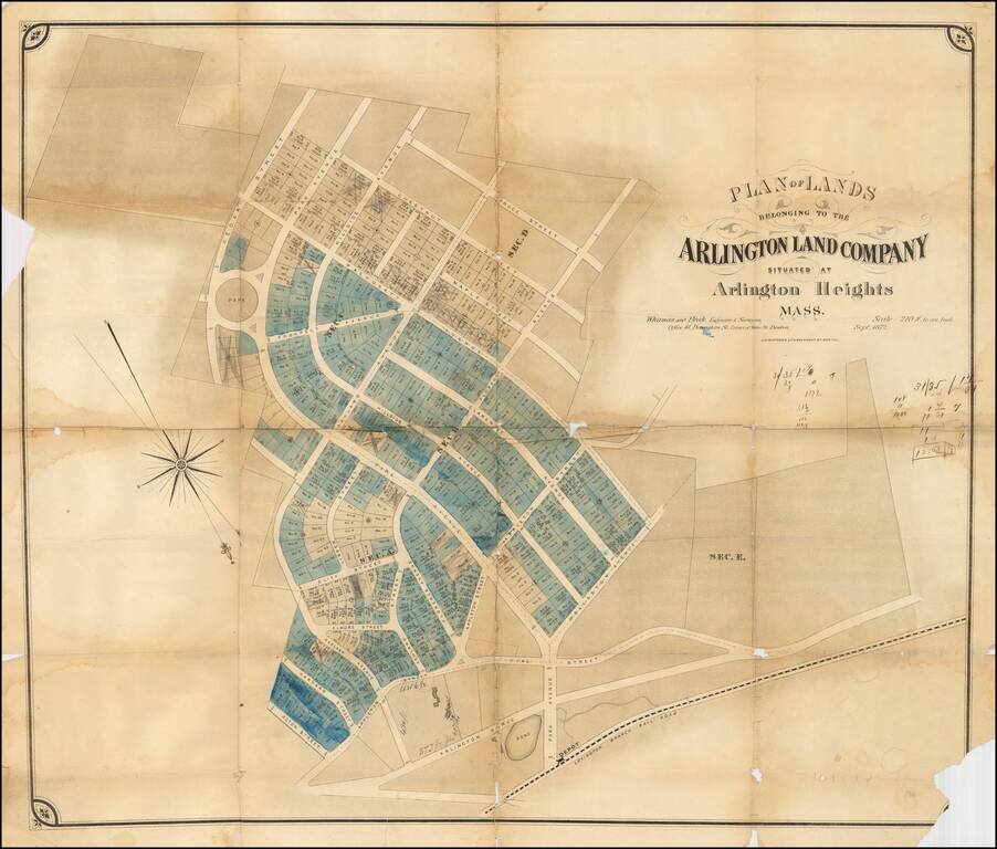
Rare early development map of Arlington Heights, Massachusetts. The map is oriented with Southwest at the top. The Park Circle Water Tower site is located. The Lexington Branch Railroad is shown looping around a Pond near the present site of the...