Map size in jpg-format: 40.9832MiB
Click to open in high resolution (open in new tab).

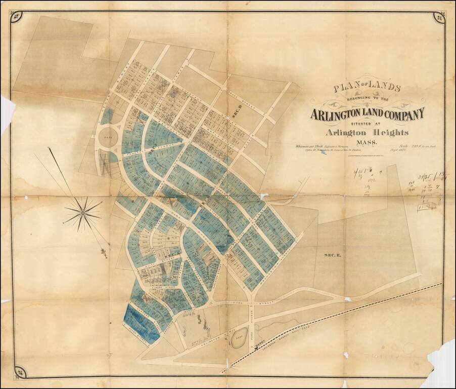
Rare early development map of Arlington Heights, Massachusetts.
The map is oriented with Southwest at the top. The Park Circle Water Tower site is located.
The Lexington Branch Railroad is shown looping around a Pond near the present site of the Arlington Reservoir, with a train depot at Park Avenue.
The map appears to have been marked up by an early real estate broker tracking lot sals.
If you are a student, write to us in telegram: @antiquemaps and indicate what material you need and for what work you need a map in high detail. We are ready to provide material on special terms. For students only!