Map size in jpg-format: 5.0805MiB
Click to open in high resolution (open in new tab).
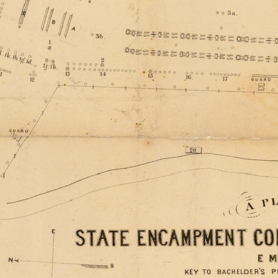
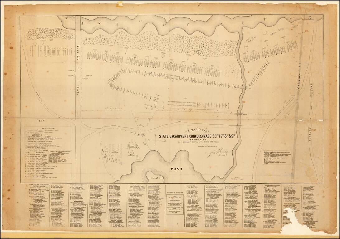
Scarce plan of the 1859 military procession of the Massachusetts Volunteers, published to accompany Bachelder's fine lithographed view of the same, titled: REVIEW OF THE MASS. VOLUNTEER MILITIA, at Concord, Sept. 9th, 1859. An inscription below the image commemorates the Battle of Lexington and Concord, fought on the same location on April 19th, 1775.
The plan can be seen as pre-Civil War northern military posturing and provides an excellent assessment of the regiments and commanders who, in less than two years, would head south in defense of the Union.
John B. Bachelder (1825-1894) was one of the premier viewmakers in mid-19th century New England; he was responsible for many town and city views, and showed a particular flair for sunlit landscapes, see Reps, Urban Views and Viewmakers, for a survey of his works. Aside from his work in that field, he is also remember as a preeminent 19th century historian of the Battle of Gettysburg.
John Bachelder (1825-1894) was a painter, lithographer, photographer and historian. Early in his career he produced an important and appealing body of work depicting sites and cities in the northeastern United States. On his own initiative he traveled to Gettysburg immediately after the battle, where he spent no fewer than 84 days traversing the field, making sketches, and interviewing witnesses to the events. Later that year he published a spectacular and detailed bird’s-eye view of Gettysburg, his first published depiction of the battlefield. He went on to become the preeminent 19th-century historian of the battle and for years served as director of the Gettysburg Battlefield Memorial Association.
If you are a student, write to us in telegram: @antiquemaps and indicate what material you need and for what work you need a map in high detail. We are ready to provide material on special terms. For students only!