
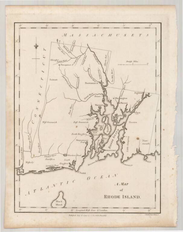
Rare example of John Stockdale's map of Rhode Island from the London edition of Morse's Geography. This map is quite possibly the first English language map of Rhode Island published following the conclusion of the American Revolution and one of only...
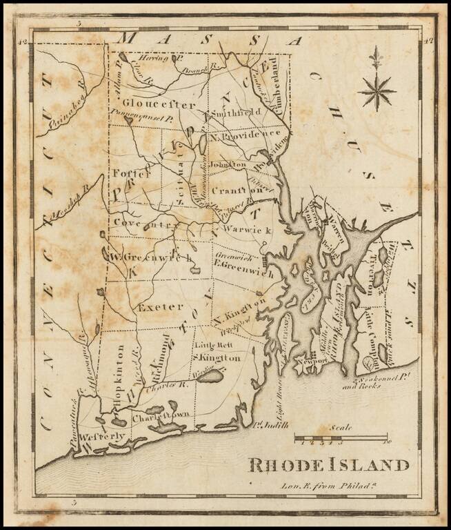
One of the earliest American maps of the state of Rhode Island from the first American gazetteer. Joseph T. Scott, a Philadelphia engraver and publisher, issued his gazetteer during the early days of American cartography. Scott included much detail of...
Early map of Rhode Island, divided by Counties. Shows towns, rivers, roads, lakes, islands, bays, points, harbors, etc. Includes both Block Island and Fischers Island. A nice example, from Arrowsmith & Lewis's New & Elegant Atlas, an early...
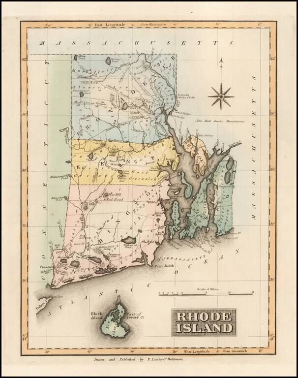
Important early map of Rhode Island, from Carey's American Atlas, one of the earliest separate maps of Rhode Island printed in the US. Includes towns, travel routes, topographical detail and waterways shown. Carey published his American Atlas in 1795,...
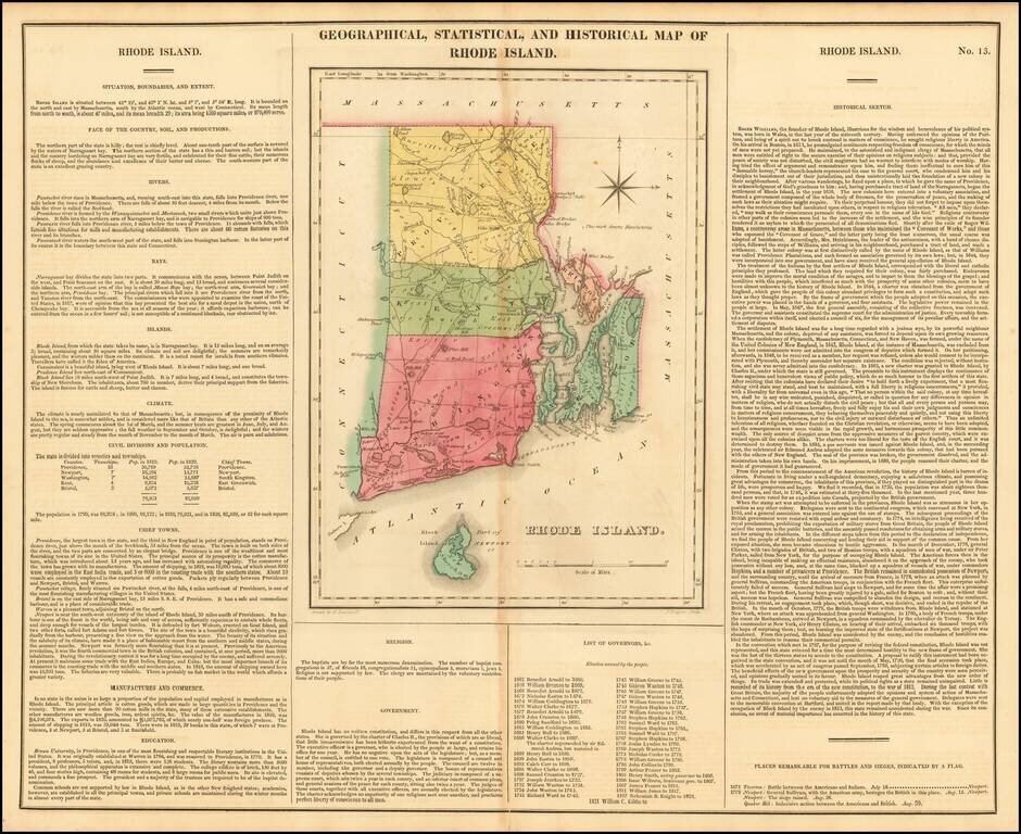
Rich full-color example, from the first edition of Carey & Lea's Atlas. Size includes text surrounding map, which includes wonderful contemporary details concerning the topography, indigenous lands, rivers, climate, towns, manufacturing, commerce,...
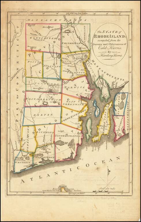
Rare map of Rhode Island, hand colored by counties and showing townships. Shows towns, roads, lakes, rivers, mills, political boundaries, and other features. Detailed treatment of the islands of the coast and compass rose. Block Island is shown in...
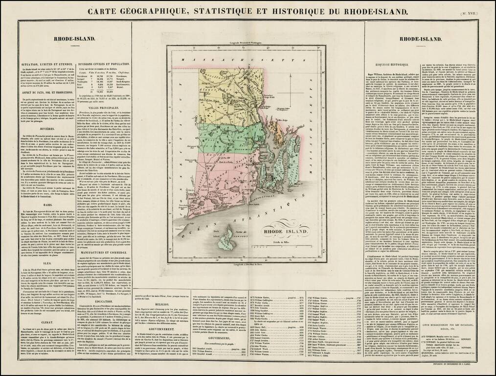
Nice example of the French edition of this early map of Rhode Island from Carey & Lea's Atlas. Includes wonderful contemporary details concerning the topography, indigenous lands, rivers, climate, towns, manufacturing, commerce, education,...
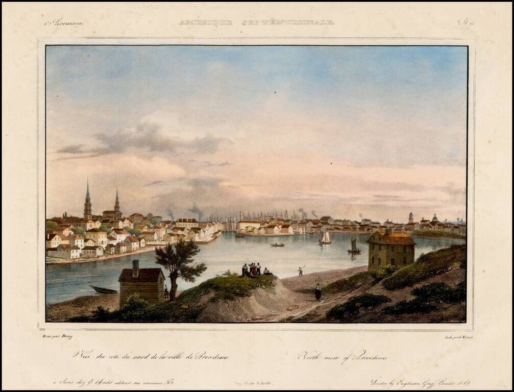
Decorative view of Providence, Rhode Island, which appeared in Jacques Milbert's rare Itineraire Pittoresque du Fleuve Hudson &c. Milbert travelled to the United States in 1815 and returned to France in 1823. During his stay he studied and...
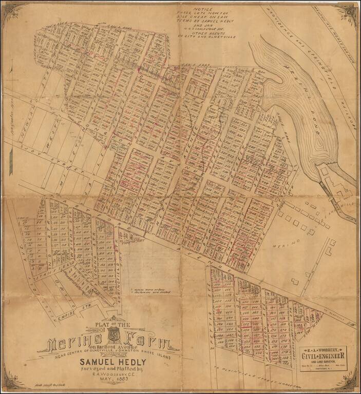
Detailed plat of the center of Harford, Rhode Island, with annotations reflecting what would appear to be the progress of lot sales. The map shows the subdivision of the area which had for decades been the location of the Merino Mill and the Merino...

Decorative and unusual trading card map from this famous series. Map is surrounded by decorative vignette, showing Locomotives and Newport R.I. Includes population statistics.
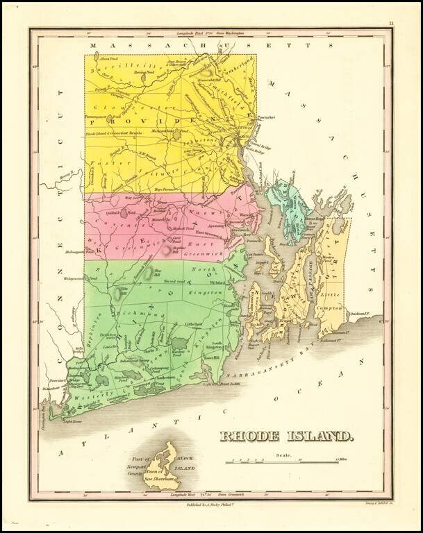
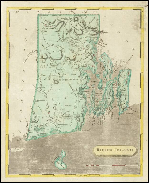
Striking map of the state of Rhode Island from Finley's New General Atlas. The map is hand colored by counties and shows towns, roads, rivers, mountains and other geographical features. Excellent detail throughout Narragansett Bay and in the interior...
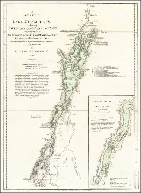
An Important Revolutionary War Period map of Lake Champlain & Lake George, based upon William Brassier's survey of the region during the French & Indian War. Sayer & Bennett's map is the first separately published map to focus on Lake...
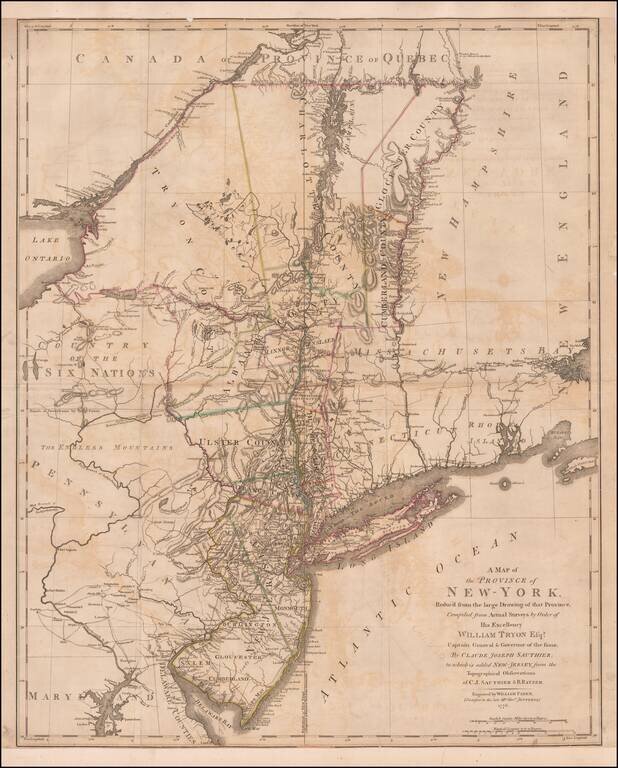
Important early Revolutionary War map, published by William Faden shortly after the signing on the Declaration of Independence. This remarkable map is a combination of two of the most important colonial surveys conducted on the eve of the Revolution,...
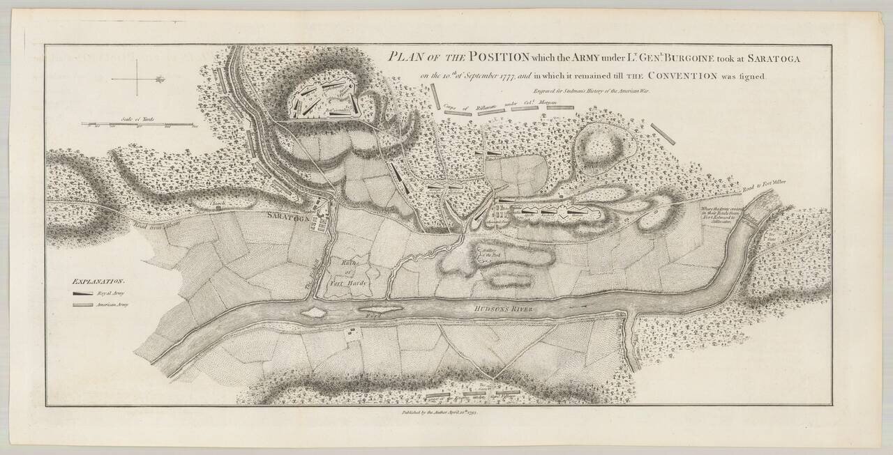
An important early battle plan, showing the position of the British and American Troops following the second battle of Saratoga. Following the first battle, Burgoyne took a defensive position, while the Americans withdrew to wait for his next move....
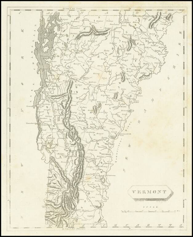
Early engraved map of Vermont from Arrowsmith & Lewis's New & Elegant Atlas, an early collaboration between American mapmaker Samuel Lewis and British mapmaker Aaron Arrowsmith. The map names many towns including Burlington, Montpelier, Stowe,...
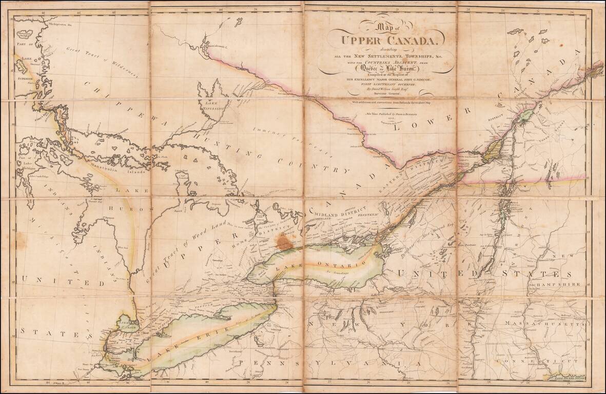
An Early Upper Canada Rarity - Sent To Thomas Jefferson During the War of 1812 Extremely rare separately published map of Upper Canada, Lake Huron, Lake Erie, Lake Ontario and contiguous parts of New York, Michigan, Vermont and Pennsylvania, published...