
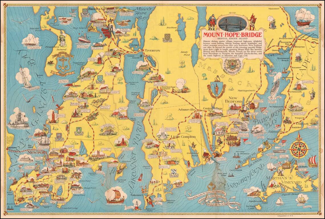
Scarce pictorial map of Mount Hope Bridge and vicinity, published in Bristol, Rhode Island by the Mount Hope Bridge Corporation. The map is "Arranged" by John W. Haley, Rhode Island Historian, designed by H.W. Hetherington and lithographed by the J.C....
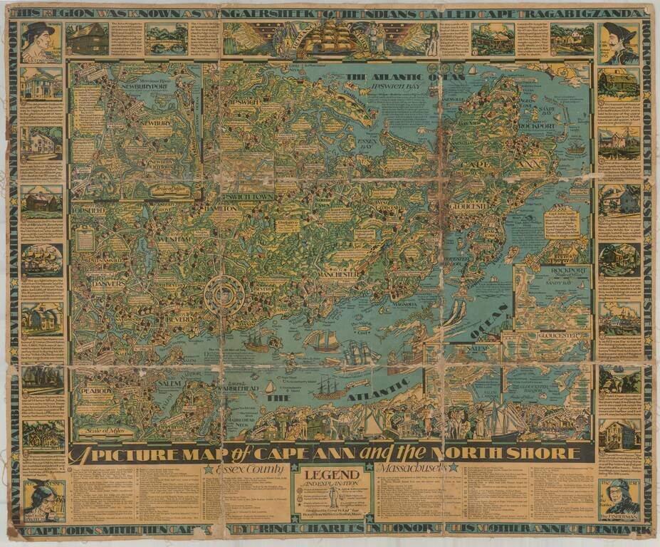
Finely illustrated pictorial map of Cape Ann area of northern coastal area of Massachusetts. Timelines and noteworthy feature descriptions border the map.
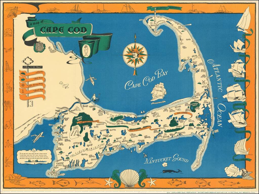
One of the best vintage pictorial maps of Cape Cod, printed in black, blue, green, and orange. The mapmaker is Paul Paige of East Brewster, Mass. The "Key to the Cape" incorporates an actual key and illustrates Airports, Golf Courses, Life Saving...
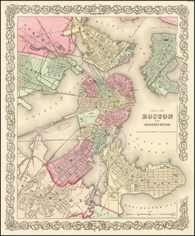
Detailed map of Boston and vicinity, extending to the Mystic River, Chelsea Creek, Sommerville, Cambridge, Roxbury and South Boston. Shows streets, roads, railroads, bridges, buidings, wharfs, etc. An excellent map of Boston during the Civil War. JH...
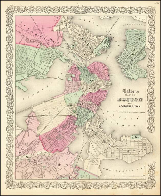
Highly detailed large format map of the city of Boston and environs, hand colored by wards. Shows railroad lines, roads, streets, wharfs, bridges, buildings, rivers and other landmarks. Extends to Charlestown. Large inset of Boston Harbor and Islands....
Detailed map of Boston and vicinity, extending to the Mystic River, Chelsea Creek, Sommerville, Cambridge, Roxbury and South Boston. Shows streets, roads, railroads, bridges, buidings, wharfs, etc. An excellent map of Boston during the Civil War. JH...
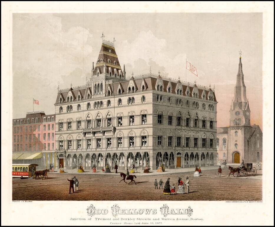
Striking chromolithographic view of the recently completed Odd Fellows Hall in Boston. The credit includes the name of the architect, J.E. Billings.
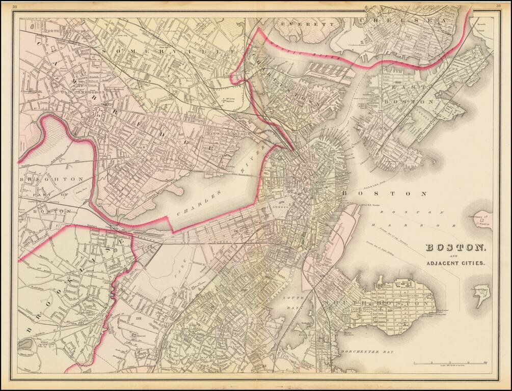
Wonderful double page map of Boston and the neighboring cities, published by OW Gray. The map shows marvelous local details throughout. Extends to Brookline, Cambridge, Somerville, Everett, Chelsea, etc. From one of the leading American map publisher...
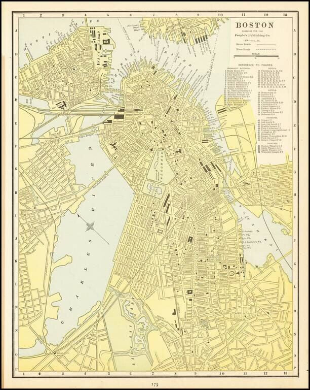
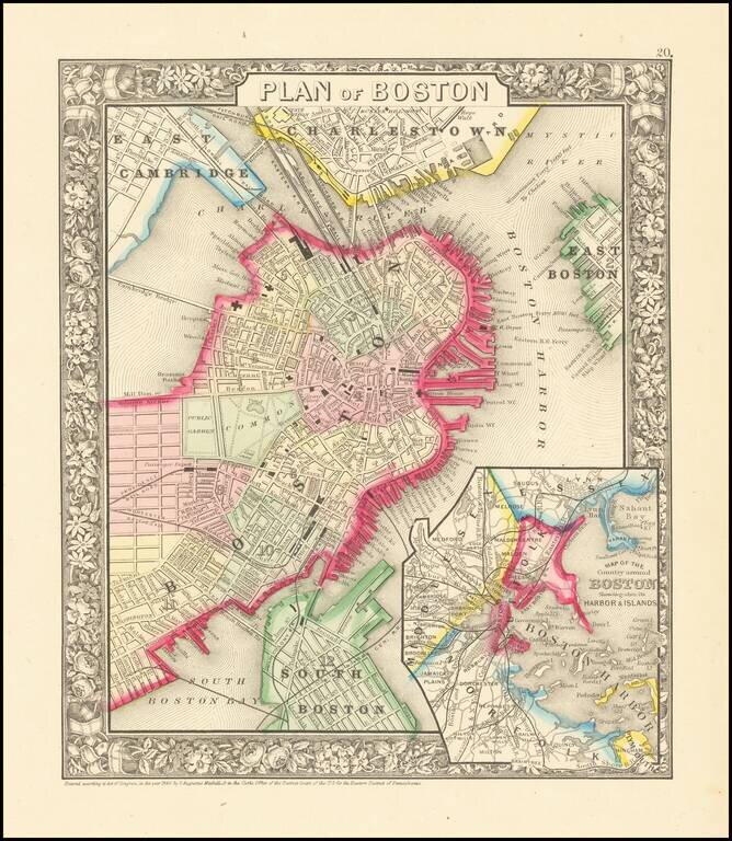
Detailed city plan of Boston, showing streets, buildings, train lines, public places, rivers etc.
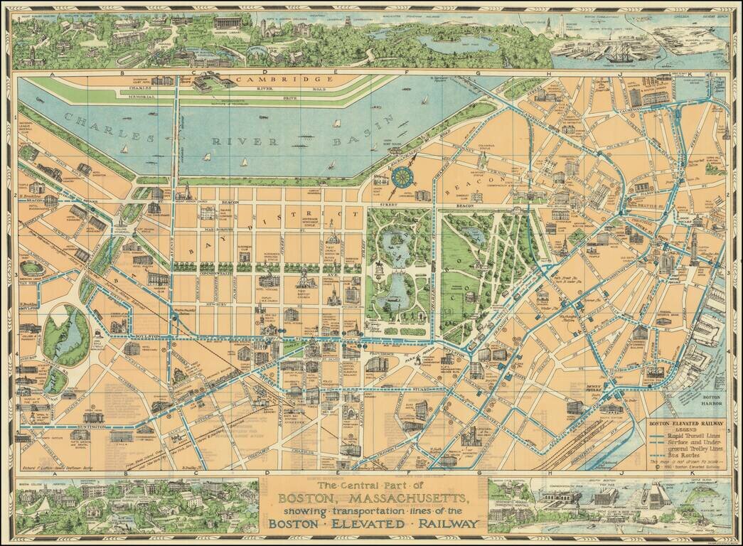
Decorative pictorial map of Boston, with 3 large inset views of various parts of the City. The map shows streets, parks, city blocks, Rapid Transit Lines, surface and underground trolley lines and bus routes, city landmarks, including hotels, Fenway...
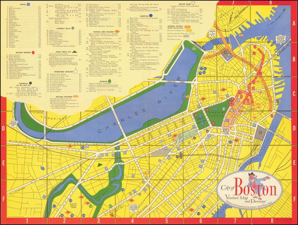
Lively tourist map of Boston, published by Zorigian Studios in Boston. The map was published under the direction of then Mayor, John B. Hynes, who served as mayor of Boston from 1950 to 1960.
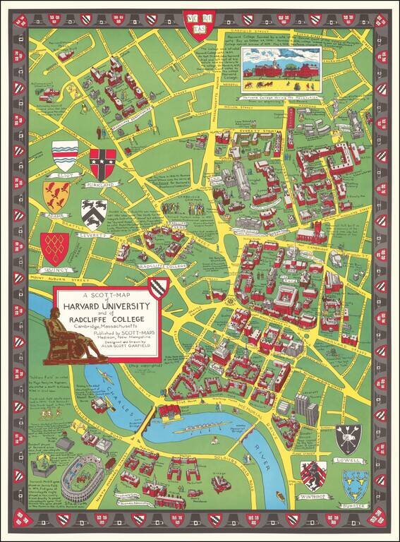
Decorative vintage pictorial birdseye view of the campus and grounds at Harvard, made by Alva Scott Garfield in 1959. The buildings on the Harvard campus at the time are pictured in a bird's eye view style. Note that Leverett Towers at the lower right...
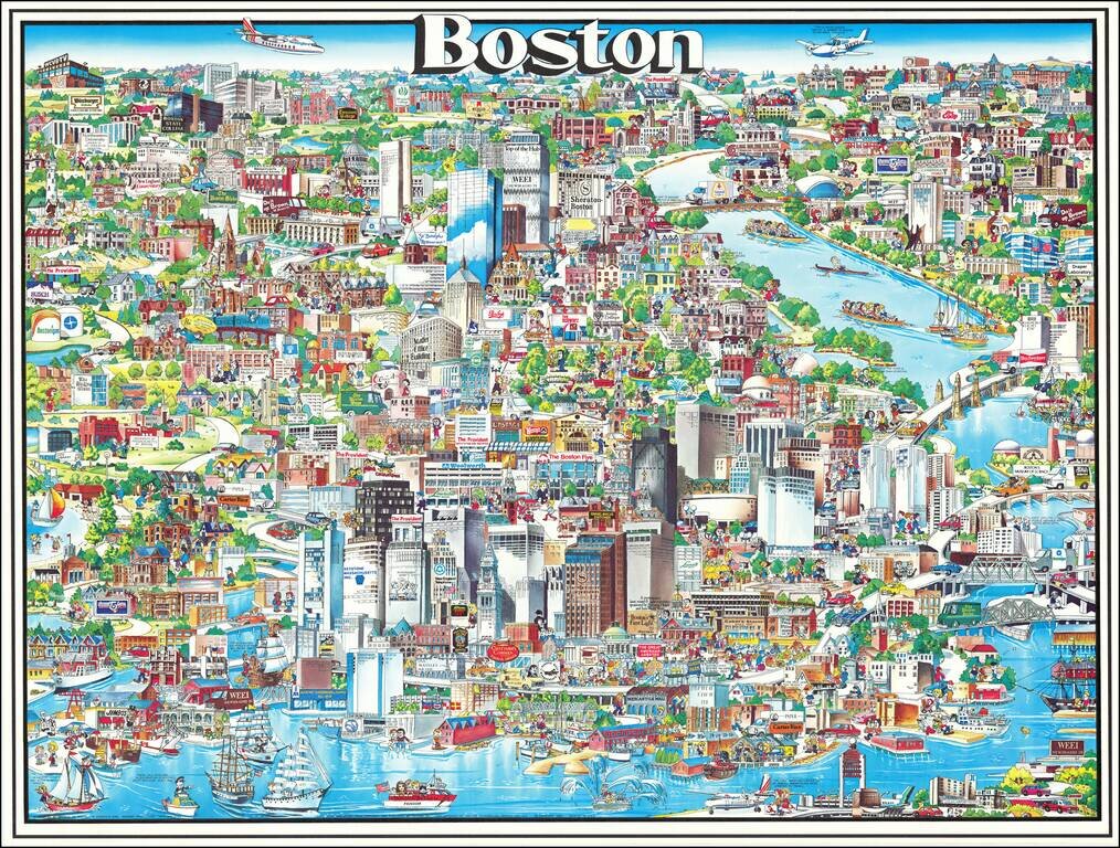
Richly embellished advertising oriented pictorial map / birdseye view of the Boston area, published by Archar Inc. of Canada. Packed with advertising for local businesses, the images shows buildings, tourism and other landmarks, recreational...
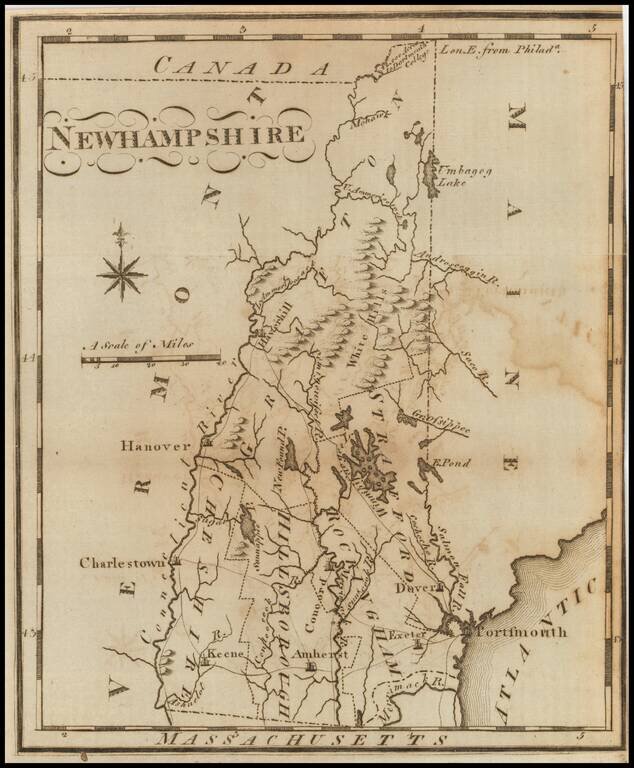
One of the earliest American maps of New Hampshire from the first American gazetteer. Joseph T. Scott, a Philadelphia engraver and publisher, issued his gazetteer during the early days of American cartography. Scott included much detail of rivers,...
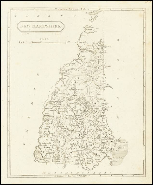
Early map of New Hampshire, divided by counties. Shows towns, rivers, roads, lakes, islands, bays, points, harbors, etc. A nice example, from Arrowsmith & Lewis's New & Elegant Atlas, an early collaboration between American mapmaker Samuel...
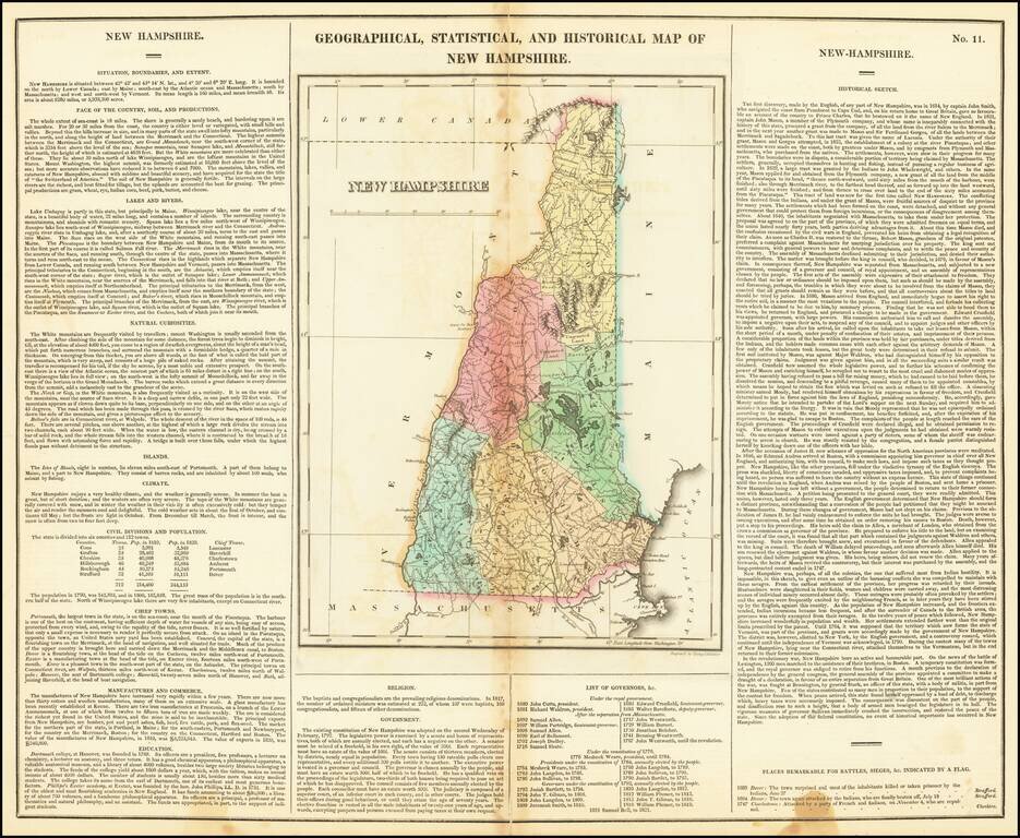
Nice example of this early map of New Hampshire, from Carey & Lea's Atlas. Size includes text surrounding map, which includes wonderful contemporary details concerning the topography, indigenous lands, rivers, climate, towns, manufacturing,...