Map size in jpg-format: 1.13052MiB
Click to open in high resolution (open in new tab).
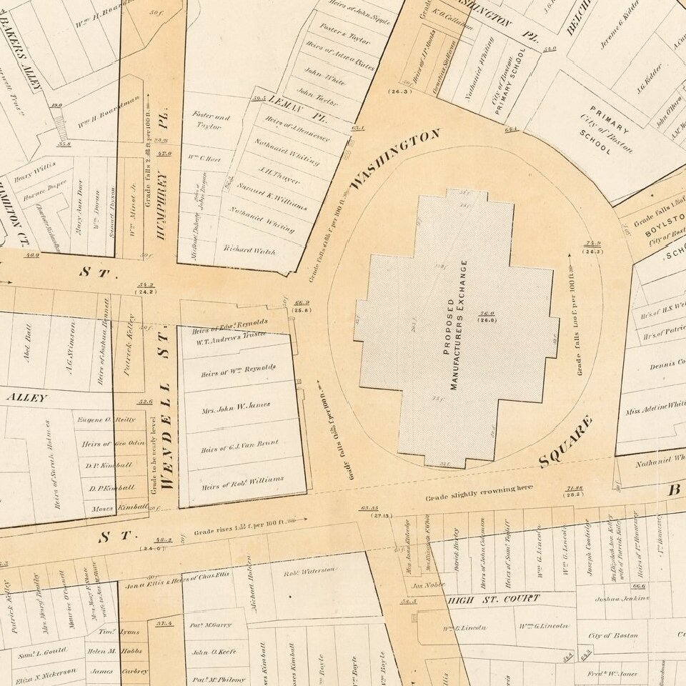
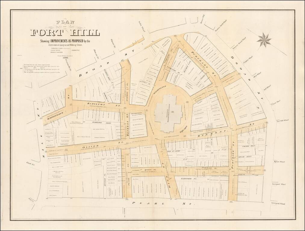
Fascinating large format map of part of downtown Boston, published for the Common Council.
Detailed planning map showing part of downtown Boston, near the modern day Aquarium, Harbor Towers, Norman B. Leventhal Park, and Boston Harbor Sailing Club.
This map shows the initial land ownership and new street layout including High Street, Purchase Street, Belmont Street, and Oliver Street.
Published in 1866, it shows the landowners at that time and the elevations and street layouts with new street layouts and elevation drop superimposed over the old. The changes shown on this map are now nearly gone and barely recognizable. This map shows the cutting down of Fort Hill by up to 50 feet. New roads are highlighted in a light orange-tan color.
Fort Hill
Fort Hill is a 0.4 square mile neighborhood and historic district of Roxbury, in Boston, Massachusetts. The approximate boundaries of Fort Hill are Malcolm X Boulevard on the north, Washington Street on the southeast, and Columbus Avenue on the southwest.
The geographic area comprising Fort Hill was strategically important during the American Revolutionary War and housed the patriot army defenses during the Siege of Boston. Fort Hill is actually named after an earthwork fortification that the patriot army built upon the hill located at the center of the neighborhood. The hill is now the location of Highland Park, which is notable for a Victorian-era tower designed by Nathaniel Jeremiah Bradlee, and landscaping designed by Frederick Law Olmsted.
If you are a student, write to us in telegram: @antiquemaps and indicate what material you need and for what work you need a map in high detail. We are ready to provide material on special terms. For students only!