
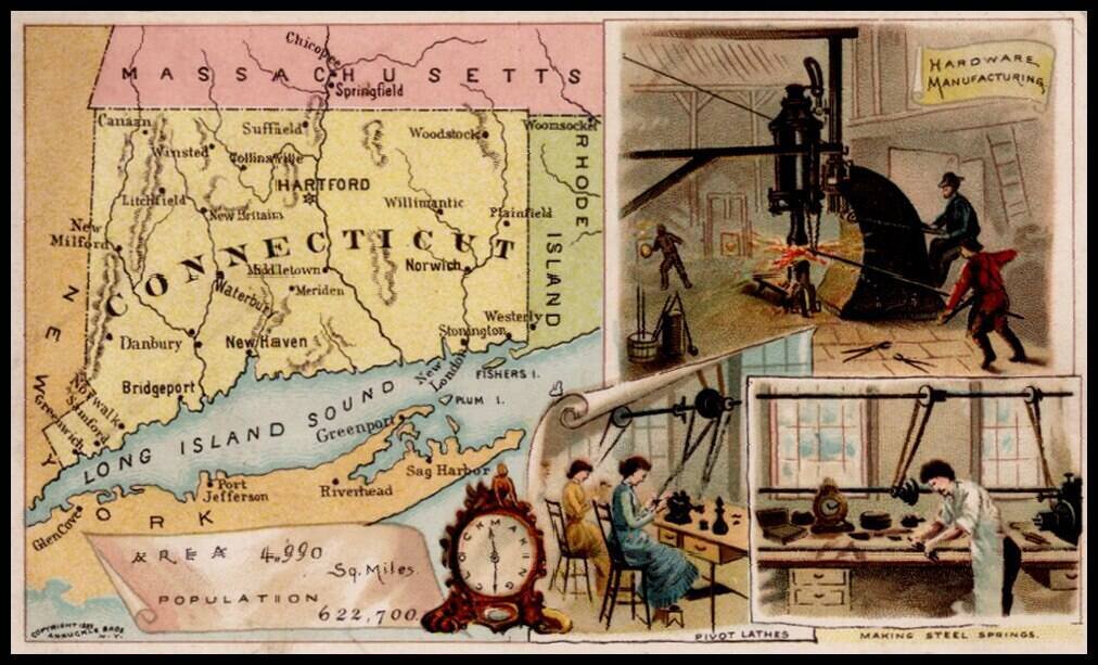
Decorative and unusual trading card map of Connecticut from this famous series. The map is surrounded by decorative vignette, showing Hardware Manufacturing, Pivot lathes and making steel springs. Includes population statistics.
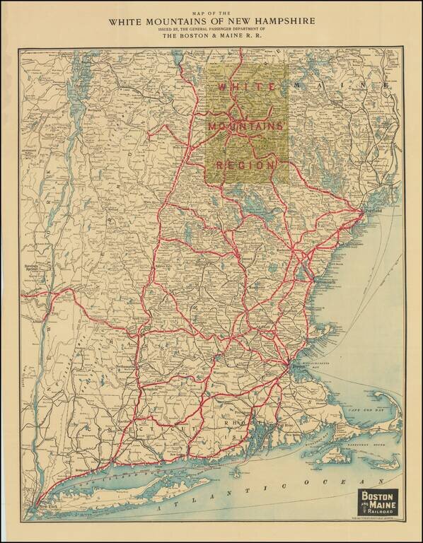
Attractive color-lithographed map of New England, issued by the Boston and Maine Rail Road to promote regional tourist travel to the White Mountains. The map extends from New York City in the far southwest to the New Hampshire border with Canada in...
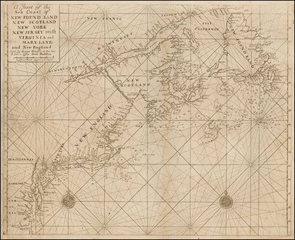
A "Pirated Dublin" Sea Chart of the Northeast Coastlin of North America. A rare chart of the coastline adapted from the work of Cyprian Southack and Mount & Page and published in a Dublin edition of the English Pilot. The Fourth Book. The chart...
![[Cape Elizabeth to Moose Point, Maine]](/map/small/48612.jpg)
The best Revolutionary War chart of southern Maine. Large, two-sheet hand-colored engraved sea chart of part of the Maine coastline. The map illustrates the length of the Kennebec River to Fort Halifax. It also shows Fort Western (now Augusta),...
![[Coast of Maine from Moose Cove to Gouldsboro Bay]](/map/small/62847.jpg)
Important early map of the Coast of Washington County, Maine, from J.F.W. Des Barres Atlantic Neptune. The map includes the areas which would later include the towns of Steuben, Cherryfield, Milbridge,, Harrington, Addison, Jonesport, Beals Jonesboro,...
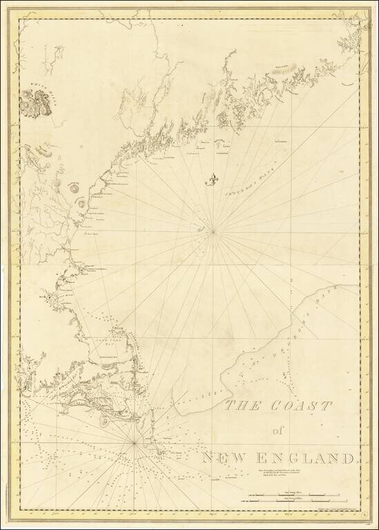
By far the finest 18th-century depiction of the Coast of New England issued in The Atlantic Neptune to meet the needs of British navigators during the American Revolution. This monumental chart depicts the complex coast of New England from...
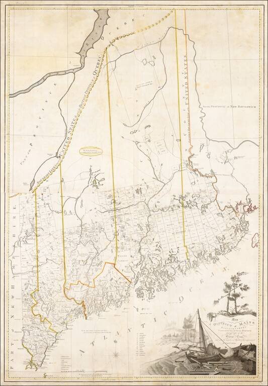
A Landmark Map of Maine Carleton's map of Maine is one of the most important early maps of the State. Drawn at a scale of 2.5 miles to the inch, the map illustrates in fine detail the intricate coastline and complex system of rivers, streams, lakes...
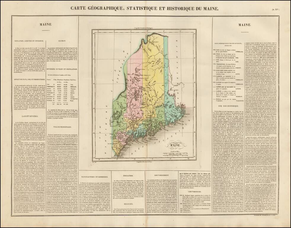
Nice example of this early map of Maine, from the first edition of Carey & Lea's Atlas. Size includes text surrounding map, which includes wonderful contemporary details concerning the topography, indigenous lands, rivers, climate, towns,...
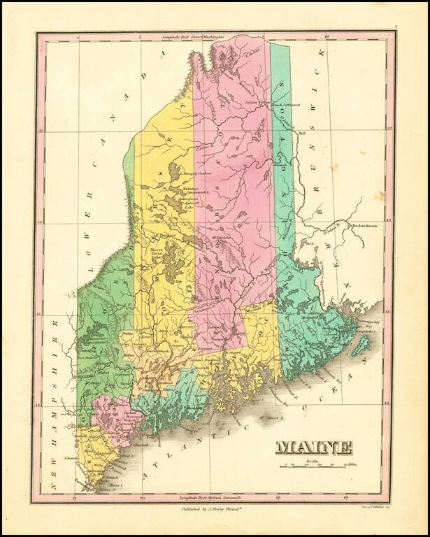
Decorative map of Maine from Finley's New General Atlas. The map is hand colored by county, showing towns, roads, railroads, lakes, rivers, mountains, etc. One of the best maps of the state during the period. Anthony Finley was the dominant map...
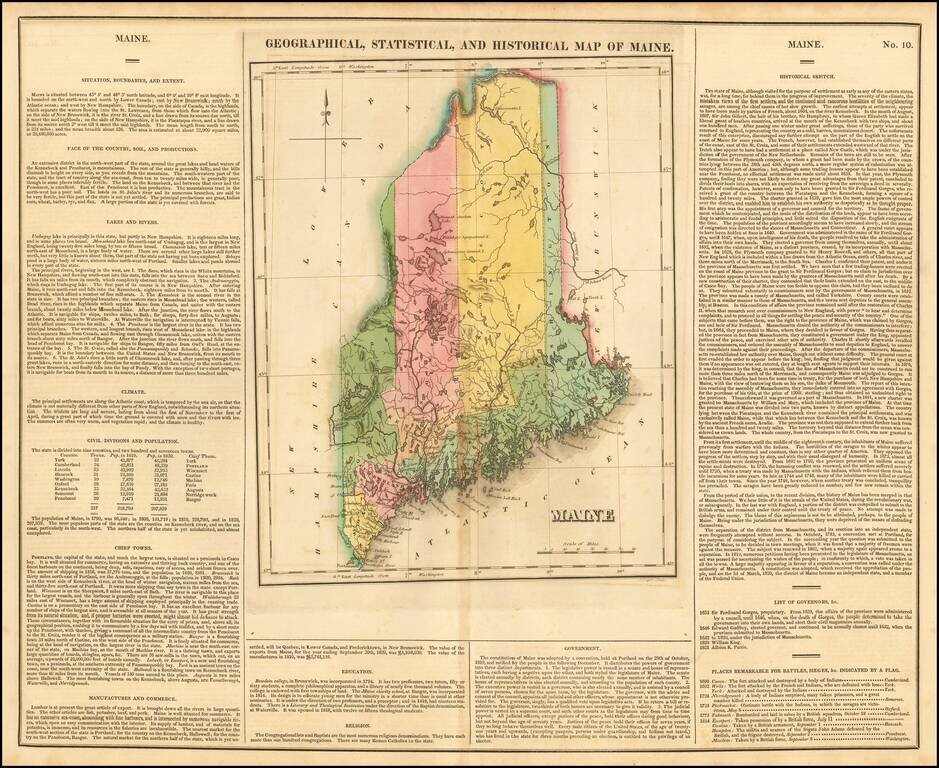
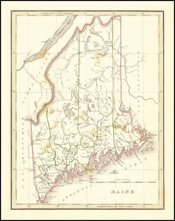
One of the Earliest Maps of Maine Published Outside America Finely engraved early map of Maine, hand colored by counties. Roads, towns, rivers, and lakes are included on map. Key notes flags for 10 remarkable battles. Size includes text surrounding...
Interesting and detailed map of Maine, from an early edition of Bradford's Comprehensive Atlas. The map is colored by counties and shows towns, rivers, lakes, bays, harbors, islands and other important places. Bradford's Comprehensive Atlas launched...
![Maine [showing disputed boundaries as claimed by US, New Brunswick and as settled by the King of the Netherlands]](/map/small/70387.jpg)
Elegant map of Maine by David Burr, one of the most important cartographic publishers of the early 19th Century. The map is highly detailed, showing towns, roads, rivers, lakes, mountains, and a host of other details. The map locates the disputed...
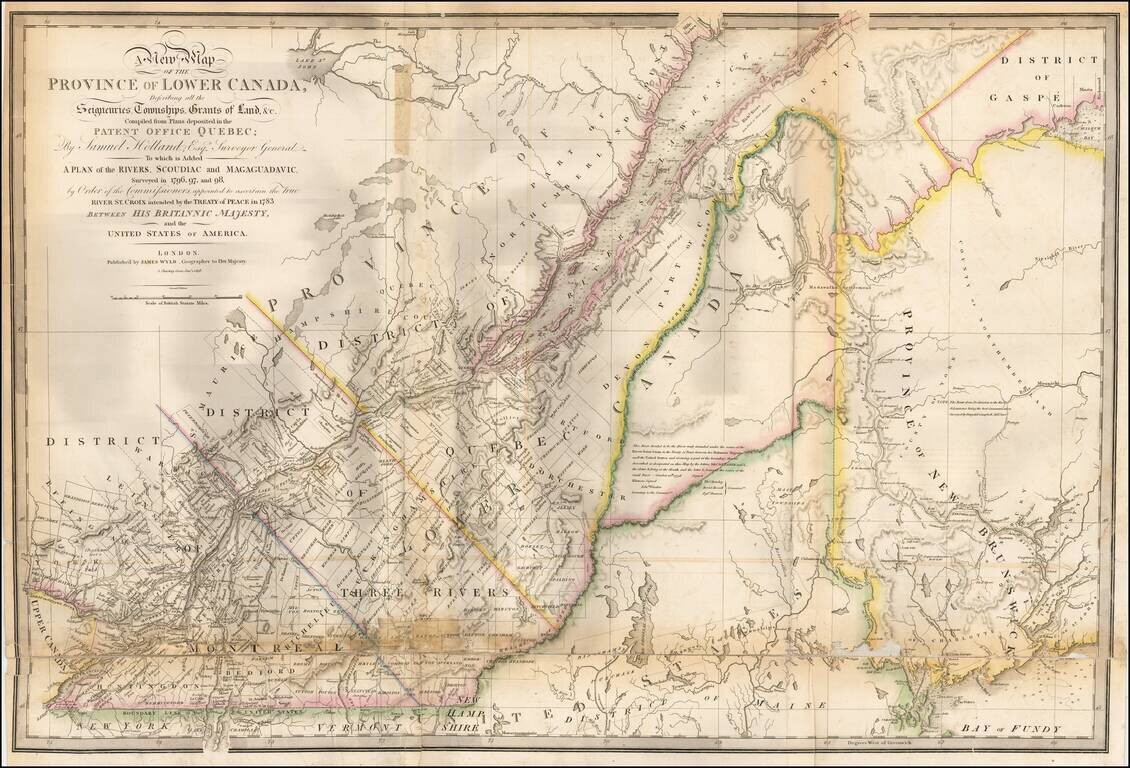
Updated example of this important map of the Lower Province of Canada and Maine, first issued by Faden in 1813. The original Faden map included information concerning over 100 land grants on either side of the St. Lawrence River, including the names...
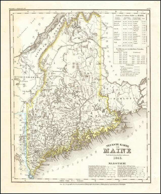
Elegantly engraved and detailed map of Maine, based upon Tanner's worck in the early 1840's. Shows counties, towns, roads, canals, lakes, etc.
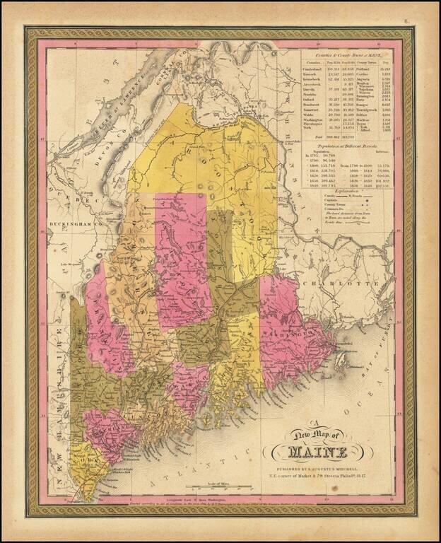
Detailed map of Maine from Mitchell's New Universal Atlas, showing early railroads, townships, canals, etc. The map is hand colored by counties, and includes statistical table showing county populations. One of the most detailed of all atlas maps of...
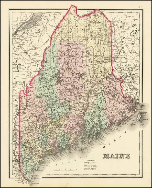
Beautiful and highly detailed map of Maine, colored by townships and showing outline borders for the counties. Also shows, railroads, stations, towns, rivers, lakes, islands, etc.