
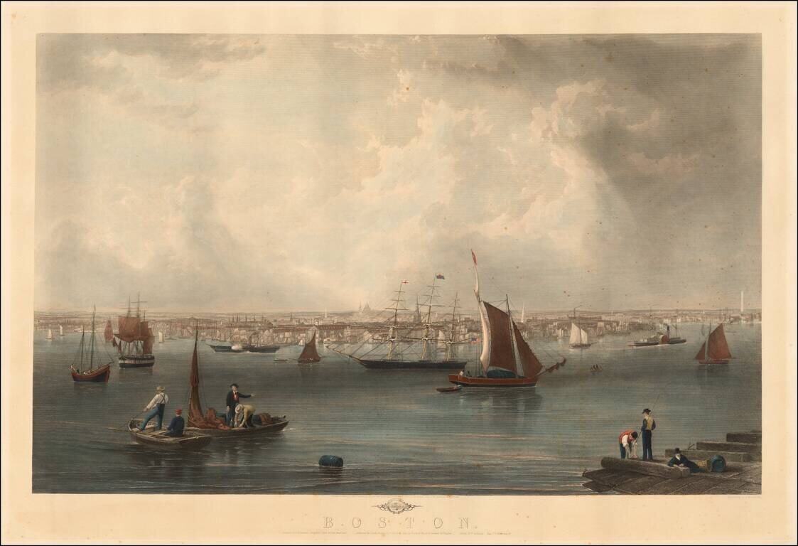
Fine view of Boston engraved by Charles Mottram, based upon a painting by John W. Hill. Originally published by Smith Brothers & Co. in 1857, the view is one of the finest 19th Century views of Boston and its harbor, with the statehouse dome...
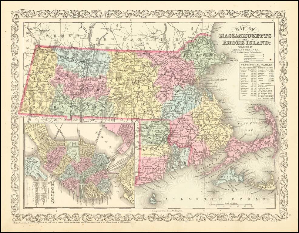
Striking map of Massachusetts and Rhode Island, hand colored by counties, from Charles Desilver's New Universal Atlas. The map names towns, rivers, lakes, islands, etc. and shows roads with distances, railroads and other details. Large inset of Boston.
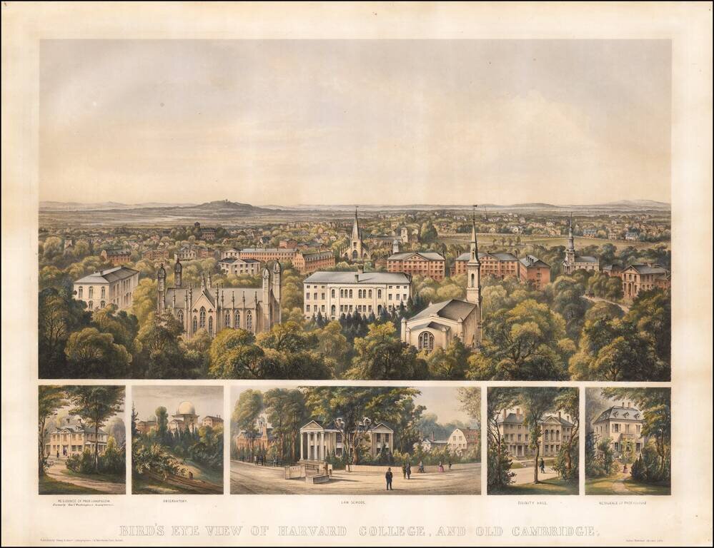
Finely colored early view of Harvard College, published in Boston in 1858. Includes a fine overview of Harvard, with 5 smaller views showing: Residence of Prof. Longfellow, formally Genl. Washington's Headquarters Observatory Law School Divinity...
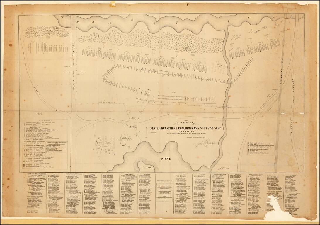
Scarce plan of the 1859 military procession of the Massachusetts Volunteers, published to accompany Bachelder's fine lithographed view of the same, titled: REVIEW OF THE MASS. VOLUNTEER MILITIA, at Concord, Sept. 9th, 1859. An inscription below the...
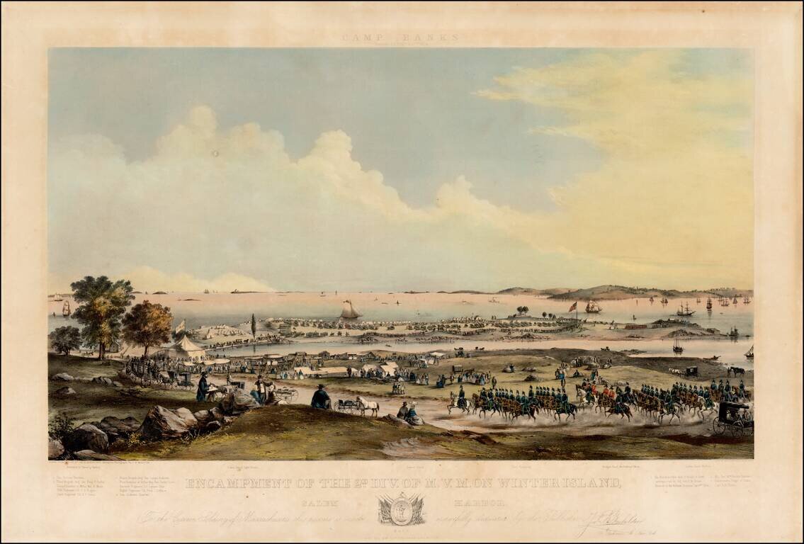
Large colored lithograph showing a Military encampment on island and shore with soldiers on horseback, troops parading, tents and carriages. Overlooking body of water with many ships. "Drawn from nature by JNO. B. Bachelder, assisted by photographs...
Fascinating large format map of part of downtown Boston, published for the Common Council. Detailed planning map showing part of downtown Boston, near the modern day Aquarium, Harbor Towers, Norman B. Leventhal Park, and Boston Harbor Sailing Club....
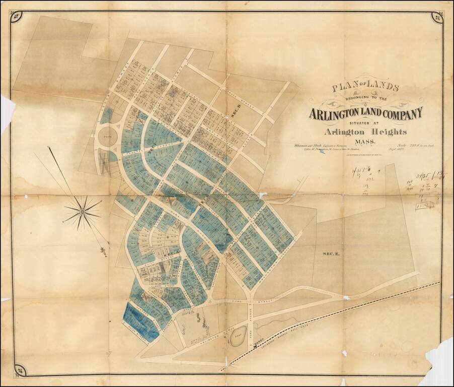
Rare early development map of Arlington Heights, Massachusetts. The map is oriented with Southwest at the top. The Park Circle Water Tower site is located. The Lexington Branch Railroad is shown looping around a Pond near the present site of the...
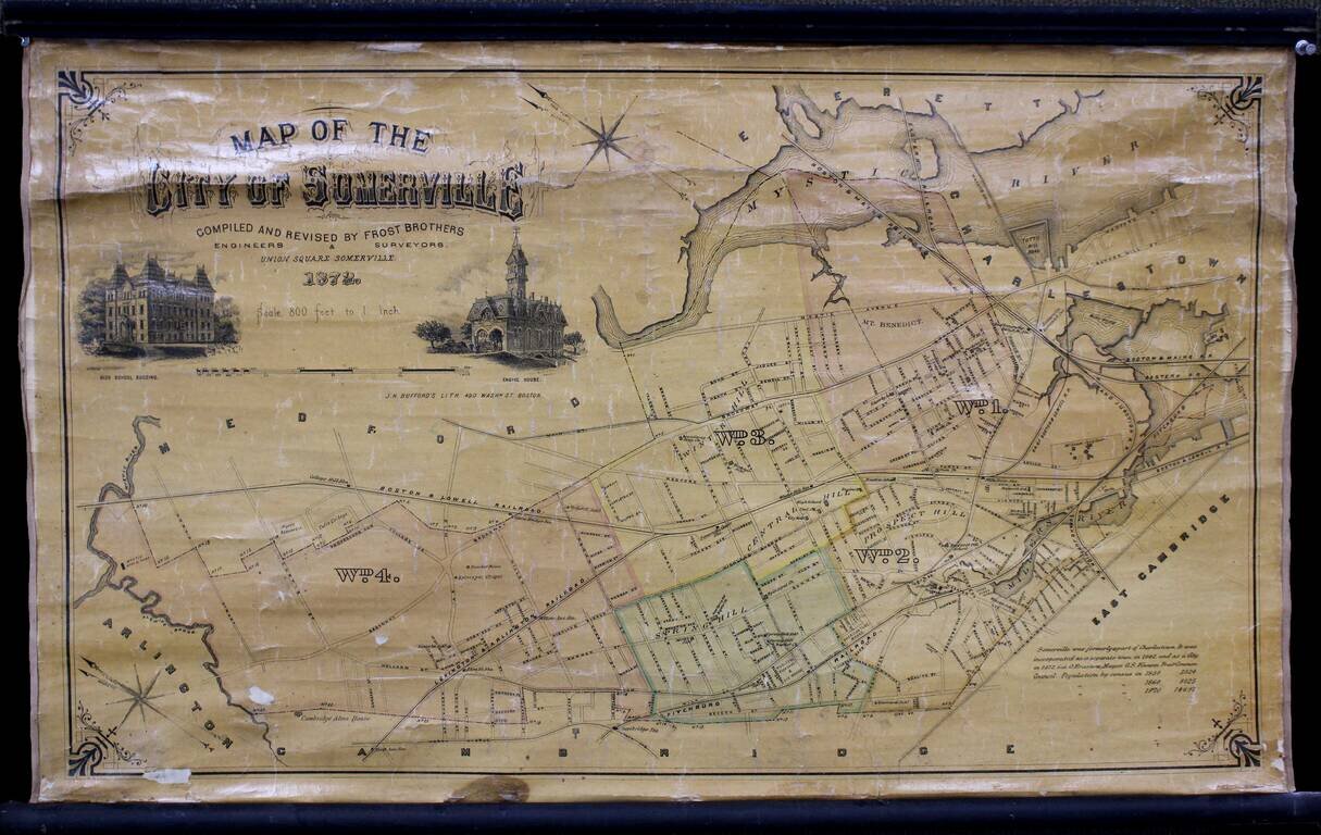
Wonderful separately issued map of Somerville, Massachusetts, in the Boston metropolitan area. Tufts College is shown on the border between Somerville and Medford. The Mystic Reservoir is named and illustrated. College Hill Station is labeled....
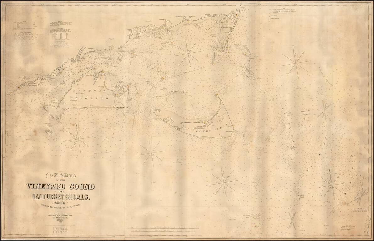
Fine large format sea chart of the waters around Martha's Vineyard and Nantucket, by George Eldridge, the leading private American chartmaker of the era. This mammoth chart depicts, in detail, the waters around the Elizabeth Islands, Martha's...
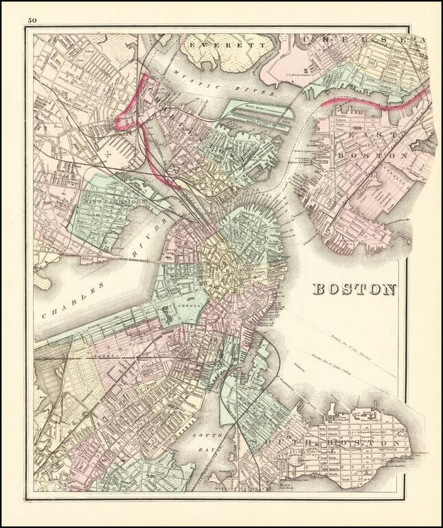
Fine example of OW Gray's map of Boston and the neighboring cities, showing marvelous local details throughout. Extends to Brookline, Cambridge, Somerville, Everett, Chelsea, etc. From one of the leading American map publisher's of the 1870s.
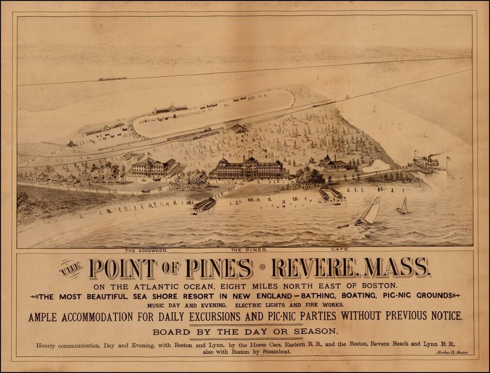
Rare view of The Point of Pines, in Revere Massachusetts, promoting this beach resort 8 miles northeast of Boston. The view shows two hotels (The Pines and the Goodwood) and a Cafe, along with the a horse racing track, the local train depot and scenes...
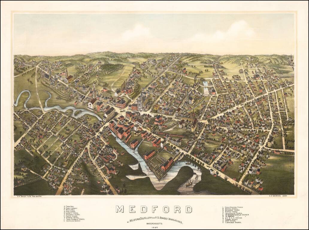
Rare bird's-eye view of Medord, Massachusetts, published by O.H. Bailey in Boston. The view shows a booming commercial town on the banks of the Mystic River, looking northward from the general direction of Tufts University (which would be just below...
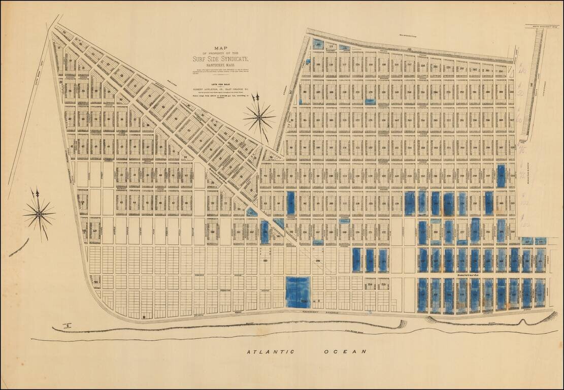
An extremely rare 1880s plat of lots for sale in Surfside on Nantucket’s South Shore. Note: This plat was acquired in partnership with Boston Rare Maps as part of an archive of some 150 Nantucket real estate maps and plats. The group includes...
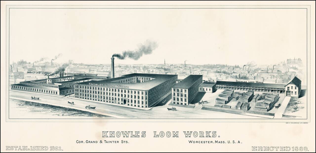
Rare view of the Knowles Loom Works in Worcester, Massachusetts, with the town and rail road line in the background. OCLC locates no other examples of the view.
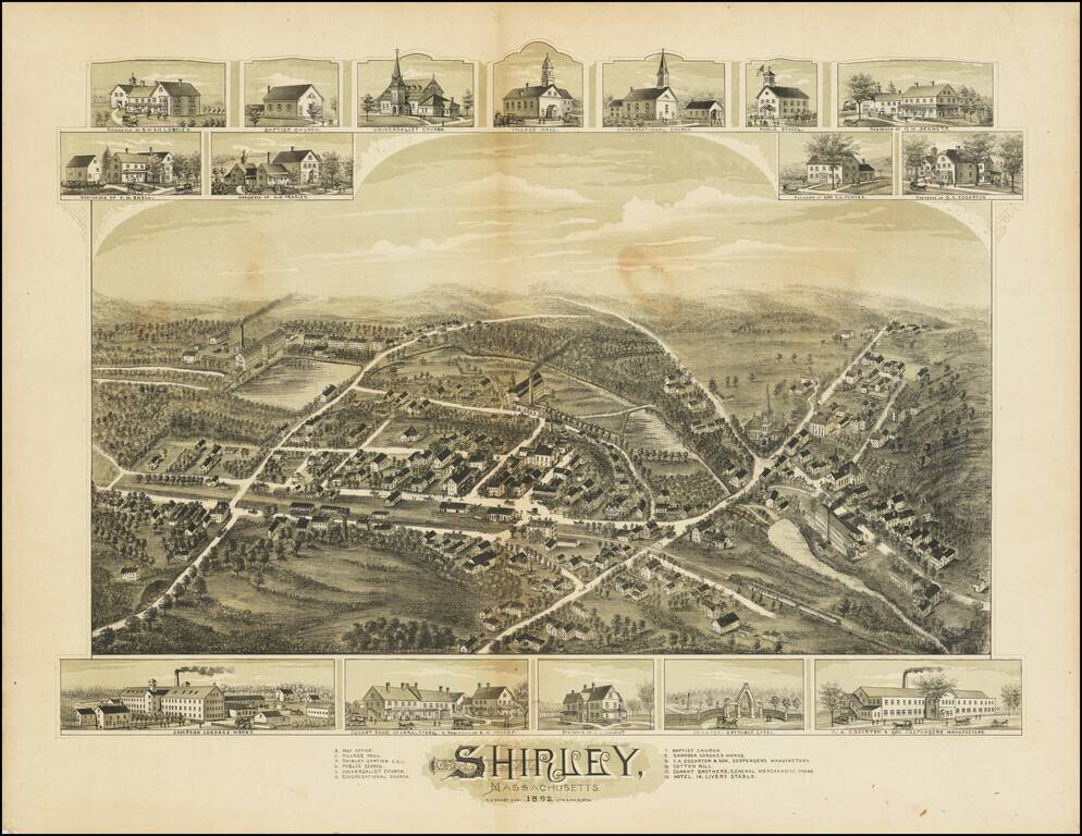
Fine antique birdseye view of Shirley, Massachusetts, published in Boston. Below the view, smaller images of Sampson Cordage Works, Conant Brothers General Store, and C.A. Garton & Son Suspenders Manufactory. At the top are images of churches,...
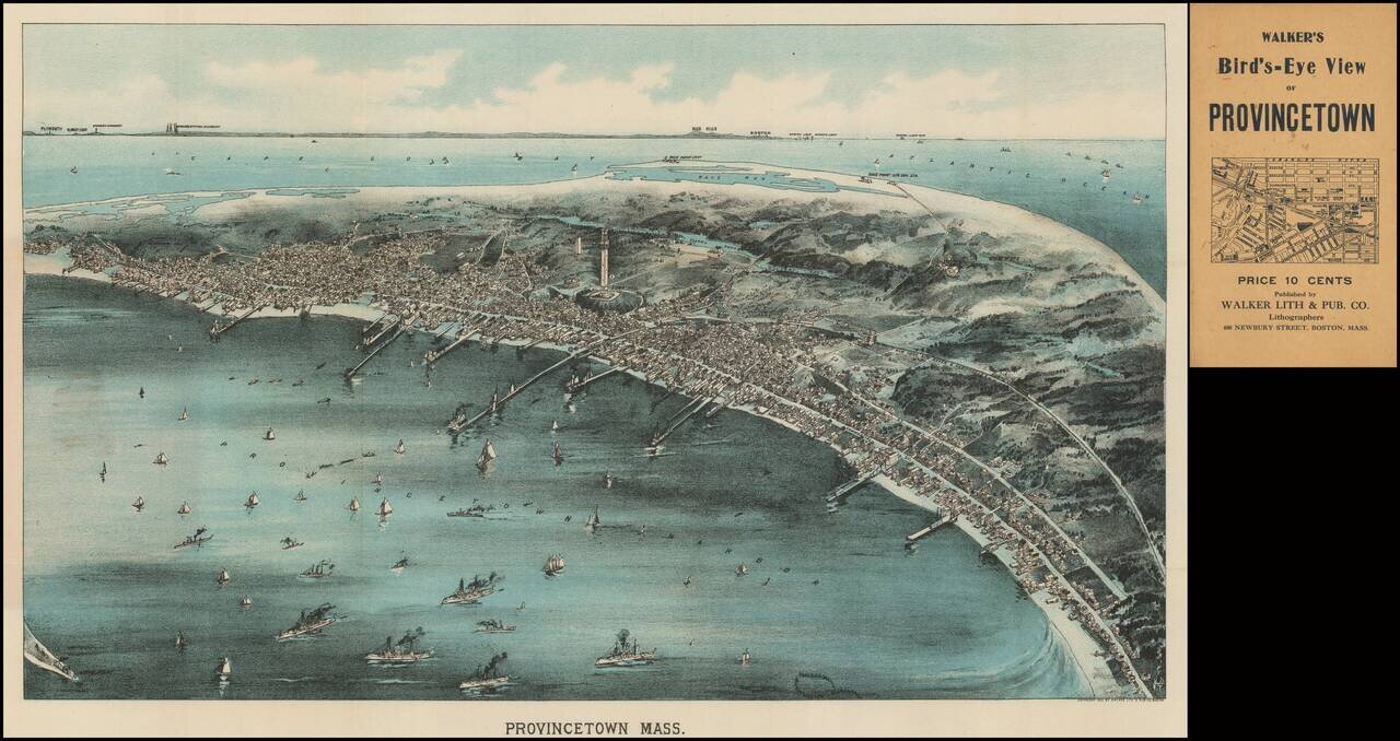
Rare pocket map version of Walker's view of Provincetown, published in Boston in 1910. As noted on the Leventhal Center website: Looking in a northwesterly direction toward Cape Cod Bay and the distant Boston shoreline, this bird's eye view portrays...