
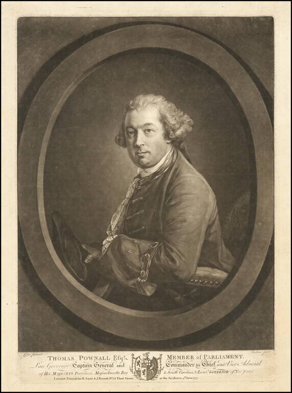
Rare mezzotint portrait of Thomas Pownall, one of the most important figures in the later Colonial history of the British Colonies in North America. Mezzotint portrait engraved by Richard Earlom after a painting by Francis Cotes. Thomas Pownall was...
![[Boston -- 4 Views From The Harbor]](/map/small/65118.jpg)
Sailing Into Boston Harbor During The American Revolution Large aquatint and engraved sheet with four profile views of Boston, which were published by J.F.W. Des Barres, which appeared in his Atlantice Neptune. This sheet of views would have used by...
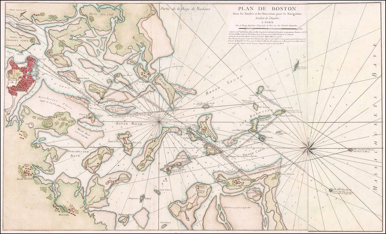
Rare French edition of Sayer & Bennett's rare chart of Boston Harbor revised and issued in Le Rouge's Pilote Americain Septentrionale, which was compiled specifically for use by the French Navy during the American Revolution. A note following the...
![[Boston] Carte Particuliere Du Havre De Boston . . . 1780](/map/small/61227.jpg)
Boston & Environs During The American Revolution Finely hand-colored example of this scarce Revolutionary War era plan of Boston Harbor, issued by the Depot General des Cartes, Plans et Journaux de la Marine, based on Des Barres' chart of Boston...
![[Plymouth Bay, Cape Cod Bay, Duxbury Bay]](/map/small/51249.jpg)
Des Barres Chart of Plymouth Bay, Cape Cod Bay and Duxbury Bay Fine detailed sea chart of the area around Plymouth and Duxbury, Massachusetts, and covering Cape Cod Bay, Duxbury Bay and Plymouth Bay, published in London by Des Barres. The map shows...
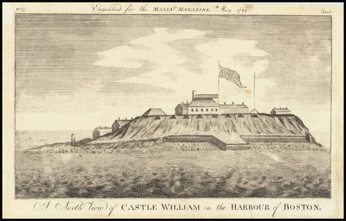
Rare Early American View Early American view of Castle William in Boston Harbor. Castle William's history dates to 1634 when cannons were first deployed to defend Boston Harbor. British officials used the fort as a refuge in the year prior to the...
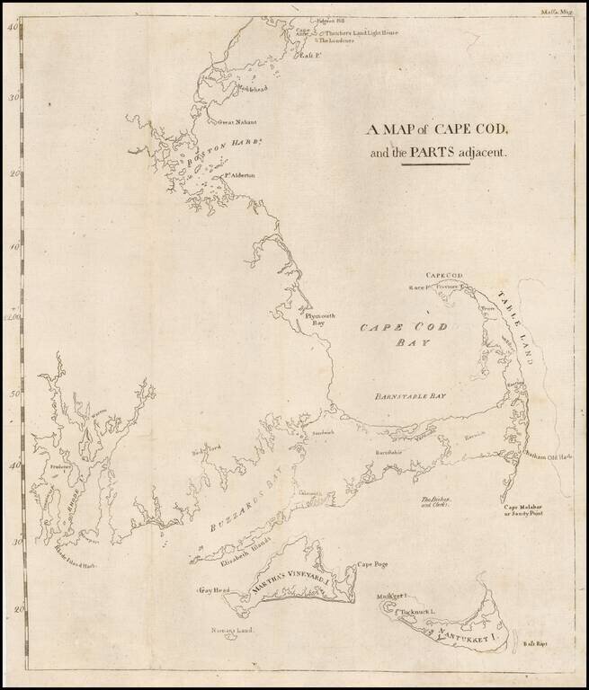
The first map printed in America to focus on the area around Cape Cod and illustrating an early attempt to create a canal from Barnstable Bay to Buzzard Bay. This rare map appeared in the Massachusetts Magazine, published by one of America's most...
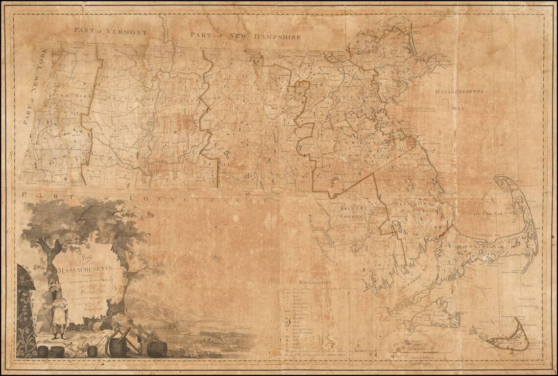
A Massachusetts Landmark Map -- The First Map Official Map of the State of Massachusetts Nice example of the first state of Osgood's Carleton's 1801 map of Massachusetts, the first officially sanctioned and sponsored map of the State. Based largely...
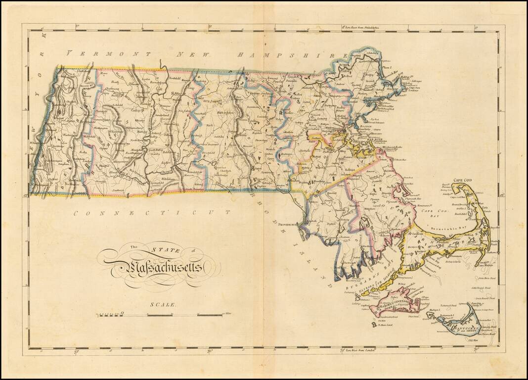
Matthew Carey's double-page engraved map of Massachusetts, from Carey's General Atlas. The map is hand colored by counties and shows towns, rivers, lakes, mountains, roads, islands, bays, shoals, and a host of other details. Carey published the first...
Striking example of Fielding Lucas' fine early map of Massachusetts, perhaps the rarest atlas map of the state from this period. Lucas' maps are printed on a higher quality paper than contemporary maps by Carey & Lea and demonstrate a superior...
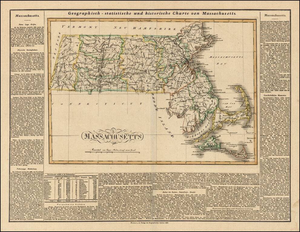
Rare German edition of Carey & Lea's map of Massachusetts. Shows early counties, roads, towns and a host of other details. Carey & Lea published their monumental Geographical, Statistical and Historical Atlas of North America in 1822. The...
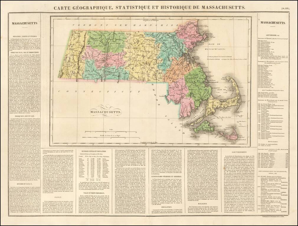
Fine early map of Massachusetts, colored by county and showing the various towns, roads, rivers, bridges, and a host of other details. One of the earliest obtainable maps of Massachusetts printed in Europe. Surrounded by text describing the state,...
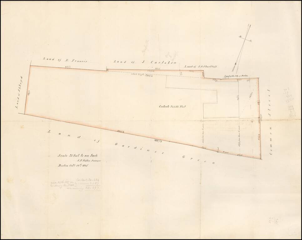
Detailed map of the area west of Common Street, which is now Winthrop Square and the location of the Freedom Trail, Training Field and Soldier's Monument. The lands owned by Gardiner Green are shown. The map is described on the verso as The map was...

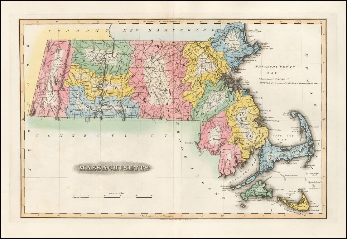
Fine example of Finley's map of Massachusetts. The map is colored by counties and shows towns, roads, rivers, mountains and other geographical features.
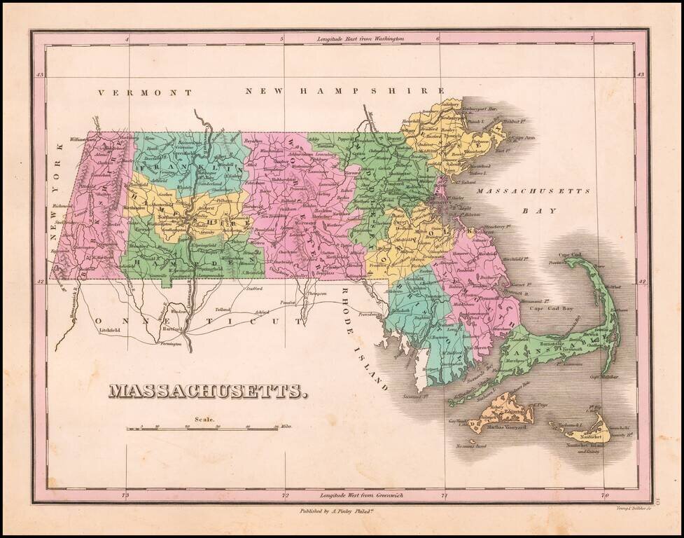
Fine example of Finley's map of Massachusetts. The map is colored by counties and shows towns, roads, rivers, mountains and other geographical features.
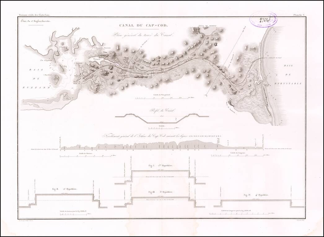
Early Plans for the Cape Cod Canal Detailed map illustrating the course and profiles for the Cape Cod Canal, from Buzzard Bay to Barnstable Bay. The eminent French engineer, Major William Tell Poussin, who worked for some time in the United States,...