
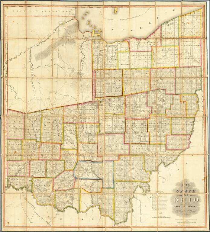
The First Great Map of Ohio Fine example of the Hough & Bourne map of Ohio, published in Chillicothe, Ohio, prepared by John Melish and printed by Benjamin Tanner in Philadelphia in 1815. Hough & Bourne's map of Ohio is the second large...
![[Edwinburgh, Ohio] (Millsboro Township, Richland County)](/map/small/66072.jpg)
An Early Ohio Town Plan Produced For An Early (Failed) Ohio Bank Proprietor Hand drawn town plat and testimonial for the town of Edwinburgh, in Richland County, Ohio, which would later become Millsboro, on the Clear Fork branch of the Mohickan River....
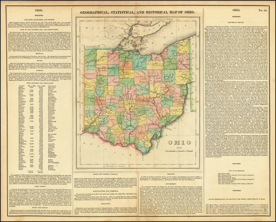
Striking old color example of the first edition of Carey & Lea's map of Ohio. Includes wonderful contemporary details concerning the topography, indigenous lands, rivers, climate, towns, manufacturing, commerce, education, history, population by...
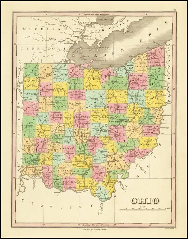
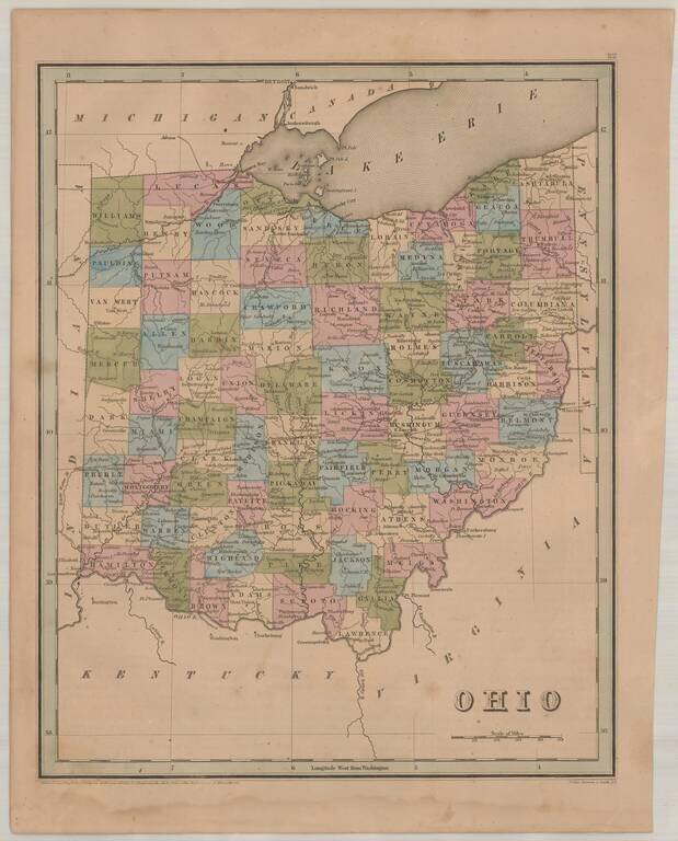
Nice map of Ohio from an early edition of Finley's New General Atlas, colored by counties and showing towns, roads, rivers, mountains and other geographical features. The western portion of the state lacks several counties. One of the best maps of the...
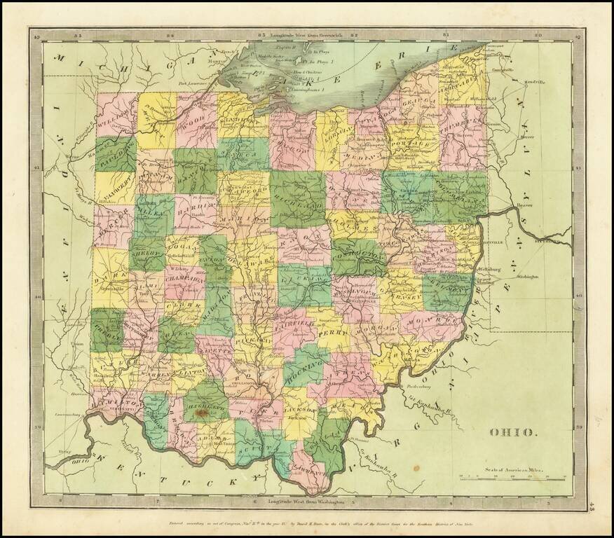
Full color example of the first edition David Burr's map of Ohio, which appeared in his Universal Atlas, first issued in 1836. Burr's Atlas was perhaps the most elegant American commercially published atlas of its time, utilizing wonderful wash colors...
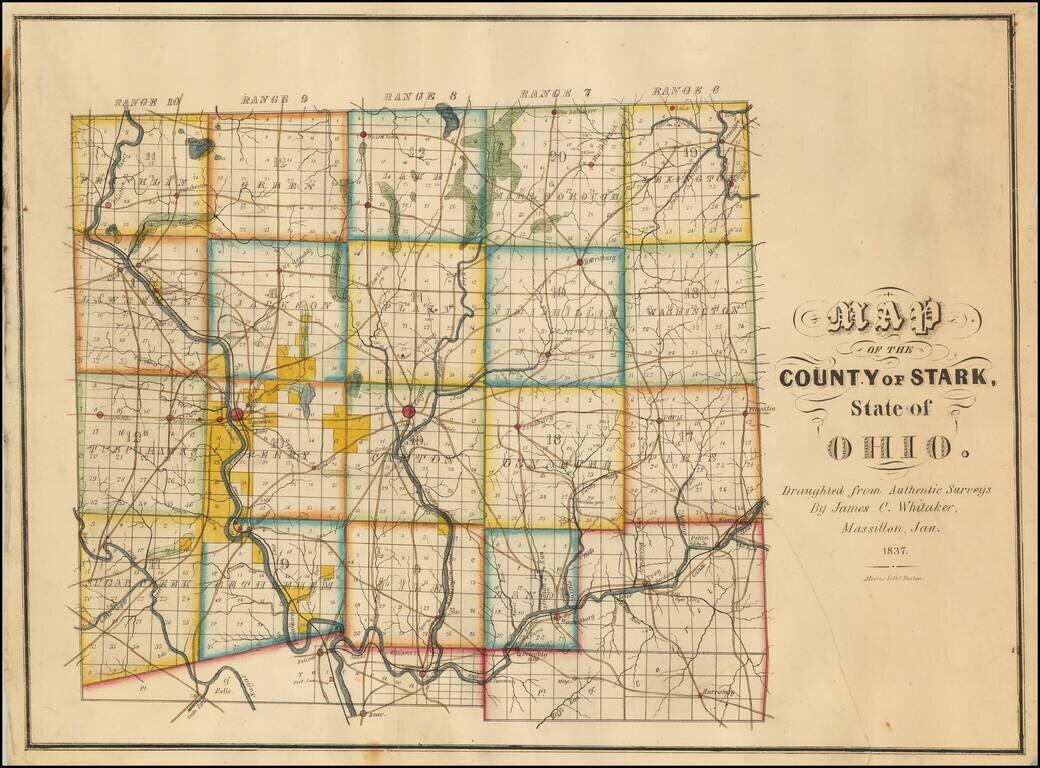
Rare Early Map of Stark County, Ohio -- One of the Earliest Obtainable Ohio County Maps. James C. Whitaker was apparently a local map maker, who was then active in Massillon, Ohio.The following article appeared in the January 25, 1936 edition of the...
Interesting and detailed map of Ohio, from an early edition of Bradford's Atlas. The map is colored by counties and shows towns, rivers, lakes, roads and other important details.
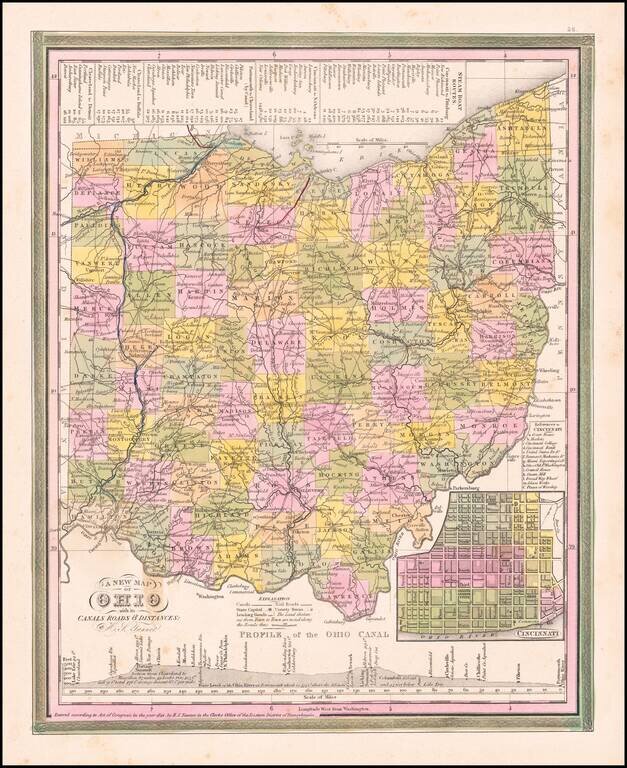
Nice example of Tanner's map of Ohio, hand colored by county, showing roads, canals, towns, steamship routes and other interesting details. An inset shows the city plan for Cincinnati and a profile of the Ohio Canal. One spot in the border at the...
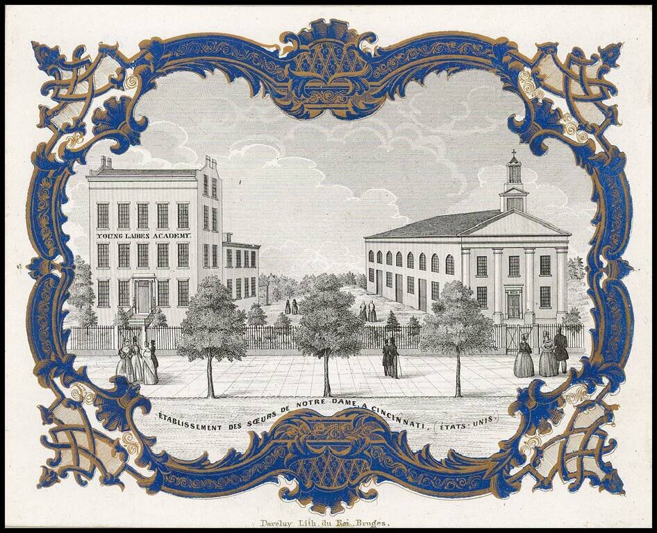
Rare " Porseleinkaart", showing the "Instituut der Soeurs de Notre-Dame te Cincinnati" (Young Ladies Academy of the Sisters of Notre Dame in Cincinnati. Archdiocese of Cincinnati established the Young Ladies Literary Institute and Boarding School in...
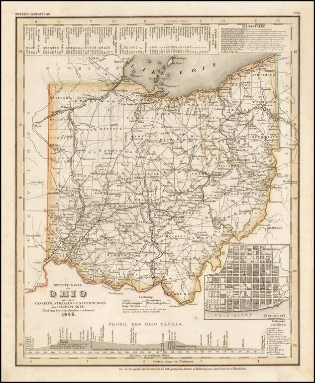
Elegantly engraved and detailed map of Ohio, with an inset map of Cincinnati and profiles of the Ohio Canals, taken based upon Tanner's work in the early 1840s. Shows counties, towns, roads, canals, lakes, etc. While often referred to as the German...
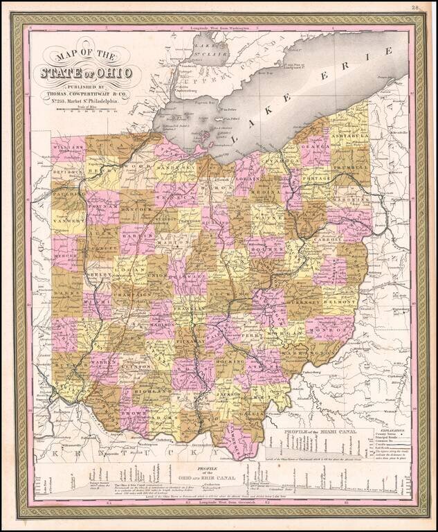
Rare first state of the Thomas Cowperthwait & Co. map of Ohio. Detailed and interesting map, hand colored by county and showing towns, rivers, lakes, railroads, roads, distances, forts, etc. Profile of Miami, Ohio and Erie Canals shown.
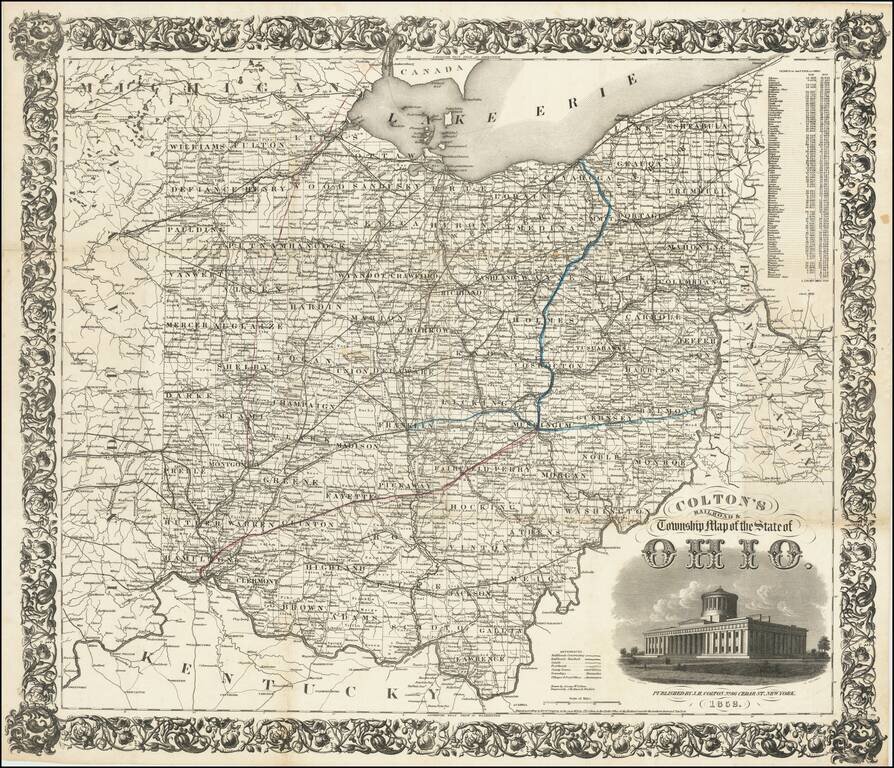
First Edition! Detailed engraved folding map of Ohio, issued by J.H. Colton in 1852. The map shows the "new" Ohio Statehouse building. Ohio had planned to build a new statehouse building for years, but the project took on urgency in 1852 when the old...
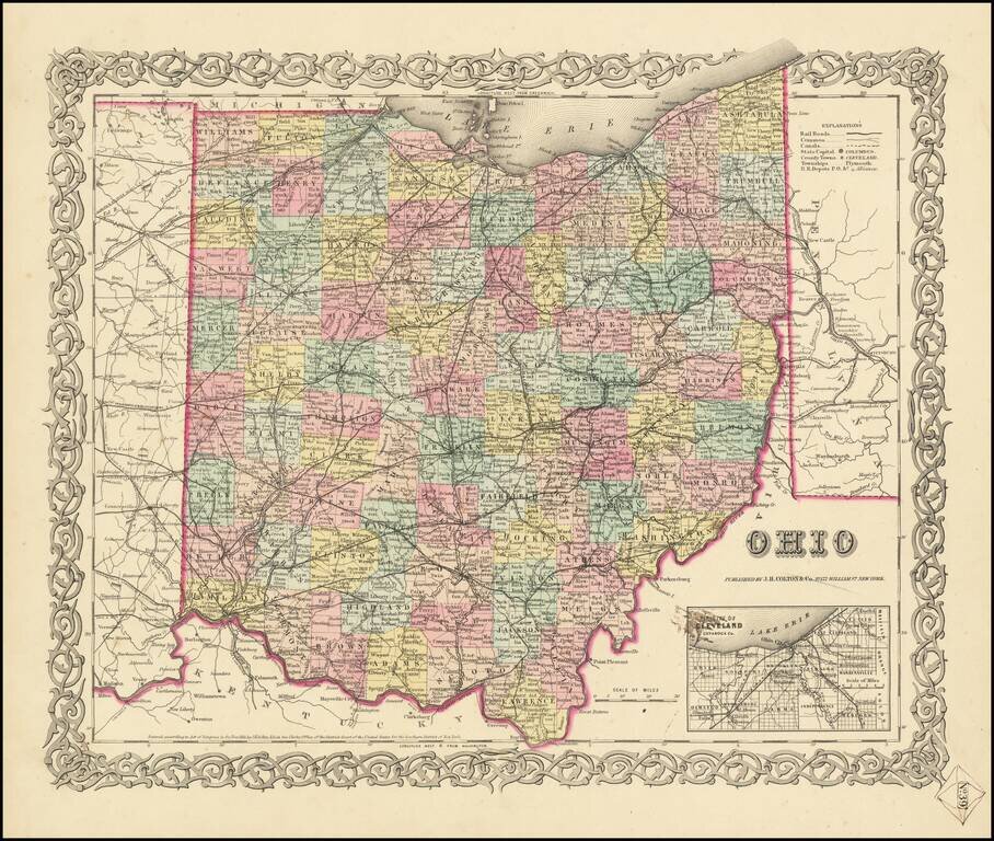
First Edition of JH Colton's Map of Ohio Detailed map of Ohio, published in New York by J.H. Colton. The map is colored by counties, and shows roads, railroads, towns, villages, post offices, canals, rivers, lakes, stations and a host of other...
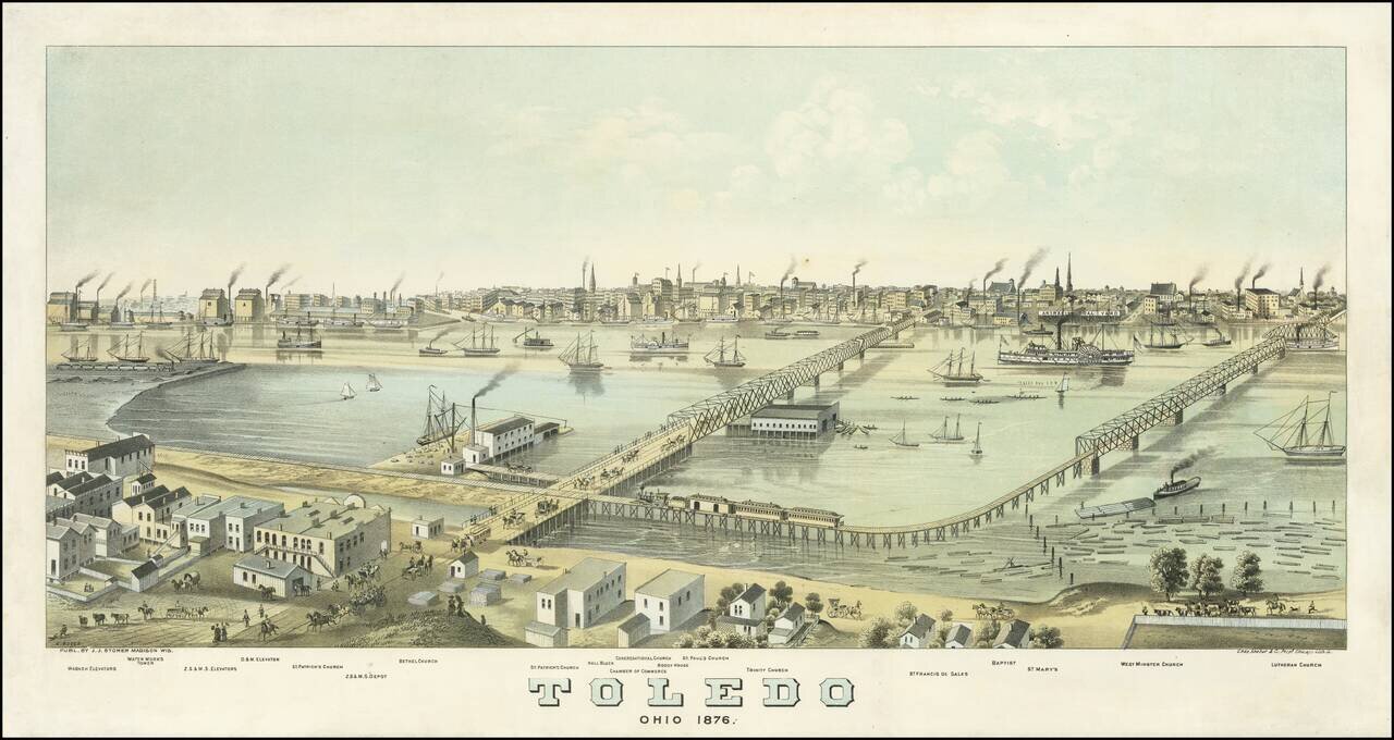
Rare early view of Toledo, Ohio, drawn by Albert Ruger, published by J.J. Stoner of Madison, Wisconsin, and printed in Chicago by Charles Shober & Company. As note on the Library of Congress website: This panoramic map shows Toledo, Ohio, as it...
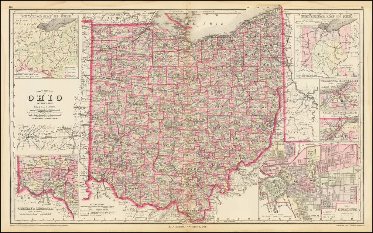
Highly detailed map of Ohio, published by OW Gray. The map is colored by townships and showing towns, roads, railroads, Post Offices, etc. Insets of Cleveland, Toledo, Columbus, Cincinnati and two smaller maps of the state.

Decorative and unusual trading card map from this famous series. Map is surrounded by decorative vignette, showing Wool raising and the Garfield Monument. Includes population statistics.