
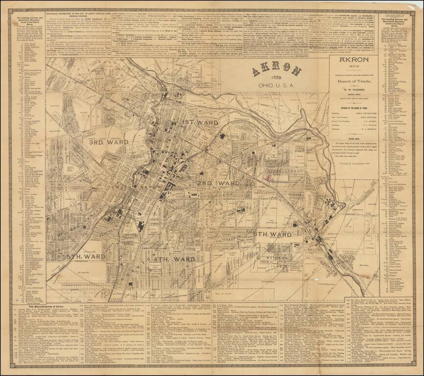
Great early map of Akron, Ohio by W.W. Warner, produced under the auspices of the Akron Board of Trade. The map shows the city divided into wards, with fine plot-level detail throughout the covered area. Some neighborhoods and landowners are named....
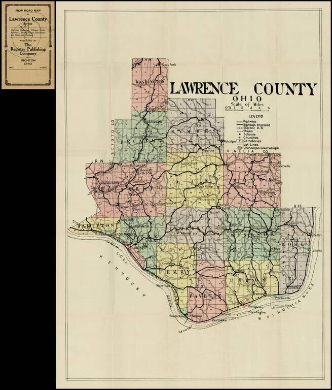
Detailed pocket map of Lawrence Ohio, published by the Register Publishing Company. Shows highways, electric railway lines, steam rail road lines, schools churches, cemetaries, etc.
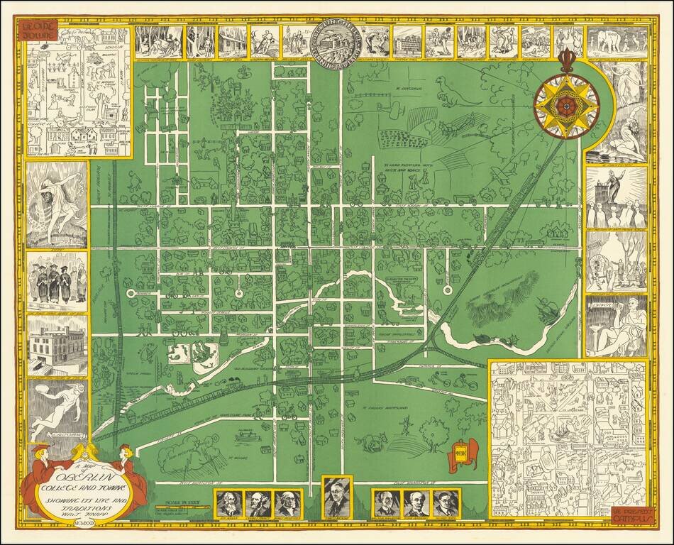
Rare vintage pictorial map of Oberlin College and the town of Oberlin, Ohio. The map was made by Walter Knapp in 1929, during the Golden Age of Pictorial Mapmaking, and it relies on many of the themes embodied in that movement. The map includes...
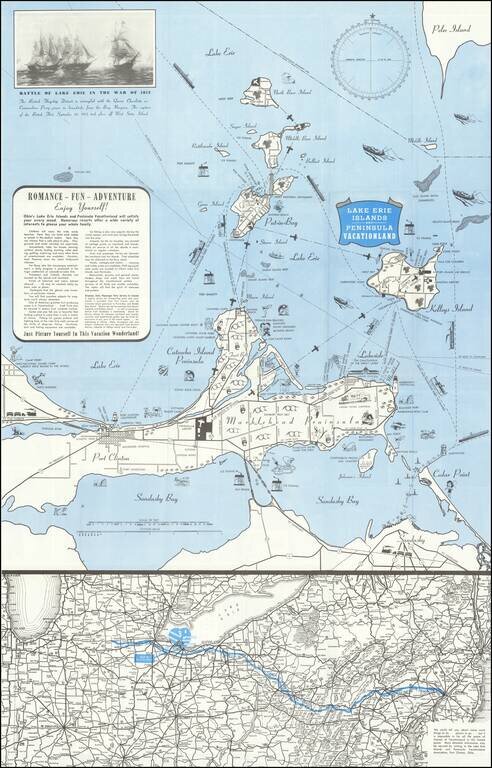
Lively pictorial map of the Lake Erie and Peninsula Vacationland, near Port Clinton Ohio, between Toledo and Cleveland on Lake Erie. The main map focuses on recreational opportunities on Marblehead and Catawba Island Peninsulas, with Port Clinton....
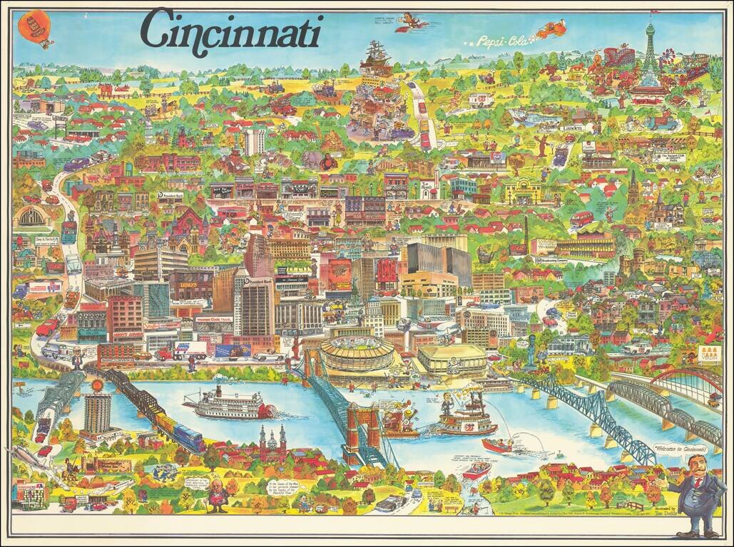
Lively pictorial map of Cincinnati, published by City Design Print and illustrated by Tom Dodds. The map includes advertising for dozens of Cincinnati's local businesses, including a number of local landmarks, providing an entertaining an informative...