
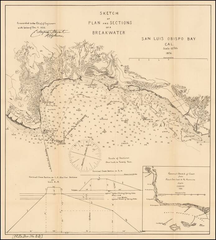
Scarce early map of San Luis Obispo area. Shows topographical contour lines and other details. Includes a model elevation for the breakwater and regional map. One of the earliest obtainable plans of San Luis Obispo.
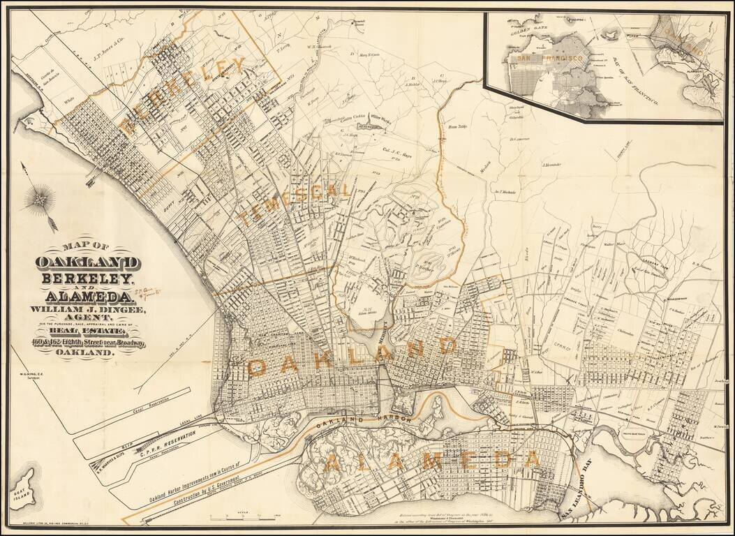
Published Shortly After Incorporation of the Town of Berkeley -- Early Map Promoting William Jackson Dingee Antique map of Oakland, Berkeley and surrounding areas, published in the first year of the real estate career of William Jackson Dingee and...
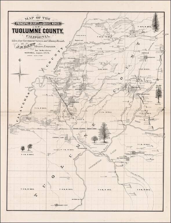
Scarce large format map of Tuolumne County. Includes extensive Mining and Government Survey Information and illustrations of the various types of Oak and Pine trees indigenous to the region. Shows towns, rivers, mining claims and other details. A...
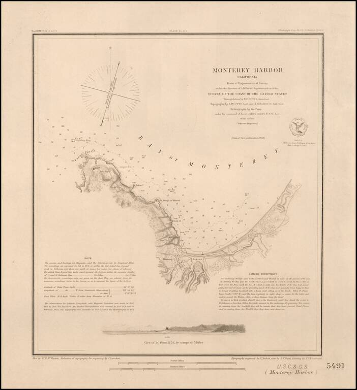
Nice example of this important early survey of Monterey Bay, published by the United States Coast & Geodetic Survey. Incudes a profile view of Pt. Pinos. Shows a Monterey town plan, Point Pinos, Pt. Anlon, Pt Almejor Mussell, the Lagoon, Fort,...
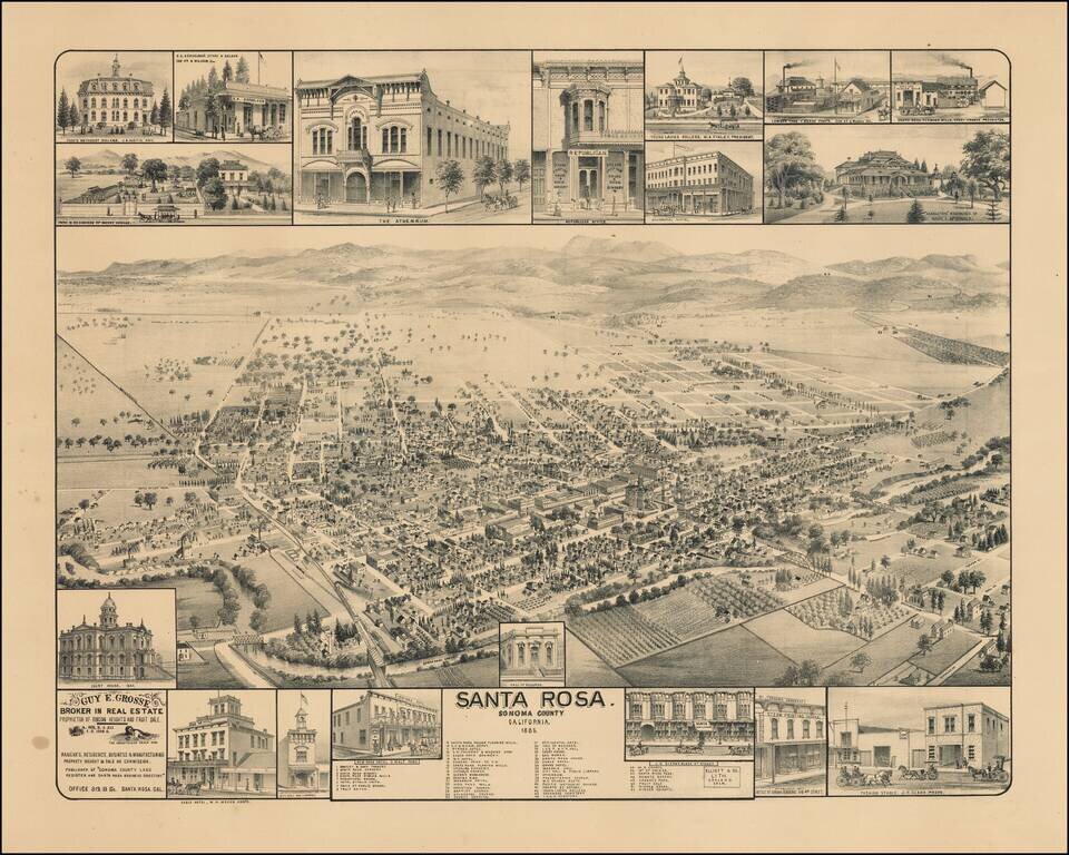
Scarce birdseye view of Santa Rosa, California, published by Elliott & Co. in Oakland, California. Rare bird's-eye view of Santa Rosa, north of San Francisco, produced for Guy E. Grosse, "Broker in Real Estate, Proprietor of Rincon Heights and...
![[San Carlos / Edgewood Park] Map of a Portion of The Brittan Ranch, San Mateo. Surveyed by J.J. Cloud, Co. Surveyor. April 1885](/map/small/66630.jpg)
A Beautiful Tract of Valley Land 3/4 mile from Redwood City at the base of the Coastal Range . . . Fine map of a large portion of San Carlos, California, showing the subdivision of John Wesley Brittan's Ranch in San Mateo County, in 1885. The map...
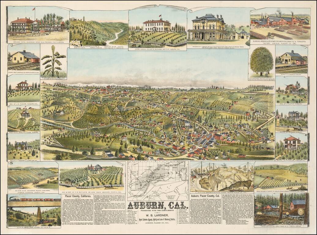
Rare birds-eye view of Auburn, California, including 22 smaller views and a map showing Placer County's Railroad Connections to Sacramento and San Francisco. This fine view illustrates one of the important early California Gold Rush boom towns. The...
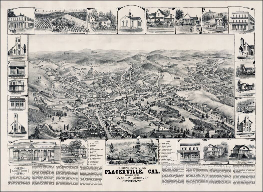
Rare view of Placerville, California, in the heart of California's Gold Country, by W. W. Elliott. Marvelous detailed plan of this important early California mining town sketched by L. Roethe, showing buildings, street names, topographical details,...
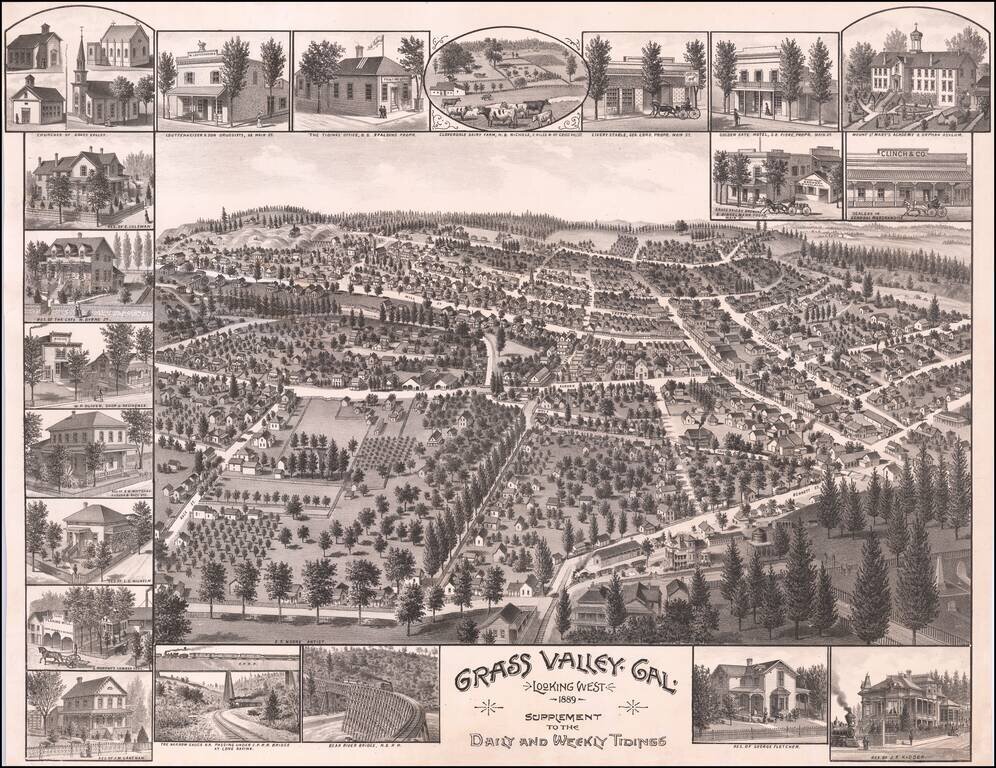
A Rare View of Grass Valley, California Finely executed birds-eye view of Grass Valley, California, created by E.S. Moore and published by Grass Valley's Newspaper, the Grass Valley Daily and Weekly Tidings. The view captures a mature Grass Valley,...
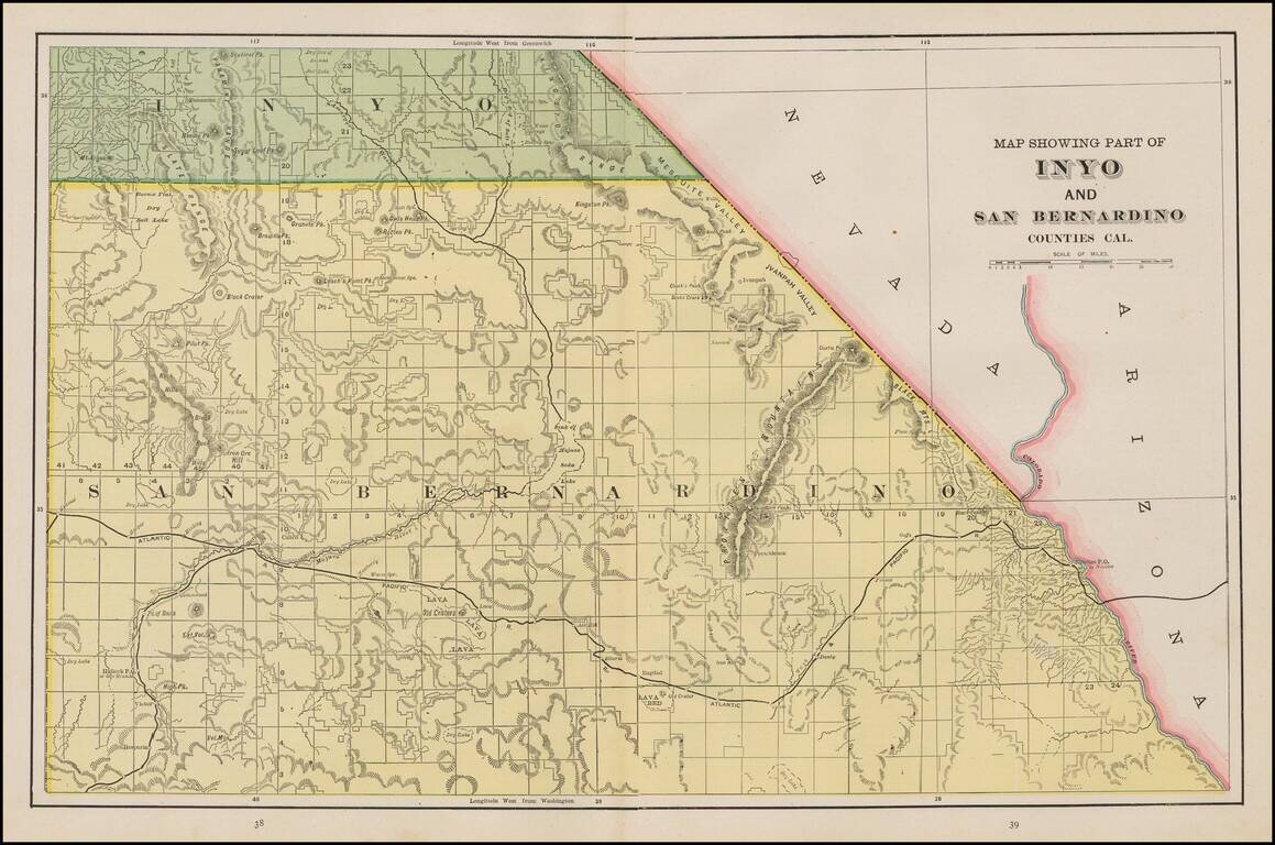
Scarce regional map of San Bernardino County and part of Inyo County. Many small towns, railroads, rivers, mountains, Indian Villages,railway stations, mines, and other details are shown. One of the few detailed separate maps of the region to appear...
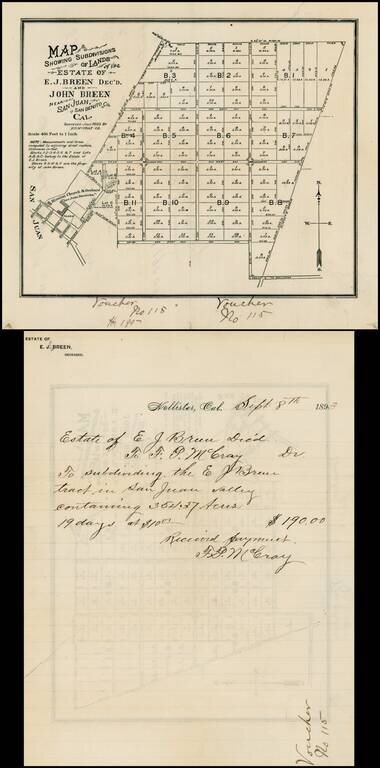
Map of the lands owned by the Breen family in San Juan Valley, San Benito, California. The lands shown were owned by Edward Breen and John Breen, two of the sons of Patrick Breen and Margaret Breen, survivors of the Donner Party. It was Patrick Breen...
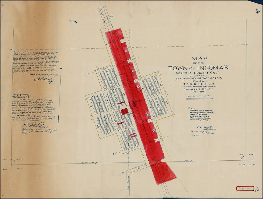
Detailed 1897 survey of Ingomar in Merced, California, by Lott D. Norton, one of the primary surveyors for the Pacific Improvement Company. Highly detailed map of this small railroad town in Merced County, showing the town plan, subdivisions, public...
Rare separately published map of Pasadena, printed by Kitts & Jeffries in Los Angeles. The map is centered on the Santa Fe Train Depot, with the Green Hotel and Carleton Hotel across the street. The Fire Deparatment, Los Angeles T. Depot and...
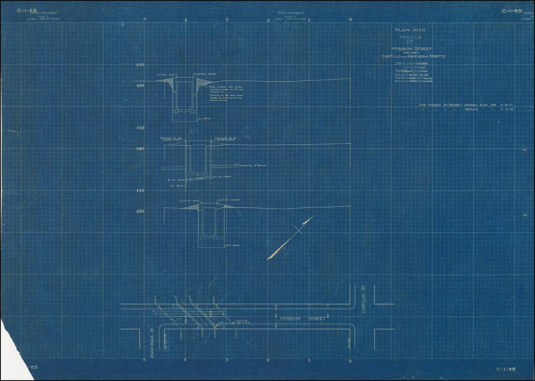
Ephemeral blueprint plan of engineering work on Mission Street in Santa Barbara, California. The map bears the facsimile signature of A.B. Cook, City Engineer for Santa Barbara.
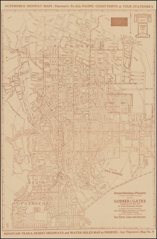
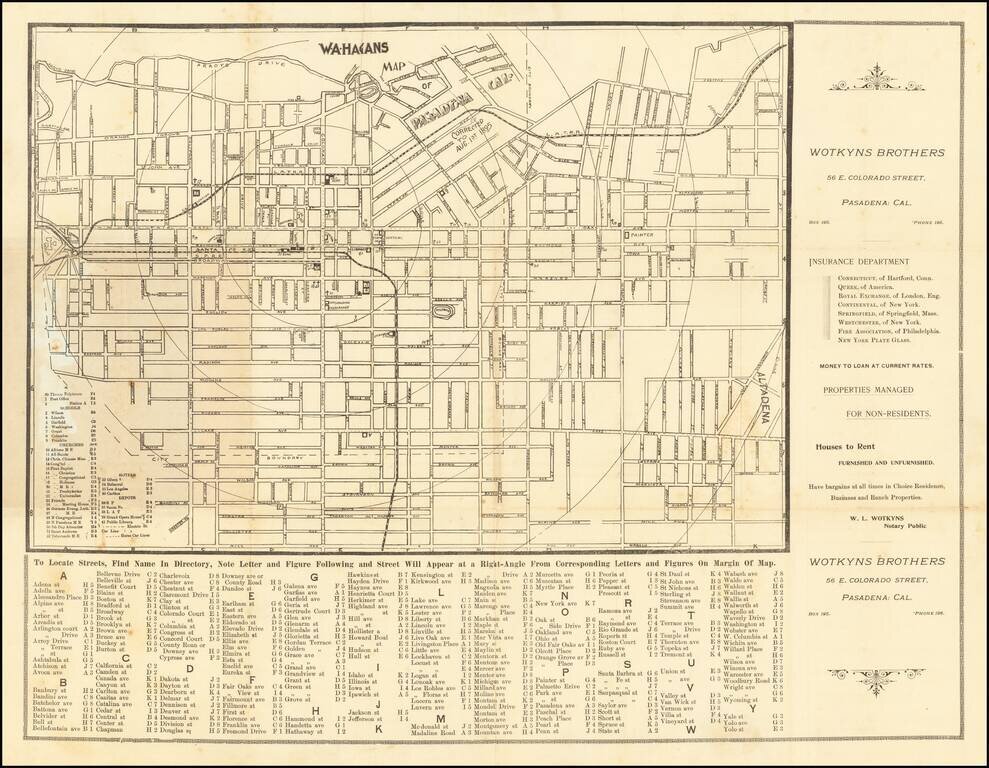
Scarce separately issued map of Pasadena, South Pasadena, Altadena and San Marino, published by Los Angeles map published Albert G. Thurston. The present example includes advertising from Godber & Gates, offering "A Complete List of All of...
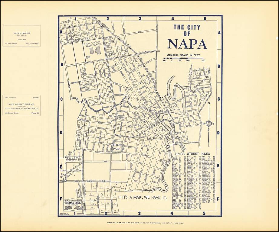
Early map of Napa, with a map of Vallejo on the verso. Nice plan of the area, including streets, major buildings, railroad lines, etc.