
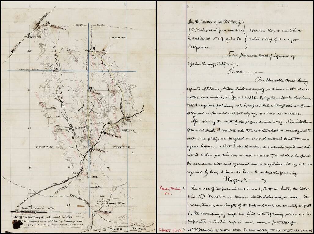
Interesting manuscript map of a part of Yuba County, Northeast of Yuba City and Northwest of Grass Valley, extending from the Yuba River in the south, beyond Sicard Flat and extending north toward Oroville along the Smith Valley. The map and...
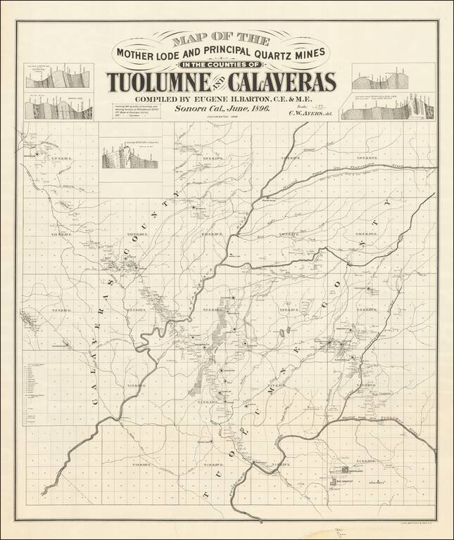
Mother Lode in Calaveras and Tuolumne Counties An interesting and little known map, centered on the Stanislaus River in Gold Country. The map is quite exceptional, "covering 860 square miles of territory and showing location of 500 different mines....
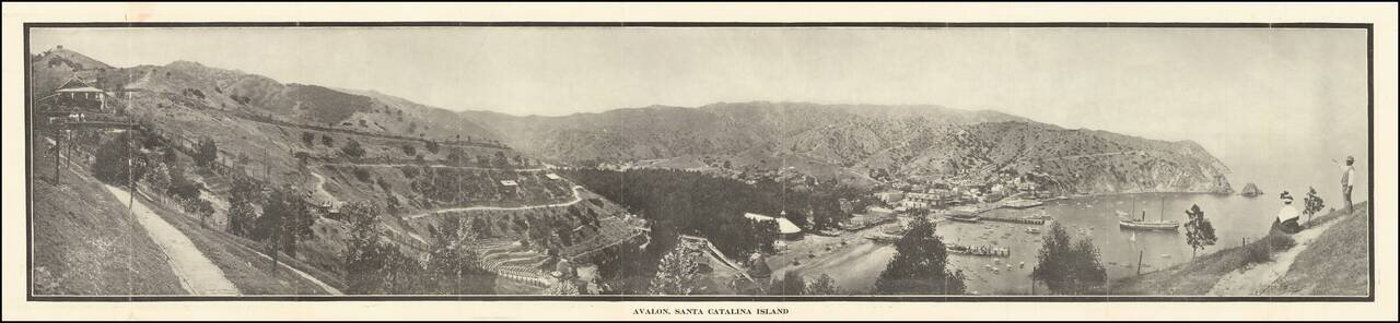
Scarce early Catalina Island promotional brochure, issued by the Wilmington Transportation Co. The brochure opens to reveal a panoramic view of Avalon, Santa Catalina Island, served by Steamers of Wilmington Transportation Line, Banning Line, the...
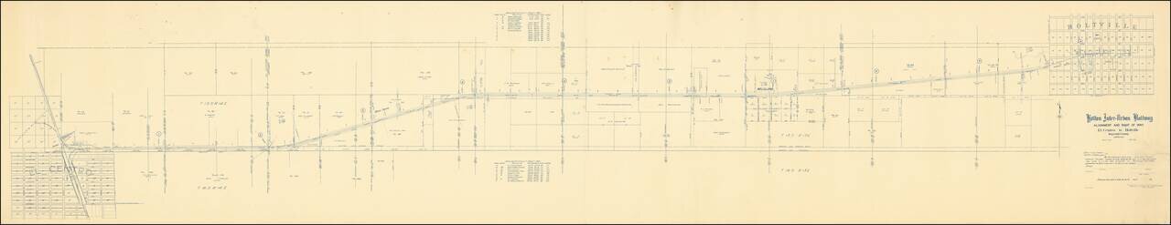
The Holton Inter-Urban Railway Company was incorporated W. F. Holt in December, 1903. The line connects El Centro with Holtville (a distance of about eleven miles) using standard gauge construction. The company carried both freight and passenger...
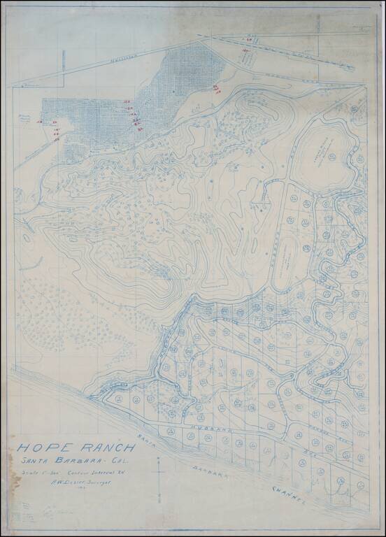
The Original Dozier Plan for Development of Hope Ranch Fine blue line contour map of Hope Ranch, executed by A.W. Dozier. This is the survey of Hope Ranch which would ultimately form the basis for its development by Harold Chase in 1923, illustrating...
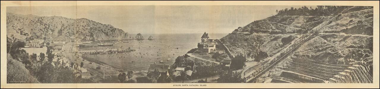
Scarce early Catalina Island promotional brochure, issued by the Wilmington Transportation Co. The brochure opens to reveal a panoramic view of Avalon, Santa Catalina Island, served by Steamers of Wilmington Transportation Line, Banning Line, the...
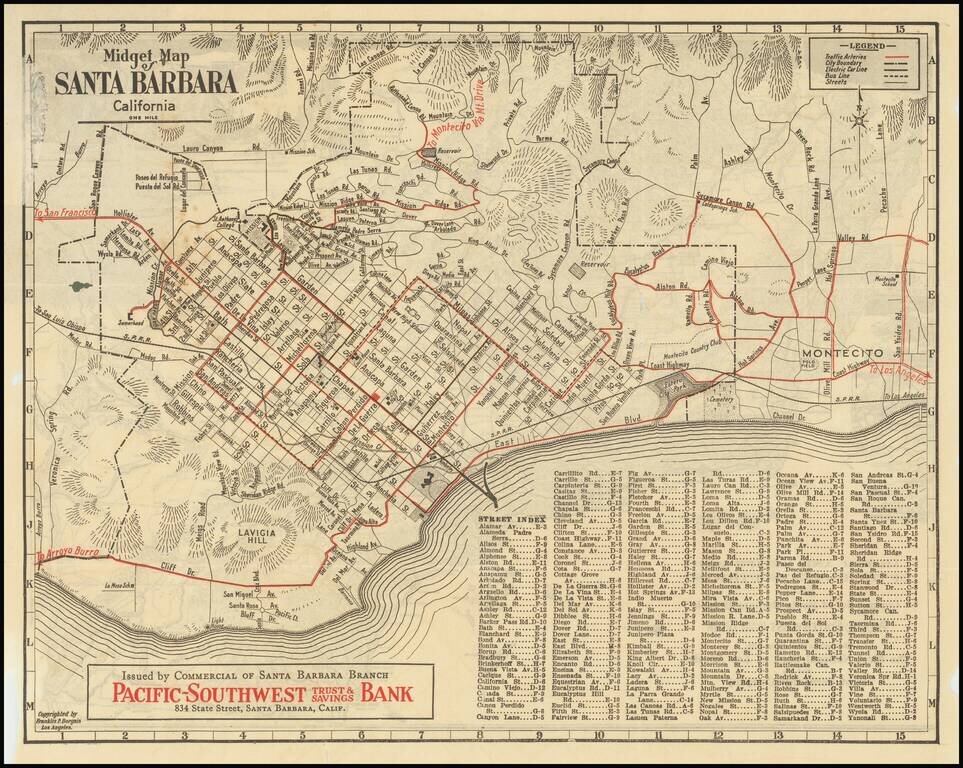
Rare early "midget" series map of Santa Barbara, published as a promotional map for Pacific-Southwest Trust & Savings Bank. Includes a birdseye view style "Motor and Relief Map" of Southern and Central California (extending to San Francisco) on...
![[Los Angeles & Orange Counties] Status of Lands Survey Conducted During 1926 Central Portion of Coastal Plain . . .](/map/small/66323.jpg)
Detailed Irrigation map of a portion of the Los Angeles Basin, published by the California Department of Public Works, Division of Water Rights. A color key identifies: Irrigated areas (green) Unirrigated areas (yellow) Subdivided (urban) areas...
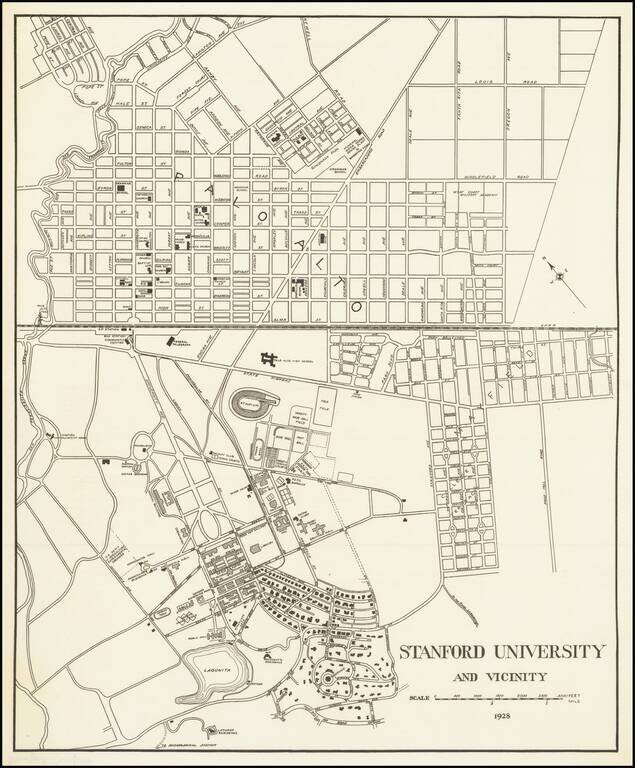
Detailed map of the Stanford University Campus, as it appeared in 1928. The map was likely created for a guide book, although we do not know the source. The map shows a portion of campus in academic use and street map of Palo Alto. The map is very...
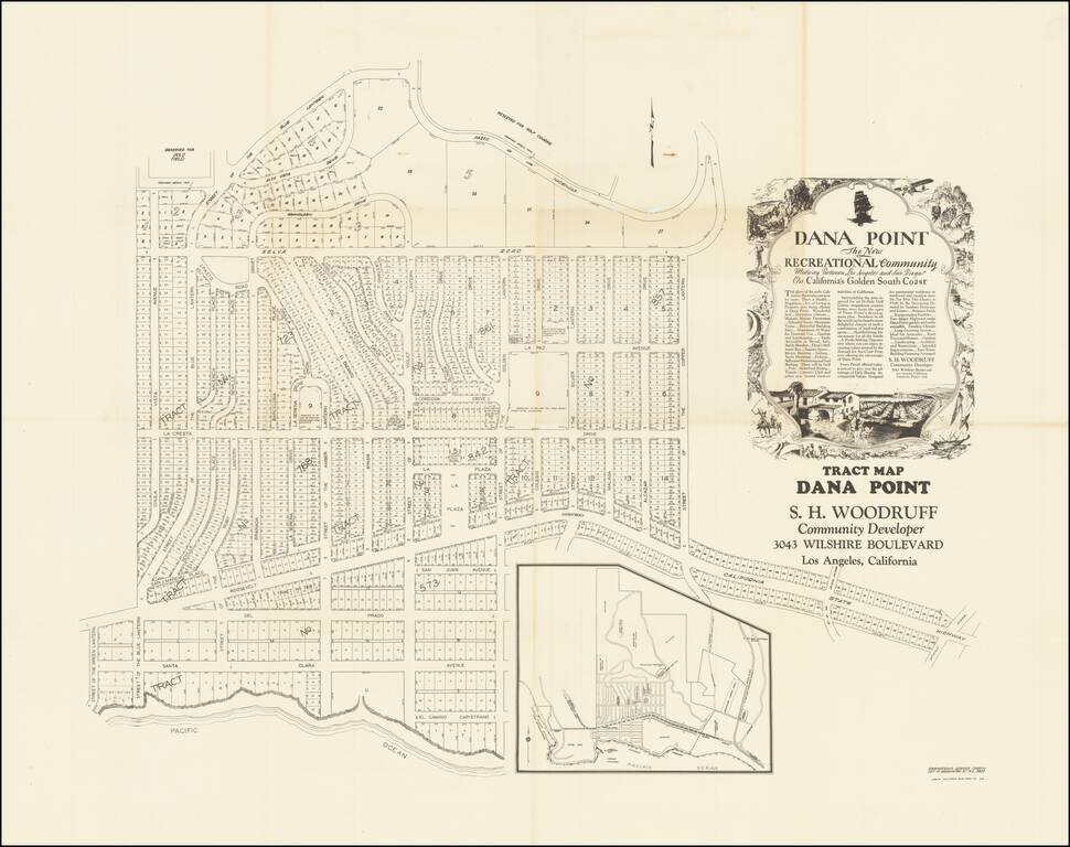
Remarkable oversized tract map of Dana Point, almost certainly the earliest large format subdivision map of Dana Point. The present map, which locates a number of ambitious future improvements, including a country club, polo field, hotel site,...
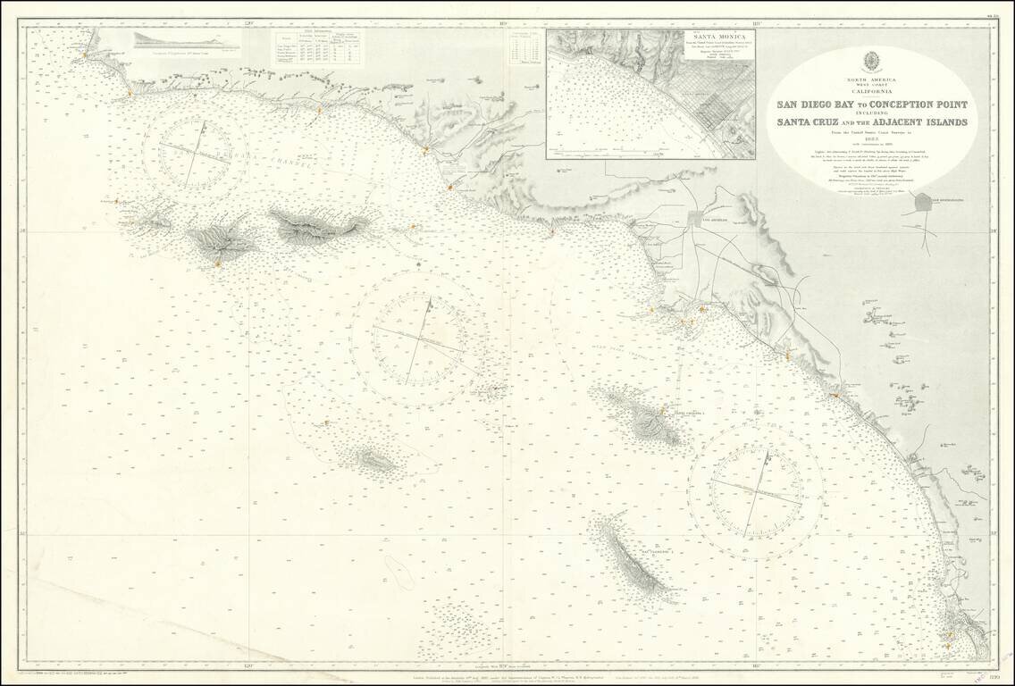
Fine large British sea chart of the Southern California Coastline, published in 1928, with small corrections to 1957. The chart extends from San Diego to Point Conception and Arguello Point, centered on Santa Monica and the LA Basin. Offshore islands...
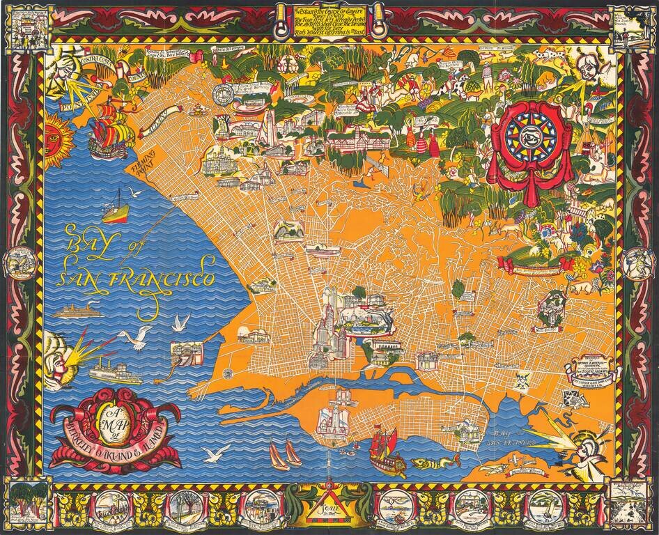
A Monumental Pictorial Map of Berkeley & The East Bay, With Original Decorative Folder Fabulous Art Deco style map by Michael Baltekal Goodman, notable for its brilliant color and striking design. The minimalist design of the street layout at...
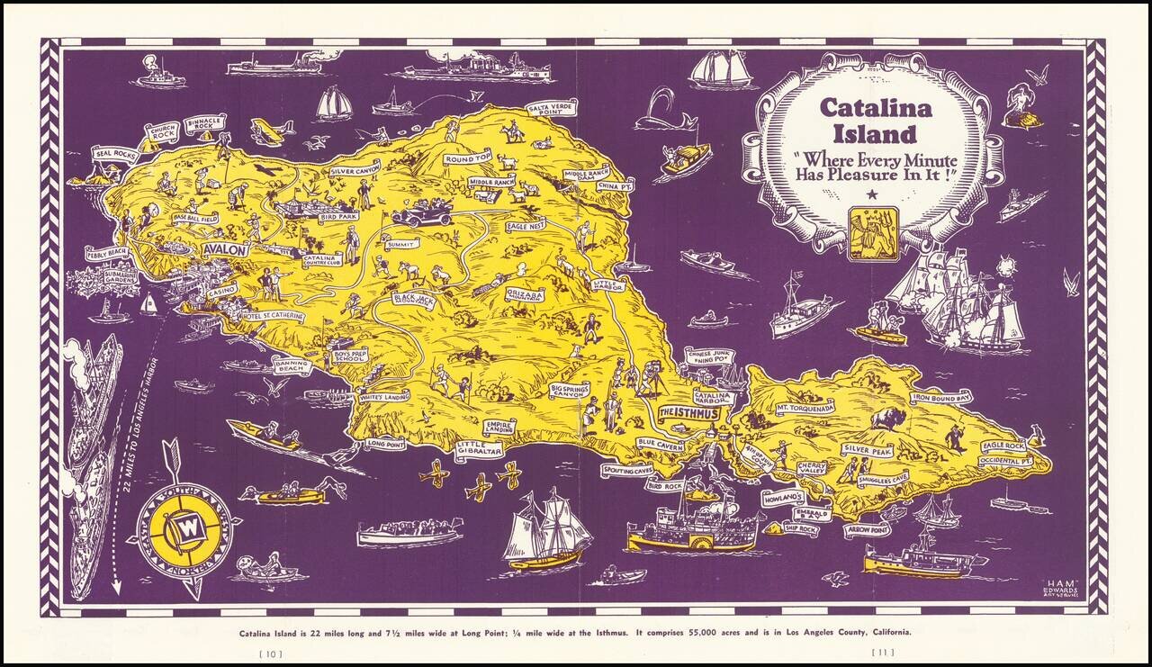
Decorative map of Catalina Island, appearing at the centerpiece of this interesting tourist brochure. The map is scarce. This is the first example we have offered for sale.
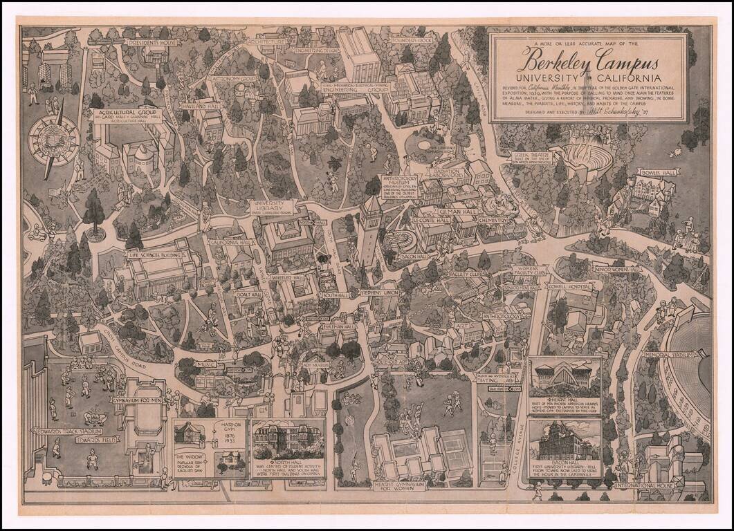
Showing The Berkeley Radiation Laboratory in 1939 Rare pictorial map of the Berkeley campus, by Artist Milt Schenkovsky (UC Berkeley class of 1937). The map provides a detailed treatment of Berkeley and the University of California Campus in the...

An attractive tourist map of Sacramento produced for the city's 1939 centennial. The recto is centered on a map of Sacramento itself and the immediate vicinity, while the verso shows a map of the greater "Golden Empire" area from Mt. Shasta to Tuolumne...
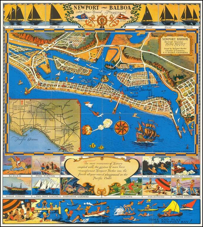
An early pictorial map of Newport Beach. Decorative promotional map of Newport Harbor and Newport Beach, California, issued by the Newport Harbor Chamber of Commerce. Includes a number of lively vignettes.