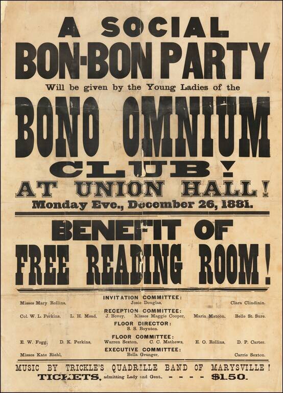
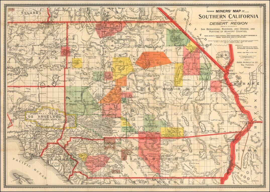
logo

1915. Plan and Profile of Mission Street between Castillo and Rancheria Streets City of Santa Barbara...

  • Plan and Profile of Mission Street between Castillo and Rancheria Streets City of Santa Barbara...

Plan and Profile of Mission Street between Castillo and Rancheria Streets City of Santa Barbara... information:

Year of creation: 
Resolution size (pixels): 
 3251x2318 px
Disk Size: 
 1.66904MiB
Number of pages: 
 1
Place: 
 Santa Barbara, California
Author: 

Print information. Print size (Width x height in inches):
Printing at 72 dpi 
  45.15 х 32.19
Printing at 150 dpi 
 21.67 х 15.45
Printing at 300 dpi 
 10.84 х 7.73

An example of detailing the file of this map of in a printable high-resolution:

Click to open in high resolution (open in new tab).
Attention! this is just the central piece (central area 960x960 px) of the map file!
This is an example, so that you can see and study the level of detail of a given map. The entire Map will be fully available after payment!

Plan and Profile of Mission Street between Castillo and Rancheria Streets City of Santa Barbara...

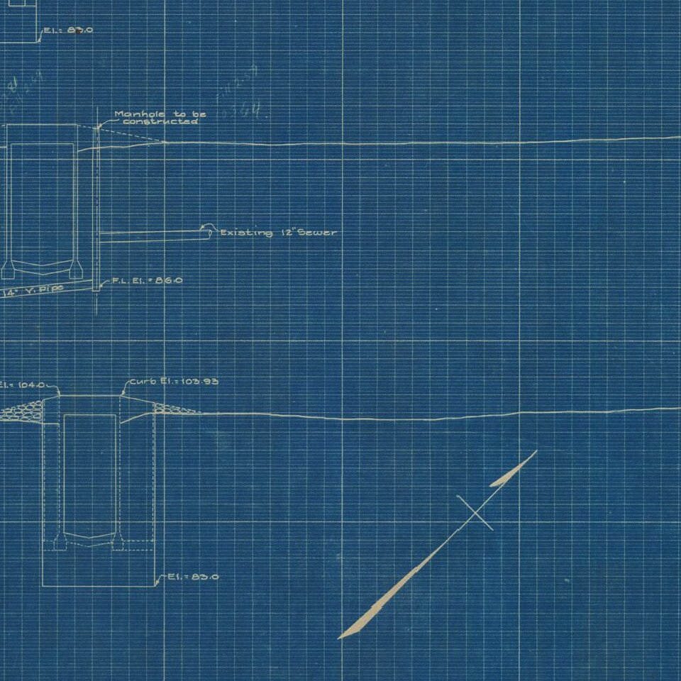
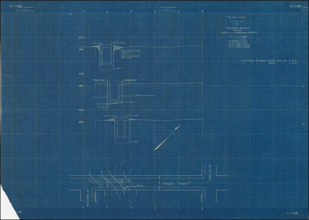
Ephemeral blueprint plan of engineering work on Mission Street in Santa Barbara, California.

The map bears the facsimile signature of A.B. Cook, City Engineer for Santa Barbara.


Special conditions for students!

If you are a student, write to us in telegram: @antiquemaps and indicate what material you need and for what work you need a map in high detail. We are ready to provide material on special terms. For students only!

Item information:

Year of creation:
Size:
3251x2318 px
Disk:
1.66904MiB
Number of pages:
1
Place:
Santa Barbara, California
Author:
A.B. Cook.
$14.99

Related item