
![[Imperial & Coachella Valley Advertising Map -- Valerie Jean Date Shop]](/map/small/69651.jpg)
Interesting advertising map, promoting Valerie Jean's Date Shop, the first retail establishment to sell dates produced in the Coachella Valley, beginning in about 1935. The map is also of note for its location of Hilton's Art Studio, the workshop of...
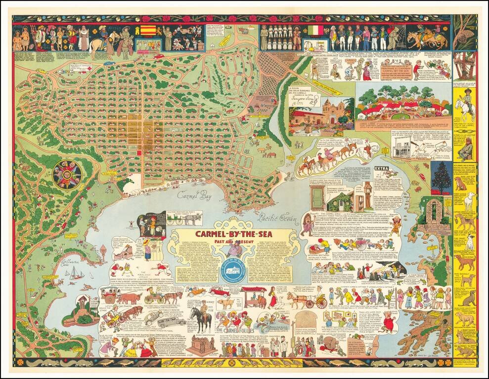
Fine example of Jo Mora's marvelous map of Carmel and the location of Mora's art studio. The map includes a detailed and whimsical look at the area around Carmel, with marvelous vignettes of the major landmarks, past and present, a town plan and a...
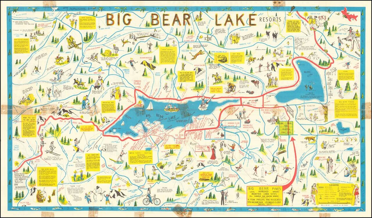
Rare Big Bear Lake Pictorial map, published by the Recreational Publishing Company. The main map shows the area around Big Bear Lake, with emphasis on recreational activities, both winter and summer, including Moonridge Ski Run Snow Valley...
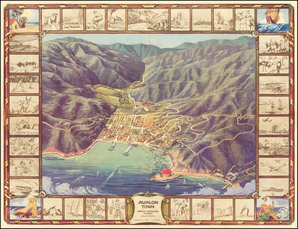
Pictorial Map of Avalon, During the Catalina Golden Age Decorative birdseye view of the town of Avalon on Santa Catalina Island, off the coast of Southern California. Includes a striking birdseye view of the town, Casino, harbor and vicinity, showing...
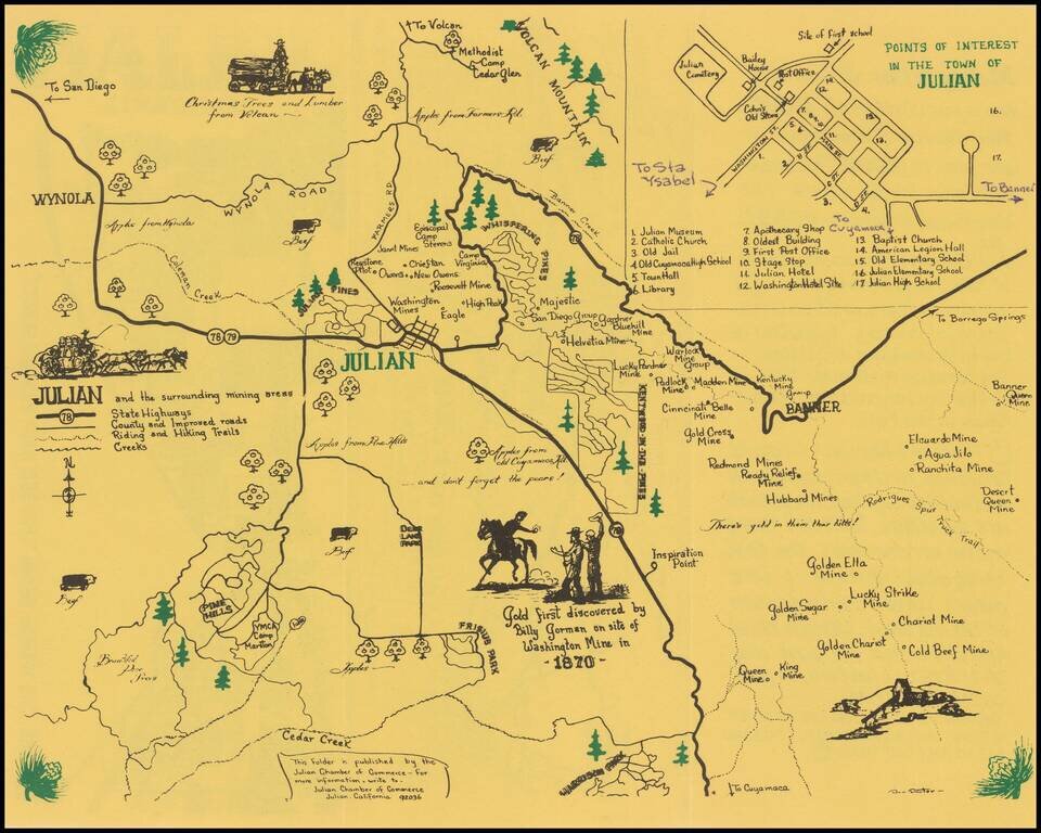
Julian -- Where Winds From The Sea and Desert Meet Rare pictorial map and promotional brochure for Julian, in San Diego County, published by the Julian Chamber of Commerce. The primary map shows the areas around Julian, stretching from Wynola and...
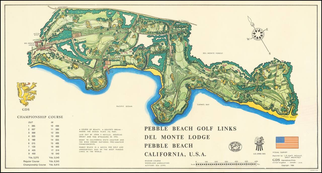
Decorative map of the Pebble Beach Golf Links, first published in 1968. Pebble Beach is the oldest continuously operating golf course west of the Mississippi River.
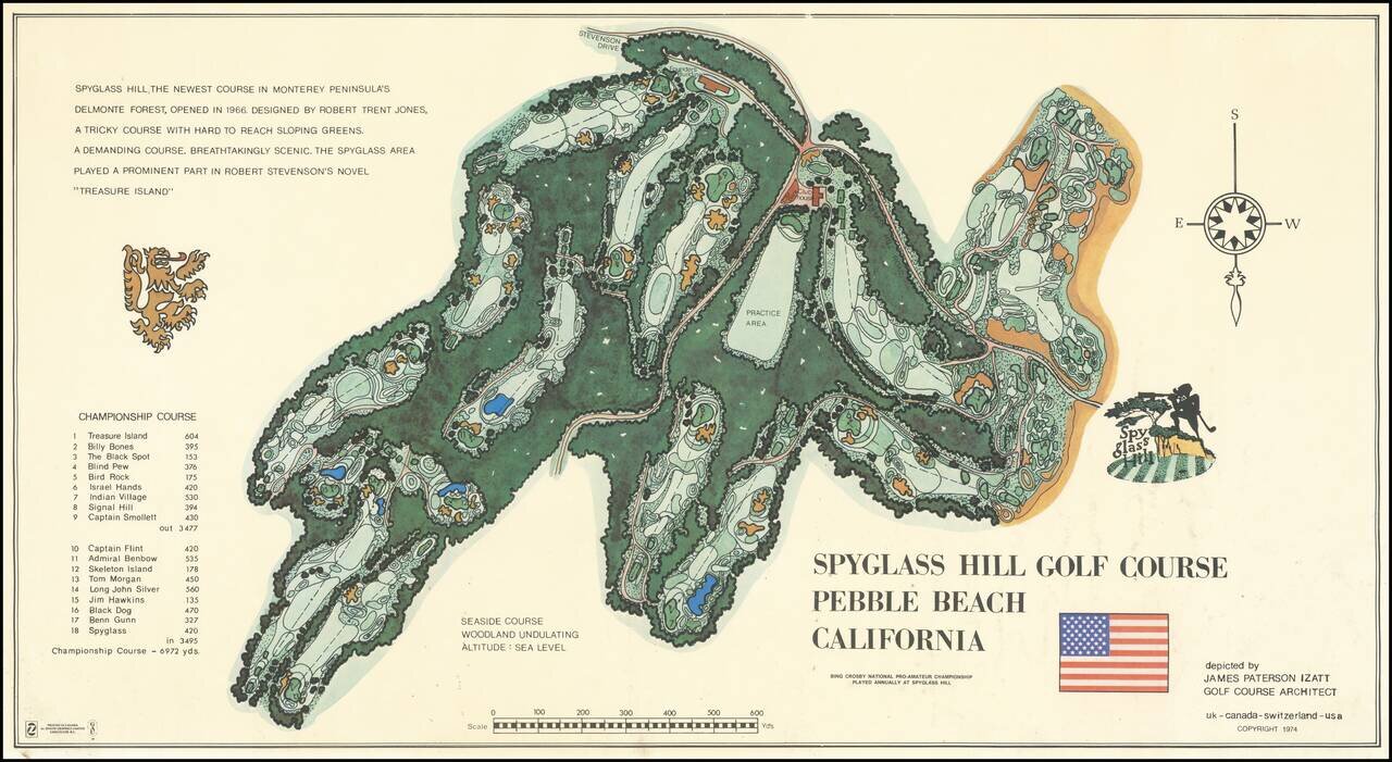
Decorative map of the Spyglass Hill Golf Course, published in 1974. Spyglass Hill was designed by Robert Trent Jones Sr., and opened 54 years ago on March 11, 1966, after six years of planning, design, and construction. The course has been in the...
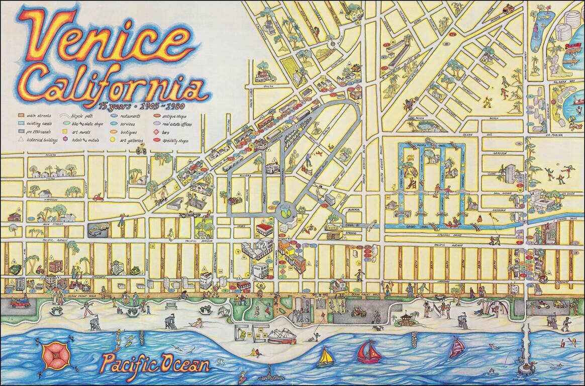
Whimsical Pictorial Map of Venice Beach, California, published as a local tourism promotional item. The artwork is by C. June Barton and R. Freenway Frager and includes an extensive guide on the verso, including lists of "Historic buildings," "Art...
![[Rare Variant] Disneyland 40 Years of Adventure](/map/small/65639.jpg)
The Rare First State of the 1995 Map Finely illustrated map of the Magic Kingdom, celebrating its 40th anniversary. This is one of two nearly identical maps from 1995. The difference between the two maps relate to various errors, which were...
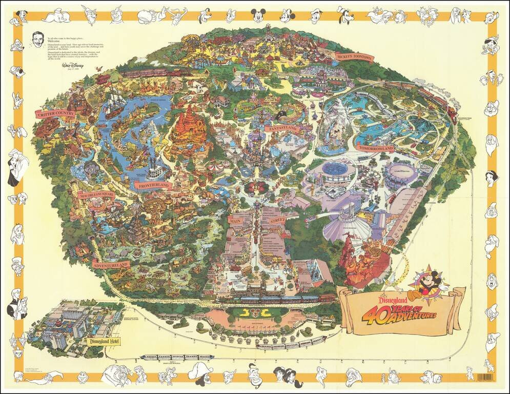
Second State of the 1995 Map Finely illustrated map of the Magic Kingdom, celebrating its 40th anniversary. This is one of two nearly identical maps from 1995. The difference between the two maps relate to various errors, which were discovered after...
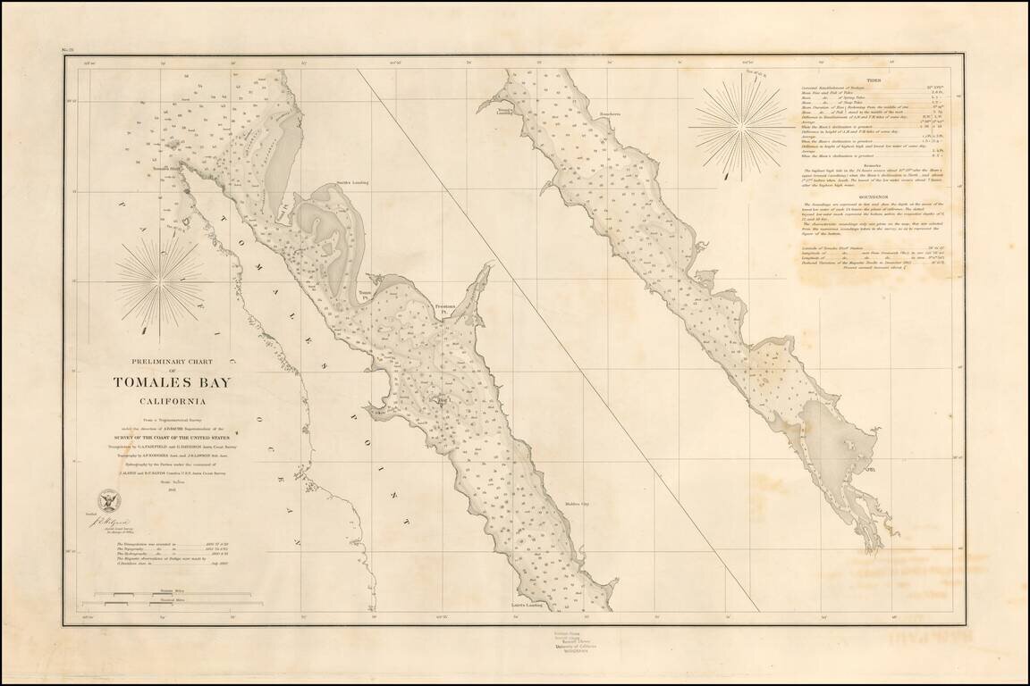
Rare separately pubilshed thick paper example of George Davidson's copy of the US Coast Survey Chart of Tomales Bay, first published in 1861. Tomales Bay's history is quite interesting, having been discovered by the English in the 16th Century,...
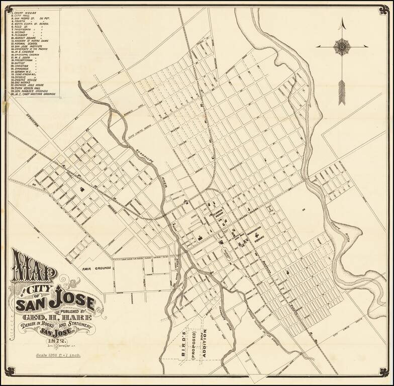
One of the Earliest Printed Maps (and Guides) for San Jose Fine early map of San Jose, lithographed in San Francisco by Britton & Rey in 1872. The map provides a fine early look at San Jose, including street names, early buildings, railroad...
![[Untitled Map of Pittburg, California & Vicinity] Pittsburg Chamber of Commerce Trade Card](/map/small/19402.jpg)
An interesting trade card map, with promotional info for the Pittsburg Chamber of Commerce on the verso. See verso here: /gallery/enlarge/19402a
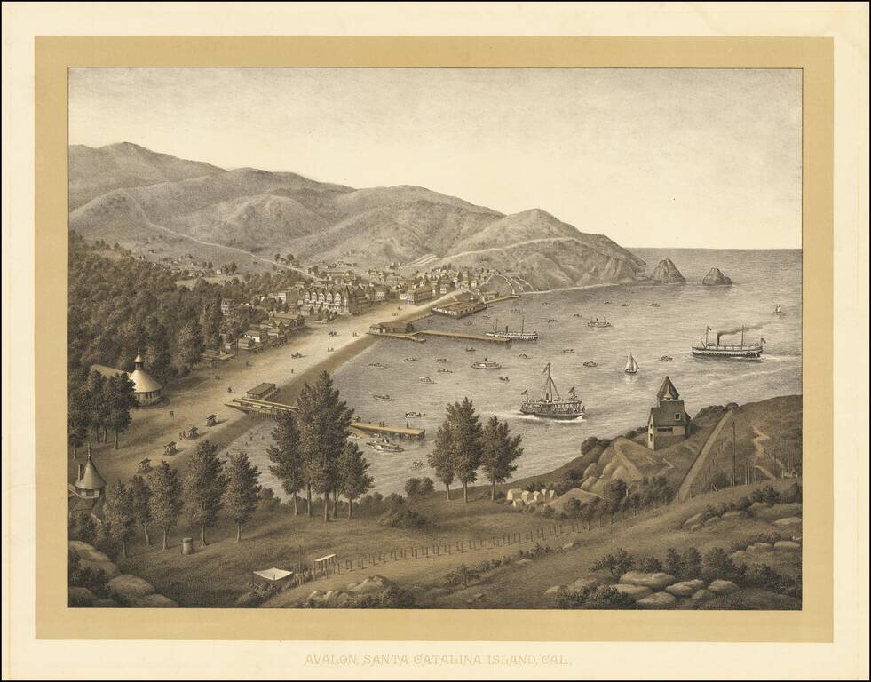
Rare birdseye view of Avalon, on Catalina Island, which was most likely lithographed in the 1880s by Kurz & Allison, prior to the acquisition of the island by the Banning Brothers in 1892. Juan Cabrillo originally discovered and claimed Catalina...
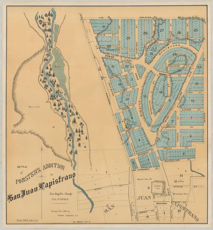
Earliest Printed Map To Detail The Mission San Juan Capistrano and Environs Rare plan of the Forster Addition, within the City of San Juan Capistrano, showing the Mission San Juan Capistrano and surrounding neighborhoods. The lands covered are those...
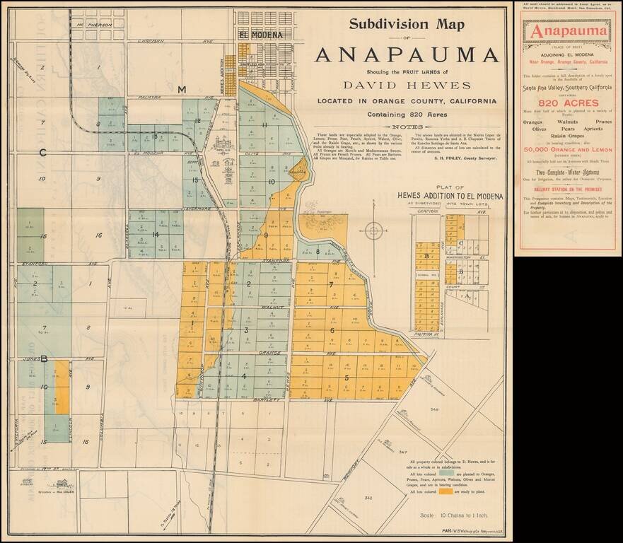
Fine example of the original subdivision promotional map for Anapauma, California, a short-lived real estate development in Southern California promoted by David Hewes, who is perhaps most famous for having been the creator of the "Golden Spike."...