Map size in jpg-format: 7.68589MiB
Click to open in high resolution (open in new tab).
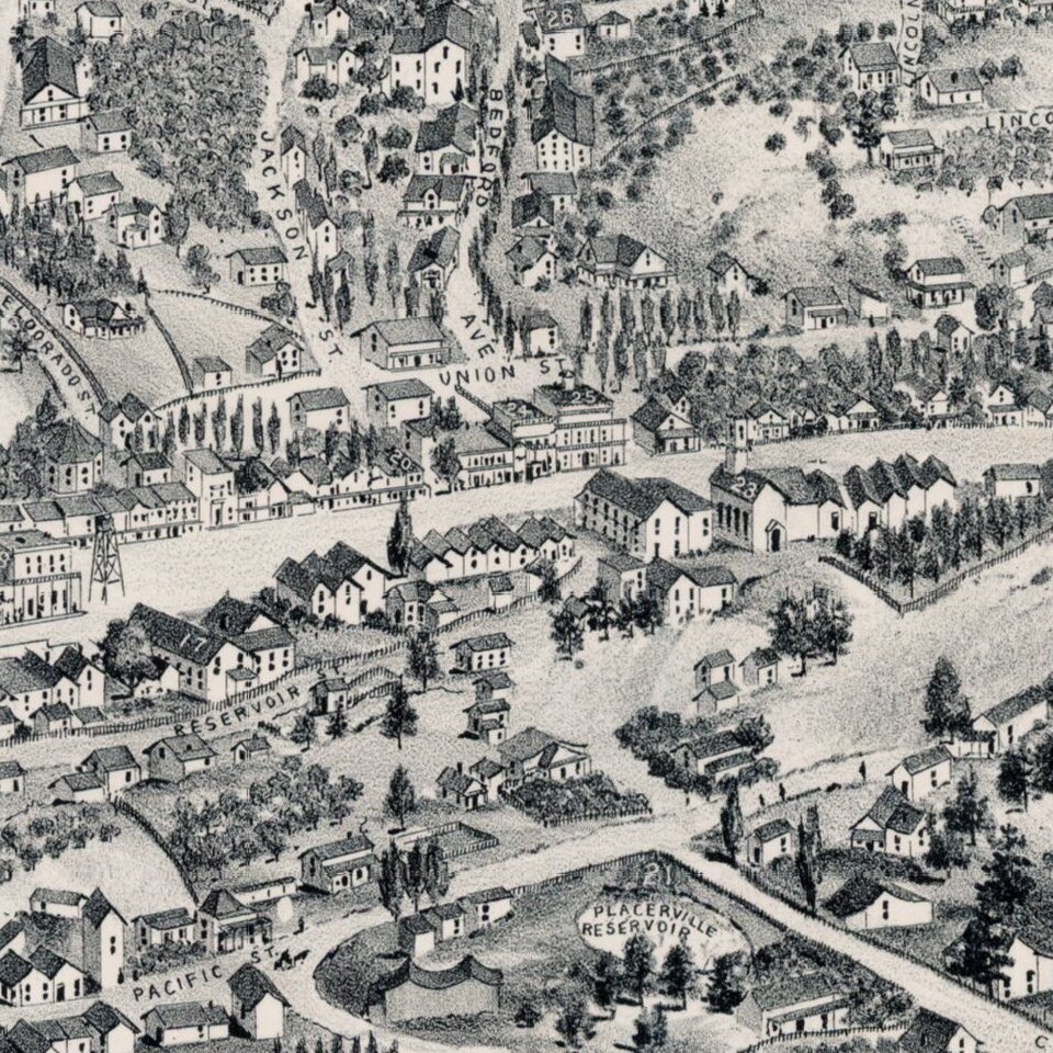
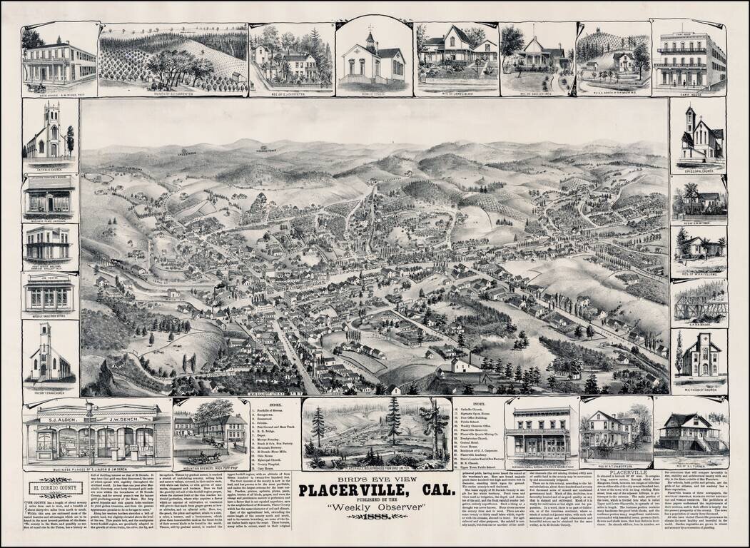
Rare view of Placerville, California, in the heart of California's Gold Country, by W. W. Elliott.
Marvelous detailed plan of this important early California mining town sketched by L. Roethe, showing buildings, street names, topographical details, etc. The view is one of the earliest large format printed views of Placerville and is quite rare on the market. The view includes 25 insets of prominent buildings and residences in Placerville, and a smaller view showing Placerville in 1851. The map also includes an index identifying 30 places and a testimonial narrative about El Dorado County, California.
Several mining areas can be seen in the hills. An interesting birdseye view by Elliott, who also published some of the rarest Illustrated California County histories, richly illustrated with maps and views of local buildings.
If you are a student, write to us in telegram: @antiquemaps and indicate what material you need and for what work you need a map in high detail. We are ready to provide material on special terms. For students only!