Map size in jpg-format: 7.81029MiB
Click to open in high resolution (open in new tab).

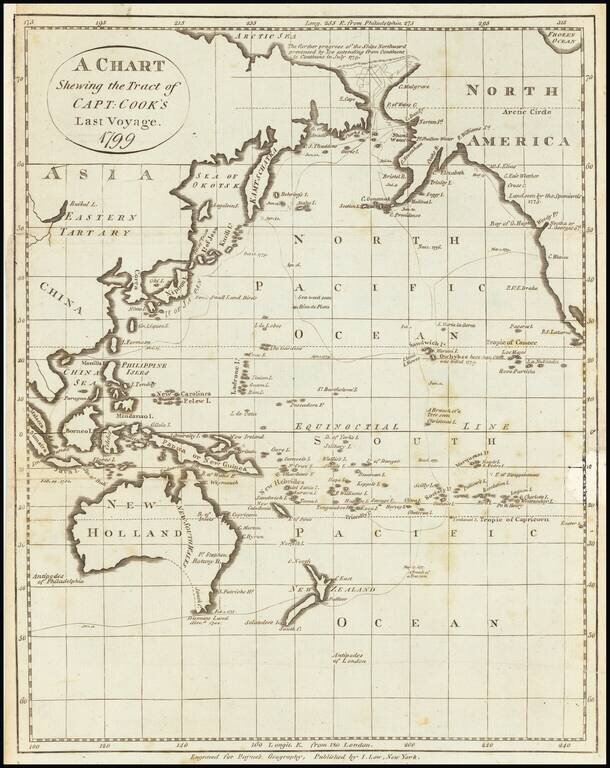
Early American printed map showing the Tract of Cook's final voyage.
Cover Alaska, the Northwest Coast of America, Australia, New Zealand, the Coast of Russia, China, Japan, the Philippines, etc.
Centered on Hawaii (Sandwich Islands)
If you are a student, write to us in telegram: @antiquemaps and indicate what material you need and for what work you need a map in high detail. We are ready to provide material on special terms. For students only!
![America [Manuscript Map Showing the Sea of the West!]](/map/small/41297dm.jpg)

![[Atlantis?] Ristretto Delle Carte presentate all' Academia delle Scienze di Parigi negli anni 1737 e 1752 dal Sig di Buache](/map/small/58667.jpg)