
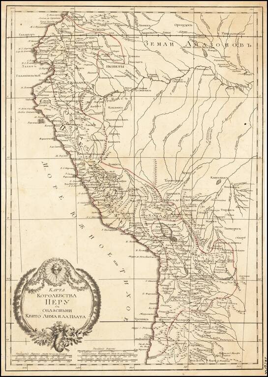
Russian-language antique map of the "Kingdom of Peru" from Ecuador to Chile on the western coast of South America. The map was created by Alexander Wilbrecht in Saint Petersburg in 1793, and was based on Janvier's Carte Du Perou ou se trouvent les...
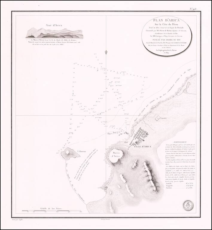
Rare separately published sea chart of the northern Chilean Coastline, centered on the town of Arica. Fine chart of the area around Arica in Chile, on the border with Peru, from Volume 7 of the Neptune Francois. The plan was drawn in 1822 during...
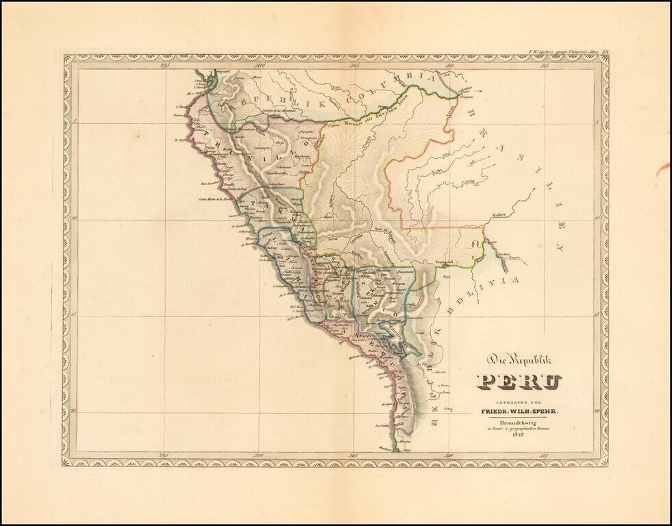
Extremely rare early map of the Republic of Peru, published by F.W. Spehr. The map was intended to be a part of Spehr's Geographischer Universal-Atlas. This work was started between 1822 and 1825, but the atlas was never completed, with only 36 of...
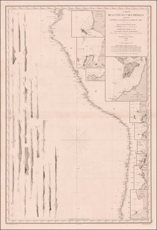
Remarkable sea chart of part of the West coast of South America, published by the French Hydrographic Survey. The chart extends from Guayaquil in the North to the Bay of Coquimbo in Chile, centered on Arica. The map includes large insets plans of:...
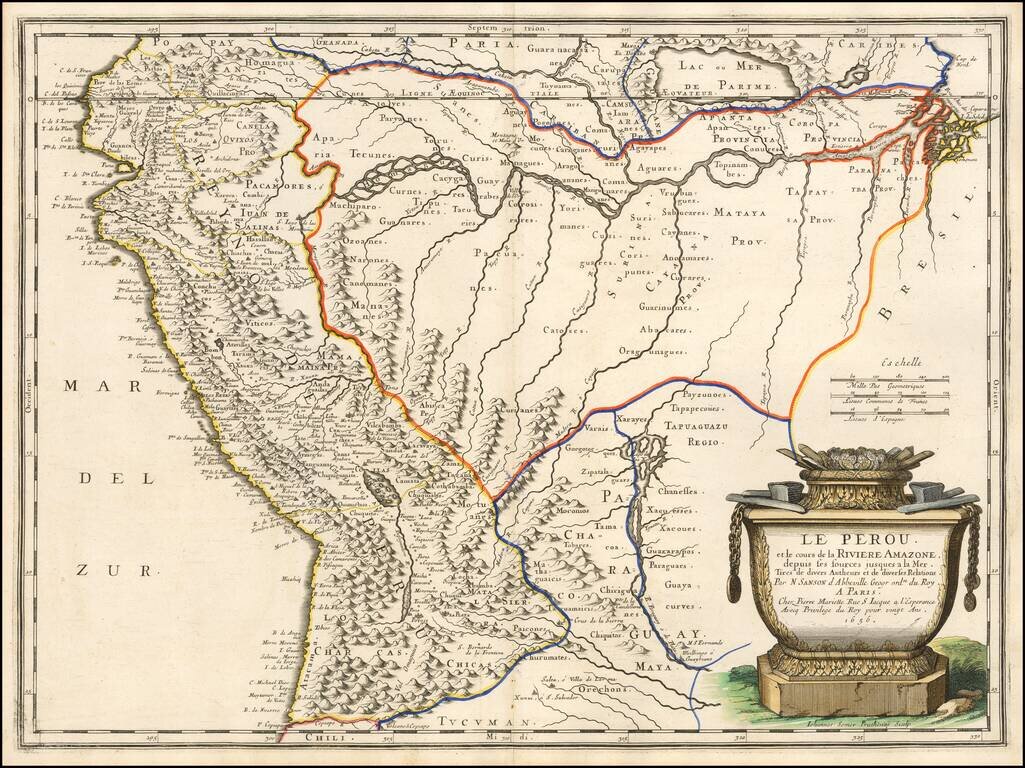
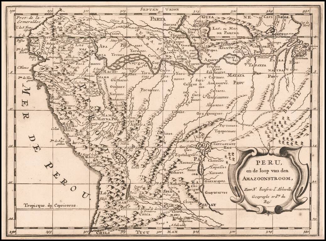
Finely colored example of Sanson's 1656 double-page engraved map of Peru, extending from the Pacific to the mouth of the Amazon River and tracking the Amazon to its sources in the Andes. A massive mythical Lake Parime is shown. The Rio Paraguay o di...
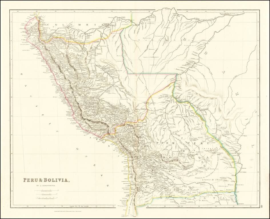
A marvelous highly detailed map of Peru and Bolivia, colored by regions. Arrowsmith's map is perhaps the single most detailed atlas map of the period.

Striking full color example of David Burr's map of Peru and Bolivia, which first appeared in David Burr's Universal Atlas, in 1836. Burr's Atlas was perhaps the most elegant American commercially published atlas of its time, utilizing wonderful wash...
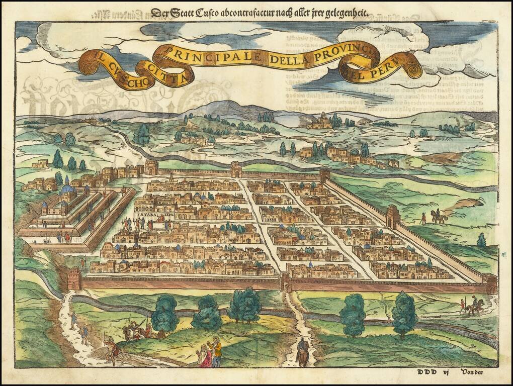
Early decorative birdseye view of Cusco, from a German edition of Munster's Cosmographia, one of the most influential geographical works of the 16th Century. One of the earliest obtainable views of the New World. Munster's Geographia was a...
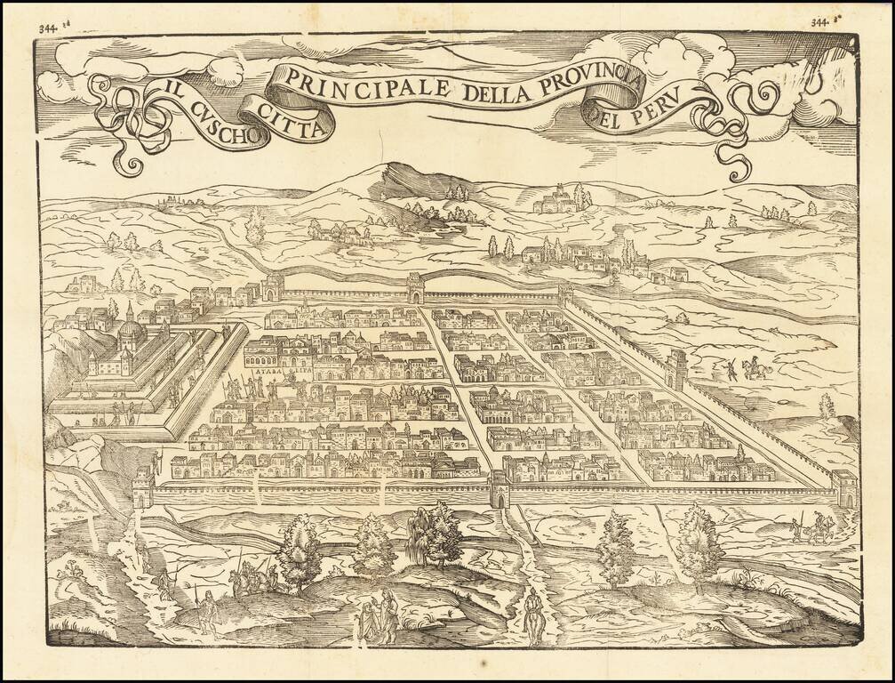
Fine example of this influential and decorative birdseye view of Cusco, from Ramusio's Raccolta di Navigationi et Viaggi., one of the most influential geographical works of the 16th Century. The view would later be copied by Munster and other 16th...
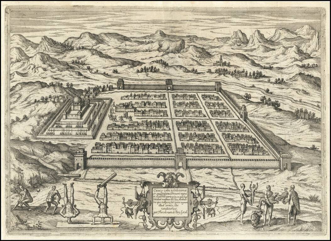
Detailed view of the town of Cusco in Peru, then one of the largest cities in the Americas. The view shows the indigenous Inca king being carried in his elevated chair near the town center. In the foreground Inca people playing a ball game and showing...
Important early map of Peru, one of the earliest obtainable maps to focus on the region and the first to rely upon the work of Hessel Gerritsz. This remarkable early map pre-dates the maps of Peru issued by Blaeu and Jansson. Johannes De Laet's...
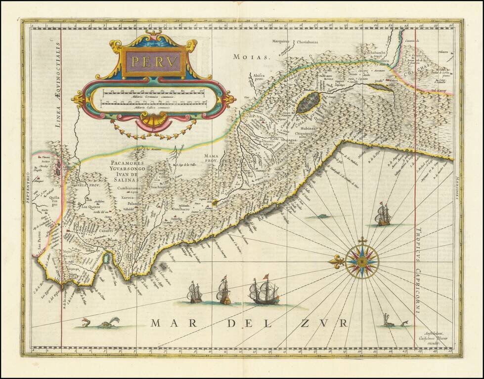
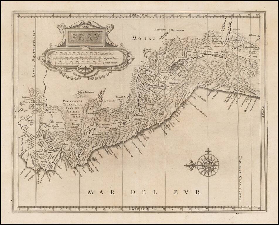
Striking, Early Map of Peru from the Dutch Golden Age Fine old-color example of Blaeu's map of Peru, one of the best early decorative maps of the region. This is one of the two earliest atlas maps to focus on Peru, along with the map by Henricus...
Dutch edition of Sanson's map of Peru and the Amazon region, showing the extensive rivers and tributaries which extend to the Andies, along with the rich details of the mountainous regions of Peru, then the most affluent of all of the Early Spanish...
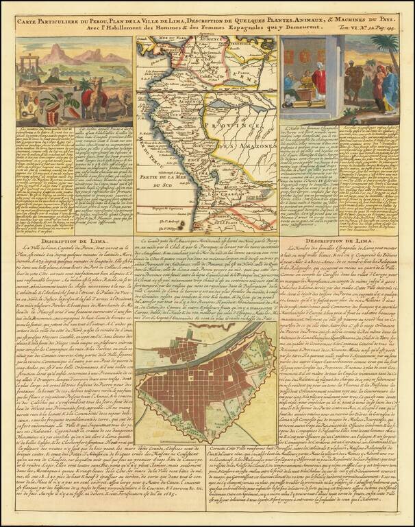
Detailed plan of Lima and regional map of Peru, published in Henri Chatelain's 7 volume Atlas Historique. The sheet also includes two views showing indigenous flora and fauna and the manner of living of the Spanish women in Peru.

Detailed map of Peru, pubished in Paris by a young Philippe Buache, who would go on to become the pre-eminent French mapmaker of the middle of the 18th Century, along with J.B.B. D'Anville.
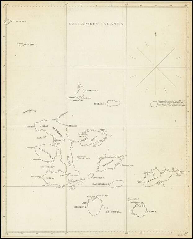
The First American Map of the Galapagos Islands Scarce early 19th Century map showing the Galapagos Islands in detail. An unnamed island (the modern Genovesa) is shown with a note that it "is situated agreably to the report of several Whalemen and...