logo

1827. Die Republik Peru

  • Die Republik Peru

Map size in jpg-format: 14.3865MiB

Download "Die Republik Peru", in high resolution.

Die Republik Peru information:

Year of creation: 
Resolution size (pixels): 
 11549x9040 px
Disk Size: 
 14.3865MiB
Number of pages: 
 1
Place: 
 Braunschweig

Print information. Print size (Width x height in inches):
Printing at 72 dpi 
  160.4 х 125.56
Printing at 150 dpi 
 76.99 х 60.27
Printing at 300 dpi 
 38.5 х 30.13

An example of detailing the file of this map of in a printable high-resolution:

Click to open in high resolution (open in new tab).
Attention! this is just the central piece (central area 960x960 px) of the map file!
This is an example, so that you can see and study the level of detail of a given map. The entire Map will be fully available after payment!

Die Republik Peru

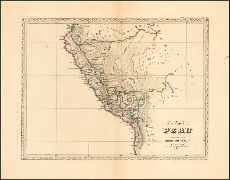
Extremely rare early map of the Republic of Peru, published by F.W. Spehr.

The map was intended to be a part of Spehr's Geographischer Universal-Atlas. This work was started between 1822 and 1825, but the atlas was never completed, with only 36 of the 90 planned maps actually printed.

We locate no other examples of the map, other than the present example, which was acquired in 2017 from Norbert Haas.


Special conditions for students!

If you are a student, write to us in telegram: @antiquemaps and indicate what material you need and for what work you need a map in high detail. We are ready to provide material on special terms. For students only!

Item information:

Year of creation:
Size:
11549x9040 px
Disk:
14.3865MiB
Number of pages:
1
Place:
Braunschweig
Author:
Friedrich Wilhelm Spehr.
$14.99

Related item