
![[Straits of Le Maire, Nova Guinea, South Pacific]](/map/small/61345op.jpg)
The Earliest Printed Map of Le Maire's Voyage Around Cape Horn and Across The Pacific Nice example of Joris van Spilbergen's rendering of Willem Schouten and Jacob Le Maire's map / sea chart of a portion of his circumnavigation of the world, showing...
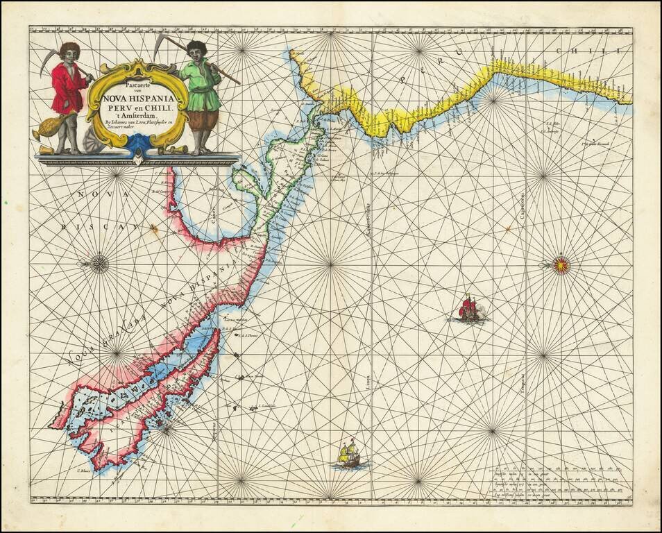
Rare Golden Age Dutch Sea Chart of the Island of California and Western Pacific Rare Johannes Van Loon sea chart of the Western Pacific. The map appeared in the first edition of Van Loon's Zee Atlas. It derives from Doncker's map of the Western...

Fine old color example of Braun & Hogenberg's views of Mexico City and Cusco, among the earliest printed views of any American City. This view was the only 2 American views in Braun & Hogenberg's Civitatus Orbis Terrarum, the most influential...
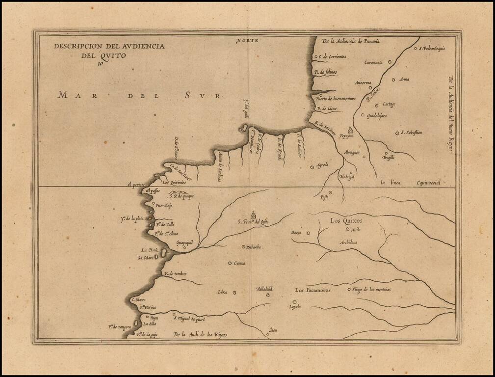
Amsterdam edition of Antonio de Herrera y Tordesillas' map of the Audiencia of Quito, from his Descripcion de las Indias Occidentalis, first published as part of his Historia General, in Madrid in 1601. This map is the earliest printed Spanish map to...
![[Galapagos] Carte de la Cote Occidentale D'Amerique Comprise Entre Le Golfe de Tehuantepec et le Golfe de Guayaquil (Amerique Centrale, Nlle Grenade, Equateru) . . . .1864](/map/small/57942.jpg)
Scarce sea chart of Central America and the coasts of Colombia, Equador and Peru, published by the French Hydrographical Office. Includes a relatively large treatment of the Galapagos Islands, just five years after Charles Darwin's publication of his...
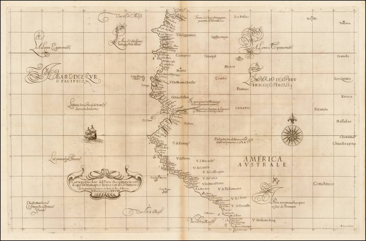
Fine example of the first state of Robert Dudley's chart of a part of the northwestern coastline of South America, the earliest obtainable chart of the region. The chart is centered on Quayquil and the coast of Ecuador, extending south to the area of...
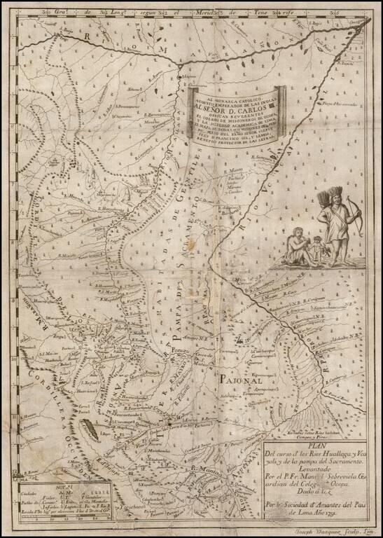
Extremely rare first edition of this important early map of part of northeastern Peru with the Marañon River at the top, the Ucayali River at right, the Huallaga River in the center and Lima at lower left, prepared from the original manuscript maps of...

Presented to Farabee's Wife An interesting archive of maps drawn to illustrate William Farabee's first expedition to South America, to visit the indigenous peoples of Eastern Peru. Along with the maps enumerated below, the archive includes a book...
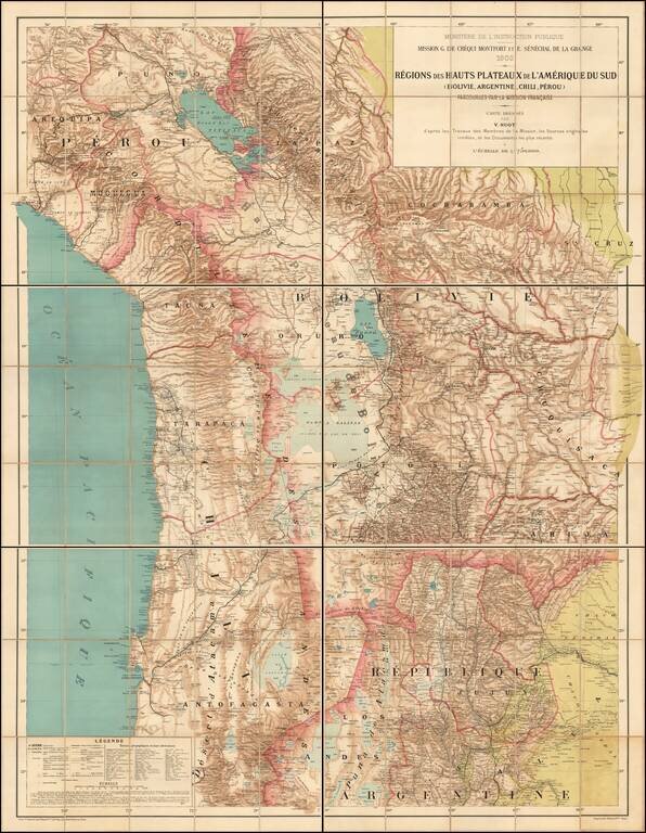
The First Comprehensive Scientific Mapping of the Andes Rare large scale map of the South American Highlands of Bolivia, Argentina, Chile and Peru, compiled by Victor Huot as part of a comprehensive study of the region by the Scientific Mission of G....
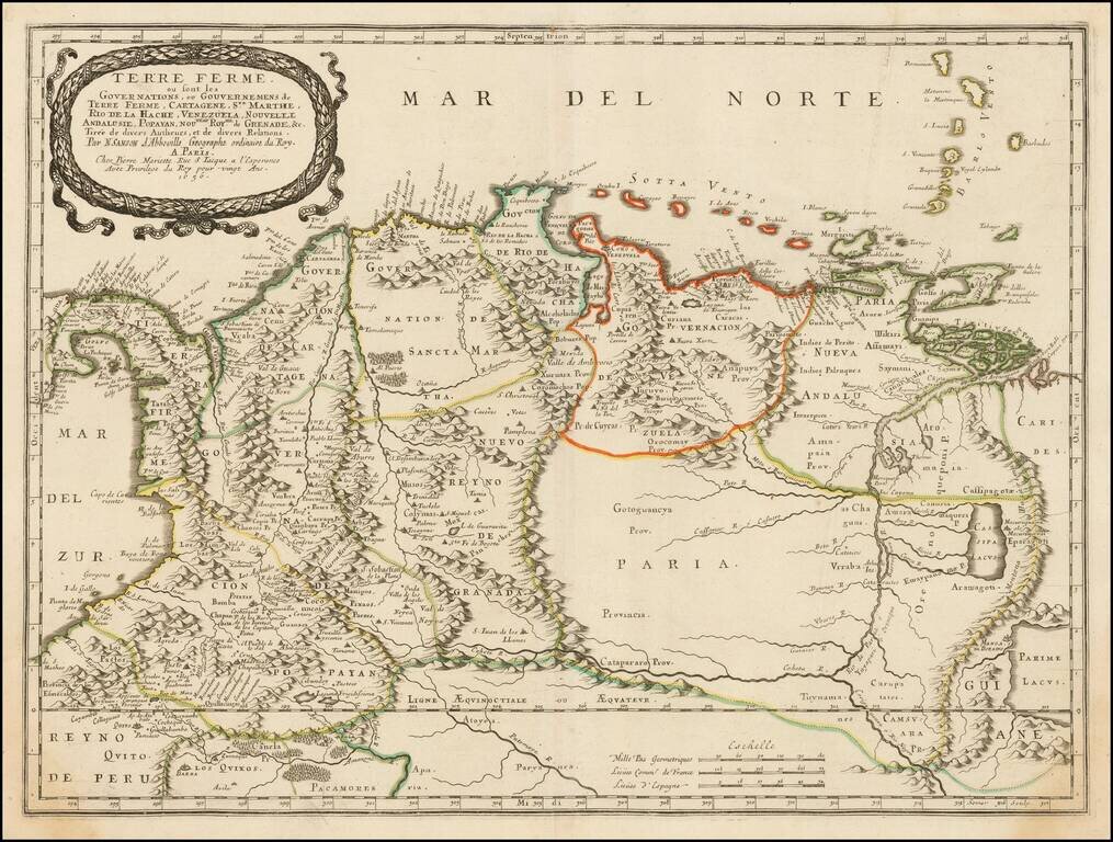
Antique Map of Colombia and Venezuela, etc., Extending To The Famed City of El Dorado Important early map of Columbia and Venezuela, from the most important French map maker of the 17th Century. The map shows the course of the Rio de Paria or...
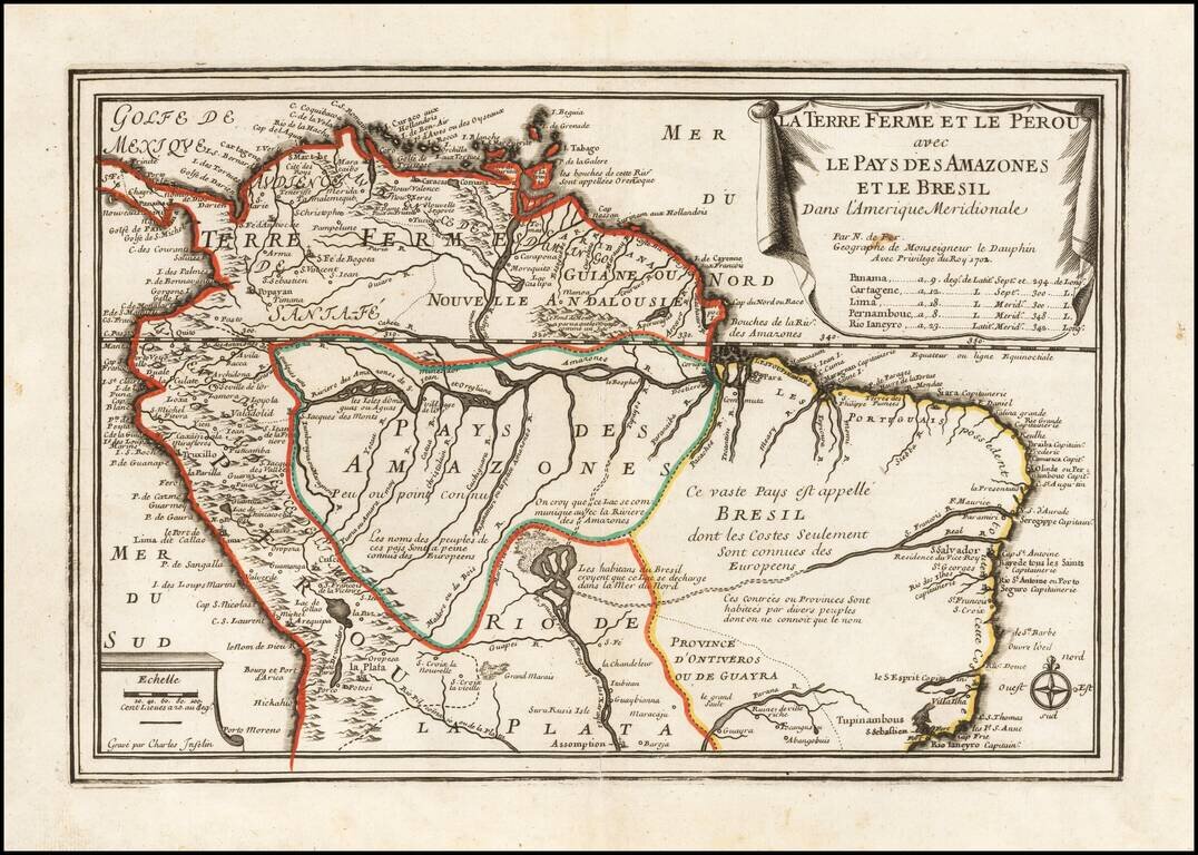
Striking old color example of Der Fer's map of the northern part of South America, from his Atlas Curieux. The map extends south to include Rio Ianeyro (Rio De Janeiro). A number of annotations on the indigenous people of the interior and other features.
Nice example of Coven's & Mortier's edition De L'Isle's maps of the northern part of South America. The map Colombia, Venezuela, Peru, Ecuador, Brazil, Guiana and parts of Bolivia, Chile, Paraguay and Argentina. De L'Isle was known for his fine...
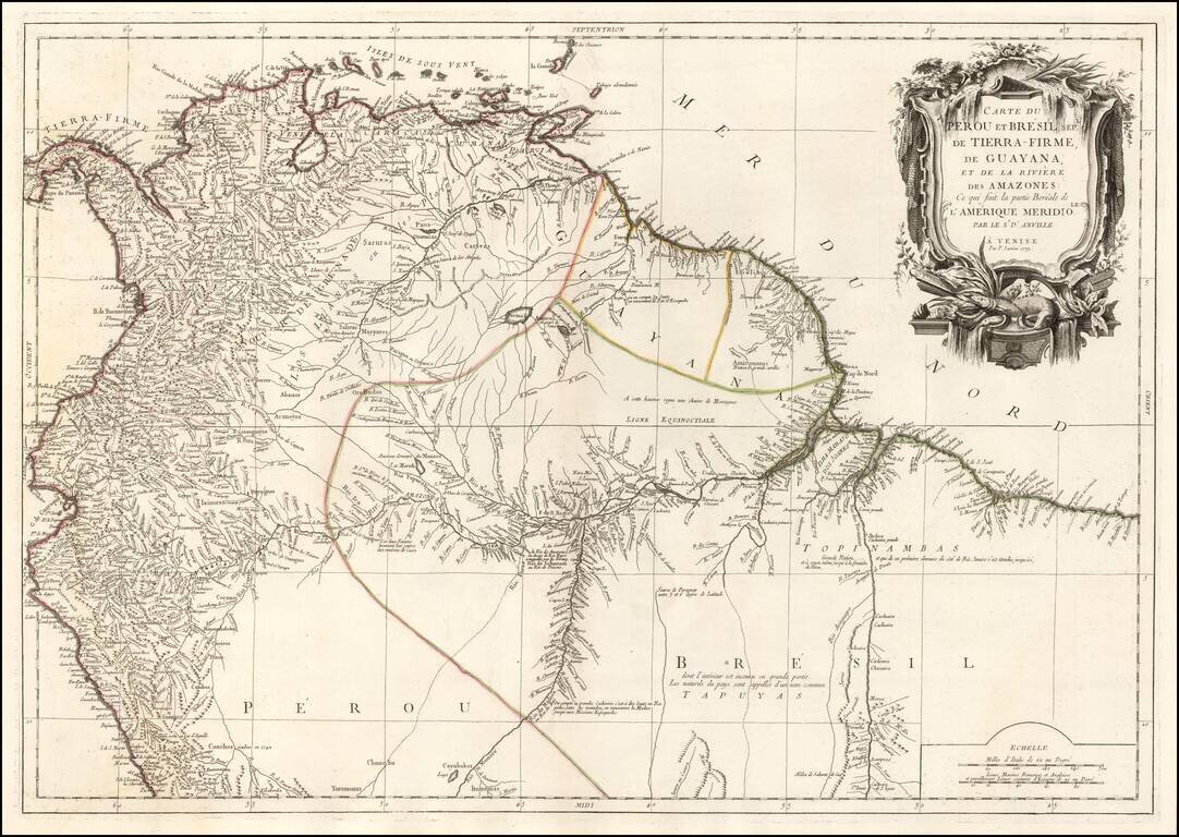
Finely engraved map of the northern part of South America, from Santini's Venetian edition of d'Anville's map from "Atlas Universel" printed in 1776-84. The map includes Colombia, Venezuela, Ecuador, Guayana, northern Peru, and part of Brazil.
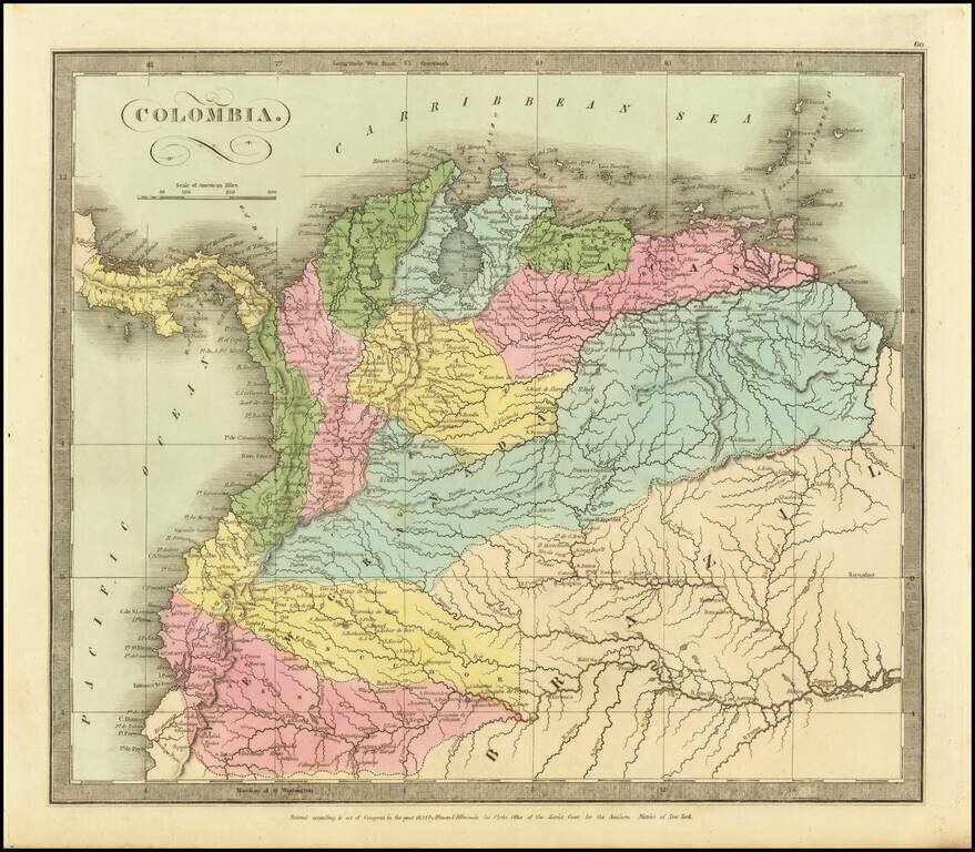
Striking map of Colombia, hand colored by provinces. Includes excellent detail on the River Systems, and shows towns, mountains, lakes, islands, etc. From David Burr's rare Universal Atlas.
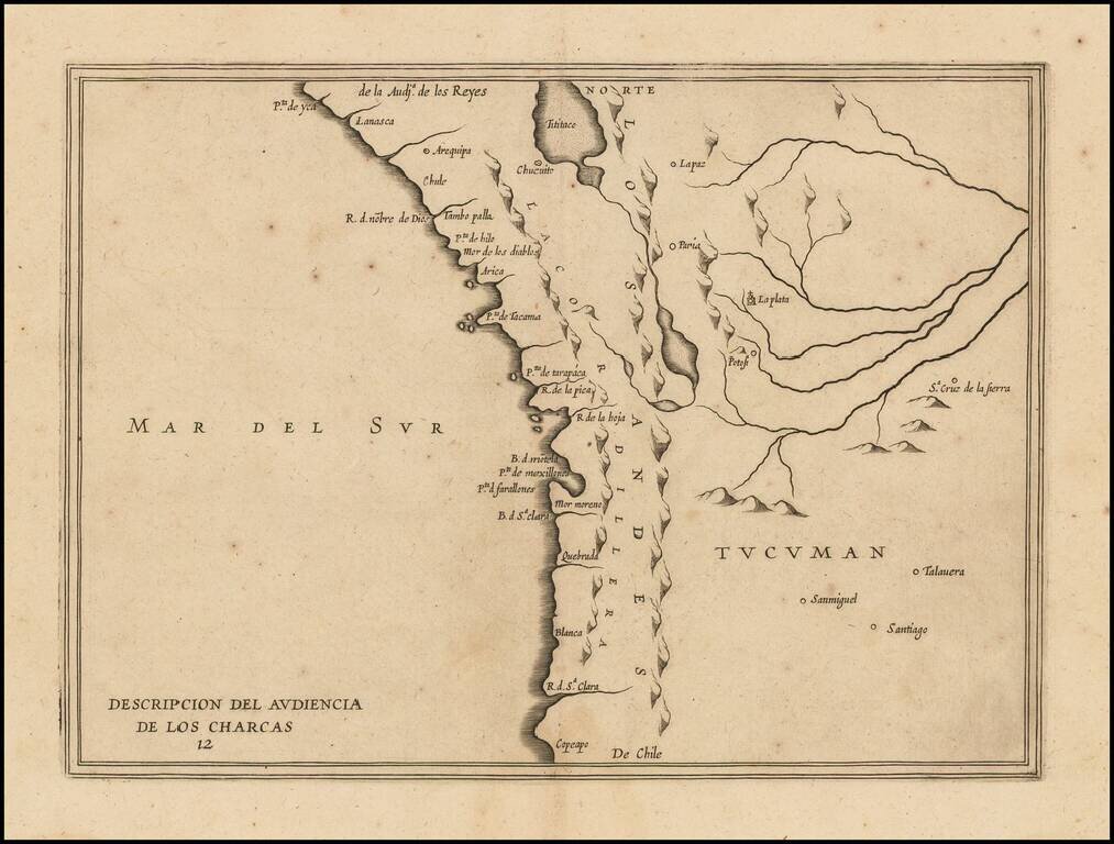
Rare early map of the Audiencia of the New Kingdom of Charcas, parts of modern-day Peru, Bolivia and Chile. The map locates rivers and settlements. The earliest map to include information from the previously secret manuscript maps of the Spanish...
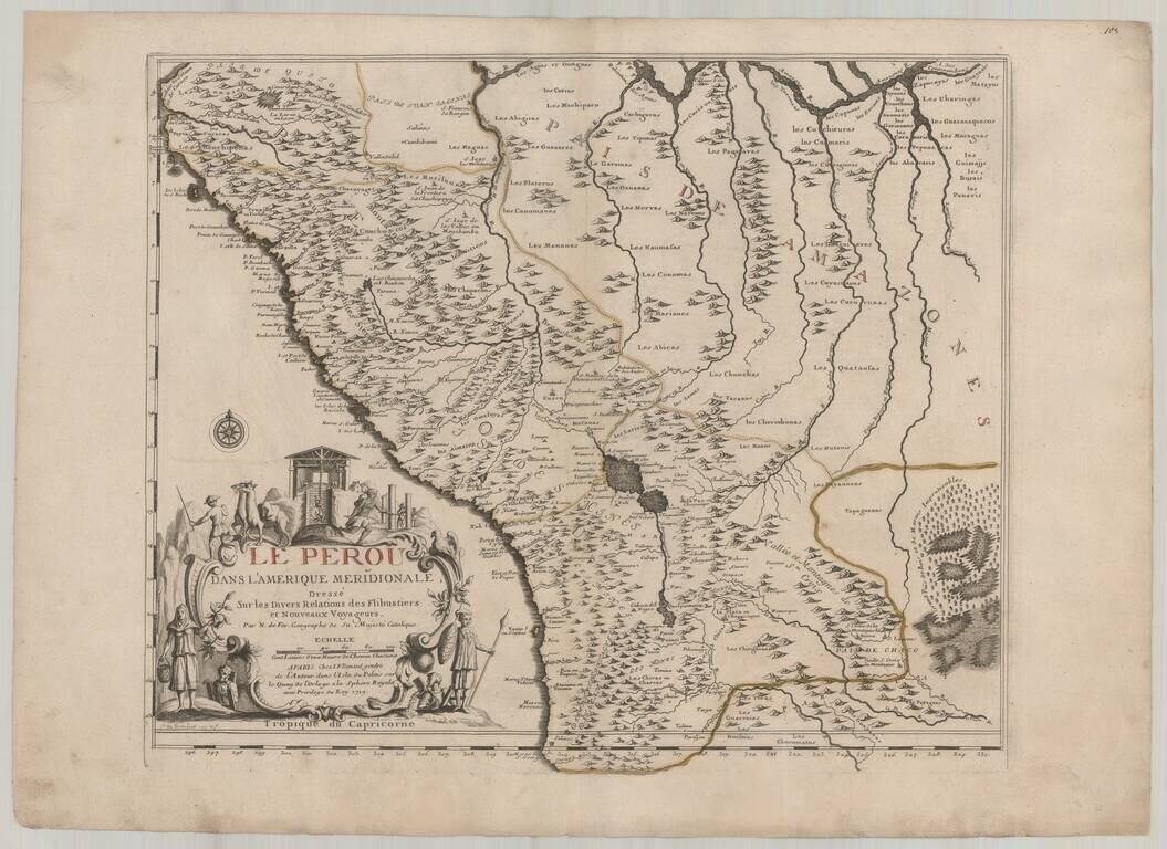
Fine example of De Fer's map of Peru and contiguous parts of the Andes and Upper Amazon River Basin. The striking large format map is the result of some of the most up to date cartographic information coming back to Europe from the Jesuit...