Map size in jpg-format: 18.8916MiB
Click to open in high resolution (open in new tab).
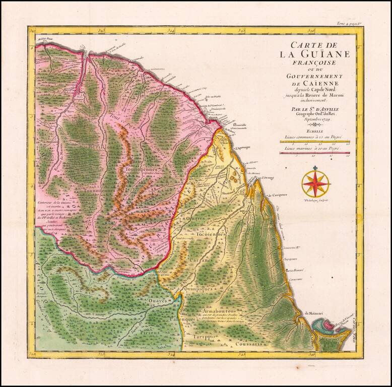
Striking Map of French Guiana Showing Jesuit Influence in the Region
Fine, old color map of French Guiana by D’Anville showing this seldom-mapped region. The map was included in a travel account by the navigator and slave ship captain the Chevalier des Marchais.
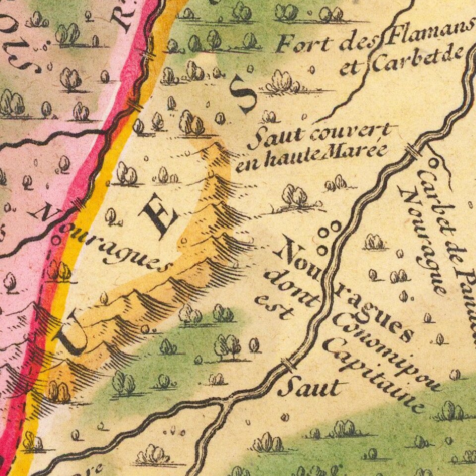
Although seemingly crowded with details, many of the notes D’Anville includes admit to a lack of precise knowledge about the geography. A remark in large letters explains that most of the land is covered in woods. Many rivers are shown, along with their tributaries.
Many labels show which indigenous groups were understood to live in the area. Some of these also have explanatory texts that reflect European perceptions and prejudices of American peoples. For example, the Armaboutous, “have large ears hanging to their shoulders and several holes in their faces.” The Tounoiennes, or Galibis, are “reputedly savages.”
A note in the center left reads:
The interior of Guiana is unknown and we still have nothing of it except by the arrival of the PP Grillet and Bechamel Jesuits who penetrated to the Acoquas in the year 1674.
D’Anville is referring to Jesuit missionaries Jean Grillet and Francois Bechamel who left from Cayenne on a harrowing journey overland to reach hitherto uncontacted indigenous groups. Having run out of supplies, they were dependent on the local people to help them return to Cayenne. Although they converted no souls and found only one possible location for a mission, they did bring back new information on the geography of the region, which was published in an account of their travels in the late seventeenth century.
Chevalier des Marchais and French Guiana
This map was part of another travel account, that of the Chevalier des Marchais in French Guiana. Europeans first came to Guiana in the 1530s, although the coastline was sighted by Columbus on his third voyage. The area seemed to be a land of milk and honey, and possibly gold. It quickly became associated with the mythic El Dorado in the European imagination. In 1595, Sir Walter Raleigh came searching for the gleaming city.
The French first began to have influence in the region in the seventeenth century. French Jesuit missionaries sought to make Guiana another Paraguay, where they ran massive agricultural missions known as reductions. They arrived in Cayenne in 1666 from Martinique. They would continue in the region until 1763, when they were expelled in favor of the Franciscans a decade before the global suppression of the Jesuit order.
Reynaud des Marchais, the Chevalier des Marchais, arrived in Guiana early in the eighteenth-century as the captain of a slave ship. He used his participation in the brutal triangle trade to chart much of the coasts of West Africa, northern South America, and the West Indies. He was in Guiana in 1725-7, where he gathered notes and materials.
These were published posthumously in 1730 and 1731 by father J. B. Labat and D’Anville provided the maps for the volumes. This map appeared in volume 4, as indicated by the page number in the upper right corner. The map is one of the first to show the region and was part of an important history that brought Guiana to wider European attention.
If you are a student, write to us in telegram: @antiquemaps and indicate what material you need and for what work you need a map in high detail. We are ready to provide material on special terms. For students only!