Map size in jpg-format: 51.0046MiB
Click to open in high resolution (open in new tab).
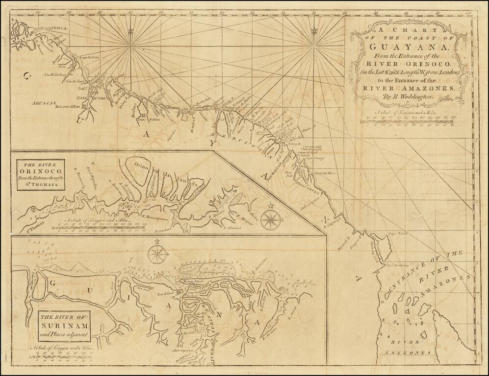
Scarce early English sea chart showing the coast of Guyana, with insets of the River Orinoco, published in London by Mount & Page.
The map extends from the entrance thereof to St. Thomas, and the River of Surinam and places adjacent.
If you are a student, write to us in telegram: @antiquemaps and indicate what material you need and for what work you need a map in high detail. We are ready to provide material on special terms. For students only!