
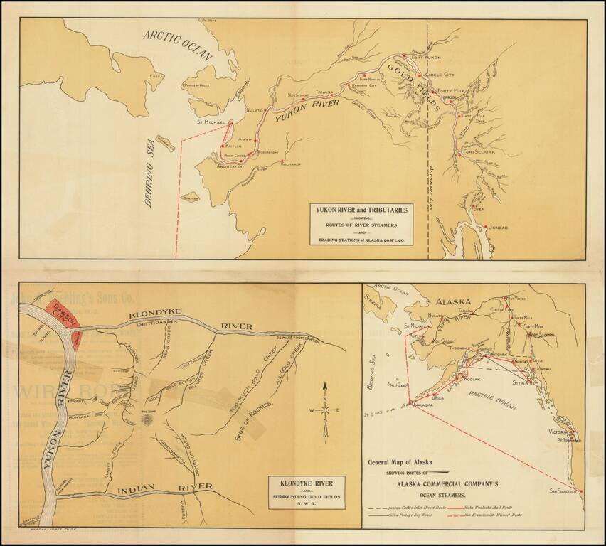
Rare promotional pamphlet showing the routes to the Klondike, published by the Alaska Commercial Company. Three maps includes: General Map of Alaska Showing Routes of Alaska Commercial Company's Ocean Steamers Klondike River and Surrounding Gold...
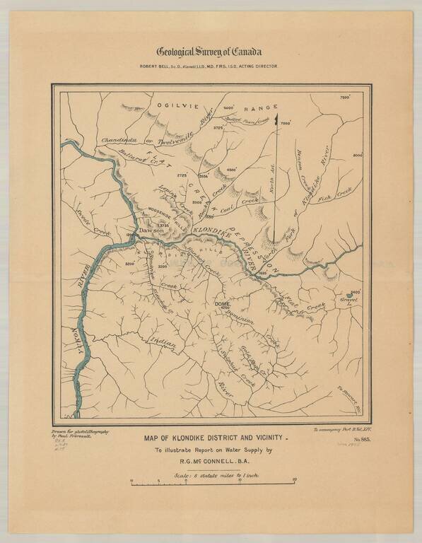
Detailed map of the Klondike Gold Region, centered on Dawson's and the Klondike River.
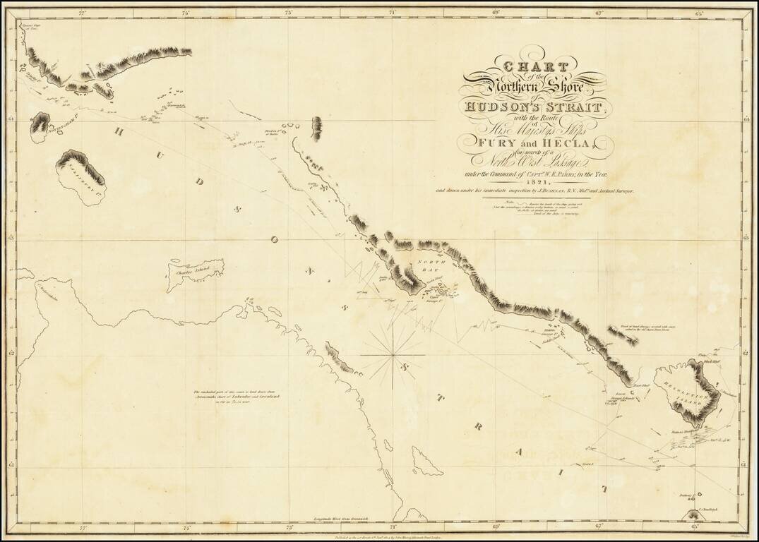
A nice example of Parry's map of Hudson's Strait, showing a portion of his expedtiion in search for the Northwest Passage. Shows Parry's tracts in marvelous detail, including a day by day account of his route and a number of annotations. After...
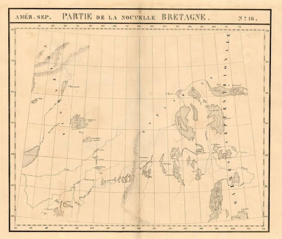
Large format map of the region the Esquimaux and Chippeway Lands of Canada. Highly detailed, with many rivers, lakes, place names, Indian Tribes, forts, etc. From Vandermaelen's remarkable 6 volume atlas, which if combined as globe gores forms an...
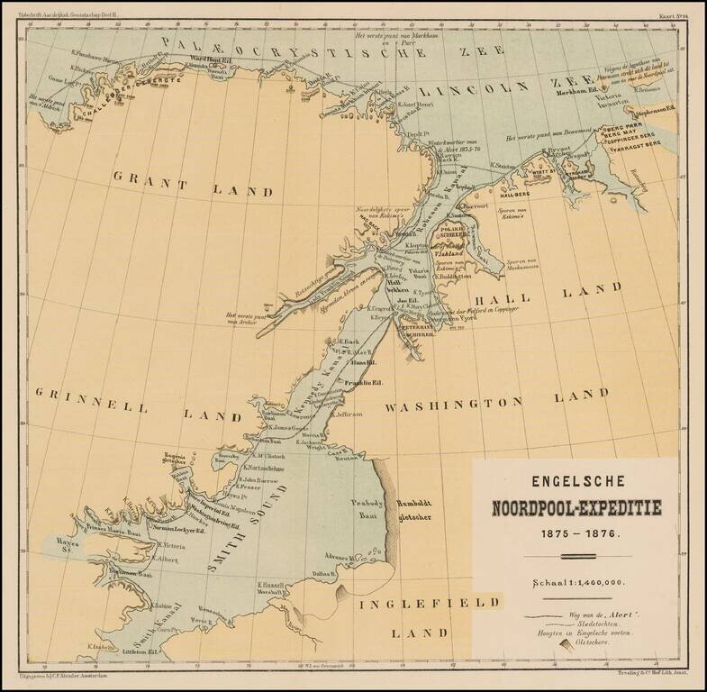
Detailed map illustrating the British Arctic Expedition of 1875-1876. The British Arctic Expedition of 1875-1876, led by Sir George Strong Nares, was sent by the British Admiralty to attempt to reach the North Pole via Smith Sound. Two ships, HMS...
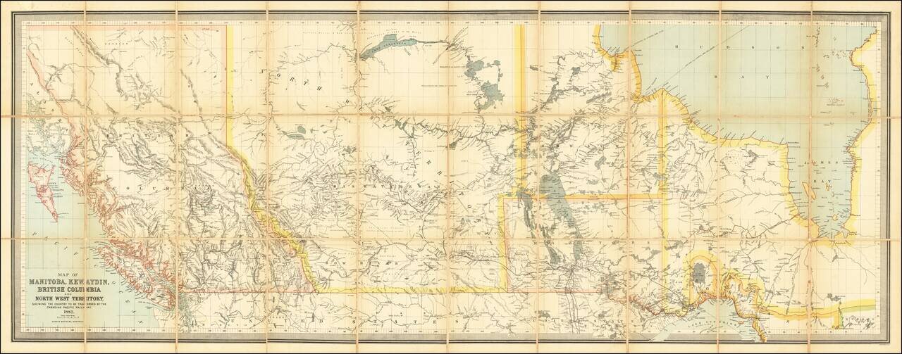
Impressive Canadian Railroad Map Showing the Proposed - But Never Realized - Province of Kewaydin. Color-lithographed antique folding map of Canada west of Ontario, published in Montreal in 1882 by the Dawson Brothers. The map features the Province...
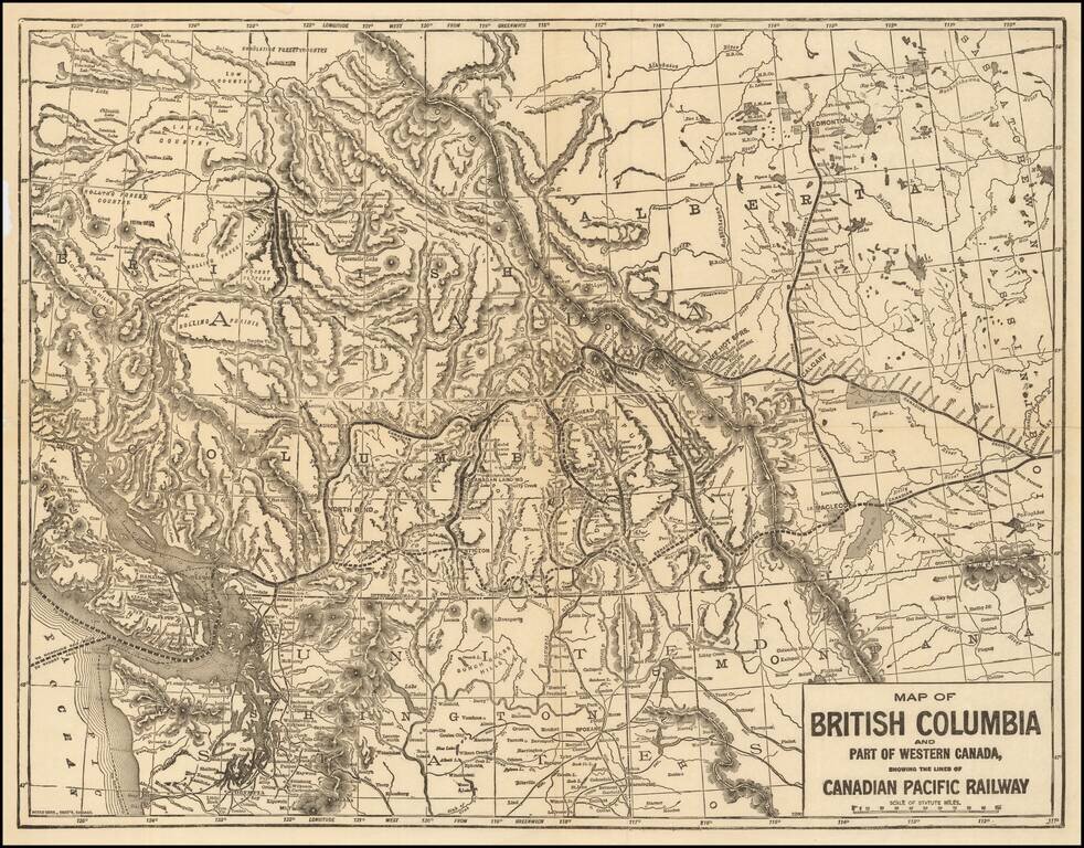
Rare map of the Canadian Pacific Railway, tracking the route of the lines between Medicine Hat and Dunimore to New Westminster and Vancouver. The map shows the region from Vancouver Island East to the Alberta-Saskatchewan border. Also includes some of...
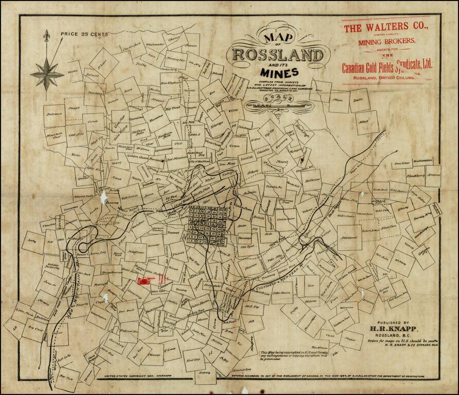
Rare early map of Rossland, British Columbia, in the Kootenay District, in the year of the great Rossland Gold Rush. The present map shows Rossland at the beginning of its boom period, during which time it would become one of the largest cities in...
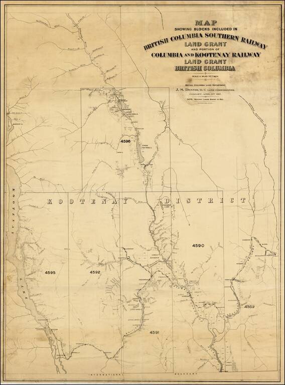
A very rare map with great importance to the historical development of the Kootenay Region of British Columbia. This map embraces the southeastern portion of British Columbia as far westward as Kootenay Lake, and charts the route of the British...
![[Route of the 1938 Westward Northwest Passage Cover] Map of the Northwest Territories 1929](/map/small/60046.jpg)
Illustrating Canadian Postal History -- A Cover's Travel Through the Northwest Passage in 1939 Fine large format map of the Northwest Territories of Canada, published by the Department of the Interior. The map identifies: Royal Canadian Mounted...
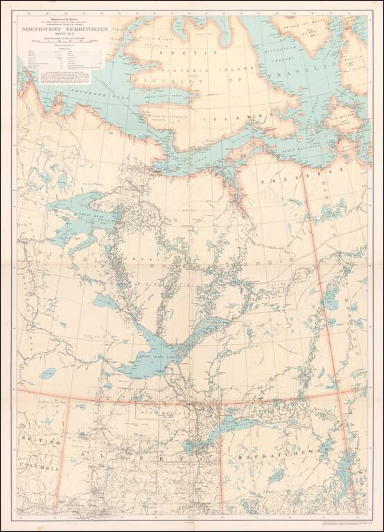
Detailed map of a portion of the Northwest Territories, published by the Department of the Interior in 1932. The map illustrates: Main, Wagon and Winter Roads Falls and Rapids Ranger Cabins Royal Candian Mounted PoliceStations Sea Plane...
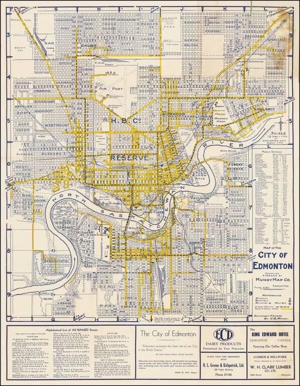
"Edmonton Possesses The Finest Site of any City in the British Empire" -- Sir John Foster Frazer Fine early plan of Edmonton, published in Edmonton by the Mundy Map Company. The center of town is dominated by a large area noted as "Hudson Bay...
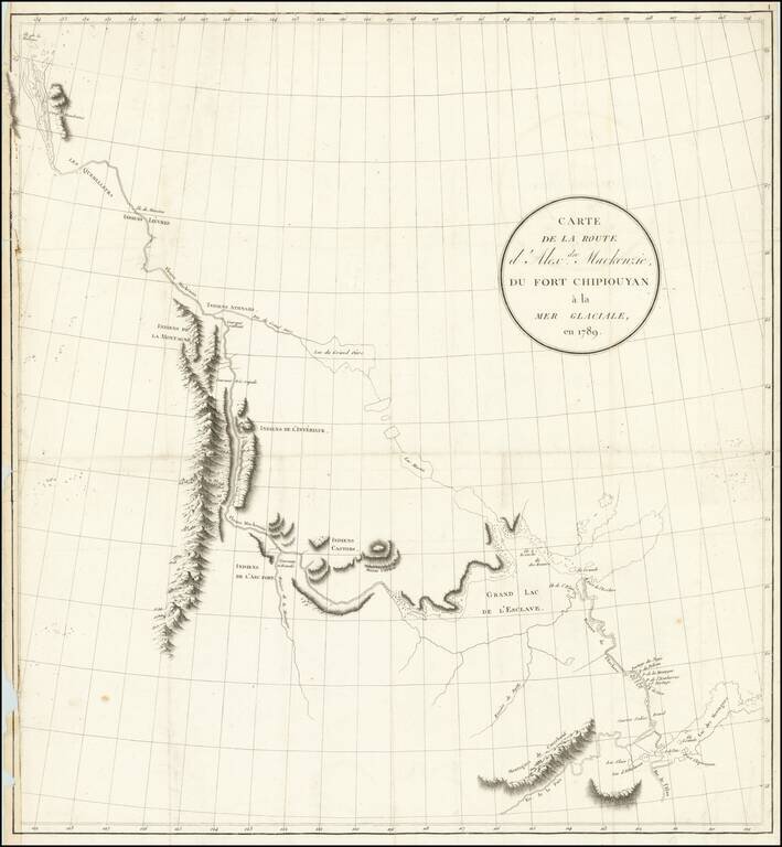
Exploring the River Which Would Bear His Name Nice example of the French edition of Alexander Mackenzie's route map between Lake Athabasca to the Arctic Sea in 1789. Alexander Mackenzie was the first European to cross the North American continent...
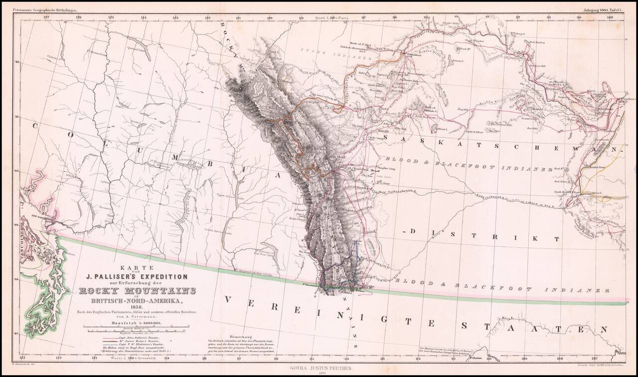
Detailed map of Western Canada illustrating the western part of Captain John Palliser's explorations in Western Canada, based upon Palliser's virtually unobtainable map published about three years earlier. The map shows the disputed boundary claim...
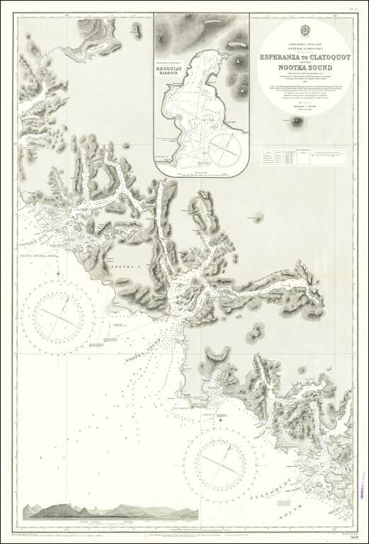
Finely detailed sea chart of a portion of the Western Coast of Vancouver Island, published by the British Admiralty. The chart is centered on Nootka Sound and extends north to Atluck Lake and the Fair Harbor area, and south to Vargas Island and...
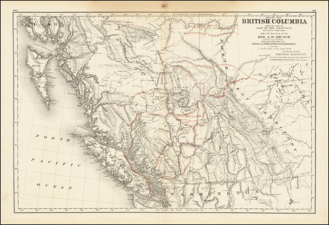
A historically important map of British Columbia after the province entered the Confederation which shows the proposed routes for the Canadian Pacific Railway. Following the establishment of the Canadian Confederation in 1867, Trutch worked to...