Map size in jpg-format: 9.26499MiB
Click to open in high resolution (open in new tab).
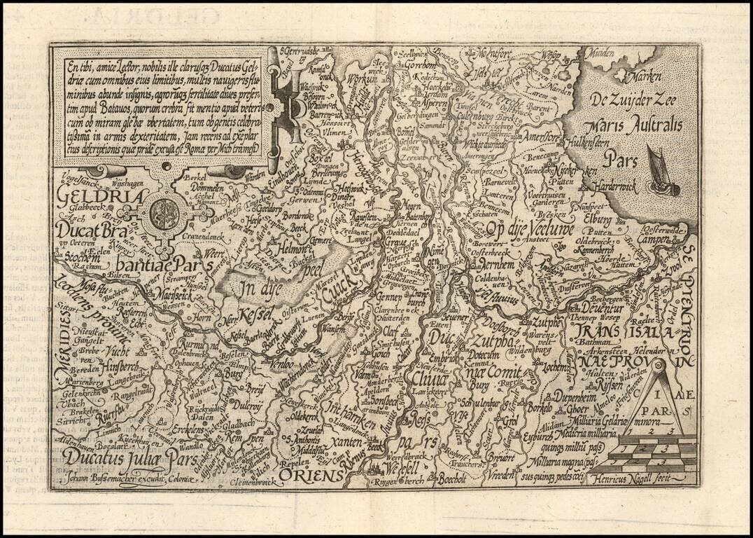
Nice example of this scarce map of Geldria, published in Cologne.
The map is oriented with west at the top.
The present map was produced by two of the primary Cologne School mapmakers, Johann Bussemacher and Matthias Quad. The Cologne School of cartography, was perhaps the only group of mapmakers competing with the Low Countries-based map publishing houses at the end of the 16th century (De Jode and Ortelius). For more on the Cologne School, see: Meurer, Atlantes Colonienses. Die Kolner Schule der Atlas Kartographie 1570-1610.
If you are a student, write to us in telegram: @antiquemaps and indicate what material you need and for what work you need a map in high detail. We are ready to provide material on special terms. For students only!


