Map size in jpg-format: 6.73291MiB
Click to open in high resolution (open in new tab).
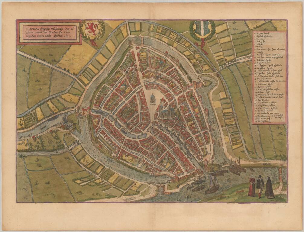
Nice old color example of Braun & Hogenberg's map of Gouda.
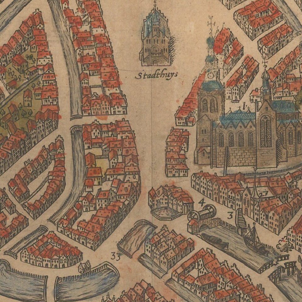
This is a bird's-eye view of the city from the south. In the foreground is the confluence of the Gouwe and the IJssel. Prominent features are the town hall (Stadthuys) and the Gothic Sint-Janskerk, the largest church in the Netherlands.
Gouda lies in a polder that was created in the Middle Ages through the construction of dams and drainage systems. After being granted a municipal charter in 1272, the city developed into an important centre of trade. It was captured by the Watergeuzen in 1572 during the Dutch Revolt, and it played an important role in the assembly of the States-General. Around 1600 it still had a flourishing cloth industry, but suffered a decline in the 17th century.
Georg Braun (1541-1622) was born and died in Cologne. His primary vocation was as Catholic cleric; he spent thirty-seven years as canon and dean at the church St. Maria ad Gradus, in Cologne. Braun was the chief editor of the Civitates orbis terrarum, the greatest book of town views ever published. His job entailed hiring artists, acquiring source material for the maps and views, and writing the text. In this role, he was assisted by Abraham Ortelius. Braun lived into his 80s, and he was the only member of the original team to witness the publication of the sixth volume in 1617.
If you are a student, write to us in telegram: @antiquemaps and indicate what material you need and for what work you need a map in high detail. We are ready to provide material on special terms. For students only!


