Map size in jpg-format: 2.2434MiB
Click to open in high resolution (open in new tab).

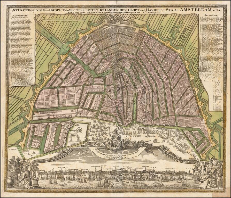
Nice example of Homann's map of Amsterdam, along with a striking birds-eye view of the city.
Marvelous panoramic view, flanked by scenes of commerce.
Amsterdam is shown after its period of explosive growth during the late 16th and 17th centuries, which saw it grow from a small port town to one of the most important centers of commerce and finance in Europe.
The key on the map identifies over 300 locations.
If you are a student, write to us in telegram: @antiquemaps and indicate what material you need and for what work you need a map in high detail. We are ready to provide material on special terms. For students only!


