Map size in jpg-format: 3.85311MiB
Click to open in high resolution (open in new tab).
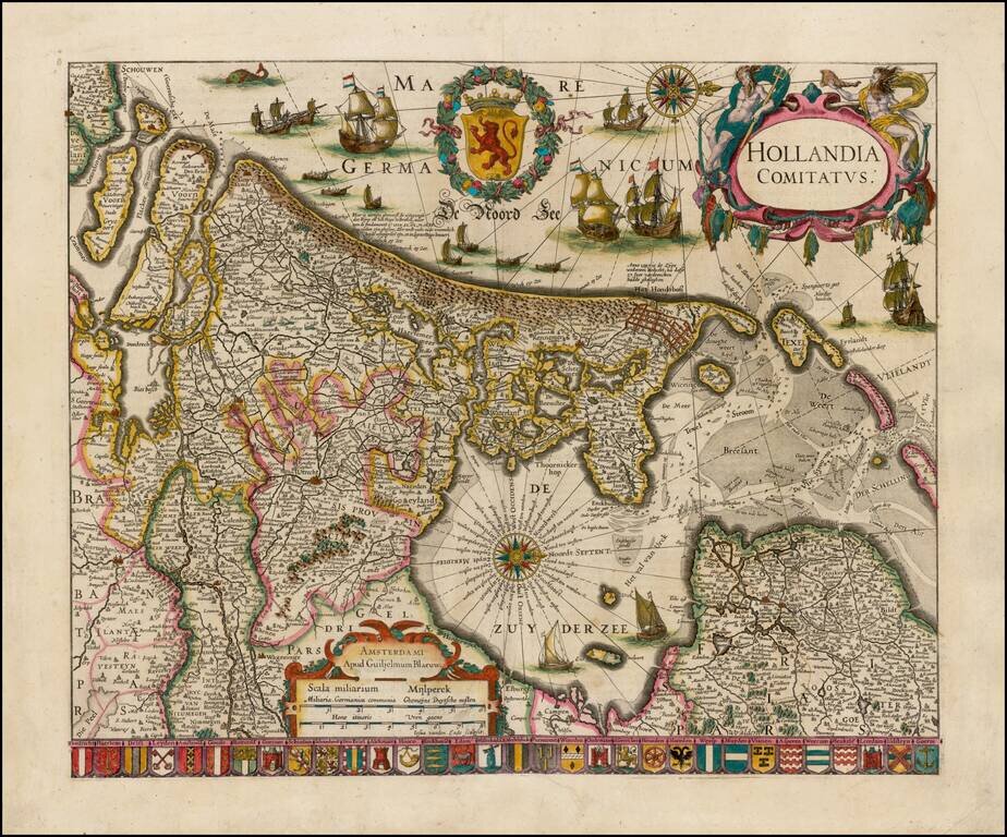
Striking example of Blaeu's rare early map of Holland, oriented with west at the top.
The title cartouche is flanked by two sea gods, with 32 coats of arms of the major cities of the Netherlands along the bottom.
The present map is known in 4 states, including two early states by Willem Janszoon Blaeu, and one state each by Robout van den Hoeye and Justus Danckerts.
The map was issued separately and was not part of a regularly published atlas.
Willem Janszoon Blaeu (1571-1638) was a prominent Dutch geographer and publisher. Born the son of a herring merchant, Blaeu chose not fish but mathematics and astronomy for his focus. He studied with the famous Danish astronomer Tycho Brahe, with whom he honed his instrument and globe making skills. Blaeu set up shop in Amsterdam, where he sold instruments and globes, published maps, and edited the works of intellectuals like Descartes and Hugo Grotius. In 1635, he released his atlas, Theatrum Orbis Terrarum, sive, Atlas novus.
Willem died in 1638. He had two sons, Cornelis (1610-1648) and Joan (1596-1673). Joan trained as a lawyer, but joined his father’s business rather than practice. After his father’s death, the brothers took over their father’s shop and Joan took on his work as hydrographer to the Dutch East India Company. Later in life, Joan would modify and greatly expand his father’s Atlas novus, eventually releasing his masterpiece, the Atlas maior, between 1662 and 1672.
If you are a student, write to us in telegram: @antiquemaps and indicate what material you need and for what work you need a map in high detail. We are ready to provide material on special terms. For students only!


