logo

1787. Carta Esferica Desde Punta de Europa a Cabo de Gata en la Costa de Europa, y desde Ceuta hasta Cabo Hone en la de Africa . . .

  • Carta Esferica Desde Punta de Europa a Cabo de Gata en la Costa de Europa, y desde Ceuta hasta Cabo Hone en la de Africa . . .

Carta Esferica Desde Punta de Europa a Cabo de Gata en la Costa de Europa, y desde Ceuta hasta Cabo Hone en la de Africa . . . information:

Year of creation: 
Resolution size (pixels): 
 3250x2318 px
Disk Size: 
 1.16453MiB
Number of pages: 
 1
Place: 
 Madrid

Print information. Print size (Width x height in inches):
Printing at 72 dpi 
  45.14 х 32.19
Printing at 150 dpi 
 21.67 х 15.45
Printing at 300 dpi 
 10.83 х 7.73

An example of detailing the file of this map of in a printable high-resolution:

Click to open in high resolution (open in new tab).
Attention! this is just the central piece (central area 960x960 px) of the map file!
This is an example, so that you can see and study the level of detail of a given map. The entire Map will be fully available after payment!

Carta Esferica Desde Punta de Europa a Cabo de Gata en la Costa de Europa, y desde Ceuta hasta Cabo Hone en la de Africa . . .

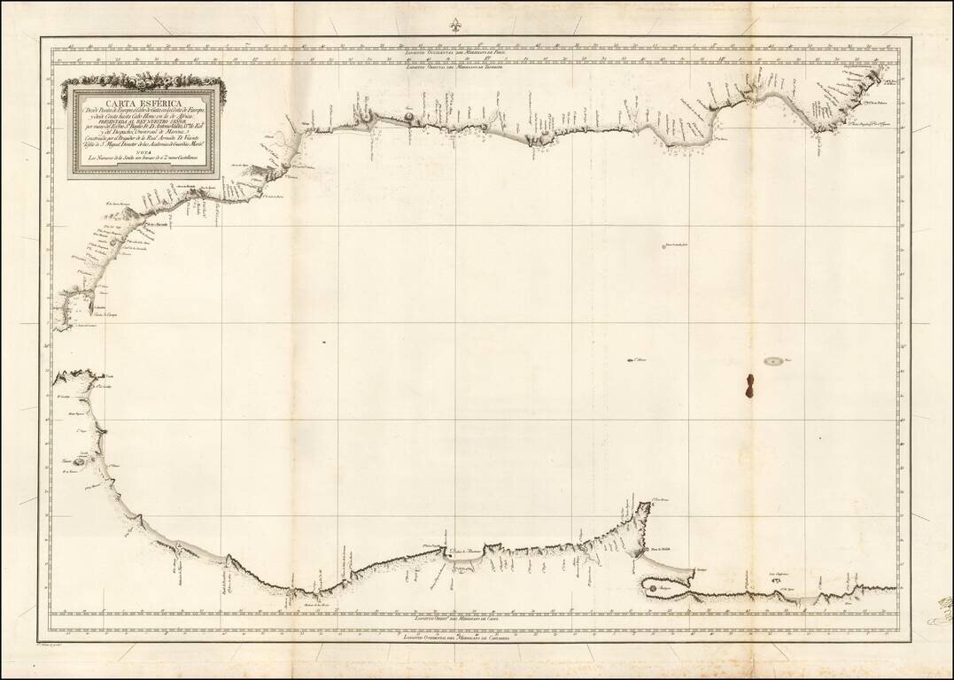
Scarce blue back chart of the Western Mediterranean, published under the direction of the Spanish Hydrographical Department.


Special conditions for students!

If you are a student, write to us in telegram: @antiquemaps and indicate what material you need and for what work you need a map in high detail. We are ready to provide material on special terms. For students only!

Item information:

Year of creation:
Size:
3250x2318 px
Disk:
1.16453MiB
Number of pages:
1
Place:
Madrid
Author:
Don Vincente Tofiño de San Miguel.
$14.99

Related item