logo

1787. Plano De Las Rias De Ferrol, Coruña, y Betanzos; Levantado Por El Brigadier De La Real Armada D. Vicente Tofiño De S. Miguel. Año de 1787.

  • Plano De Las Rias De Ferrol, Coruña, y Betanzos; Levantado Por El Brigadier De La Real Armada D. Vicente Tofiño De S. Miguel.  Año de 1787.

Plano De Las Rias De Ferrol, Coruña, y Betanzos; Levantado Por El Brigadier De La Real Armada D. Vicente Tofiño De S. Miguel. Año de 1787. information:

Year of creation: 
Resolution size (pixels): 
 2439x1914 px
Disk Size: 
 911002B
Number of pages: 
 1
Place: 
 Madrid

Print information. Print size (Width x height in inches):
Printing at 72 dpi 
  33.88 х 26.58
Printing at 150 dpi 
 16.26 х 12.76
Printing at 300 dpi 
 8.13 х 6.38

An example of detailing the file of this map of in a printable high-resolution:

Click to open in high resolution (open in new tab).
Attention! this is just the central piece (central area 960x960 px) of the map file!
This is an example, so that you can see and study the level of detail of a given map. The entire Map will be fully available after payment!

Plano De Las Rias De Ferrol, Coruña, y Betanzos; Levantado Por El Brigadier De La Real Armada D. Vicente Tofiño De S. Miguel.  Año de 1787.

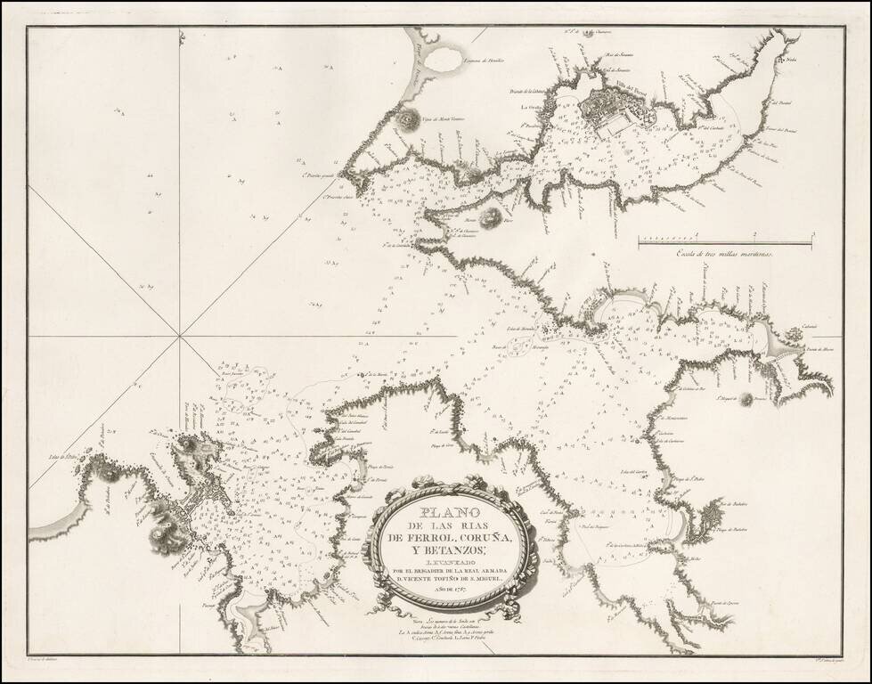
Detailed sea chart of a part of Galicia, showing the harbors at the mouths of the Rivers Ferrol, Coruña and Betanzos, published for the Spanish Hydrographical Society in 1787.

This chart was one of the most important early modern surveys of the region.

The fortified harbor at Villa Del Ferrol can be seen, along with a plan for Coruña.


Special conditions for students!

If you are a student, write to us in telegram: @antiquemaps and indicate what material you need and for what work you need a map in high detail. We are ready to provide material on special terms. For students only!

Item information:

Year of creation:
Size:
2439x1914 px
Disk:
911002B
Number of pages:
1
Place:
Madrid
Author:
Don Vincente Tofiño de San Miguel.
$9.99

Related item