logo

1782. Carte d'Espagne et de Portugal Comprenant les Routes des Postes et autres de ces deuxe Roiaumes . . . 1782

  • Carte d'Espagne et de Portugal Comprenant les Routes des Postes et autres de ces deuxe Roiaumes . . . 1782

Carte d'Espagne et de Portugal Comprenant les Routes des Postes et autres de ces deuxe Roiaumes . . . 1782 information:

Year of creation: 
Resolution size (pixels): 
 20203x18200 px
Disk Size: 
 89.049MiB
Number of pages: 
 1
Place: 
 Paris
Author: 

Print information. Print size (Width x height in inches):
Printing at 72 dpi 
  280.6 х 252.78
Printing at 150 dpi 
 134.69 х 121.33
Printing at 300 dpi 
 67.34 х 60.67

An example of detailing the file of this map of in a printable high-resolution:

Click to open in high resolution (open in new tab).
Attention! this is just the central piece (central area 960x960 px) of the map file!
This is an example, so that you can see and study the level of detail of a given map. The entire Map will be fully available after payment!

Carte d'Espagne et de Portugal Comprenant les Routes des Postes et autres de ces deuxe Roiaumes . . . 1782

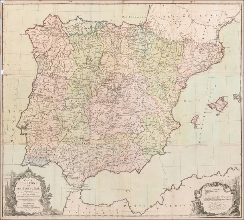
Rare Six-Sheet Postal Map of Spain and Portugal

Finely executed map of the Iberian Peninsula, focusing on the postal routes throughout the region.

The key at the bottom right identifies the various types of cities, towns and regions, along with different types of postal services.


Special conditions for students!

If you are a student, write to us in telegram: @antiquemaps and indicate what material you need and for what work you need a map in high detail. We are ready to provide material on special terms. For students only!

Item information:

Year of creation:
Size:
20203x18200 px
Disk:
89.049MiB
Number of pages:
1
Place:
Paris
Author:
Louis Charles Desnos.
$21.99

Related item