
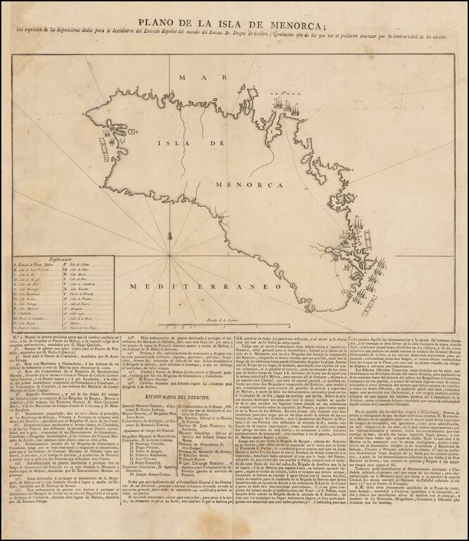
Spanish Broadside Map of the 1781-82 Conquest of Menorca. Rare separately issued broadside map showing information related to the Conquest of Menorca in February, 1782. The map shows the support provided by the Spanish in aid of the Duke of Crillon,...
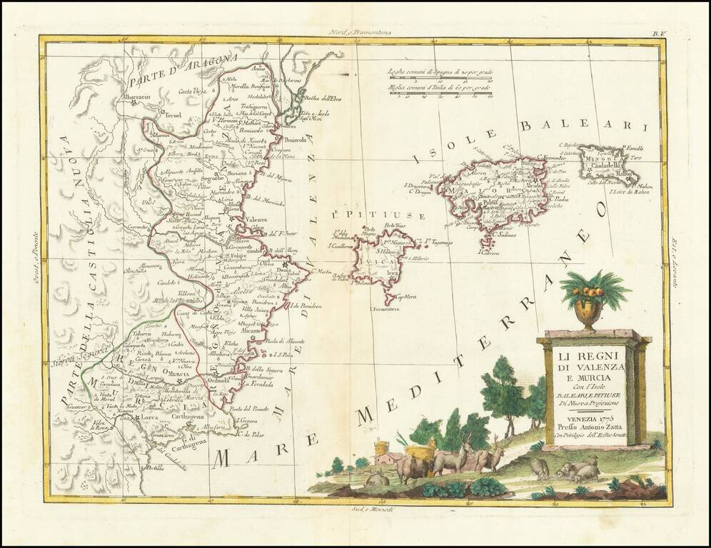
Detailed map of the eastern coastline of Spain, centered on Valencia, Murcia and the Balearic Islands of Ibiza, Minora and Majorca. Very interesting early map, with nice detail. Decorative title cartouche. From Zatta's monumental Altante Novissimo,...
![Spain and Portugal, with Their General Divisions . . . [Balaeric Islands]](/map/small/65193.jpg)
Detailed late 18th Century map of the Iberian Peninsula and contiguous islands. Scarce English language map of the region. From Dunn's New Atlas or Mundane System of Geography.
![[Eastern Mediterranean]](/map/small/61501sb.jpg)
Only known example of the rare map of of the Eastern Mediterranean. As note by Bifolco, this unique map is one of four sheets from a 16th century wall map of Europe, which an incomplete example survives the Civic Library of Bergamo in Italy (3 of 4...
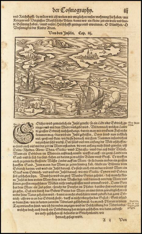
Fascinating map of a ship in the Mediterranean. Islansd mentioned in the text include Sicily, Rhodes, Delos, Alone, and Thera.
![Cyprus Insula [with] Candia, Olim Creta](/map/small/65746.jpg)
Striking example of Ortelius' first map of Cyprus and Crete, from Ortelius' Theatrum Orbis Terrarum, the first modern atlas of the World. The map is based upon earlier maps by Bordone (1528) and Camocio (1564). During the time of the map's creation,...
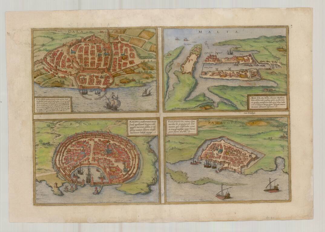
Nice old color example of Braun & Hogenberg's views of Famagusta, Rhodes, Malta and Cagliari. From Braun & Hogenberg's Civitatus Orbis Terrarum, the most important book of town plans and views published in the 16th Century.
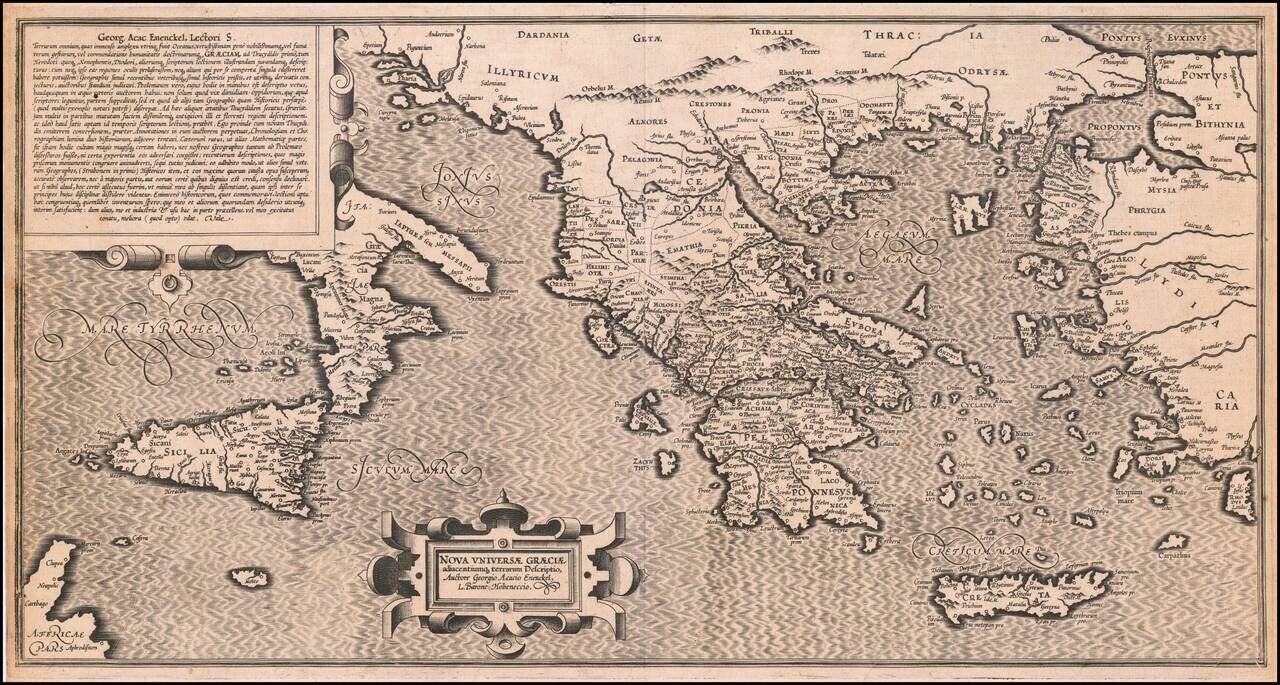
Extremely rare 16th Century map of the "New Greek Universe," by George Achatz von Eneneckel. The map extends from Sicliy and Puglia to the western coast of Asia minor, the regions controlled by the Ancient Greeks. This is the first time we have ever...
![[Crete / Corsica / Sardinia] Corsica [and] Sardinia [and] Creta . . . [and] Insulae Mari Ionii](/map/small/33196bp.jpg)
Decorative example of Ortelius' maps of Corsica, Sardinia, Crete and the Ionian Sea, from his Theatrum Orbis Terrarum, the first modern atlas of the world.
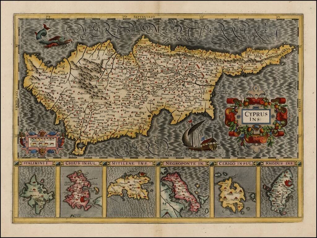
Striking early map of Cyprus, with 6 smaller maps below, showing Stalimini, Chius, Mitilene, Negroponte, Cerigo and Rhodus Islands. A fine example of Mercator's work, with the classic engraving of the sea characteristic of his work. Nice example.
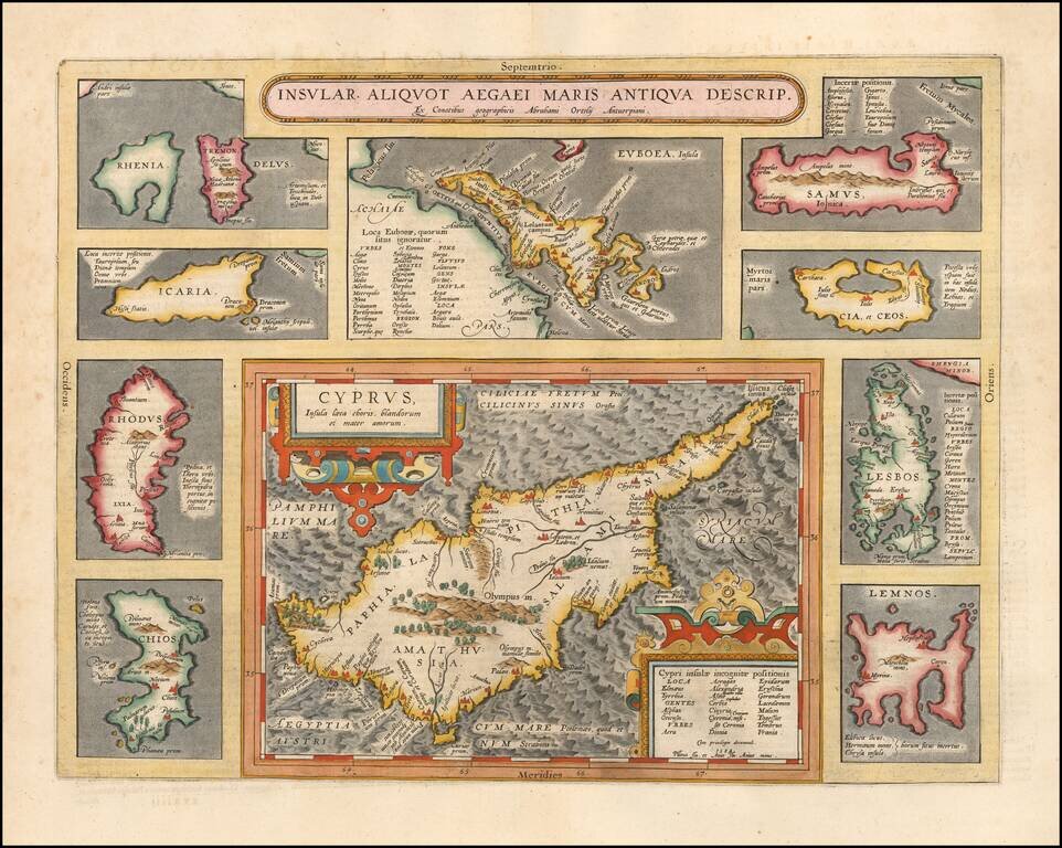
Striking full color example of Ortelius' map of Cyprus, ringed by smaller maps of islands in the Aegean, including Lesbos, Rhodes, Rhenia, Tremon, Icaria, Euboaea, Chios, Lemnos, Cia et Ceos and Samus. From Abraham Ortelius' Theatrum Orbis Terrarum,...
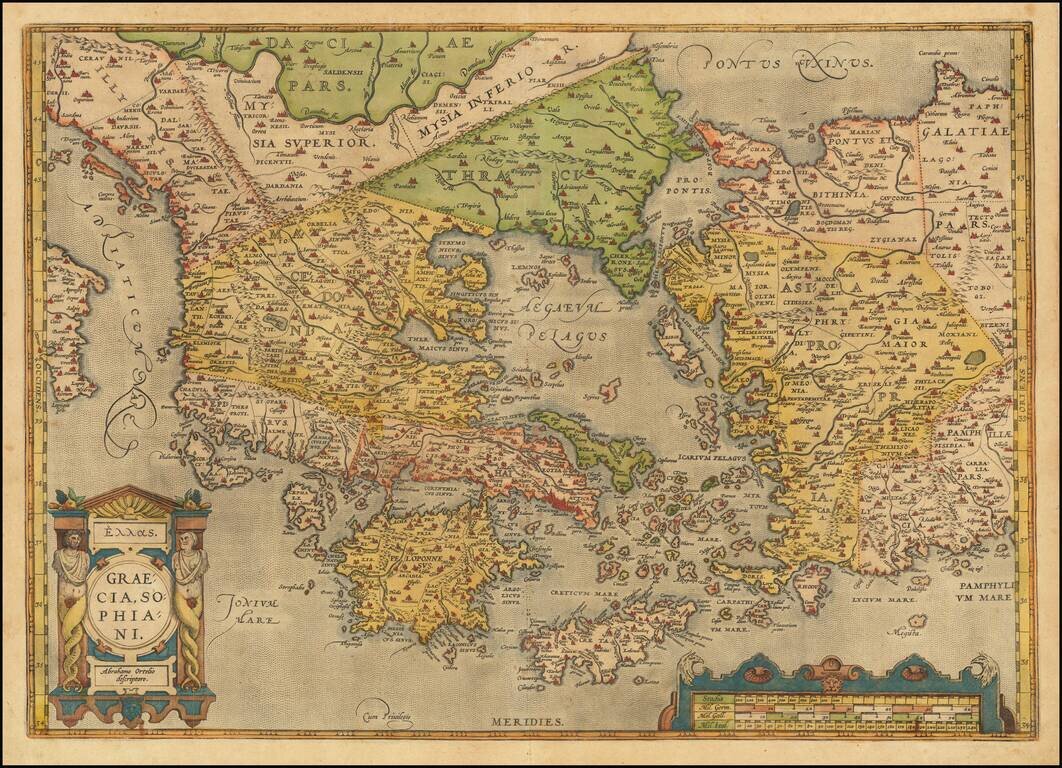
Old color example of Ortelius' decorative map of Greece, Turkey and Asia Minor, with neighboring islands, from Ortelius' Theatrum Orbis Terrarum, the first modern atlas of the world. The map is embellished by a decorative cartouche and scale of miles....
![L. Rouwolfs Reys-Togten, door de Levant, of Oosterse Landschappen der Middellandse Zee [shows Cyprus]](/map/small/55336.jpg)
Interesting map of the Mediterranean region, showing Leendert Rouwolf's route from France to Tripoli. Includes decorative cartouche.
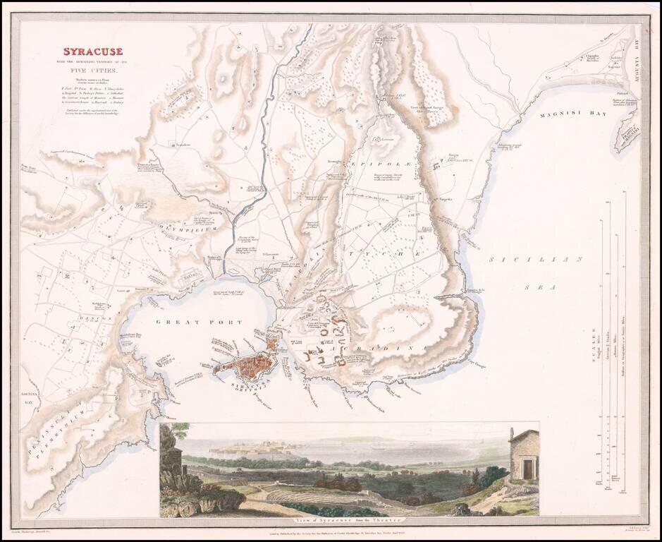
Highly detailed town plan of Syracuse, with a larger view of the City from its Roman Ampitheatre. One of the best published in a commercial atlas in the 19th Century. Plans of Syracuse are quite rare.
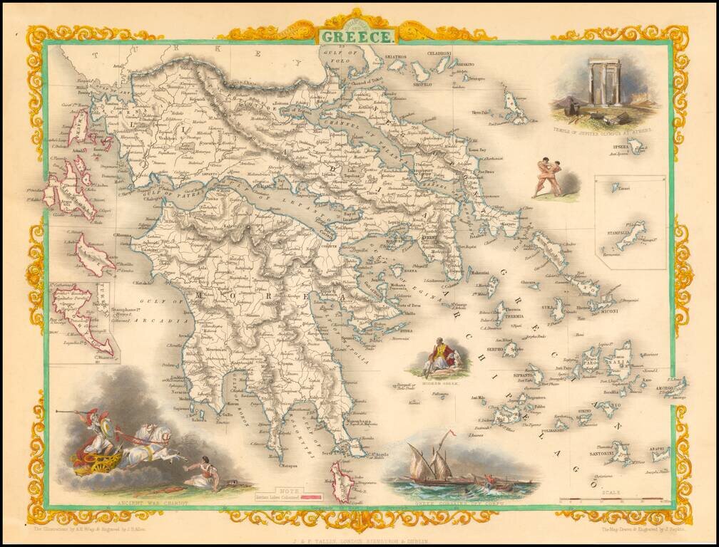
Decorative color example of this marvelous map. Decorative vignettes of an ancient war chariot, Temple of Jupiter on Mt. Olympus, Greek Corsairs off Corfu, a modern Greek and wrestlers. Engraved for R. Montgomery Martin's Illustrated Atlas. Tallis was...
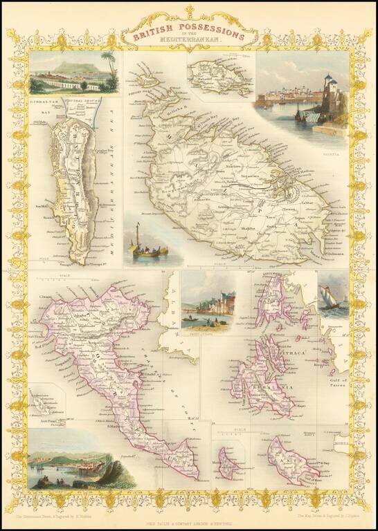
Gorgeous full color example of Tallis' map, with vignettes showing Valetta, Ithaca, Gibraltar and Corfu. Islands that are shown are Gibraltar, Malta, Corfu, Zante, Cerigo, Morea, Cephalonia, Ithaca and Gozo. Engraved for R. Montgomery Martin's...