

Detailed map of the Greek Islands, showing towns, mountains, rivers, roads, lakes, gulfs, bays, etc. Decorative border. A terrific regional map, from JH Colton, one of the most prolific American mapmakers of the mid-19th Century.
![Patriarchatus Antiocheni Geographica Descriptio . . . [shows Cyprus]](/map/small/54177.jpg)
The Cradle of Civilization Rare and highly decorative map of the region bounded by Cyprus and the Holy Land in the west and Sinus Persicus and Susiana in the east. Toward the center is the confluence of the Tigris and Euphrates rivers.

Ortelius' Map of the North Atlantic Old color example of Abraham Ortelius's important early map of the North Atlantic, extending from Scandinavia and the Polar regions in the East, to the mythical Islands of the North Atlantic, Greenland, Iceland and...

Fine birds-eye view of the island of Terceira and the town of Angra, based upon Baptista van Deutecum's view of the Island, which appeared in LInschoten's Itinerario. Linschoten's view of Terceira in the Azores is one of the most decorative and...
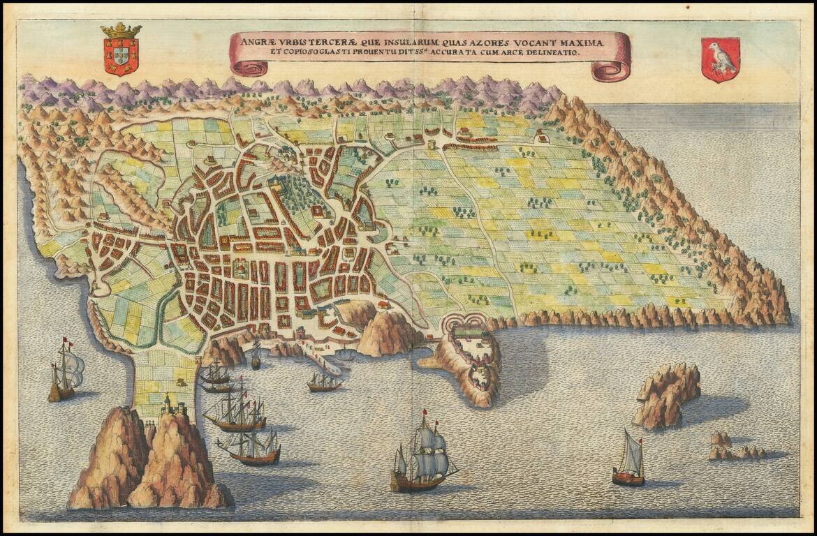
Fine birds-eye view of the island of Terceira and the town of Angra, based upon Baptista van Deutecum's view of the Island, which appeared in Linschoten's Itinerario. Linschoten's view of Terceira in the Azores is one of the most decorative and...
![Corsica [and] Sardinia](/map/small/41806.jpg)
Old color example of Gerard Mercator's maps of Corsica and Sardinia. Includes decorative cartouches.
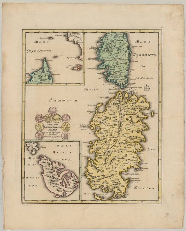
Decorative map of the islands of Corsica, Sardinia, and Malta.
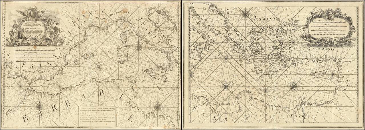
Rare 2 sheet chart of the Mediterranean, published by Francois Olivier in Toulon in 1746. One of the most advanced sea charts of the period, which was produced as a working chart and for which there are very few surviving examples. To the upper right...
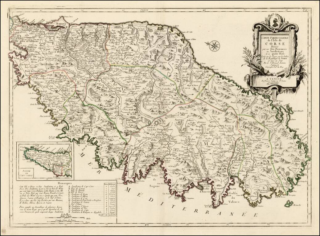
Striking large format map of Corsica, oriented with east at the top. Includes a large decorative cartouche and table showing details of the Jurisdictions and Fiefs. The map shows towns, roads, rivers, lakes, mountains, gulfs and many other details. A...
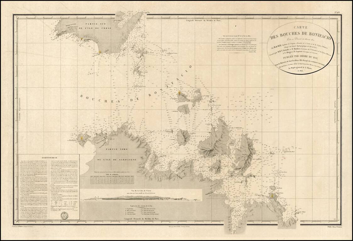
Detailed map of channel between the Islands of Corsica and Sardinia, with topographical and nautical details concerning the contiguous coastlines of each of the islands. Includes a profile view of the Coast of Corsica, along with detailed sailing...
![Valetta, the Capital of the Island of Malta [with] Balearic Islands [and] Corsica and Sardinia](/map/small/54874.jpg)
Detailed plan of Valetta, with a map of the Balearic Islands and a map of Sardinia and Corsica.
![Turcici Imperii Imago [shows Cyprus]](/map/small/68676.jpg)
Fine Map of the Ottoman Empire from the Mercator-Hondius Atlas Striking example of this map of the Ottoman Empire, showing their territories in the Balkans, Anatolia, the Levant, the Arabian Peninsula, and North Africa. It was published by Henricus...
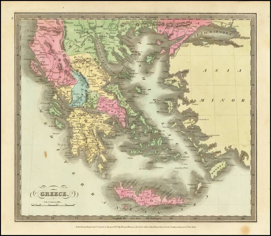
Marvelous detailed map of Greece, Turkey, Macedonia, Crete, and surrounding islands from this scarce American atlas.
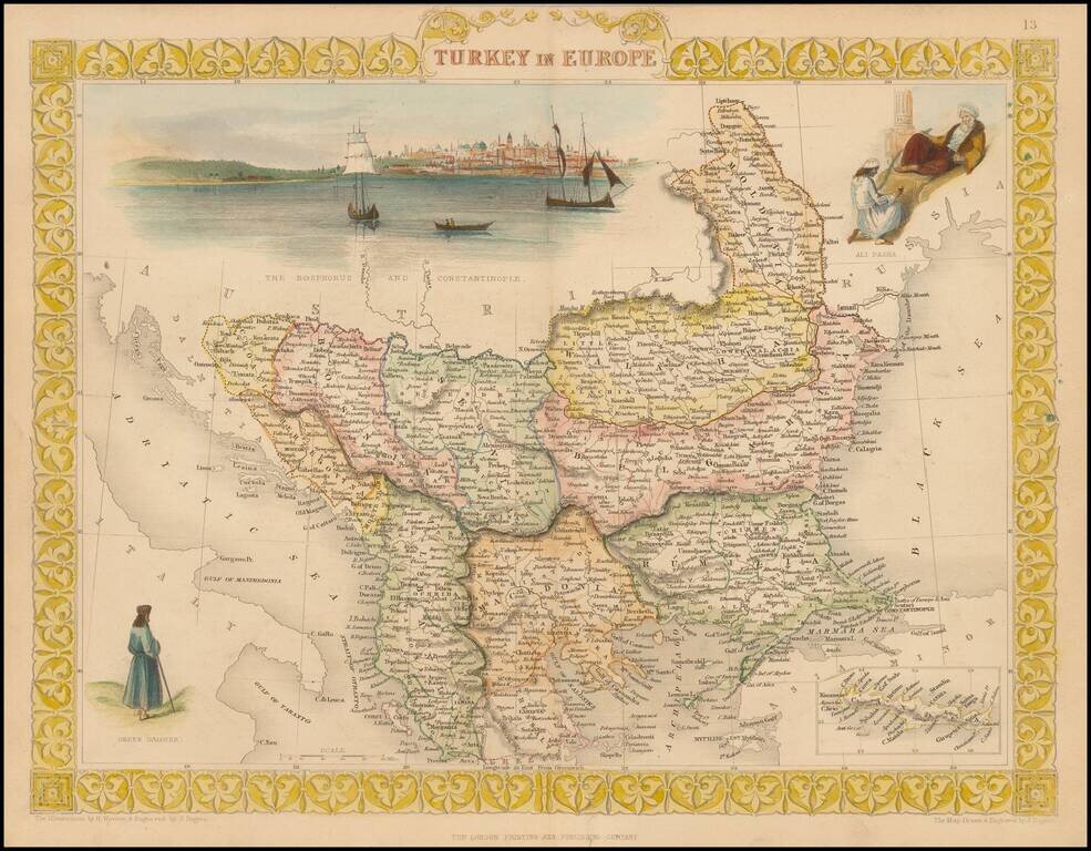
Striking full color example of Tallis' map of European Turkey. Decorative Vignettes of Ali Pasha, The Bosphorus and Constantinople and a Greek Caloyer figure, also inset of island of Cadia. Engraved for R. Montgomery Martin's Illustrated Atlas....
![Insularum Aliquot Maris Mediterranei Descriptio [Sicily, Malta, Sardinia, Corfu, Elba and Zerbia]](/map/small/45115.jpg)
Fine example of Ortelius' maps of the islands of Sicily, Malta, Sardinia, Corfu, Elba and Zerbia, from the Ortelius' Theatrum Orbis Terrarum, the first modern Atlas of the World. Includes a number of sailing ships, including a sinking vessel off...
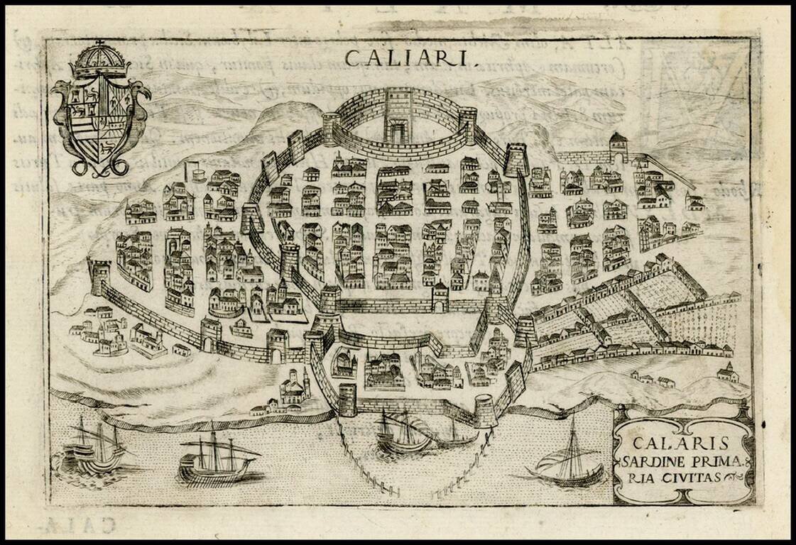
Detailed view of Caliari, which appeared in Bertelli's Theatrum Urbium Italicarum, first published in Venice in 1599. Includes a large coat of arms.